Category:Clyde Walkway
Jump to navigation
Jump to search
Great Trail in Glasgow City, Scotland, UK  | |||||
| Upload media | |||||
| Instance of |
| ||||
|---|---|---|---|---|---|
| Location |
| ||||
| Length |
| ||||
 | |||||
The Clyde Walkway is a 40 mile long public footpath running between the centre of Glasgow to New Lanark.
Subcategories
This category has the following 6 subcategories, out of 6 total.
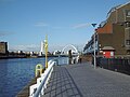
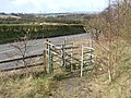
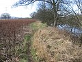
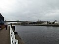
Media in category "Clyde Walkway"
The following 129 files are in this category, out of 129 total.
-
 A social distance fail in Glasgow (50374989287).jpg 4,032 × 3,024; 4.67 MB
-
 A straight section of the Clyde Walkway (geograph 1687495).jpg 640 × 480; 108 KB
-
 A straight section of the Clyde Walkway (geograph 1697861).jpg 1,024 × 768; 282 KB
-
 A Tuesday afternoon stroll in Glasgow (50088925618).jpg 4,032 × 3,024; 3.96 MB
-
 A Winters Day in Glasgow (19) (28039781099).jpg 4,608 × 3,072; 5.38 MB
-

-
 Auchenshuggle Bridge.png 4,950 × 3,284; 22.8 MB
-
 Beneath the Clydeford Bridge - geograph.org.uk - 1359090.jpg 640 × 480; 153 KB
-
 Beside the Clyde - geograph.org.uk - 5153651.jpg 640 × 360; 81 KB
-
 Better to die on your feet than live forever on your knees - geograph.org.uk - 2625512.jpg 3,648 × 2,736; 5.74 MB
-
 Bridge over the Kelvin at Kelvinhaugh (geograph 4207981).jpg 800 × 600; 89 KB
-
 Bridges over the Clyde, Glasgow - geograph.org.uk - 4796630.jpg 1,024 × 682; 169 KB
-
 Bridges over the River Clyde near Uddingston (geograph 1687385).jpg 640 × 480; 85 KB
-
 Broomielaw Quay - geograph.org.uk - 2881419.jpg 640 × 480; 114 KB
-
 Building Site (geograph 5316730).jpg 1,600 × 1,200; 323 KB
-
 Building site on Clyde Street - geograph.org.uk - 5813411.jpg 790 × 1,024; 301 KB
-
 By the Clyde (2939879922).jpg 1,024 × 768; 405 KB
-
 Cambuslang Bridge (geograph 5316987).jpg 1,600 × 1,200; 581 KB
-
 Carmyle Heron by the Clyde - geograph.org.uk - 131398.jpg 640 × 480; 124 KB
-
 Carmyle Weir - geograph.org.uk - 1359124.jpg 640 × 480; 138 KB
-
 Clyde between Cambuslang and Carmyle - geograph.org.uk - 1321997.jpg 640 × 480; 110 KB
-
 Clyde Walkway - geograph.org.uk - 1042938.jpg 640 × 480; 218 KB
-
 Clyde walkway - geograph.org.uk - 1347485.jpg 640 × 480; 51 KB
-
 Clyde Walkway - geograph.org.uk - 4679816.jpg 800 × 600; 423 KB
-
 Clyde Walkway - geograph.org.uk - 903549.jpg 640 × 480; 117 KB
-

-
 Clyde Walkway - M74 bridge site - geograph.org.uk - 1322012.jpg 640 × 480; 92 KB
-
 Clyde Walkway and Cycle Route No. 75 - geograph.org.uk - 1359086.jpg 640 × 480; 150 KB
-

-

-
 Clyde Walkway approaching Adders Gill - geograph.org.uk - 148655.jpg 640 × 480; 79 KB
-
 Clyde Walkway at Dalmarnock (geograph 3894135).jpg 1,024 × 768; 766 KB
-
 Clyde Walkway at Dalmarnock - geograph.org.uk - 135599.jpg 640 × 480; 158 KB
-
 Clyde Walkway at Dalmarnock - geograph.org.uk - 341712.jpg 640 × 480; 134 KB
-
 Clyde Walkway at Newton Burn (geograph 4894581).jpg 1,024 × 768; 289 KB
-
 Clyde Walkway at Newton Farm (geograph 4894637).jpg 1,024 × 768; 234 KB
-
 Clyde Walkway at Rutherglen Bridge - geograph.org.uk - 1167911.jpg 640 × 480; 164 KB
-
 Clyde Walkway at Uddingston - geograph.org.uk - 377695.jpg 640 × 427; 134 KB
-

-
-
 Clyde Walkway near Dalmarnock - geograph.org.uk - 341707.jpg 640 × 480; 145 KB
-
 Clyde Walkway near Newton - geograph.org.uk - 341677.jpg 640 × 480; 187 KB
-
 Clyde Walkway near Parkhead - geograph.org.uk - 341703.jpg 640 × 480; 165 KB
-
 Clyde Walkway near Upper Carbarns - geograph.org.uk - 148659.jpg 640 × 480; 85 KB
-
 Clyde Walkway nearing Cambuslang (geograph 1687588).jpg 640 × 480; 106 KB
-
 Clyde walkway plaque. - geograph.org.uk - 1470410.jpg 640 × 480; 114 KB
-
 Clyde Walkway, Dalmarnock - geograph.org.uk - 1167875.jpg 640 × 480; 133 KB
-
 Clyde walkway, Parkhead - geograph.org.uk - 1322054.jpg 640 × 480; 147 KB
-
 Clyde Walkway, Rutherglen Bridge - geograph.org.uk - 1330622.jpg 640 × 359; 122 KB
-
 Clyde Walkway, the river and Kingston Bridge - geograph.org.uk - 5485202.jpg 1,600 × 1,200; 631 KB
-
 Clydeford Bridge - geograph.org.uk - 1304440.jpg 640 × 359; 108 KB
-
 ClydeWalkway01.jpg 1,139 × 854; 335 KB
-
 ClydeWalkway08.jpg 1,139 × 854; 344 KB
-
 ClydeWalkway18.jpg 1,139 × 854; 276 KB
-
 ClydeWalkway24.jpg 1,139 × 854; 371 KB
-
 ClydeWalkway27.jpg 1,139 × 854; 429 KB
-
 Cobbled together - geograph.org.uk - 35545.jpg 640 × 480; 135 KB
-

-
 Cycling by the Clyde, Dalmarnock - geograph.org.uk - 135612.jpg 640 × 480; 123 KB
-
 Dalmarnock Railway Bridge - geograph.org.uk - 1167882.jpg 640 × 480; 116 KB
-
 Dalmarnock Railway Bridge - geograph.org.uk - 1167892.jpg 640 × 480; 124 KB
-
 Dalmarnock Railway Bridge 2016-03-07.jpg 3,432 × 1,438; 1.69 MB
-
 Dalmarnock Road Steps.jpg 3,488 × 2,616; 3.73 MB
-
 Directions on cycle path by River Clyde - geograph.org.uk - 1359082.jpg 640 × 480; 158 KB
-
 Disused railway bridge over River Clyde - geograph.org.uk - 1359127.jpg 640 × 480; 129 KB
-
 Flotsam and Jetsam In The Clyde - geograph.org.uk - 1475520.jpg 640 × 462; 148 KB
-
 Footbridge over the Rotten Calder - geograph.org.uk - 939834.jpg 640 × 480; 111 KB
-
 Footbridge over the Rotten Calder.jpg 1,500 × 1,000; 438 KB
-
 Footbridge to Cuningar Loop (geograph 5650116).jpg 640 × 480; 158 KB
-
 Glasgow Bridge - geograph.org.uk - 6104263.jpg 4,032 × 3,024; 4.09 MB
-
 Glasgow bridges (16) - geograph.org.uk - 6259484.jpg 4,130 × 3,097; 2.87 MB
-
 Glasgow Sheriff Court - geograph.org.uk - 5983987.jpg 1,024 × 625; 256 KB
-

-

-
 Jogging Along - geograph.org.uk - 1475387.jpg 640 × 453; 89 KB
-
 King George V Bridge - Graffiti - geograph.org.uk - 628014.jpg 640 × 480; 103 KB
-
 Looking back along the Clyde Walkway - geograph.org.uk - 956613.jpg 640 × 480; 68 KB
-
 M74 - Motorway Bridge (geograph 5317057).jpg 1,600 × 1,200; 278 KB
-
 M74 Bridge Site over the River Clyde (geograph 1697906).jpg 4,000 × 3,000; 4.36 MB
-
 M74 passes over the Clyde Walkway - geograph.org.uk - 5764817.jpg 1,600 × 1,200; 508 KB
-
 Meadowside Quay - geograph.org.uk - 2367332.jpg 3,008 × 2,502; 5.14 MB
-

-
 On the Clyde Walkway by the Garrion Burn - geograph.org.uk - 1622783.jpg 640 × 480; 127 KB
-
 P1000218 (2938670981).jpg 1,024 × 768; 625 KB
-
 Passing The Time Of Day - geograph.org.uk - 1475369.jpg 640 × 470; 112 KB
-
 Path by the Clyde - geograph.org.uk - 6195541.jpg 1,024 × 683; 134 KB
-
 Path from Newton Farm (geograph 3895795).jpg 1,024 × 602; 459 KB
-
 Pylons from the Clyde Walkway - geograph.org.uk - 1359094.jpg 640 × 480; 110 KB
-
 River Clyde - geograph.org.uk - 1304428.jpg 640 × 480; 99 KB
-
 River Clyde and the Clyde Walkway (geograph 1697885).jpg 640 × 480; 103 KB
-
 River Clyde from Clyde Walkway - geograph.org.uk - 1359104.jpg 640 × 480; 175 KB
-
 River Clyde Walkway - geograph.org.uk - 895845.jpg 640 × 480; 100 KB
-
 Riverside pasture opposite Uddingston - geograph.org.uk - 1229422.jpg 640 × 480; 114 KB
-
 Rough ground, Cambuslang - geograph.org.uk - 1304438.jpg 640 × 359; 81 KB
-
 Rutherglen Bridge cobbled path, Police stairs 2016-03-07.jpg 2,560 × 1,920; 2.01 MB
-

-
 Signpost on the Clyde Walkway - geograph.org.uk - 1657544.jpg 640 × 480; 102 KB
-

-
 South Portland Street Suspension Bridge - geograph.org.uk - 6224719.jpg 1,600 × 1,200; 471 KB
-
 The Auchenshuggle Bridge - geograph-5764826.jpg 1,600 × 1,200; 355 KB
-
 The Carmyle Heron - geograph.org.uk - 1304446.jpg 480 × 640; 67 KB
-
 The Carmyle Heron - geograph.org.uk - 131412.jpg 640 × 413; 47 KB
-
 The Clyde at Dalmarnock (geograph 5650109).jpg 640 × 480; 208 KB
-
 The Clyde at Glasgow - geograph.org.uk - 4648168.jpg 640 × 459; 160 KB
-
 The Clyde Walkway - geograph.org.uk - 1657749.jpg 640 × 480; 90 KB
-
 The Clyde Walkway - geograph.org.uk - 1657784.jpg 640 × 395; 84 KB
-
 The Clyde Walkway - geograph.org.uk - 3415420.jpg 640 × 480; 153 KB
-
 The Clyde Walkway - geograph.org.uk - 3415460.jpg 640 × 480; 149 KB
-
 The Clyde Walkway - geograph.org.uk - 3415588.jpg 640 × 480; 125 KB
-
 The Clyde Walkway - geograph.org.uk - 3415594.jpg 640 × 480; 130 KB
-
 The Clyde Walkway - geograph.org.uk - 4251487.jpg 640 × 480; 167 KB
-
 The Clyde Walkway - geograph.org.uk - 760621.jpg 640 × 480; 155 KB
-
 The Clyde Walkway - geograph.org.uk - 760630.jpg 640 × 480; 131 KB
-
 The Clyde Walkway - geograph.org.uk - 915701.jpg 480 × 640; 105 KB
-

-
 The Clyde Walkway at Upper Carbarns Farm - geograph.org.uk - 1657651.jpg 640 × 480; 104 KB
-
 The Clyde Walkway near Cardies Bridge - geograph.org.uk - 1658394.jpg 640 × 480; 140 KB
-

-
 The Clyde Walkway passing East Lodge - geograph.org.uk - 1658342.jpg 640 × 480; 112 KB
-

-
 The River Clyde at Glasgow - geograph.org.uk - 3651408.jpg 640 × 397; 118 KB
-
 The River Clyde near Lower Carbarns - geograph.org.uk - 1657184.jpg 640 × 480; 73 KB
-
 The Tiger Lucky Eight - geograph.org.uk - 2621038.jpg 640 × 326; 137 KB
-
 Towards Cambuslang - geograph.org.uk - 1359100.jpg 640 × 480; 120 KB
-
 Townfoot Farm (geograph 4877316).jpg 1,024 × 683; 155 KB
-
 Weir at Carmyle - geograph.org.uk - 939889.jpg 640 × 480; 86 KB
-
 Wild flowers by the Clyde Walkway - geograph.org.uk - 1359115.jpg 640 × 480; 150 KB
-
 Wilson Waste Services - geograph.org.uk - 1304434.jpg 640 × 359; 97 KB
-

.jpg)
.jpg)
.jpg)
.jpg)
_(28039781099).jpg)


.jpg)

.jpg)

.jpg)

.jpg)
.jpg)


.jpg)


.jpg)
.jpg)


.jpg)


.jpg)

_-_geograph.org.uk_-_6259484.jpg)


.jpg)
.jpg)


.jpg)


.jpg)


.jpg)


.jpg)


.jpg)


.jpg)


