Category:Clough, County Down
Jump to navigation
Jump to search
village in County Down, Northern Ireland, United Kingdom ,_October_2009.JPG) ,_October_2009.JPG) | |||||
| Upload media | |||||
| Instance of | |||||
|---|---|---|---|---|---|
| Location | County Down, Northern Ireland | ||||
 | |||||
Subcategories
This category has the following 3 subcategories, out of 3 total.
B
S
- Signs in Clough (18 F)
Media in category "Clough, County Down"
The following 185 files are in this category, out of 185 total.
-

-
 "Tha Wee Man and his Coo" - geograph.org.uk - 4563653.jpg 1,600 × 1,217; 284 KB
-
 "Tha Wee Man and his Coo" at Clough - geograph.org.uk - 4405201.jpg 1,310 × 1,600; 402 KB
-
 'Tha Wee Mon and his Coo' in a beflagged Clough - geograph.org.uk - 5445958.jpg 4,000 × 3,000; 3.1 MB
-

-

-
-
 A2 Dundrum Road, Clough - geograph.org.uk - 2254790.jpg 640 × 496; 56 KB
-
 A25 Castlewellan Road, Clough - geograph.org.uk - 2254781.jpg 640 × 480; 48 KB
-
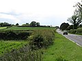
 A25 near Clough - geograph.org.uk - 2645381.jpg 640 × 480; 52 KB
-
 An old cottage south of the Blackstaff Road - geograph.org.uk - 2184627.jpg 1,024 × 768; 259 KB
-
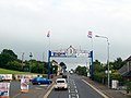 An Orange Arch at Clough - geograph.org.uk - 4577728.jpg 1,600 × 1,199; 214 KB
-
-

-
 Arable land north of the Downpatrick Road (A25) - geograph.org.uk - 2307976.jpg 1,024 × 767; 163 KB
-

-
 Arable land south of the Ballydugan Road - geograph.org.uk - 3749743.jpg 1,024 × 638; 91 KB
-
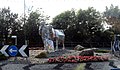
 Artwork on a roundabout in Clough - geograph.org.uk - 3682036.jpg 4,000 × 3,000; 4.77 MB
-

-

-

-
 Bus crash on Newcastle Road in Clough - geograph.org.uk - 3682030.jpg 4,000 × 3,000; 2.77 MB
-
 Bus stop on Main Street, Clough - geograph.org.uk - 2066801.jpg 1,024 × 790; 136 KB
-
 Castlewellan Road dressed overall - geograph.org.uk - 2497974.jpg 1,024 × 768; 204 KB
-
 Castlewellan Road, Clough - geograph.org.uk - 4101076.jpg 885 × 1,024; 130 KB
-
 Castlewellan Road, Clough - geograph.org.uk - 4555434.jpg 1,510 × 1,005; 888 KB
-
 Castlewellan Road, Clough - geograph.org.uk - 4572304.jpg 1,600 × 1,155; 224 KB
-
 Castlewellan Road, near Clough - geograph.org.uk - 595720.jpg 640 × 426; 73 KB
-
 Castlewellan Road. Clough - geograph.org.uk - 3858900.jpg 1,024 × 750; 148 KB
-
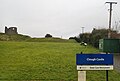
 Claragh Court, Clough - geograph.org.uk - 5602920.jpg 4,000 × 3,000; 2.57 MB
-
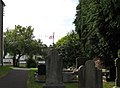
 Clough (06), October 2009.JPG 4,272 × 2,848; 5.75 MB
-
 Clough (18), October 2009.JPG 4,272 × 2,848; 4.77 MB
-
 Clough (20), October 2009.JPG 4,272 × 2,848; 5.98 MB
-
 Clough (40), October 2009.JPG 2,848 × 4,272; 3.91 MB
-
 Clough (41), October 2009.JPG 2,848 × 4,272; 2.78 MB
-
 Clough Health Centre, Clough - geograph.org.uk - 5602175.jpg 3,776 × 1,988; 3.13 MB
-

-

-
 Clough Pharmacy at the new Clough Health Centre - geograph.org.uk - 3595955.jpg 1,024 × 768; 127 KB
-
 Clough Presbyterian Church - geograph.org.uk - 5605348.jpg 1,309 × 1,064; 596 KB
-

-
 Clough's Big Cow - geograph.org.uk - 2497920.jpg 1,024 × 867; 153 KB
-
 Clough's Health Centre - geograph.org.uk - 3595969.jpg 1,024 × 760; 132 KB
-
 Clough's Health Centre approaching completion - geograph.org.uk - 3967629.jpg 1,024 × 766; 153 KB
-
 Clough's Non-Subscribing Presbyterian Church - geograph.org.uk - 2498558.jpg 1,024 × 768; 135 KB
-
 Clough's Orange Arch - geograph.org.uk - 3330558.jpg 734 × 1,024; 163 KB
-
 Clough's Orange Arch, 2015 - geograph.org.uk - 4563173.jpg 1,600 × 1,463; 301 KB
-
 Clough's Orange Hall - geograph.org.uk - 2498587.jpg 1,024 × 768; 201 KB
-
 Clough's Presbyterian Church - geograph.org.uk - 2498582.jpg 1,024 × 594; 96 KB
-
 Clough's Presbyterian Church Hall in Cumran Park - geograph.org.uk - 3967668.jpg 1,024 × 768; 163 KB
-
 Clough's Twelfth of July Orange Arch - geograph.org.uk - 3967691.jpg 1,024 × 753; 100 KB
-
 Clough's Wee Man and his Cow - geograph.org.uk - 3190521.jpg 1,024 × 645; 167 KB
-
 Convectional shower sweeping into Clough - geograph.org.uk - 5521991.jpg 3,694 × 2,866; 1.11 MB
-
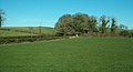
 Countryside near Clough - geograph.org.uk - 798741.jpg 639 × 407; 87 KB
-
 Crop land west of Cumran Lane - geograph.org.uk - 2508913.jpg 1,024 × 768; 173 KB
-
 Cropland north of the Ballydugan Road - geograph.org.uk - 3858924.jpg 1,024 × 583; 91 KB
-
 Cropland north of the Castlewellan Road - geograph.org.uk - 3597487.jpg 1,024 × 768; 118 KB
-
 Cropland on a drumlin slope west of Clough - geograph.org.uk - 3597491.jpg 1,024 × 768; 138 KB
-
 Cropland on the outskirts of Clough - geograph.org.uk - 4744520.jpg 1,600 × 1,200; 426 KB
-

-
 Cropland on the western fringes of Clough - geograph.org.uk - 4430592.jpg 1,600 × 1,200; 233 KB
-
 Cropland south of the Blackstaff Road - geograph.org.uk - 2190757.jpg 1,024 × 768; 119 KB
-
 Croplands between Clough and Dundrum - geograph.org.uk - 4744291.jpg 1,600 × 1,200; 300 KB
-
 Deer near Clough - geograph.org.uk - 459241.jpg 640 × 427; 65 KB
-
 Downpatrick Road near Clough - geograph.org.uk - 1205771.jpg 640 × 466; 325 KB
-
 Drumlins west of Cumran Lane - geograph.org.uk - 2509068.jpg 1,024 × 768; 238 KB
-
 Drumlins west of the village of Clough - geograph.org.uk - 2840396.jpg 1,024 × 751; 67 KB
-
 Dundrum Road, Clough - geograph.org.uk - 2254796.jpg 640 × 480; 60 KB
-
 Emblems of Loyalism in Main Street, Clough - geograph.org.uk - 2066787.jpg 1,024 × 653; 112 KB
-

-
 Entering Clough from the South on the A2 - geograph.org.uk - 5365741.jpg 2,739 × 2,021; 811 KB
-

-

-
 Eurospar at Clough - geograph.org.uk - 4577730.jpg 1,600 × 1,200; 247 KB
-
 Farm lane on the eastern outskirts of Clough - geograph.org.uk - 2190770.jpg 1,024 × 768; 277 KB
-
 Farmer and cow sculpture, Clough - geograph.org.uk - 2645379.jpg 640 × 480; 71 KB
-
 Farmland alongside the Ballydugan Road - geograph.org.uk - 2752335.jpg 1,024 × 768; 97 KB
-
 Farmland east of Clough - geograph.org.uk - 2190782.jpg 1,024 × 768; 152 KB
-
 Farmland north of the A25 (Downpatrick Road) - geograph.org.uk - 5605510.jpg 3,287 × 1,942; 2.67 MB
-
 Farmland west of the A24 between Clough and Seaforde - geograph.org.uk - 5995241.jpg 3,157 × 2,653; 5.28 MB
-
 French's Mace Supermarket, Castlewellan Road - geograph.org.uk - 2498555.jpg 1,024 × 609; 122 KB
-
 Gentle curves on the Cumran Green Lane - geograph.org.uk - 2509061.jpg 1,024 × 768; 213 KB
-

-

-
 Harvested croplands east of Clough - geograph.org.uk - 2066829.jpg 1,024 × 768; 129 KB
-
-
 Heathcote's General Store, Clough - geograph.org.uk - 3198686.jpg 1,024 × 740; 100 KB
-
 Houses at the southern outskirts of Clough - geograph.org.uk - 4572311.jpg 1,600 × 1,161; 297 KB
-
 Houses at The Square, Clough - geograph.org.uk - 3597537.jpg 1,024 × 571; 119 KB
-
 Houses on Main Street, Clough - geograph.org.uk - 2752321.jpg 1,024 × 570; 97 KB
-
 Houses on the Blackstaff Road near Clough - geograph.org.uk - 2066754.jpg 1,024 × 713; 207 KB
-
 Jordanstown Estate, Clough - geograph.org.uk - 4556342.jpg 1,600 × 1,157; 216 KB
-
 Jordanstown Estate, Clough - geograph.org.uk - 5602194.jpg 3,708 × 2,000; 3.73 MB
-
 Jordanstown Estate, Clough close to sundown - geograph.org.uk - 5602720.jpg 2,398 × 1,249; 1.25 MB
-
 Jordanstown, Clough - geograph.org.uk - 4321826.jpg 1,600 × 1,156; 217 KB
-
 King William's Banner at Clough Roundabout - geograph.org.uk - 2497926.jpg 1,024 × 719; 103 KB
-

-
 Main Street, Clough - geograph.org.uk - 2752319.jpg 931 × 1,024; 129 KB
-
 Main Street, Clough - geograph.org.uk - 5365497.jpg 3,881 × 2,911; 1.66 MB
-

-
 Motte and bailey at Clough Castle - geograph.org.uk - 4556336.jpg 1,600 × 893; 209 KB
-
 Motte and Bailey Castle at Clough - geograph.org.uk - 5712718.jpg 3,538 × 2,387; 4.02 MB
-

-
 Newcastle Road, Clough - geograph.org.uk - 3597544.jpg 1,024 × 768; 110 KB
-

-
 Old pump, Clough - geograph.org.uk - 2254786.jpg 640 × 480; 69 KB
-
 Orange Arch at Clough - geograph.org.uk - 2497994.jpg 1,024 × 768; 148 KB
-

-
 Pasture land west of Cumran Lane - geograph.org.uk - 2509079.jpg 1,024 × 768; 177 KB
-
 Pastureland on the western outskirts of Clough - geograph.org.uk - 2308812.jpg 1,024 × 557; 104 KB
-

-
 Potato field on the southern outskirts of Clough - geograph.org.uk - 4744300.jpg 1,600 × 1,200; 384 KB
-
 Potatoes ripe for harvesting near Clough - geograph.org.uk - 4406464.jpg 1,600 × 1,200; 306 KB
-
 Red, white and blue bunting at Clough - geograph.org.uk - 4405207.jpg 1,600 × 1,004; 275 KB
-

-
 Roundabout near Clough - geograph.org.uk - 2645376.jpg 640 × 480; 48 KB
-
 Ruined house off the Main Street, Clough - geograph.org.uk - 2190812.jpg 1,024 × 768; 285 KB
-
 Rush hour traffic at the roundabout in Clough - geograph.org.uk - 4137857.jpg 1,024 × 744; 171 KB
-
 Tha Wee Man and his Coo at Clough Roundabout - geograph.org.uk - 5365007.jpg 1,973 × 1,227; 562 KB
-
 The A2 (Blackstaff Road) at Clough - geograph.org.uk - 4744303.jpg 1,600 × 1,200; 351 KB
-

-
 The A2 at the southern outskirts of Clough - geograph.org.uk - 4577717.jpg 1,600 × 867; 158 KB
-

-
 The A2 outside Clough - geograph.org.uk - 4592087.jpg 1,600 × 882; 269 KB
-

-

-
 The A24 approaching the Clough roundabout - geograph.org.uk - 4574246.jpg 1,424 × 1,051; 621 KB
-
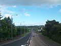
 The A24 Newcastle Road at Clough - geograph.org.uk - 2307857.jpg 1,024 × 768; 142 KB
-
-

-
 The Blackstaff Road in the direction of Clough - geograph.org.uk - 2190750.jpg 1,024 × 548; 132 KB
-
 The Clough Cow - geograph.org.uk - 2497891.jpg 1,024 × 768; 190 KB
-
 The Clough end of the Castlewellan Road - geograph.org.uk - 2307863.jpg 899 × 1,024; 174 KB
-
 The Clough Orange Arch - geograph.org.uk - 5470152.jpg 2,388 × 1,610; 646 KB
-
 The Clough Orange Arch, 2014 - geograph.org.uk - 4101085.jpg 1,024 × 670; 111 KB
-
 The Clough Orange Arch, 2017 - geograph.org.uk - 5445943.jpg 3,333 × 2,356; 1.07 MB
-
 The Clough Presbyterian Church - geograph.org.uk - 2498577.jpg 1,024 × 627; 127 KB
-
 The Cow Man, Clough, Co. Down - geograph.org.uk - 3186869.jpg 1,024 × 768; 186 KB
-
 The Cumran Green Lane - geograph.org.uk - 2508916.jpg 1,024 × 768; 380 KB
-
 The Cumran Primary School, Clough - geograph.org.uk - 2498534.jpg 1,024 × 768; 212 KB
-

-
 The Highwayman Restaurant, Clough - geograph.org.uk - 2190822.jpg 939 × 1,024; 166 KB
-
 The Jordanstown Estate at Clough - geograph.org.uk - 4574254.jpg 1,600 × 1,198; 225 KB
-
 The Jordanstown Estate, Clough - geograph.org.uk - 4744517.jpg 1,600 × 1,200; 316 KB
-
 The junction of the A2 and A24 at Clough - geograph.org.uk - 2190795.jpg 1,024 × 620; 150 KB
-
 The junction of the A2 and the A24 at Clough - geograph.org.uk - 4577715.jpg 1,600 × 1,183; 148 KB
-
-
 The Loyal Orange Arch at Clough - geograph.org.uk - 4592073.jpg 944 × 693; 475 KB
-

-
 The Millennium Hall,Clough - geograph.org.uk - 2498561.jpg 1,024 × 764; 115 KB
-
 The motte and bailey mounds of Clough Castle - geograph.org.uk - 4744311.jpg 1,600 × 1,199; 464 KB
-
 The Newcastle road near Clough - geograph.org.uk - 458885.jpg 640 × 427; 88 KB
-
 The Non-Subscribing Presbyterian Church, Clough - geograph.org.uk - 5602188.jpg 3,962 × 2,207; 6.85 MB
-
 The obverse side of the Clough Orange Arch - geograph.org.uk - 5470149.jpg 3,279 × 2,870; 2.07 MB
-
 The Orange Hall at Clough - geograph.org.uk - 2498602.jpg 752 × 1,024; 153 KB
-
 The ruins of Mount Panther near Clough - geograph.org.uk - 3544153.jpg 1,024 × 770; 106 KB
-
 The southern end of the Cumran Lane path - geograph.org.uk - 2498613.jpg 1,024 × 766; 162 KB
-
 The Square at Clough - geograph.org.uk - 2498609.jpg 1,024 × 640; 106 KB
-
 The Square at Clough - geograph.org.uk - 4555752.jpg 1,600 × 991; 226 KB
-
 The Square at Clough - geograph.org.uk - 4572309.jpg 1,600 × 1,180; 232 KB
-
 The Square, Clough - geograph.org.uk - 2190815.jpg 1,024 × 768; 144 KB
-
 The Square, Clough - geograph.org.uk - 2498546.jpg 1,024 × 711; 119 KB
-
 The Square, Clough, viewed from Main Street - geograph.org.uk - 2190827.jpg 1,024 × 780; 153 KB
-
 The Square, Clough, viewed from the A2 - geograph.org.uk - 2184266.jpg 1,024 × 768; 131 KB
-
 The Square. Clough - geograph.org.uk - 3858918.jpg 883 × 1,024; 166 KB
-
 The Ulster Scots Banner at Clough Roundabout - geograph.org.uk - 2497933.jpg 1,024 × 768; 182 KB
-

-
 The western end of Blackstaff Road at Clough - geograph.org.uk - 3601770.jpg 1,024 × 661; 117 KB
-
 Traffic at the roundabout at Clough - geograph.org.uk - 5602804.jpg 2,660 × 1,991; 2.55 MB
-
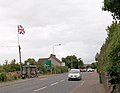
 Twelfth of July flags and bunting at Clough - geograph.org.uk - 3544128.jpg 1,024 × 761; 132 KB
-
 Vacant school, Clough - geograph.org.uk - 2254785.jpg 640 × 480; 46 KB
-

-

-

-

-
 View North along Clough's Main Street - geograph.org.uk - 5470175.jpg 2,558 × 1,681; 687 KB
-
 View south along Main Street, Clough - geograph.org.uk - 3870477.jpg 1,024 × 603; 127 KB
-
 View south along Main Street, Clough - geograph.org.uk - 4577713.jpg 1,600 × 1,198; 218 KB
-
 View WNW across farmland towards a farmhouse on Cumran Lane - geograph.org.uk - 5995263.jpg 3,786 × 2,688; 6.43 MB
-
 Wooded bog land between Clough and Seaforde - geograph.org.uk - 4572317.jpg 1,600 × 1,185; 299 KB
-
 Downpatrick-Clough road near Tullymurry - geograph.org.uk - 340552.jpg 640 × 426; 135 KB
-
 Flowerbed at Clough - geograph.org.uk - 488117.jpg 640 × 426; 97 KB
-
 Meadow beside the Leitrim River - geograph.org.uk - 397934.jpg 640 × 336; 184 KB
-
 Old road near Tullymurry - geograph.org.uk - 340566.jpg 640 × 426; 185 KB
-
 The Newcastle road at Clough - geograph.org.uk - 340580.jpg 640 × 426; 120 KB


_-_geograph.org.uk_-_2307976.jpg)


,_October_2009.JPG)
,_October_2009.JPG)
,_October_2009.JPG)
,_October_2009.JPG)
,_October_2009.JPG)


_Road_-_geograph.org.uk_-_3870455.jpg)


_-_geograph.org.uk_-_5605510.jpg)


_at_Clough_-_geograph.org.uk_-_4744303.jpg)
_west_of_Blackstaff_Bridge_-_geograph.org.uk_-_2184647.jpg)


_at_the_southern_end_of_Clough_-_geograph.org.uk_-_2498553.jpg)
_approaching_the_village_of_Clough_from_the_north_-_geograph.org.uk_-_4574252.jpg)


_as_it_approaches_Clough_-_geograph.org.uk_-_2502661.jpg)


_with_Main_Street,_Clough_-_geograph.org.uk_-_2190809.jpg)


