Category:Clintonville
Jump to navigation
Jump to search
human settlement in Columbus, Ohio, United States of America  Clintonville | |||||
| Upload media | |||||
| Instance of | |||||
|---|---|---|---|---|---|
| Named after | |||||
| Location | Columbus, Franklin County, Ohio | ||||
| Located in or next to body of water | |||||
| Population |
| ||||
 | |||||
English: Clintonville is a neighborhood in north-central Columbus, Ohio with around 28,000 residents. Since Clintonville is an informal neighborhood, there are no formally recognized borders. The southern border is loosely defined as Arcadia Avenue or the Glen Echo Ravine. To the east, either I-71 or the adjacent railroad tracks are commonly accepted. The western boundary is assumed to be the Olentangy River. The northern border of Clintonville is the most ambiguous, with definitions anywhere in the three-mile (5 km) stretch from Cooke Road to the southern border of Worthington. The Clintonville Area Commission recognizes Worthington as its northern border.
Residential districts in Clintonville are divided into three distinct (and unofficial) areas: South Clintonville, North Clintonville, and Beechwold.
Subcategories
This category has the following 12 subcategories, out of 12 total.
B
- Bishop Watterson High School (2 F)
C
- Columbus Park of Roses (36 F)
I
- Indianola Informal School (4 F)
N
- Northmoor Engine House (4 F)
O
W
- Whetstone High School (7 F)
Media in category "Clintonville"
The following 44 files are in this category, out of 44 total.
-
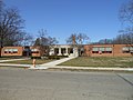 030612 Glenmont School--Columbus, Ohio (4).jpg 4,608 × 3,456; 3.3 MB
-
 1949 - Columbus, Ohio.jpg 1,040 × 574; 214 KB
-
 5464 North High Street Columbus Ohio.JPG 400 × 219; 89 KB
-
 5525 North High Street Columbus Ohio.JPG 400 × 300; 130 KB
-
 5540 North High Street Columbus Ohio.JPG 450 × 204; 103 KB
-
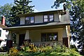
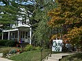
 A home in the Clintonville neighborhood in Columbus, Ohio.jpg 2,966 × 4,464; 10.72 MB
-
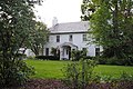
 A.B. Graham House.jpg 5,343 × 3,552; 6.56 MB
-
 Aerial view of Ohio School for the Deaf.jpg 3,205 × 2,155; 1.07 MB
-

-
 Cblck.jpg 2,048 × 1,536; 716 KB
-
 Clinton School -2 (1922)--Columbus, Ohio - 2578690299.jpg 2,288 × 1,712; 770 KB
-
 Clinton Theatre.jpg 4,032 × 3,024; 7.09 MB
-
 Clinton Township School -1.jpg 2,288 × 1,712; 731 KB
-
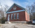 Clintonville former schoolhouse.jpg 5,115 × 4,000; 15.19 MB
-
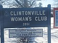
 Clintonville Plaque.jpg 3,991 × 2,661; 8.18 MB
-
 Clintonville underground walkway.jpg 4,032 × 3,024; 3.93 MB
-
 Clintonville.jpg 4,032 × 3,024; 4.25 MB
-
 Columbus ohio richard berry jr house.jpg 3,872 × 2,592; 4.56 MB
-
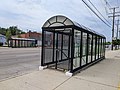
 COTA bus turnaround.jpg 3,752 × 2,170; 1.83 MB
-

-
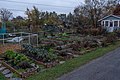 CRC's (Clintonville-Beechwold Community Resources Center) community Midgarden in Autumn 2021.jpg 6,000 × 4,000; 15.41 MB
-
 Csign.jpg 2,048 × 1,536; 686 KB
-
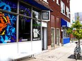
 Cstrip.jpg 1,536 × 2,048; 760 KB
-
 Cville.jpg 1,232 × 1,632; 616 KB
-
 Former HoJo Restaurant, Columbus, OH.jpg 3,000 × 1,170; 3.75 MB
-
 Gates of Hell exit.jpg 3,101 × 2,237; 2.03 MB
-

-

-
 Inside the Gates of Hell storm sewer.jpg 3,256 × 2,440; 4.01 MB
-
 Kroger sign, Clintonville, Columbus, OH.jpg 1,024 × 658; 285 KB
-
 Nancy's Home Cooking - panoramio.jpg 1,932 × 2,580; 1.13 MB
-
 North Broadway east of Calumet.jpg 2,816 × 1,584; 1.65 MB
-
 NS 7632 GE ES40DC & NS 8882 GE C40-9.jpg 1,280 × 799; 193 KB
-
 NS 7670 GE ES40-DC.jpg 2,304 × 1,536; 679 KB
-
 Old Clintonville sign.jpg 3,391 × 5,765; 11.58 MB
-
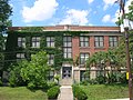
 Schoolhouse in Clintonville.jpg 1,024 × 799; 354 KB
-
 Stream at the Walhalla ravine.jpg 1,024 × 768; 764 KB
-
 V 3ABC.jpg 576 × 1,024; 242 KB
-
 V 5A9C.jpg 576 × 1,024; 248 KB
-
 V 89DE.jpg 1,024 × 576; 273 KB
-
 V EA37.jpg 1,024 × 576; 254 KB
-
 Walhalla-Ravine.jpg 213 × 320; 112 KB
-
 Whetstone Branch Library.jpg 4,032 × 3,024; 8.94 MB
-
 Whetstone Park.jpg 4,032 × 3,024; 8.18 MB
.jpg)


--Columbus,_Ohio_-_2578690299.jpg)


_community_Midgarden_building_at_the_community_garden_in_the_Clintonville_neighborhood_of_Columbus,_Ohio._The_west_wall_is_adorned_with_a_flower_mural.jpg)
_community_Midgarden_in_Autumn_2021.jpg)


.jpg)
.jpg)


