Category:Clashnessie
Jump to navigation
Jump to search
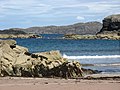
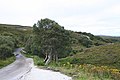
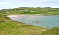
English: Clashnessie is a small crofting community on the North-West coast of Scotland; specifically in the Assynt area of Sutherland.
human settlement in Highland, Scotland, UK  | |||||
| Upload media | |||||
| Instance of | |||||
|---|---|---|---|---|---|
| Location |
| ||||
 | |||||
Media in category "Clashnessie"
The following 53 files are in this category, out of 53 total.
-
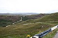 A serpentine road heading eastwards. - geograph.org.uk - 229185.jpg 640 × 426; 93 KB
-
 Clashnessie Bay - geograph.org.uk - 1215662.jpg 640 × 481; 128 KB
-
 Clashnessie Bay - geograph.org.uk - 1215679.jpg 640 × 481; 135 KB
-
 Clashnessie Bay - geograph.org.uk - 1254931.jpg 640 × 426; 75 KB
-
 Clashnessie Bay - geograph.org.uk - 2411403.jpg 1,500 × 978; 389 KB
-
 Clashnessie Bay - geograph.org.uk - 4428654.jpg 1,600 × 1,066; 460 KB
-
 Clashnessie Bay - geograph.org.uk - 5776548.jpg 3,870 × 2,205; 1.62 MB
-
 Clashnessie Bay - geograph.org.uk - 5776554.jpg 4,000 × 2,357; 1.67 MB
-
 Clashnessie Bay - geograph.org.uk - 71681.jpg 640 × 480; 57 KB
-
 Clashnessie Bay - geograph.org.uk - 903602.jpg 638 × 480; 34 KB
-
 Clashnessie Bay over Imirfada - geograph.org.uk - 921574.jpg 640 × 480; 61 KB
-
 Clashnessie beach - geograph.org.uk - 1367460.jpg 640 × 401; 90 KB
-
 Clashnessie beach - geograph.org.uk - 4946408.jpg 1,800 × 1,013; 1.22 MB
-
 Clashnessie Falls - Flickr - Charlie From Bristol.jpg 4,580 × 6,820; 14.74 MB
-
 Clashnessie viewed from the beach - geograph.org.uk - 1022732.jpg 640 × 480; 71 KB
-
 Clashnessie Waterfall - geograph.org.uk - 1468972.jpg 480 × 640; 101 KB
-
 Clashnessie Waterfall - geograph.org.uk - 1468979.jpg 640 × 480; 58 KB
-
 Clashnessie, Sutherland, Scotland, 14 April 2011 - Flickr - PhillipC.jpg 3,810 × 2,366; 1.78 MB
-
 Clashnessie1.jpg 400 × 264; 23 KB
-
 Clean sand on Clashnessie beach - geograph.org.uk - 870470.jpg 640 × 449; 71 KB
-
 Entering Clashnessie - geograph.org.uk - 1086791.jpg 640 × 601; 122 KB
-
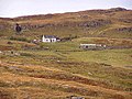 Houses overlooking Clashnessie Bay - geograph.org.uk - 1215673.jpg 640 × 481; 159 KB
-

-

-
 Road by Clashnessie Bay - geograph.org.uk - 3935268.jpg 1,439 × 957; 807 KB
-
 Rough pasture at Clashnessie Bay - geograph.org.uk - 910567.jpg 525 × 394; 53 KB
-
 Rubh' a' Gharbh Uillt - geograph.org.uk - 6196865.jpg 640 × 427; 110 KB
-
 Sheep grazing at Clashnessie - geograph.org.uk - 1254921.jpg 640 × 426; 62 KB
-
 Stream on the beach at Clashnessie - geograph.org.uk - 5904534.jpg 640 × 480; 230 KB
-
 Swimming at the end of Clashnessie Bay - geograph.org.uk - 157071.jpg 640 × 480; 124 KB
-
 The beach at Clashnessie Bay - geograph.org.uk - 5904730.jpg 640 × 480; 211 KB
-
 Tidal rock in Clashnessie Bay - geograph.org.uk - 5904737.jpg 640 × 480; 285 KB
-
-
 Waterfall Near Clashnessie - geograph.org.uk - 1108774.jpg 640 × 428; 82 KB
-
 Bridge over Allt na Claise. - geograph.org.uk - 229171.jpg 640 × 426; 92 KB
-
 Bridge Over the Oldany River - geograph.org.uk - 227625.jpg 480 × 640; 111 KB
-
 Clashnessie Bay - geograph.org.uk - 117898.jpg 640 × 481; 113 KB
-
 Clasnessie Bay - geograph.org.uk - 242980.jpg 640 × 384; 61 KB
-

-
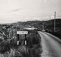
 Entering the hamlet of Clashnessie. - geograph.org.uk - 229143.jpg 640 × 426; 98 KB
-
 Imirfada - geograph.org.uk - 229268.jpg 640 × 384; 60 KB
-
 Imirfada,near Clashnessie - geograph.org.uk - 709257.jpg 640 × 428; 106 KB
-
 Loch na Bruthaich - geograph.org.uk - 227609.jpg 640 × 384; 68 KB
-
 Loch nan Lub - geograph.org.uk - 661070.jpg 640 × 480; 58 KB
-

-
 Lochan with no name, near Clashnessie - geograph.org.uk - 709263.jpg 640 × 427; 77 KB
-

-
 Oldany - geograph.org.uk - 227626.jpg 640 × 384; 85 KB
-
 Road alongside Clashnessie Bay - geograph.org.uk - 425016.jpg 600 × 450; 312 KB
-
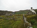
 Ruined Fence and Wall, Clashnessie - geograph.org.uk - 227603.jpg 640 × 384; 96 KB
-
 The Kylesku junction on the B869. - geograph.org.uk - 228935.jpg 640 × 426; 71 KB
-
 The lane to Ardvar. - geograph.org.uk - 229175.jpg 640 × 426; 122 KB
-
 Wall End, Clashnessie - geograph.org.uk - 239751.jpg 640 × 384; 76 KB


