Category:Claonaig
Jump to navigation
Jump to search

village in Argyll and Bute, Scotland, UK  | |||||
| Upload media | |||||
| Instance of | |||||
|---|---|---|---|---|---|
| Location |
| ||||
 | |||||
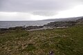
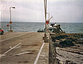
English: Claonaig is a small village on the east coast of the Kintyre peninsula in western Scotland, linked to Lochranza on the Isle of Arran by ferry (summer only).
Gàidhlig: 'S e baile-beag ann an Cinn Tìre th' ann an Claonaig. 'S e port-mara airson aiseig a tha ann. An sin tha aiseagan a' dol eadar Claonaig agus Loch Raonasa ann an Arainn le Caledonian Mac a' Bhruthainn.
Media in category "Claonaig"
The following 74 files are in this category, out of 74 total.
-
 "Are we there yet" - geograph.org.uk - 59044.jpg 640 × 480; 96 KB
-
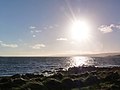 Afternoon sun at Claonaig - geograph.org.uk - 3233067.jpg 1,600 × 1,202; 277 KB
-
 Allt a Bhuic Meets the Sea. - geograph.org.uk - 348312.jpg 640 × 480; 106 KB
-
 Arran and the ferry from Claonaig.jpg 640 × 435; 57 KB
-
 Arran ferry dock at Claonaig - geograph.org.uk - 3761376.jpg 1,600 × 1,067; 294 KB
-
 Auchameanach Farm - geograph.org.uk - 1093600.jpg 640 × 427; 171 KB
-
 Beach at Claonaig - geograph.org.uk - 3067695.jpg 640 × 480; 82 KB
-
 Black Guillemot (Cepphus Grylle) - geograph.org.uk - 3817185.jpg 478 × 640; 42 KB
-
 Choppy sea at Claonaig - geograph.org.uk - 3857125.jpg 1,600 × 1,203; 415 KB
-
 Claonaig - geograph.org.uk - 563855.jpg 640 × 480; 46 KB
-
 Claonaig Ferry Terminal - geograph.org.uk - 2803237.jpg 4,000 × 3,000; 4.88 MB
-
 Claonaig Pier - geograph.org.uk - 2608563.jpg 2,048 × 1,536; 566 KB
-
 Claonaig Pier - geograph.org.uk - 555.jpg 640 × 484; 26 KB
-
 Claonaig Pier and ferry to Lochranza - geograph.org.uk - 3514683.jpg 640 × 480; 53 KB
-
 Claonaig Slipway - geograph.org.uk - 3145612.jpg 640 × 427; 352 KB
-
 Cloanaig slipway - geograph.org.uk - 2274921.jpg 1,024 × 634; 196 KB
-
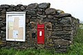 Edward VII letter box at Claonaig. - geograph.org.uk - 470650.jpg 640 × 427; 281 KB
-
 Entrance to Forestry in Allt Romain. - geograph.org.uk - 342072.jpg 640 × 480; 78 KB
-

-
 From Claonaig Pier - geograph.org.uk - 167763.jpg 640 × 445; 305 KB
-
 Great Northern Loon by Claonaig ferry dock - geograph.org.uk - 3817176.jpg 1,600 × 1,196; 498 KB
-
 Kilbrannan Sound. - geograph.org.uk - 88817.jpg 640 × 480; 48 KB
-
 Loading the ferry - Claonaig - geograph.org.uk - 2528289.jpg 1,000 × 662; 510 KB
-
 Mobile cinema - Claonaig - geograph.org.uk - 2528287.jpg 1,000 × 662; 327 KB
-

-
 NCN Millennium Milepost MP178 Claonaig.jpeg 1,000 × 3,449; 406 KB
-
 No ferries today^ - geograph.org.uk - 3817196.jpg 1,600 × 1,200; 244 KB
-
 Ordnance Survey One-Inch Sheet 58 Knapdale, Published 1956 2.jpg 8,597 × 10,871; 16.43 MB
-
 Ordnance Survey One-Inch Sheet 58 Knapdale, Published 1956.jpg 8,229 × 9,867; 9.03 MB
-
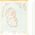 Ordnance Survey One-Inch Sheet 66 Arran, Published 1956 2.jpg 10,733 × 10,661; 13.95 MB
-
 Ordnance Survey One-Inch Sheet 66 Arran, Published 1956.jpg 8,256 × 9,888; 7.08 MB
-
 Ordnance Survey One-Inch Sheet 71 Island of Bute, Published 1925.jpg 12,190 × 11,123; 13.44 MB
-
 Perimeter Fence at Claonaig Car Park. - geograph.org.uk - 554292.jpg 426 × 640; 320 KB
-

-

-
 Queuing at Claonaig - geograph.org.uk - 1860297.jpg 640 × 480; 50 KB
-
 Raised beach, Claonaig - geograph.org.uk - 5188616.jpg 1,024 × 683; 265 KB
-
 Rocky shore at Claonaig Bay - geograph.org.uk - 3761393.jpg 1,600 × 1,067; 241 KB
-
 Rocky Shoreline at Coille Rubha Dhuibh. - geograph.org.uk - 348274.jpg 640 × 480; 115 KB
-
 Shore at Claonaig - geograph.org.uk - 5132473.jpg 640 × 360; 197 KB
-
 Small Bay at Coille Rubha Dhuibh. - geograph.org.uk - 348256.jpg 640 × 480; 116 KB
-
 The Arran ferry dock at Claonaig - geograph.org.uk - 3233109.jpg 1,600 × 1,206; 581 KB
-
 Two Cormorants fishing at Claonaig - geograph.org.uk - 3761384.jpg 1,600 × 1,201; 409 KB
-
 View of Arran - geograph.org.uk - 5188618.jpg 1,024 × 683; 253 KB
-
 Waiting for the ferry from Arran - geograph.org.uk - 2618368.jpg 640 × 427; 249 KB
-
 Allta a Bhuic. - geograph.org.uk - 348284.jpg 640 × 480; 116 KB
-
 Alltan Coire. - geograph.org.uk - 345330.jpg 480 × 640; 122 KB
-
 Arivore Lodge - geograph.org.uk - 610234.jpg 640 × 480; 63 KB
-
 Auchmeanach Farm - geograph.org.uk - 308691.jpg 640 × 426; 93 KB
-
 B8001 single track road to Carradale. - geograph.org.uk - 122057.jpg 640 × 480; 125 KB
-
 Car Park at Claonaig. - geograph.org.uk - 554295.jpg 640 × 426; 262 KB
-
 Claonaig Bay and Ferry Slipway. - geograph.org.uk - 348298.jpg 640 × 480; 101 KB
-
 Claonaig by Skipness, Kintyre. - geograph.org.uk - 58721.jpg 640 × 480; 76 KB
-
 Claonaig Ferry Slipway, Kintyre. - geograph.org.uk - 122226.jpg 640 × 480; 94 KB
-

-
 Claonaig Ferry Terminal, Kintyre - geograph.org.uk - 122223.jpg 640 × 480; 100 KB
-
 Claonaig Jetty - geograph.org.uk - 495337.jpg 640 × 497; 125 KB
-
 Clonaig Ferry Terminal. - geograph.org.uk - 88815.jpg 640 × 480; 50 KB
-
 Countryside from the B8001 - geograph.org.uk - 610207.jpg 640 × 480; 53 KB
-
 Countryside pond - geograph.org.uk - 610203.jpg 640 × 480; 60 KB
-
 Drainage ditches - geograph.org.uk - 308662.jpg 640 × 426; 93 KB
-
 Glenreasdell Lodge - geograph.org.uk - 610248.jpg 640 × 480; 50 KB
-
 Gorse thicket - geograph.org.uk - 308732.jpg 640 × 426; 106 KB
-
 Hills of Isle of Arran - geograph.org.uk - 61060.jpg 640 × 480; 109 KB
-
 Moorland - geograph.org.uk - 610216.jpg 640 × 480; 46 KB
-
 Road to Kennacraig. - geograph.org.uk - 105160.jpg 640 × 480; 81 KB
-
 Rocky foreshore at Claonaig Jetty - geograph.org.uk - 417765.jpg 424 × 640; 182 KB
-
 The Jetty at Claonaig - geograph.org.uk - 50396.jpg 640 × 426; 53 KB
-
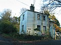
 The Old Chapel, Claonaig, Kintyre - geograph.org.uk - 59056.jpg 640 × 480; 83 KB
-
 Towards Loch Fyne from North Kintyre - geograph.org.uk - 41056.jpg 640 × 480; 85 KB
-

-
 Waterfall near to Claonaig, Kintyre. - geograph.org.uk - 63452.jpg 640 × 480; 195 KB
-

-


_-_geograph.org.uk_-_3817185.jpg)


