Category:City Park, Żarów
Jump to navigation
Jump to search
| Object location | | View all coordinates using: OpenStreetMap |
|---|
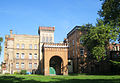
park in Żarów, Lower Silesian Voivodeship, Poland  | |||||
| Upload media | |||||
| Instance of | |||||
|---|---|---|---|---|---|
| Location | Żarów, Gmina Żarów, Świdnica County, Lower Silesian Voivodeship, Poland | ||||
| Street address |
| ||||
| Heritage designation |
| ||||
| Inception |
| ||||
 | |||||
Polski: Żarów - zespół parku miejskiego, 1860:
- park miejski z aleją dębową, 1860 (597815)
- budynek administracyjno-mieszkalny fabryki przem. chemicznego, 1860 (597816)
- grota (z rudy darniowej), 1860 (597817)
Media in category "City Park, Żarów"
The following 9 files are in this category, out of 9 total.
-
 Park w Żarowie 01aw.jpg 3,083 × 2,139; 2.11 MB
-
 Park w Żarowie 02aw.jpg 4,000 × 3,000; 3.67 MB
-
 Park w Żarowie 03aw.jpg 3,913 × 2,710; 2.28 MB
-
 Park w Żarowie 04aw.jpg 3,706 × 2,565; 1.87 MB
-
 Park w Żarowie 05aw.jpg 3,000 × 4,000; 3.18 MB
-
 Park w Żarowie 06aw.jpg 3,000 × 4,000; 4.75 MB
-
 Park w Żarowie 07aw.jpg 3,850 × 2,664; 2.57 MB
-
 Park w Żarowie 08aw.jpg 3,343 × 2,067; 2.01 MB
-
 Park w Żarowie 09aw.jpg 3,344 × 2,320; 2.6 MB


