Category:Cima Fournier
Jump to navigation
Jump to search
|
Cima Fournier has an entry on OpenStreetMap (show). |
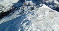
mountain of the Cottian Alps  | |||||
| Upload media | |||||
| Instance of | |||||
|---|---|---|---|---|---|
| Location |
| ||||
| Mountain range | |||||
| Topographic prominence |
| ||||
| Elevation above sea level |
| ||||
 | |||||
Subcategories
This category has only the following subcategory.
P
Media in category "Cima Fournier"
The following 4 files are in this category, out of 4 total.
-
 Cima Fournier cippo confinario sulla vetta.png 2,127 × 1,133; 3.24 MB
-
 Cima Fournier da Poggio Carabinieri.jpg 5,152 × 3,864; 7.88 MB
-
 Cima Fournier da vallone Servierettes.jpg 5,152 × 2,127; 5.27 MB
-
 Lago Nero in inverno.png 1,177 × 441; 727 KB

