Category:Churchtown, Lancashire
Jump to navigation
Jump to search
English: Kirkland is a civil parish located on the banks of the River Wyre midway between Preston and Lancaster in the English county of Lancashire. It is also the historic name of the village of Churchtown within the parish. There are two pubs: the Punchbowl and the Horns Inn. (→Churchtown, Lancashire)
village in Lancashire, UK | |||||
| Upload media | |||||
| Instance of | |||||
|---|---|---|---|---|---|
| Location | Kirkland, Wyre, Lancashire, North West England, England | ||||
 | |||||
Subcategories
This category has the following 2 subcategories, out of 2 total.
H
P
- The Punchbowl, Churchtown (3 F)
Media in category "Churchtown, Lancashire"
The following 27 files are in this category, out of 27 total.
-
 Ainspool Lane, Churchtown - geograph.org.uk - 1000989.jpg 640 × 480; 166 KB
-
 Bridge, Weir and Pump - geograph.org.uk - 1110102.jpg 640 × 426; 141 KB
-
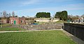
 Church Square, Churchtown - geograph.org.uk - 219275.jpg 640 × 480; 117 KB
-
 Church Street, Churchtown - geograph.org.uk - 1000944.jpg 640 × 480; 169 KB
-
 Church Street, Churchtown - geograph.org.uk - 1000987.jpg 640 × 480; 152 KB
-
 Churchtown - panoramio - jim walton (1).jpg 1,000 × 750; 233 KB
-
 Churchtown - panoramio - jim walton (2).jpg 1,000 × 750; 203 KB
-
 Churchtown - panoramio - jim walton (4).jpg 1,000 × 750; 244 KB
-
 Churchtown - panoramio - jim walton (6).jpg 1,000 × 750; 151 KB
-
 Churchtown - panoramio - jim walton.jpg 1,000 × 750; 233 KB
-
 Churchtown - panoramio.jpg 1,000 × 750; 232 KB
-
 Churchtown lancashire - panoramio (2).jpg 990 × 743; 352 KB
-
 Churchtown lancashire - panoramio.jpg 990 × 743; 306 KB
-
 Churchtown Sewage Works - geograph.org.uk - 1192033.jpg 640 × 341; 83 KB
-
 Churchtown village memorial - geograph.org.uk - 1043647.jpg 640 × 479; 66 KB
-
 Clean Round the Bend - geograph.org.uk - 1192030.jpg 640 × 426; 131 KB
-
 Concrete Blocks - geograph.org.uk - 1110115.jpg 640 × 426; 120 KB
-
 Ditch next to Sharple's Lane - geograph.org.uk - 1041119.jpg 640 × 479; 109 KB
-
 Footbridge over the River Wyre - geograph.org.uk - 218332.jpg 640 × 480; 84 KB
-
 Horns Inn - geograph.org.uk - 1570324.jpg 640 × 480; 69 KB
-
 Monitoring Mast - geograph.org.uk - 1110150.jpg 400 × 600; 79 KB
-

-
 Stile for path leading over Wag Hill - geograph.org.uk - 1041122.jpg 640 × 479; 93 KB
-
 Storage Tower on Tarnacre House farm - geograph.org.uk - 1041126.jpg 640 × 479; 60 KB
-
 The Green, Churchtown - geograph.org.uk - 1000993.jpg 640 × 480; 199 KB
-
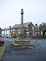
 The village cross, Churchtown - geograph.org.uk - 219276.jpg 640 × 480; 72 KB
-
 The village pillar, Churchtown - geograph.org.uk - 1000940.jpg 474 × 632; 136 KB


.jpg)
.jpg)
.jpg)
.jpg)


.jpg)


