Category:Churches in Derbyshire photographed in 2015
Jump to navigation
Jump to search
English: Churches in Derbyshire photographed in 2015.
Français : Églises dans le Derbyshire photographiées en 2015.
Ceremonial counties of England: Bedfordshire · Buckinghamshire · Cambridgeshire · Derbyshire · Essex · Gloucestershire · Greater London · Hampshire · Hertfordshire · Kent · Lincolnshire · Norfolk · North Yorkshire · Northamptonshire · Oxfordshire · Suffolk · West Sussex · Wiltshire · Worcestershire
City-counties:
Former historic counties:
Other former counties:
City-counties:
Former historic counties:
Other former counties:
Media in category "Churches in Derbyshire photographed in 2015"
The following 185 files are in this category, out of 185 total.
-

-
-
-

-

-

-

-

-

-
-
-

-
 Holy Trinity, Fernilee, altar - geograph.org.uk - 4611213.jpg 640 × 480; 91 KB
-

-

-

-

-
 Holy Trinity, Fernilee, lectern - geograph.org.uk - 4611396.jpg 640 × 480; 71 KB
-
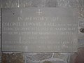
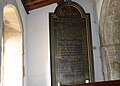
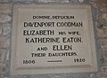
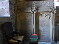
 Holy Trinity, Fernilee, memorial (I) - geograph.org.uk - 4611380.jpg 640 × 480; 50 KB
-

-

-

-
 Holy Trinity, Fernilee, memorial (V) - geograph.org.uk - 4612813.jpg 640 × 480; 50 KB
-
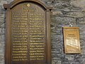
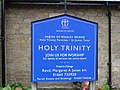 Holy Trinity, Fernilee, noticeboard - geograph.org.uk - 4590049.jpg 640 × 480; 93 KB
-

-
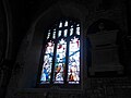
 Inside Holy Trinity, Fernilee (i) - geograph.org.uk - 4611222.jpg 640 × 480; 71 KB
-
 Inside Holy Trinity, Fernilee (ii) - geograph.org.uk - 4611225.jpg 640 × 480; 67 KB
-
 Inside Holy Trinity, Fernilee (iii) - geograph.org.uk - 4611227.jpg 640 × 480; 63 KB
-
 Inside Holy Trinity, Fernilee (iv) - geograph.org.uk - 4611228.jpg 640 × 480; 66 KB
-
 Inside Holy Trinity, Fernilee (ix) - geograph.org.uk - 4612821.jpg 640 × 480; 68 KB
-
 Inside Holy Trinity, Fernilee (v) - geograph.org.uk - 4611230.jpg 640 × 480; 67 KB
-
 Inside Holy Trinity, Fernilee (vi) - geograph.org.uk - 4611397.jpg 640 × 480; 77 KB
-
 Inside Holy Trinity, Fernilee (vii) - geograph.org.uk - 4612818.jpg 640 × 480; 74 KB
-
 Inside Holy Trinity, Fernilee (viii) - geograph.org.uk - 4612819.jpg 441 × 640; 63 KB
-
 Inside Holy Trinity, Fernilee (x) - geograph.org.uk - 4612822.jpg 640 × 473; 59 KB
-
 Inside Holy Trinity, Fernilee (xi) - geograph.org.uk - 4612824.jpg 640 × 480; 77 KB
-
 Inside Holy Trinity, Fernilee (xiii) - geograph.org.uk - 4612827.jpg 640 × 480; 65 KB
-
 Inside Holy Trinity, Fernilee (xiv) - geograph.org.uk - 4612829.jpg 640 × 480; 68 KB
-
 Inside Holy Trinity, Fernilee (xiv) - geograph.org.uk - 4612831.jpg 640 × 480; 59 KB
-
 Inside St James, Harpur Hill (i) - geograph.org.uk - 4625032.jpg 640 × 471; 56 KB
-
 Inside St James, Harpur Hill (ii) - geograph.org.uk - 4625034.jpg 640 × 480; 60 KB
-
 Inside St James, Harpur Hill (iii) - geograph.org.uk - 4625035.jpg 640 × 480; 60 KB
-
-

-

-

-

-

-

-

-

-

-

-

-

-

-
-

-
-

-

-

-

-

-

-

-

-
-

-

-

-
-

-

-

-

-
 St James' Church, Buxworth (2).jpg 640 × 480; 99 KB
-
 St James, Buxworth, churchyard (i) - geograph.org.uk - 4602199.jpg 640 × 480; 137 KB
-
 St James, Buxworth, churchyard (ii) - geograph.org.uk - 4602234.jpg 640 × 480; 111 KB
-
 St James, Buxworth, churchyard (iii) - geograph.org.uk - 4602238.jpg 640 × 480; 93 KB
-
 St James, Buxworth, churchyard (iv) - geograph.org.uk - 4602240.jpg 640 × 480; 113 KB
-
 St James, Buxworth, churchyard (v) - geograph.org.uk - 4602242.jpg 640 × 480; 108 KB
-
 St James, Buxworth, churchyard (vi) - geograph.org.uk - 4602244.jpg 640 × 480; 78 KB
-
 St James, Buxworth, churchyard (vii) - geograph.org.uk - 4602246.jpg 640 × 480; 120 KB
-
 St James, Buxworth, churchyard (viii) - geograph.org.uk - 4602250.jpg 640 × 480; 105 KB
-
 St James, Harpur Hill, churchyard (a) - geograph.org.uk - 4625009.jpg 640 × 480; 105 KB
-

-
 St James, Harpur Hill, font - geograph.org.uk - 4625038.jpg 640 × 464; 44 KB
-
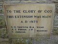
 St James, Harpur Hill, foundation stone - geograph.org.uk - 4625028.jpg 640 × 477; 107 KB
-
 St James, Harpur Hill, late July 2015 - geograph.org.uk - 4591235.jpg 640 × 480; 107 KB
-
 St James, Harpur Hill, memorial (i) - geograph.org.uk - 4625024.jpg 640 × 480; 102 KB
-
 St James, Harpur Hill, memorial (ii) - geograph.org.uk - 4625027.jpg 640 × 480; 65 KB
-
 St James, Harpur Hill, organ - geograph.org.uk - 4625040.jpg 640 × 480; 48 KB
-

-

-

-

-

-

-

-

-

-

-

-

-

-

-

-
 St John the Baptist, Chelmorton, porch - geograph.org.uk - 4624130.jpg 640 × 480; 119 KB
-

-

-
 St Margaret, Wormhill, an overgrown tomb - geograph.org.uk - 4615911.jpg 640 × 480; 151 KB
-

-
 St Margaret, Wormhill, church path - geograph.org.uk - 4614468.jpg 640 × 480; 122 KB
-
 St Margaret, Wormhill, graves - geograph.org.uk - 4615907.jpg 640 × 480; 115 KB
-
 St Margaret, Wormhill, gravestones - geograph.org.uk - 4615905.jpg 640 × 480; 132 KB
-
 St Margaret, Wormhill, late July 2015 - geograph.org.uk - 4590097.jpg 640 × 480; 100 KB
-
 St Michael, Taddington, churchyard (A) - geograph.org.uk - 4624047.jpg 640 × 480; 102 KB
-

-

-
 St Michael, Taddington, churchyard (D) - geograph.org.uk - 4624065.jpg 640 × 480; 115 KB
-

-
 St Michael, Taddington, lych gate - geograph.org.uk - 4624033.jpg 640 × 480; 80 KB
-

-
 St Michael, Taddington, war memorial - geograph.org.uk - 4624044.jpg 640 × 480; 82 KB
-
-

-

-

-

-

-

-

-

-

-

-

-
-

-

-

-

-

-

-

-
-

-

-
-

-

-
-

-

-

-
-

-

-

-

-

-

-

-

-

-

-

-

-

-

-

-
-

-

-

-

-

-

-

-

-
-

-

-

-

_-_geograph.org.uk_-_4614435.jpg)
_-_geograph.org.uk_-_4614439.jpg)
_-_geograph.org.uk_-_4614440.jpg)
_-_geograph.org.uk_-_4614441.jpg)
_-_geograph.org.uk_-_4614447.jpg)
_-_geograph.org.uk_-_4614442.jpg)
_-_geograph.org.uk_-_4614444.jpg)
_-_geograph.org.uk_-_4614445.jpg)
_-_geograph.org.uk_-_4614448.jpg)
_-_geograph.org.uk_-_4614449.jpg)
_-_geograph.org.uk_-_4614450.jpg)
_-_geograph.org.uk_-_4614451.jpg)


_-_geograph.org.uk_-_4611210.jpg)
_-_geograph.org.uk_-_4611200.jpg)


_-_geograph.org.uk_-_4611380.jpg)
_-_geograph.org.uk_-_4611382.jpg)
_-_geograph.org.uk_-_4611392.jpg)
_-_geograph.org.uk_-_4611394.jpg)
_-_geograph.org.uk_-_4612813.jpg)


_-_geograph.org.uk_-_4611222.jpg)
_-_geograph.org.uk_-_4611225.jpg)
_-_geograph.org.uk_-_4611227.jpg)
_-_geograph.org.uk_-_4611228.jpg)
_-_geograph.org.uk_-_4612821.jpg)
_-_geograph.org.uk_-_4611230.jpg)
_-_geograph.org.uk_-_4611397.jpg)
_-_geograph.org.uk_-_4612818.jpg)
_-_geograph.org.uk_-_4612819.jpg)
_-_geograph.org.uk_-_4612822.jpg)
_-_geograph.org.uk_-_4612824.jpg)
_-_geograph.org.uk_-_4612827.jpg)
_-_geograph.org.uk_-_4612829.jpg)
_-_geograph.org.uk_-_4612831.jpg)
_-_geograph.org.uk_-_4625032.jpg)
_-_geograph.org.uk_-_4625034.jpg)
_-_geograph.org.uk_-_4625035.jpg)
_-_geograph.org.uk_-_4624132.jpg)
_-_geograph.org.uk_-_4624138.jpg)
_-_geograph.org.uk_-_4624136.jpg)
_-_geograph.org.uk_-_4624137.jpg)
_-_geograph.org.uk_-_4624140.jpg)
_-_geograph.org.uk_-_4624156.jpg)
_-_geograph.org.uk_-_4624142.jpg)
_-_geograph.org.uk_-_4624143.jpg)
_-_geograph.org.uk_-_4624152.jpg)
_-_geograph.org.uk_-_4624153.jpg)
_-_geograph.org.uk_-_4624157.jpg)
_-_geograph.org.uk_-_4624158.jpg)
_-_geograph.org.uk_-_4624160.jpg)
_-_geograph.org.uk_-_4624161.jpg)
_-_geograph.org.uk_-_4612998.jpg)
_-_geograph.org.uk_-_4613021.jpg)
_-_geograph.org.uk_-_4613023.jpg)
_-_geograph.org.uk_-_4613024.jpg)
_-_geograph.org.uk_-_4613026.jpg)
_-_geograph.org.uk_-_4613027.jpg)
_-_geograph.org.uk_-_4613030.jpg)
_-_geograph.org.uk_-_4613031.jpg)
_-_geograph.org.uk_-_4613899.jpg)
_-_geograph.org.uk_-_4613001.jpg)
_-_geograph.org.uk_-_4613002.jpg)
_-_geograph.org.uk_-_4613003.jpg)
_-_geograph.org.uk_-_4613005.jpg)
_-_geograph.org.uk_-_4613009.jpg)
_-_geograph.org.uk_-_4613008.jpg)
_-_geograph.org.uk_-_4613011.jpg)
_-_geograph.org.uk_-_4613014.jpg)
_-_geograph.org.uk_-_4613016.jpg)
_-_geograph.org.uk_-_4613019.jpg)

.jpg)
_-_geograph.org.uk_-_4602199.jpg)
_-_geograph.org.uk_-_4602234.jpg)
_-_geograph.org.uk_-_4602238.jpg)
_-_geograph.org.uk_-_4602240.jpg)
_-_geograph.org.uk_-_4602242.jpg)
_-_geograph.org.uk_-_4602244.jpg)
_-_geograph.org.uk_-_4602246.jpg)
_-_geograph.org.uk_-_4602250.jpg)
_-_geograph.org.uk_-_4625009.jpg)
_-_geograph.org.uk_-_4625018.jpg)


_-_geograph.org.uk_-_4625024.jpg)
_-_geograph.org.uk_-_4625027.jpg)


_-_geograph.org.uk_-_4624074.jpg)
_-_geograph.org.uk_-_4624120.jpg)
_-_geograph.org.uk_-_4624122.jpg)
_-_geograph.org.uk_-_4624125.jpg)
_-_geograph.org.uk_-_4624198.jpg)
_-_geograph.org.uk_-_4624205.jpg)
_-_geograph.org.uk_-_4624206.jpg)
_-_geograph.org.uk_-_4624210.jpg)
_-_geograph.org.uk_-_4624214.jpg)
_-_geograph.org.uk_-_4624215.jpg)
_-_geograph.org.uk_-_4624217.jpg)


_-_geograph.org.uk_-_4624047.jpg)
_-_geograph.org.uk_-_4624048.jpg)
_-_geograph.org.uk_-_4624062.jpg)
_-_geograph.org.uk_-_4624065.jpg)


_-_geograph.org.uk_-_4612962.jpg)
_-_geograph.org.uk_-_4612971.jpg)
_-_geograph.org.uk_-_4612973.jpg)
_-_geograph.org.uk_-_4612974.jpg)
_-_geograph.org.uk_-_4612982.jpg)
_-_geograph.org.uk_-_4612975.jpg)
_-_geograph.org.uk_-_4612976.jpg)
_-_geograph.org.uk_-_4612979.jpg)
_-_geograph.org.uk_-_4612981.jpg)
_-_geograph.org.uk_-_4612983.jpg)
_-_geograph.org.uk_-_4612984.jpg)
_-_geograph.org.uk_-_4612985.jpg)
_-_geograph.org.uk_-_4612987.jpg)
_-_geograph.org.uk_-_4612988.jpg)
_-_geograph.org.uk_-_4612989.jpg)
_-_geograph.org.uk_-_4612995.jpg)
_-_geograph.org.uk_-_4612996.jpg)


_-_geograph.org.uk_-_4613040.jpg)
_-_geograph.org.uk_-_4613042.jpg)
_-_geograph.org.uk_-_4613902.jpg)
_-_geograph.org.uk_-_4613905.jpg)
_-_geograph.org.uk_-_4613043.jpg)
_-_geograph.org.uk_-_4613047.jpg)
_-_geograph.org.uk_-_4613052.jpg)
_-_geograph.org.uk_-_4613059.jpg)
_-_geograph.org.uk_-_4614310.jpg)
_-_geograph.org.uk_-_4614301.jpg)
_-_geograph.org.uk_-_4614304.jpg)
_-_geograph.org.uk_-_4614309.jpg)
_-_geograph.org.uk_-_4614314.jpg)
_-_geograph.org.uk_-_4614316.jpg)
_-_geograph.org.uk_-_4614318.jpg)
_-_geograph.org.uk_-_4614319.jpg)
_-_geograph.org.uk_-_4614324.jpg)
_-_geograph.org.uk_-_4614334.jpg)
_-_geograph.org.uk_-_4614326.jpg)
_-_geograph.org.uk_-_4614328.jpg)
_-_geograph.org.uk_-_4614329.jpg)
_-_geograph.org.uk_-_4614330.jpg)
_-_geograph.org.uk_-_4614335.jpg)
_-_geograph.org.uk_-_4614302.jpg)
_-_geograph.org.uk_-_4614394.jpg)
_-_geograph.org.uk_-_4614400.jpg)
_-_geograph.org.uk_-_4614307.jpg)


_-_geograph.org.uk_-_4614402.jpg)
_-_geograph.org.uk_-_4614403.jpg)
_-_geograph.org.uk_-_4614405.jpg)
_-_geograph.org.uk_-_4614406.jpg)
_-_geograph.org.uk_-_4614408.jpg)
_-_geograph.org.uk_-_4614409.jpg)
_-_geograph.org.uk_-_4614412.jpg)