Category:Church of Starrkirch-Wil
Jump to navigation
Jump to search
| Object location | | View all coordinates using: OpenStreetMap |
|---|
church buildings in Starrkirch-Wil in the canton of Solothurn, Switzerland  .JPG) | |||||
| Upload media | |||||
| Instance of | |||||
|---|---|---|---|---|---|
| Part of | |||||
| Named after | |||||
| Location | Starrkirch-Wil, Olten District, Olten-Gösgen, Solothurn, Switzerland | ||||
| Street address |
| ||||
| Heritage designation | |||||
 | |||||
Media in category "Church of Starrkirch-Wil"
The following 10 files are in this category, out of 10 total.
-
 Glocken .jpg 4,308 × 3,258; 7.26 MB
-
 Kirche Starrkirch.jpg 2,968 × 2,240; 2.39 MB
-
 Starrkirch-Wil 299.JPG 3,872 × 2,592; 3.17 MB
-
 Starrkirch-Wil 301.JPG 3,872 × 2,592; 3.45 MB
-
 Starrkirch-Wil kristankatolika preghejo 298.JPG 3,872 × 2,592; 3.31 MB
-
 Starrkirch-Wil kristankatolika preghejo 309.JPG 3,872 × 2,592; 3.84 MB
-
 Starrkirch-Wil kristankatolika preghejo 311.JPG 3,872 × 2,592; 3.6 MB
-
 Starrkirch-Wil kristankatolika preghejo 313 (cropped).JPG 3,098 × 2,074; 2.77 MB
-
 Starrkirch-Wil kristankatolika preghejo 313.JPG 3,872 × 2,592; 3.52 MB
-
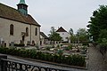 Starrkirch-Wil tombejo kaj kristankatolika preghejo 312.JPG 3,872 × 2,592; 4.17 MB


