Category:Church Lench
Jump to navigation
Jump to search
village in the United Kingdom  | |||||
| Upload media | |||||
| Instance of | |||||
|---|---|---|---|---|---|
| Location | South Lenches, Wychavon, Worcestershire, West Midlands, England | ||||
 | |||||
Subcategories
This category has the following 2 subcategories, out of 2 total.
A
C
- Church Lench War Memorial (1 F)
Media in category "Church Lench"
The following 52 files are in this category, out of 52 total.
-
 Atchlench wood - geograph.org.uk - 141758.jpg 640 × 480; 294 KB
-
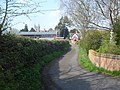 Back road at Church Lench - geograph.org.uk - 922309.jpg 640 × 480; 150 KB
-
 Entering Church Lench - geograph.org.uk - 921899.jpg 640 × 480; 116 KB
-
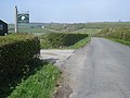 Entrance to Archbridge Farm - geograph.org.uk - 921865.jpg 640 × 480; 119 KB
-
 Entrance to Franklin's Lane - geograph.org.uk - 921847.jpg 640 × 480; 110 KB
-
 Farm Lane, Church Lench - geograph.org.uk - 40295.jpg 640 × 426; 91 KB
-

-
 Farmland north of Church Lench - geograph.org.uk - 922536.jpg 640 × 480; 101 KB
-
 Field of Oil Seed Rape, Sheriff's Lench - geograph.org.uk - 440904.jpg 640 × 426; 161 KB
-

-
 Franklin's Lane - geograph.org.uk - 921826.jpg 640 × 480; 102 KB
-
 Franklin's Lane - geograph.org.uk - 921834.jpg 640 × 480; 135 KB
-
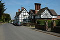 Houses in Church Lench.jpg 640 × 426; 108 KB
-
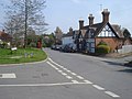
 Main road junction at Church Lench - 1 - geograph.org.uk - 921930.jpg 640 × 480; 113 KB
-
-
 Old railway goods van - geograph.org.uk - 585967.jpg 640 × 480; 73 KB
-
 Paddocks at Church Lench - geograph.org.uk - 921943.jpg 640 × 480; 119 KB
-
 Plum orchard south of Church Lench - 2 - geograph.org.uk - 922259.jpg 640 × 480; 146 KB
-
 Plum orchard south of Church Lench - geograph.org.uk - 922248.jpg 640 × 468; 119 KB
-
 Road to Rouse Lench - geograph.org.uk - 921857.jpg 640 × 480; 104 KB
-
 Rushford - geograph.org.uk - 58132.jpg 640 × 452; 177 KB
-
 Sheriff's Lench Manor - geograph.org.uk - 94654.jpg 480 × 640; 99 KB
-

-
 Thatching at Church Lench - geograph.org.uk - 921918.jpg 640 × 480; 106 KB
-
 The Church Lench road near Rough Hill - geograph.org.uk - 921842.jpg 640 × 480; 120 KB
-
 Toy Cottage, Church Lench - geograph.org.uk - 439975.jpg 426 × 640; 108 KB
-
 View from footpath near Atch Lench - geograph.org.uk - 141746.jpg 640 × 480; 219 KB
-
 Village houses, Church Lench - geograph.org.uk - 3299217.jpg 800 × 451; 212 KB
-
 Village school, Church Lench - geograph.org.uk - 3299219.jpg 800 × 451; 209 KB
-
 Wychavon Way north of Church Lench - geograph.org.uk - 922537.jpg 640 × 480; 117 KB
-
 Atchlench Wood - geograph.org.uk - 140623.jpg 639 × 479; 206 KB
-
 Badger's Hill - geograph.org.uk - 40304.jpg 640 × 400; 56 KB
-
 Building in Sherriff's lench - geograph.org.uk - 40299.jpg 640 × 489; 94 KB
-
 Cabbages and Fruit - geograph.org.uk - 58072.jpg 640 × 480; 163 KB
-
 Fields near Handgate - geograph.org.uk - 58067.jpg 640 × 480; 158 KB
-
 Fishing lake near Church Lench - geograph.org.uk - 575533.jpg 640 × 480; 72 KB
-
 Franklin's Lane - geograph.org.uk - 140618.jpg 640 × 480; 313 KB
-
 Hipton Hill - geograph.org.uk - 49871.jpg 640 × 480; 71 KB
-
 House at Hill Barn - geograph.org.uk - 141740.jpg 640 × 480; 282 KB
-
 Lone trees near Atch Lench - geograph.org.uk - 141755.jpg 640 × 480; 303 KB
-
 Old tractor - geograph.org.uk - 49874.jpg 480 × 360; 38 KB
-
 Poplar Farm Cottages - geograph.org.uk - 40303.jpg 426 × 640; 80 KB
-
 Road junction in the Lenches - geograph.org.uk - 440801.jpg 640 × 426; 118 KB
-

-
 Salford Coppice - geograph.org.uk - 141761.jpg 640 × 480; 313 KB
-
 Salford Lodge Farm - geograph.org.uk - 58069.jpg 640 × 480; 139 KB
-
 Sheriff's Lench - geograph.org.uk - 440903.jpg 640 × 426; 147 KB
-
 The Vale of Evesham - geograph.org.uk - 440798.jpg 640 × 426; 121 KB
-
 Top of the Hill - geograph.org.uk - 49872.jpg 480 × 640; 109 KB
-
 Toy Cottage, Church Lench - geograph.org.uk - 310862.jpg 390 × 640; 87 KB
-
 View towards Ab Lench - geograph.org.uk - 140640.jpg 640 × 480; 242 KB
-
 View towards Salford Lodge - geograph.org.uk - 141753.jpg 640 × 480; 215 KB


