Category:Church Leigh
Jump to navigation
Jump to search
village in Staffordshire, United Kingdom  | |||||
| Upload media | |||||
| Instance of | |||||
|---|---|---|---|---|---|
| Location | Leigh, East Staffordshire, Staffordshire, West Midlands, England | ||||
 | |||||
Subcategories
This category has only the following subcategory.
A
Media in category "Church Leigh"
The following 26 files are in this category, out of 26 total.
-
 All Saints church and Church Leigh village.jpg 640 × 480; 135 KB
-
 Barn Croft at Dods Leigh - geograph.org.uk - 354307.jpg 640 × 427; 121 KB
-
 Farmland near Bearsbrook - geograph.org.uk - 396051.jpg 640 × 427; 71 KB
-
 Farmland near Dod's Leigh - geograph.org.uk - 395994.jpg 640 × 427; 65 KB
-
 Footpath near Dod's Leigh - geograph.org.uk - 395985.jpg 640 × 427; 186 KB
-
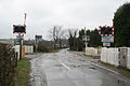 Leigh Level Crossing - geograph.org.uk - 354309.jpg 640 × 427; 93 KB
-
 Leigh station site geograph-3748106-by-Ben-Brooksbank.jpg 2,478 × 1,394; 3.47 MB
-
 Looking towards Tean Leys - geograph.org.uk - 395997.jpg 640 × 427; 109 KB
-
 New Houses - geograph.org.uk - 545090.jpg 640 × 480; 59 KB
-
 North-east from the Tower - geograph.org.uk - 545112.jpg 640 × 480; 70 KB
-
 North-west from the tower - geograph.org.uk - 545120.jpg 640 × 480; 63 KB
-
 River Blithe - geograph.org.uk - 374910.jpg 480 × 640; 133 KB
-
 South-east from the tower - geograph.org.uk - 545131.jpg 640 × 480; 41 KB
-
 South-west from the tower - geograph.org.uk - 545139.jpg 640 × 480; 42 KB
-
 The lane to Shaw Farm, Gratwich - geograph.org.uk - 354322.jpg 640 × 453; 120 KB
-
 The Star Inn at Church Leigh - geograph.org.uk - 354326.jpg 640 × 427; 101 KB
-
 Birchwood Park - geograph.org.uk - 376528.jpg 640 × 480; 72 KB
-
 Bridleway and Fog - geograph.org.uk - 264474.jpg 640 × 480; 65 KB
-
 Cottage remains - geograph.org.uk - 376475.jpg 640 × 480; 126 KB
-
 Farm buildings at Park Hall. - geograph.org.uk - 354328.jpg 640 × 375; 63 KB
-
 Field Gate - geograph.org.uk - 376453.jpg 480 × 640; 108 KB
-
 Hens and River - geograph.org.uk - 264475.jpg 640 × 480; 88 KB
-
 Hothill Lane near Withington - geograph.org.uk - 354345.jpg 640 × 427; 109 KB
-
 Muddy Path - geograph.org.uk - 264476.jpg 640 × 480; 104 KB
-

-
 Upper Nobut - geograph.org.uk - 354356.jpg 640 × 427; 127 KB


