Category:Church Eaton
Jump to navigation
Jump to search
English: Church Eaton is a small English village in the west of Staffordshire lying some 4 miles from the Shropshire border. It lies in gently rolling dairy farming countryside. The hamlet of Wood Eaton lies to its northwest.
a village located in Stafford, United Kingdom  | |||||
| Upload media | |||||
| Instance of | |||||
|---|---|---|---|---|---|
| Location | Stafford, Staffordshire, West Midlands, England | ||||
| Said to be the same as | Church Eaton (Wikimedia duplicated page, civil parish) | ||||
| official website | |||||
 | |||||
Subcategories
This category has the following 6 subcategories, out of 6 total.
Media in category "Church Eaton"
The following 200 files are in this category, out of 236 total.
(previous page) (next page)-
 A field full of polytunnels - geograph.org.uk - 2466735.jpg 640 × 480; 66 KB
-
 A lane to Orslow - geograph.org.uk - 2466603.jpg 640 × 480; 112 KB
-
 A parting of the ways - geograph.org.uk - 3511767.jpg 1,142 × 857; 356 KB
-
 A relatively recent footpath - geograph.org.uk - 3511581.jpg 734 × 979; 392 KB
-
 A sunny day on the Shropshire Union - geograph.org.uk - 832720.jpg 640 × 480; 77 KB
-
 A tiny pond in the trees - geograph.org.uk - 3512439.jpg 816 × 612; 344 KB
-
 A touch of 'The Simpsons'^ - geograph.org.uk - 398604.jpg 600 × 450; 215 KB
-
 A View to Lawnpit Covert - geograph.org.uk - 2564566.jpg 640 × 428; 77 KB
-
 Abused pond near Stoney Plantation - geograph.org.uk - 3404226.jpg 734 × 979; 421 KB
-
 Across a green field - geograph.org.uk - 471105.jpg 600 × 450; 203 KB
-
 Across Field to Farm - geograph.org.uk - 2566560.jpg 640 × 428; 92 KB
-
 Across Pastureland Towards Apeton - geograph.org.uk - 2564544.jpg 640 × 428; 73 KB
-
 Across the field towards Homers Farm - geograph.org.uk - 3511597.jpg 1,044 × 783; 375 KB
-
 Across the fields south of Shushions Manor - geograph.org.uk - 2949560.jpg 1,142 × 857; 331 KB
-
 All ploughed and ready to go - geograph.org.uk - 3404272.jpg 1,142 × 857; 348 KB
-
 Allimore Green sewage works - geograph.org.uk - 2466717.jpg 640 × 480; 135 KB
-
 Along Church Eaton Road - geograph.org.uk - 3404771.jpg 1,142 × 857; 285 KB
-
 Along the Roman Road - geograph.org.uk - 390333.jpg 600 × 450; 320 KB
-
 Along the west side of High Onn wood - geograph.org.uk - 3404770.jpg 979 × 734; 305 KB
-
 Alstone Lane - geograph.org.uk - 471092.jpg 600 × 450; 208 KB
-
 Apeton Ford - geograph.org.uk - 3944343.jpg 3,872 × 2,592; 4.61 MB
-
 Apeton ford on a wet afternoon - geograph.org.uk - 5662332.jpg 1,632 × 1,224; 937 KB
-
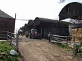
 Apeton Hall farm buildings - geograph.org.uk - 5662280.jpg 1,469 × 1,102; 509 KB
-
 Approaching Castle Cutting Bridge - geograph.org.uk - 5672638.jpg 1,280 × 851; 431 KB
-
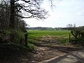
 Approaching lane junction - geograph.org.uk - 2127285.jpg 640 × 480; 64 KB
-
 Approaching Little Onn - geograph.org.uk - 2565832.jpg 640 × 428; 67 KB
-
 Axe wielding Boater with his Jack Russell terrier - geograph.org.uk - 1831333.jpg 2,304 × 1,728; 635 KB
-
 Barley in a field at Russell's Rough - geograph.org.uk - 3511699.jpg 979 × 734; 392 KB
-
 Barleybrook Farm - geograph.org.uk - 3975984.jpg 1,142 × 857; 279 KB
-
 Barn conversion at Woollaston Farm - geograph.org.uk - 396251.jpg 600 × 450; 245 KB
-
 Barns at High Onn Farm - geograph.org.uk - 390344.jpg 600 × 450; 218 KB
-
 Barns for conversion at High Onn Manor - geograph.org.uk - 3404259.jpg 1,142 × 857; 353 KB
-
 Between High Onn and Little Onn - geograph.org.uk - 3404181.jpg 1,142 × 857; 272 KB
-
 Birchmoor Lane leaves King Street - geograph.org.uk - 3402942.jpg 1,142 × 857; 341 KB
-
 Brewood bound on the Shroppie - geograph.org.uk - 2466710.jpg 640 × 480; 157 KB
-
 Bridge No 28 south of Gnosall, Staffordshire - geograph.org.uk - 4683517.jpg 768 × 1,024; 622 KB
-
 Bridge on Apeton to Church Eaton Road - geograph.org.uk - 2531253.jpg 640 × 428; 119 KB
-
 Bridleway near Woollaston Farm - geograph.org.uk - 390161.jpg 600 × 450; 334 KB
-
 Brook Cottage, Church Eaton Common - geograph.org.uk - 5662362.jpg 1,469 × 1,102; 545 KB
-
 Buildings at Green Farm - geograph.org.uk - 5662378.jpg 1,469 × 1,102; 607 KB
-
 Canal milepost near The Rookery copse - geograph.org.uk - 3975960.jpg 612 × 816; 353 KB
-
 Canal north-west of Church Eaton in Staffordshire - geograph.org.uk - 6025788.jpg 1,440 × 1,080; 1.94 MB
-

-
 Canalside flowers at High Onn Bridge - geograph.org.uk - 4600320.jpg 640 × 427; 95 KB
-
 Canalside Warehouse - geograph.org.uk - 444832.jpg 600 × 401; 185 KB
-
 Cattle and barns at Marston Farm - geograph.org.uk - 2949552.jpg 1,142 × 857; 309 KB
-
 Cereal crop north of Marston - geograph.org.uk - 6237316.jpg 800 × 600; 96 KB
-
 Church Eaton - High Street - geograph.org.uk - 864589.jpg 640 × 480; 73 KB
-

-
 Church Eaton - the primary school - geograph.org.uk - 864585.jpg 640 × 480; 94 KB
-
 Church Eaton Endowed Primary School - geograph.org.uk - 397377.jpg 600 × 450; 233 KB
-
 Church Eaton.jpg 1,979 × 1,200; 1.33 MB
-
 Converted barns at High Onns - geograph.org.uk - 2466652.jpg 640 × 480; 117 KB
-
 Cottages on the lane north of Marston - geograph.org.uk - 3403244.jpg 1,142 × 857; 414 KB
-

-
 Cows on the Road - geograph.org.uk - 2565933.jpg 640 × 428; 68 KB
-
 Disused airfield at Wheaten Aston - geograph.org.uk - 4677203.jpg 3,264 × 2,448; 4.92 MB
-

-
 Entrance to Cherry Gables - geograph.org.uk - 2565846.jpg 640 × 428; 63 KB
-
 Entrance to Marston Farm - geograph.org.uk - 2031599.jpg 640 × 480; 104 KB
-
 Entrance to the Farmyard - geograph.org.uk - 2566562.jpg 640 × 428; 55 KB
-
 Farm Buildings, High Onn - geograph.org.uk - 2565366.jpg 640 × 428; 99 KB
-
 Farm land near Little Onn in Staffordshire - geograph.org.uk - 5813265.jpg 1,600 × 882; 1.21 MB
-
 Farm Track and Bridleway - geograph.org.uk - 466722.jpg 640 × 429; 63 KB
-
 Farm Track into Fields - geograph.org.uk - 2566581.jpg 640 × 428; 90 KB
-
 Farm Track with Footpath - geograph.org.uk - 2565194.jpg 640 × 428; 77 KB
-
 Farmhouse on the edge of Apeton - geograph.org.uk - 5662282.jpg 1,795 × 1,346; 768 KB
-

-
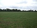
 Farmland south of Gnosall, Staffordshire - geograph.org.uk - 4683180.jpg 1,024 × 677; 400 KB
-
 Field and open country next to the canal - geograph.org.uk - 397424.jpg 600 × 450; 241 KB
-
 Field of Maize near High Onn Wood - geograph.org.uk - 2565411.jpg 640 × 428; 104 KB
-
 Fields and canal north of Little Onn - geograph.org.uk - 3403314.jpg 1,142 × 857; 335 KB
-

-
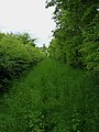 Footpath between high hedges - geograph.org.uk - 3512399.jpg 734 × 979; 362 KB
-
 Footpath through a field of Wheat - geograph.org.uk - 2565196.jpg 640 × 428; 64 KB
-
 Footpath to Wood Eaton - geograph.org.uk - 398596.jpg 600 × 450; 233 KB
-
 Former hangars for the airfield - geograph.org.uk - 3403305.jpg 1,142 × 857; 291 KB
-
 Grazing Sheep - geograph.org.uk - 466769.jpg 640 × 429; 56 KB
-
 Grazing, Marston - geograph.org.uk - 6237320.jpg 800 × 600; 96 KB
-
 Green Farm, Church Eaton Green - geograph.org.uk - 2531309.jpg 640 × 428; 72 KB
-
 Hall Farm - geograph.org.uk - 3511728.jpg 1,142 × 857; 425 KB
-
 Happy boaters south of Gnosall, Staffordshire - geograph.org.uk - 4683745.jpg 1,024 × 1,024; 763 KB
-
 High Onn farmhouse - geograph.org.uk - 3404250.jpg 1,142 × 857; 352 KB
-
 High Onn House and barns - geograph.org.uk - 3404235.jpg 1,142 × 857; 284 KB
-
 High Onn trig point - geograph.org.uk - 3404241.jpg 979 × 1,306; 451 KB
-
 High Onn Wood Looking towards Brineton - geograph.org.uk - 2565384.jpg 640 × 428; 107 KB
-
 High Street, Church Eaton - geograph.org.uk - 2127215.jpg 640 × 480; 108 KB
-
 Home from Home - geograph.org.uk - 2565327.jpg 640 × 428; 115 KB
-
 Homers Farm - geograph.org.uk - 3511587.jpg 979 × 734; 386 KB
-

-
 Lane from Church Eaton Green - geograph.org.uk - 2531326.jpg 640 × 428; 94 KB
-
 Lane junction at High Onn - geograph.org.uk - 5772670.jpg 800 × 540; 140 KB
-
 Lane junction east of Church Eaton - geograph.org.uk - 2057018.jpg 640 × 480; 64 KB
-
 Lane just north of Wood Eaton hamlet - geograph.org.uk - 5826554.jpg 1,469 × 1,102; 606 KB
-
 Lane leading to Goosemoor - geograph.org.uk - 5772661.jpg 800 × 600; 212 KB
-
 Lane near Church Eaton - geograph.org.uk - 2127287.jpg 640 × 480; 60 KB
-
 Larger pond in a field - geograph.org.uk - 3511712.jpg 1,142 × 857; 351 KB
-
 Leaving Wood Eaton - geograph.org.uk - 466756.jpg 640 × 429; 52 KB
-
 Little-used footpath - geograph.org.uk - 3511773.jpg 979 × 734; 351 KB
-
 Llama next to Slab Lane - geograph.org.uk - 5772730.jpg 777 × 800; 146 KB
-
 Lonely Trig Point - geograph.org.uk - 444771.jpg 600 × 450; 218 KB
-
 Long and Winding Road - geograph.org.uk - 2564521.jpg 640 × 393; 54 KB
-
 Looking down from Ryehill Bridge - geograph.org.uk - 2566545.jpg 428 × 640; 99 KB
-
 Looking towards High Onn bridge - geograph.org.uk - 3404191.jpg 1,142 × 857; 323 KB
-
 Marston Road towards Wheaton Aston - geograph.org.uk - 6237321.jpg 800 × 600; 85 KB
-
 Minor road junction on Sweetplace Lane - geograph.org.uk - 6237319.jpg 800 × 600; 128 KB
-
 Minor road towards High Onn - geograph.org.uk - 6237313.jpg 640 × 480; 74 KB
-
 Moored beside the Little Onn bridge - geograph.org.uk - 3403318.jpg 1,142 × 857; 394 KB
-
 Moored narrowboat near Marston in Staffordshire - geograph.org.uk - 6023484.jpg 1,080 × 1,440; 2.03 MB
-

-
 Narrow lane entering Apeton - geograph.org.uk - 5662277.jpg 1,632 × 1,224; 784 KB
-
 Narrowboat on the Shroppy at Little Onn - geograph.org.uk - 3404175.jpg 1,142 × 857; 349 KB
-
 Narrowboat west of Church Eaton, Staffordshire - geograph.org.uk - 4683502.jpg 774 × 1,024; 667 KB
-

-

-
 Narrowboats near Little Onn Bridge No 24 - geograph.org.uk - 5768000.jpg 800 × 605; 175 KB
-
 Narrowboats north-east of Marston in Staffordshire - geograph.org.uk - 6023497.jpg 1,080 × 1,440; 2.04 MB
-
 Near enough on the footpath - geograph.org.uk - 3512435.jpg 1,044 × 783; 363 KB
-
 New stables - geograph.org.uk - 832717.jpg 640 × 480; 58 KB
-
 Not hangin' around for his photo^ - geograph.org.uk - 2969775.jpg 979 × 734; 297 KB
-
 Not really on the footpath at all - geograph.org.uk - 3512395.jpg 979 × 734; 322 KB
-
 Notice on Bridge - geograph.org.uk - 2531286.jpg 640 × 428; 128 KB
-
 Oak Tree House at High Onn - geograph.org.uk - 5772693.jpg 800 × 607; 165 KB
-
 Oil Pipeline Marker - geograph.org.uk - 444881.jpg 450 × 616; 249 KB
-
 Old Gate and a Field of Maize - geograph.org.uk - 2570241.jpg 640 × 428; 101 KB
-
 OS benchmark - Church Eaton, High Cottage - geograph.org.uk - 5662369.jpg 1,102 × 1,469; 678 KB
-
 OS benchmark - Church Eaton, Laurels Cottage - geograph.org.uk - 5662385.jpg 1,102 × 1,469; 762 KB
-
 OS benchmark - Marston, farm barn - geograph.org.uk - 4648917.jpg 857 × 1,142; 569 KB
-
 OS Flush Bracket 2406 - Goosemoor Cottages - geograph.org.uk - 4093939.jpg 857 × 1,142; 501 KB
-
 OS Flush Bracket 2487 - High Onn cottage - geograph.org.uk - 4092597.jpg 857 × 1,142; 584 KB
-

-

-

-

-
 Permissive Bridleway to Shredicote - geograph.org.uk - 470219.jpg 600 × 450; 273 KB
-
 Pig sheds at Wheaton Aston airfield - geograph.org.uk - 3403293.jpg 1,142 × 857; 353 KB
-
 Pipeline Marker near Church Eaton - geograph.org.uk - 2565317.jpg 640 × 428; 79 KB
-
 Preparing the wicket - geograph.org.uk - 864599.jpg 640 × 480; 61 KB
-
 Rather fewer straw bales - geograph.org.uk - 3403308.jpg 1,142 × 857; 330 KB
-
 Road Junction near Little Onn - geograph.org.uk - 2565908.jpg 640 × 428; 77 KB
-
 Road near the Forge Cottages - geograph.org.uk - 5772704.jpg 800 × 543; 160 KB
-
 Road out of Marston, Staffordshire - geograph.org.uk - 2585888.jpg 640 × 428; 107 KB
-
 Road to Church Eaton - geograph.org.uk - 466689.jpg 640 × 429; 58 KB
-
 Roadside oaks on Church Eaton Road - geograph.org.uk - 3405018.jpg 1,142 × 857; 403 KB
-
 Roadside Pool - geograph.org.uk - 2565823.jpg 640 × 428; 112 KB
-
 Roadside semis - geograph.org.uk - 3511717.jpg 1,142 × 857; 379 KB
-
 Ruined building - geograph.org.uk - 3512427.jpg 1,142 × 857; 395 KB
-
 Rural Crossroads - geograph.org.uk - 2565376.jpg 640 × 428; 75 KB
-
 Rural crossroads with metal fencing - geograph.org.uk - 397577.jpg 600 × 450; 263 KB
-

-
 Sewage Treatment Works - geograph.org.uk - 2564587.jpg 640 × 428; 81 KB
-
 Sewage Works - geograph.org.uk - 2127214.jpg 640 × 480; 64 KB
-
 Sheep - geograph.org.uk - 466762.jpg 640 × 429; 68 KB
-

-
 Sheep in field north of Wood Eaton - geograph.org.uk - 5826558.jpg 1,469 × 1,102; 596 KB
-

-
 Shropshire Union Canal milepost - geograph.org.uk - 5752821.jpg 800 × 586; 149 KB
-
 Shropshire Union Canal milepost - geograph.org.uk - 5752826.jpg 800 × 677; 249 KB
-
 Shropshire Union Canal milepost - geograph.org.uk - 5768004.jpg 800 × 578; 227 KB
-
 Shropshire Union Canal milepost - geograph.org.uk - 5768005.jpg 800 × 704; 261 KB
-

-

-

-

-

-

-
-

-
 Shushions Cottages - geograph.org.uk - 3403259.jpg 1,142 × 857; 283 KB
-
 Small converted barn - geograph.org.uk - 397370.jpg 600 × 450; 225 KB
-
 Small ford on the Allimore Brook - geograph.org.uk - 400772.jpg 600 × 450; 294 KB
-
 Small pond in a field south of Home Farm - geograph.org.uk - 3511707.jpg 1,142 × 857; 332 KB
-
 Some gatehouse - geograph.org.uk - 832709.jpg 640 × 480; 101 KB
-
 South from High Onn trig - geograph.org.uk - 3404245.jpg 1,142 × 857; 360 KB
-
 South-east along the Roman Road - geograph.org.uk - 397617.jpg 600 × 450; 217 KB
-

-
 Staffordshire farmland north of Wheaton Aston - geograph.org.uk - 4683775.jpg 1,280 × 742; 796 KB
-
 Staffordshire farmland north of Wheaton Aston - geograph.org.uk - 4683798.jpg 1,280 × 920; 987 KB
-
 Staffordshire farmland north of Wheaton Aston - geograph.org.uk - 6022709.jpg 1,440 × 960; 1.5 MB
-
 Staffordshire farmland north of Wheaton Aston - geograph.org.uk - 6022882.jpg 1,440 × 960; 1.5 MB
-
 Staffordshire farmland west of Church Eaton - geograph.org.uk - 5812708.jpg 1,280 × 888; 1.28 MB
-
 Stile and footpath - geograph.org.uk - 401261.jpg 600 × 450; 285 KB
-

-
 That's no way to treat the old Roman Road - geograph.org.uk - 3404220.jpg 1,044 × 783; 393 KB
-
 The 'Home Farm' - geograph.org.uk - 398590.jpg 600 × 450; 302 KB
-
 The corner of High Onn Wood - geograph.org.uk - 444891.jpg 600 × 450; 226 KB
-
 The cricket pavilion - geograph.org.uk - 396399.jpg 600 × 450; 261 KB
-
 The Eaton Brook bridge - geograph.org.uk - 5662359.jpg 1,469 × 1,102; 682 KB
-
 The edge of High Onn Wood - geograph.org.uk - 444889.jpg 600 × 450; 253 KB
-
 The Gables at Little Onn - geograph.org.uk - 5772714.jpg 800 × 600; 229 KB
-
 The lane to Longnor Gorse - geograph.org.uk - 3975980.jpg 734 × 979; 300 KB
-
 The lane towards Wood Eaton Bridge - geograph.org.uk - 3511694.jpg 734 × 979; 405 KB
-
 The Marston Brook - geograph.org.uk - 3402951.jpg 734 × 979; 434 KB
-
 The Marston Brook north of the hamlet - geograph.org.uk - 3402956.jpg 734 × 979; 330 KB
-
 The Mottymeadows Brook - geograph.org.uk - 2949547.jpg 857 × 1,142; 422 KB
-
 The Mottymeadows Brook near Marston - geograph.org.uk - 2949554.jpg 857 × 1,142; 502 KB
-
 The Old Rectory at Church Eaton - geograph.org.uk - 5662394.jpg 2,774 × 2,081; 1.67 MB
-
 The Old Vicarage - geograph.org.uk - 396356.jpg 600 × 450; 257 KB
-
 The Road to Moreton - geograph.org.uk - 466694.jpg 640 × 429; 58 KB
-
 The Romans are Long Gone - geograph.org.uk - 466691.jpg 640 × 429; 57 KB


