Category:Chorleywood
Jump to navigation
Jump to search
English: Chorleywood is a town in the Three Rivers district of Hertfordshire in the United Kingdom. It had a population of 6,814 people at the 2001 census. The parish of Chorleywood as a whole has a population of 10,775. The town lies in the far south west of Hertfordshire, on the historic border with Buckinghamshire. Chorleywood is located north-west of Charing Cross in London. It is part of the London commuter belt, and included in the government-defined Greater London Urban Area.
Français : Chorleywood est une commune du Royaume-Uni, située dans le comté du Hertfordshire, à 31 kilomètres au Nord-Ouest de Londres.
Italiano: Chorleywood è un paese di 6.814 abitanti della contea dell' Hertfordshire, in Inghilterra.
Nederlands: Chorleywood is een plaats ( town) in het Engelse graafschap Hertfordshire. De stad bevindt zich in het district Three Rivers en ligt aan de oude grens met Buckinghamshire. Het stadje telt 9215 inwoners.
large village in Hertfordshire, England  | |||||
| Upload media | |||||
| Instance of | |||||
|---|---|---|---|---|---|
| Location | Three Rivers, Hertfordshire, East of England, England | ||||
| Said to be the same as | Chorleywood (Wikimedia duplicated page, civil parish) | ||||
| official website | |||||
 | |||||
Subcategories
This category has the following 6 subcategories, out of 6 total.
C
- Chorleywood Common (21 F)
- Christ Church, Chorleywood (29 F)
L
- Loudwater, Hertfordshire (4 F)
O
- The Orchard, Chorleywood (1 F)
Media in category "Chorleywood"
The following 200 files are in this category, out of 431 total.
(previous page) (next page)-
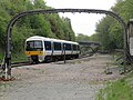 165005 passes Chorleywood 16 May 2010.jpg 4,000 × 3,000; 1.73 MB
-
 A404 - geograph.org.uk - 3444535.jpg 640 × 430; 68 KB
-
 A404 - geograph.org.uk - 3690612.jpg 640 × 430; 75 KB
-
 A404 Chorleywood Road - geograph.org.uk - 5202035.jpg 640 × 428; 131 KB
-
 A404, Amersham Rd - geograph.org.uk - 3444497.jpg 640 × 430; 101 KB
-
 A404, Chenies Rd - geograph.org.uk - 3444514.jpg 640 × 430; 82 KB
-
 A404, Chorleywood - geograph.org.uk - 3690428.jpg 640 × 430; 81 KB
-
 A404, Rickmansworth Rd - geograph.org.uk - 3308997.jpg 640 × 430; 93 KB
-
 A62 Stock 5163 at Chorleywood.jpg 4,200 × 2,136; 5.67 MB
-
 Almshouse, Dog Kennel Lane - geograph.org.uk - 3346260.jpg 640 × 430; 60 KB
-
 Almshouses, Dog Kennel Lane - geograph.org.uk - 3331823.jpg 640 × 430; 81 KB
-
 Almshouses, Dog Kennel Lane - geograph.org.uk - 3690439.jpg 640 × 430; 84 KB
-
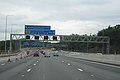
 Approach to junction 18 - M25 - geograph.org.uk - 3427981.jpg 640 × 425; 60 KB
-
 Artichoke Dell - geograph.org.uk - 3690454.jpg 640 × 430; 88 KB
-
 Banner outside The Russell School, Chorleywood - geograph.org.uk - 5961022.jpg 2,592 × 1,944; 1.4 MB
-

-
 Barrel Arch near Chorleywood - geograph.org.uk - 123842.jpg 640 × 480; 340 KB
-
 Below the M25 Viaduct - geograph.org.uk - 3330512.jpg 640 × 430; 60 KB
-
 Below the M25 Viaduct - geograph.org.uk - 3330513.jpg 640 × 430; 69 KB
-
 Bend on Sarratt Lane - geograph.org.uk - 5202017.jpg 640 × 480; 197 KB
-
 Berry Lane - geograph.org.uk - 3319956.jpg 640 × 430; 109 KB
-
 Berry Lane - geograph.org.uk - 3319957.jpg 640 × 430; 122 KB
-
 Berry Lane - geograph.org.uk - 3319961.jpg 640 × 430; 90 KB
-
 Berry Lane - geograph.org.uk - 3330499.jpg 640 × 430; 61 KB
-
 Berry Lane - geograph.org.uk - 951474.jpg 640 × 480; 102 KB
-
 Berry Lane at the junction of Common Gate Road - geograph.org.uk - 5162746.jpg 2,304 × 1,728; 1.3 MB
-
 Berry Lane, Pheasant's Wood - geograph.org.uk - 3330515.jpg 640 × 430; 100 KB
-
 Berry Lane, Valley Rd junction - geograph.org.uk - 3330508.jpg 640 × 430; 62 KB
-
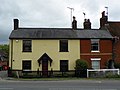
 Black Horse Cottages - geograph.org.uk - 3331805.jpg 640 × 430; 65 KB
-
 Blacketts Wood Drive, Chorleywood - geograph.org.uk - 5170221.jpg 2,304 × 1,728; 828 KB
-
 Brick and flint built barn - geograph.org.uk - 3444522.jpg 640 × 430; 76 KB
-
 Bridge Cottage on North Lane - geograph.org.uk - 5079705.jpg 2,304 × 1,728; 820 KB
-
 Bridge Cottage, Sarratmill Bridge - geograph.org.uk - 3422930.jpg 640 × 430; 82 KB
-
 Bug in the Wild (Unsplash).jpg 3,371 × 3,365; 9.08 MB
-
 Bullscroft Farm - geograph.org.uk - 3444495.jpg 640 × 428; 80 KB
-
 Bullsland Lane, The Swillett - geograph.org.uk - 5728202.jpg 2,048 × 1,536; 1.49 MB
-
 Burford House - geograph.org.uk - 3346299.jpg 640 × 430; 63 KB
-
 Burford House - geograph.org.uk - 3346320.jpg 640 × 430; 72 KB
-
 Car Boot Sale Field - geograph.org.uk - 3177262.jpg 1,600 × 1,200; 468 KB
-
 Car Park on Chorleywood Common - geograph.org.uk - 5162744.jpg 2,304 × 1,728; 833 KB
-
 Car park, Black Horse pub - geograph.org.uk - 3984181.jpg 640 × 430; 62 KB
-
 Car park, Chorleywood Common - geograph.org.uk - 3444532.jpg 640 × 430; 90 KB
-
 Carpenters Wood Drive at the corner of St Peters Way - geograph.org.uk - 5163742.jpg 2,304 × 1,728; 822 KB
-
 Carpenters Wood Drive at the corner of St Peters Way - geograph.org.uk - 5163743.jpg 2,304 × 1,728; 854 KB
-
 Carpenters Wood Drive, Chorleywood - geograph.org.uk - 5163744.jpg 2,258 × 1,666; 1.11 MB
-
 Carved wooden frog sculpture at Chorleywood Common - geograph.org.uk - 5722408.jpg 4,608 × 3,456; 4.6 MB
-
 Chalfont Lane - geograph.org.uk - 1065219.jpg 640 × 480; 92 KB
-
 Chalfont Lane at the junction of Blacketts Wood Drive - geograph.org.uk - 4172965.jpg 2,560 × 1,920; 1.97 MB
-
 Chalfont Lane at the junction of Shire Lane - geograph.org.uk - 4172597.jpg 2,466 × 1,788; 1.81 MB
-
 Chalfont Lane, Chorleywood - geograph.org.uk - 123833.jpg 640 × 480; 267 KB
-
 Chenies Rd - geograph.org.uk - 3444515.jpg 640 × 430; 70 KB
-

-
 Chess Valley - geograph.org.uk - 3146349.jpg 640 × 480; 65 KB
-
 Chess Valley Walk - geograph.org.uk - 3418754.jpg 640 × 430; 116 KB
-
 Chess Valley Walk - geograph.org.uk - 3419043.jpg 640 × 430; 103 KB
-
 Chess Valley Walk - geograph.org.uk - 3419044.jpg 640 × 430; 94 KB
-
 Chess Valley Walk - geograph.org.uk - 3419109.jpg 640 × 430; 67 KB
-
 Chess Valley Walk - geograph.org.uk - 4141937.jpg 640 × 480; 131 KB
-
 Chess Valley Walk - geograph.org.uk - 951328.jpg 640 × 480; 114 KB
-
 Chess Valley Walk and link path merge - geograph.org.uk - 3419119.jpg 640 × 430; 121 KB
-
 Chess Valley Walk north of Solesbridge Lane - geograph.org.uk - 5571292.jpg 1,600 × 1,200; 655 KB
-
 Chess Valley Walk south of Solesbridge Lane - geograph.org.uk - 5571284.jpg 1,600 × 1,200; 658 KB
-
 Chilton's Wood - geograph.org.uk - 3444493.jpg 640 × 430; 122 KB
-

-
 Chorleywood Berry Lane.jpg 640 × 428; 333 KB
-
 Chorleywood Bottom - geograph.org.uk - 3768072.jpg 1,280 × 856; 276 KB
-
 Chorleywood Bottom - geograph.org.uk - 3770323.jpg 1,280 × 856; 228 KB
-
 Chorleywood Bottom - geograph.org.uk - 5162741.jpg 2,304 × 1,728; 839 KB
-
 Chorleywood Bottom - geograph.org.uk - 5171155.jpg 2,304 × 1,728; 820 KB
-
 Chorleywood Bottom at the junction of Capell Way - geograph.org.uk - 5162740.jpg 2,304 × 1,728; 841 KB
-
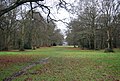
 Chorleywood Common - geograph.org.uk - 3177062.jpg 2,295 × 1,680; 873 KB
-
 Chorleywood Common - geograph.org.uk - 3308977.jpg 640 × 430; 54 KB
-
 Chorleywood Common - geograph.org.uk - 3315020.jpg 640 × 430; 129 KB
-
 Chorleywood Common - geograph.org.uk - 3315038.jpg 640 × 430; 85 KB
-
 Chorleywood Common - geograph.org.uk - 3315040.jpg 640 × 430; 57 KB
-
 Chorleywood Common - geograph.org.uk - 3315042.jpg 640 × 430; 53 KB
-
 Chorleywood Common - geograph.org.uk - 3331800.jpg 640 × 430; 56 KB
-
 Chorleywood Common - geograph.org.uk - 3331803.jpg 640 × 430; 47 KB
-
 Chorleywood Common - geograph.org.uk - 3331813.jpg 640 × 430; 56 KB
-
 Chorleywood Common - geograph.org.uk - 3331816.jpg 640 × 430; 100 KB
-
 Chorleywood Common - geograph.org.uk - 3331824.jpg 640 × 430; 77 KB
-
 Chorleywood Common - geograph.org.uk - 3418560.jpg 640 × 430; 47 KB
-
 Chorleywood Common - geograph.org.uk - 3444530.jpg 640 × 430; 100 KB
-
 Chorleywood Common - geograph.org.uk - 3444531.jpg 640 × 430; 101 KB
-
 Chorleywood Common - geograph.org.uk - 3690440.jpg 640 × 430; 68 KB
-
 Chorleywood Common - geograph.org.uk - 3690572.jpg 640 × 430; 132 KB
-
 Chorleywood Common - geograph.org.uk - 3690580.jpg 640 × 430; 114 KB
-
 Chorleywood Common - geograph.org.uk - 3768417.jpg 1,280 × 856; 415 KB
-
 Chorleywood Common - geograph.org.uk - 3770293.jpg 1,280 × 856; 340 KB
-
 Chorleywood Common - geograph.org.uk - 5162745.jpg 2,304 × 1,728; 839 KB
-
 Chorleywood Common - geograph.org.uk - 5171153.jpg 2,304 × 1,728; 847 KB
-
 Chorleywood Common - geograph.org.uk - 5171154.jpg 2,260 × 1,666; 872 KB
-
 Chorleywood Common on Rickmansworth Road - geograph.org.uk - 2282297.jpg 1,600 × 1,200; 558 KB
-

-
 Chorleywood Free Church - geograph.org.uk - 3177035.jpg 2,415 × 1,866; 1.2 MB
-
 Chorleywood Golf Course - geograph.org.uk - 3690565.jpg 640 × 430; 62 KB
-
 Chorleywood Golf Course - geograph.org.uk - 3690568.jpg 640 × 430; 93 KB
-
 Chorleywood Lawns Cemetery - geograph.org.uk - 3418564.jpg 640 × 430; 75 KB
-
 Chorleywood Lawns Cemetery - geograph.org.uk - 3418567.jpg 640 × 430; 91 KB
-
 Chorleywood Library - geograph.org.uk - 5171152.jpg 2,304 × 1,728; 1.13 MB
-
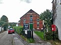
 Chorleywood Memorial Hall - geograph.org.uk - 3315059.jpg 640 × 430; 92 KB
-
 Chorleywood MMB 01 M25.jpg 4,137 × 2,148; 2.98 MB
-
 Chorleywood Park - geograph.org.uk - 1765110.jpg 1,600 × 1,200; 539 KB
-
 Chorleywood Park entrance. - geograph.org.uk - 1592090.jpg 640 × 480; 85 KB
-
 Chorleywood Road - geograph.org.uk - 2833079.jpg 640 × 481; 68 KB
-
 Chorleywood Road, Rickmansworth - geograph.org.uk - 2282245.jpg 1,600 × 1,200; 600 KB
-

-
 Chorleywood Urban District 1971 map.png 1,915 × 1,570; 109 KB
-
 Chorleywood village boundary sign - geograph.org.uk - 2833071.jpg 640 × 481; 86 KB
-
 Chorleywood, Chess Valley Walk - geograph.org.uk - 700538.jpg 640 × 427; 75 KB
-
 Chorleywood, Green Street - geograph.org.uk - 2421017.jpg 640 × 480; 75 KB
-

-
 Chorleywood, Old Shire Lane - geograph.org.uk - 566497.jpg 640 × 480; 138 KB
-
 Chorleywood, Old Shire Lane - geograph.org.uk - 566500.jpg 640 × 480; 103 KB
-
-
 Chorleywood, St Peters Way - geograph.org.uk - 2421929.jpg 640 × 480; 66 KB
-
 Christ Church C of E School - geograph.org.uk - 3690583.jpg 640 × 430; 98 KB
-
 Christ Church, Chorleywood Common - geograph.org.uk - 2282294.jpg 1,600 × 1,200; 594 KB
-

-
 Common Gate Road, Chorleywood - geograph.org.uk - 5171157.jpg 2,304 × 1,728; 1.02 MB
-
 Common Rd - geograph.org.uk - 3315065.jpg 640 × 430; 81 KB
-
 Common Rd - geograph.org.uk - 3315067.jpg 640 × 430; 107 KB
-
 Common Rd, Station Approach Junction - geograph.org.uk - 3315069.jpg 640 × 430; 70 KB
-
 Commongate Road, Chorleywood Bottom - geograph.org.uk - 3770297.jpg 1,280 × 856; 236 KB
-
 Constables Cottage - geograph.org.uk - 3690446.jpg 640 × 430; 107 KB
-
-
 Cottage, Chorleywood Cottage - geograph.org.uk - 3331814.jpg 640 × 430; 91 KB
-
 Cottage, Dog Kennel Lane - geograph.org.uk - 3331817.jpg 640 × 430; 109 KB
-
 Cottages, Chorleywood - geograph.org.uk - 4141786.jpg 640 × 480; 162 KB
-
 Cottages, Chorleywood Common - geograph.org.uk - 3331801.jpg 640 × 430; 85 KB
-
 Cricket ground, Chorleywood Common - geograph.org.uk - 3690577.jpg 640 × 430; 64 KB
-
 Cricket pavilion, Chorleywood Common - geograph.org.uk - 3690579.jpg 640 × 430; 83 KB
-
 Crossing Chorleywood Common - geograph.org.uk - 3690567.jpg 640 × 430; 98 KB
-
 Dog Kennel Cottages - geograph.org.uk - 3331772.jpg 640 × 430; 66 KB
-
 Dog Kennel Cottages - geograph.org.uk - 3331802.jpg 640 × 430; 65 KB
-
 Dog Kennel Lane - geograph.org.uk - 3330534.jpg 640 × 430; 122 KB
-
 Dog Kennel Lane - geograph.org.uk - 3331811.jpg 640 × 430; 53 KB
-
 Dog Kennel Lane - geograph.org.uk - 3331822.jpg 640 × 430; 59 KB
-
 Dog Kennel Lane - geograph.org.uk - 3690445.jpg 640 × 430; 73 KB
-
 Dog Kennel Lane - geograph.org.uk - 3690449.jpg 640 × 430; 69 KB
-

-

-

-
 Entering Chorleywood, A404 - geograph.org.uk - 3444499.jpg 640 × 430; 72 KB
-
 Entering the M25 from Chorleywood Road - geograph.org.uk - 4484731.jpg 2,560 × 1,920; 2 MB
-
 Entrance Lodge, Cedar Village - geograph.org.uk - 3331818.jpg 640 × 409; 88 KB
-
 Entrance lodge, Chorleywood Cemetery - geograph.org.uk - 3308991.jpg 640 × 430; 71 KB
-
 Entrance to Chorleywood cemetery - geograph.org.uk - 3308993.jpg 640 × 430; 102 KB
-
 Entrance to West Claydon Estate - geograph.org.uk - 3319959.jpg 640 × 412; 84 KB
-
 Entrance, Cedars Village - geograph.org.uk - 3331819.jpg 640 × 369; 81 KB
-
 Entrance, Cedars Village - geograph.org.uk - 3690441.jpg 640 × 430; 93 KB
-
 Entrance, Loudwater Ridge - geograph.org.uk - 4323536.jpg 640 × 428; 101 KB
-
 Field by the River Colne, Chorleywood - geograph.org.uk - 5079714.jpg 2,304 × 1,728; 813 KB
-
 Field in Chorleywood near Newland Park - geograph.org.uk - 124943.jpg 640 × 480; 192 KB
-
 Fisheries Cottage - geograph.org.uk - 3419138.jpg 640 × 430; 104 KB
-
 Flats on Blacketts Wood Drive, Chorleywood - geograph.org.uk - 5170220.jpg 2,304 × 1,728; 838 KB
-
 Flint built cottage - geograph.org.uk - 3444524.jpg 640 × 430; 85 KB
-
 Flooding in the Chess Valley - geograph.org.uk - 3419111.jpg 640 × 430; 115 KB
-
 Footbridge over the M25 - geograph.org.uk - 3346336.jpg 640 × 381; 39 KB
-
 Footbridge over the River Chess - geograph.org.uk - 3432483.jpg 2,048 × 1,536; 738 KB
-

-
 Footbridge, M25 - geograph.org.uk - 3445328.jpg 640 × 430; 47 KB
-
 Footbridge, M25 - geograph.org.uk - 3445337.jpg 640 × 365; 37 KB
-
 Footbridge, River Chess - geograph.org.uk - 3419159.jpg 640 × 430; 108 KB
-
 Footpath across Chorleywood Common - geograph.org.uk - 3308999.jpg 640 × 430; 112 KB
-
 Footpath along the River Chess - geograph.org.uk - 3419156.jpg 640 × 430; 79 KB
-
 Footpath heading to Bullsland Farm - geograph.org.uk - 1065321.jpg 640 × 480; 76 KB
-
 Footpath in Chorleywood Bottom - geograph.org.uk - 3319954.jpg 640 × 430; 124 KB
-
 Footpath off Amersham Rd - geograph.org.uk - 3444486.jpg 640 × 430; 65 KB
-
 Footpath off Chenies Rd - geograph.org.uk - 3444510.jpg 640 × 430; 85 KB
-
 Footpath to Solesbridge Lane - geograph.org.uk - 3419091.jpg 640 × 430; 60 KB
-
 Footpath, Chorleywood Common - geograph.org.uk - 3315023.jpg 640 × 430; 105 KB
-
 Footpath, Chorleywood Common - geograph.org.uk - 3315024.jpg 640 × 430; 61 KB
-
 Former beer house, Heronsgate Road - geograph.org.uk - 4013312.jpg 640 × 480; 98 KB
-
-
 Giant gantry - geograph.org.uk - 1994707.jpg 640 × 425; 43 KB
-
 Gilliat's Green - geograph.org.uk - 3315057.jpg 640 × 430; 71 KB
-
 Glen Chess, Loudwater - geograph.org.uk - 131591.jpg 640 × 480; 293 KB
-
 GOC Chorleywood & Chess Valley 001 Rose Cottage, Chorleywood (21625461285).jpg 3,898 × 2,925; 2.85 MB
-
 GOC Chorleywood & Chess Valley 002 Gate Cottages, Chorleywood (21634347901).jpg 4,137 × 3,102; 3.78 MB
-
 GOC Chorleywood & Chess Valley 230 Chorleywood Parish Council (22005355326).jpg 2,999 × 2,246; 2.18 MB
-
 GOC Chorleywood & Chess Valley 243 Rose & Crown, Chorleywood (21860954500).jpg 3,526 × 2,642; 3.2 MB
-
 GOC Chorleywood & Chess Valley 247 Rose & Crown, Chorleywood (21427994433).jpg 4,288 × 3,216; 3.1 MB
-
 Green St - geograph.org.uk - 3444467.jpg 640 × 430; 47 KB
-
 Green Street at the junction of Greenbury Close - geograph.org.uk - 5163739.jpg 2,304 × 1,728; 839 KB
-
 Green Street, Chorleywood - geograph.org.uk - 3768083.jpg 1,280 × 856; 282 KB
-
 Green Street, Chorleywood - geograph.org.uk - 4675329.jpg 640 × 480; 93 KB
-
 Green Street, Chorleywood - geograph.org.uk - 5162274.jpg 2,304 × 1,728; 823 KB
-
 Green Street, Chorleywood - geograph.org.uk - 5162307.jpg 2,304 × 1,728; 831 KB
-
 Green, Chorleywood Golf Course - geograph.org.uk - 3690574.jpg 640 × 430; 81 KB
-
 Greenbury Close, Chorleywood - geograph.org.uk - 5163738.jpg 2,304 × 1,728; 864 KB
-
 Haddon Road - geograph.org.uk - 923340.jpg 480 × 640; 93 KB
-
-
 Haywood Park - geograph.org.uk - 2786335.jpg 640 × 480; 84 KB
-
 Heronsgate Road at the junction of Shire Lane - geograph.org.uk - 4172955.jpg 2,392 × 1,670; 1.24 MB
-
 Heronsgate Road, The Swillett - geograph.org.uk - 4172901.jpg 2,560 × 1,920; 1.99 MB
-
 Heronsgate Road, The Swillett - geograph.org.uk - 4172952.jpg 2,560 × 1,920; 2.11 MB
-
 House by the River Chess - geograph.org.uk - 4141957.jpg 640 × 480; 163 KB
-

-


.jpg)


.jpg)
.jpg)
.jpg)
.jpg)
.jpg)


