Category:Chithurst
Jump to navigation
Jump to search
English: Chithurst is a village in the Chichester district of West Sussex, England. It lies within the civil parish of Trotton with Chithurst, just off the A272 road 3 miles (5km) west of Midhurst.
village and former civil parish in West Sussex, England | |||||
| Upload media | |||||
| Instance of |
| ||||
|---|---|---|---|---|---|
| Location | Trotton with Chithurst, Chichester, West Sussex, South East England, England | ||||
 | |||||
Media in category "Chithurst"
The following 46 files are in this category, out of 46 total.
-
 A quiet lane winds up a hillside - geograph.org.uk - 1232260.jpg 3,264 × 2,448; 2.99 MB
-
 Bridge on Hammer Lane, Chithurst - geograph.org.uk - 355200.jpg 640 × 480; 173 KB
-
 Bridge over Hammer Stream on Hammer Lane - geograph.org.uk - 1500348.jpg 640 × 360; 100 KB
-
 Bridleway East of Oakham Common - geograph.org.uk - 264136.jpg 640 × 480; 194 KB
-
 Brier Lane - geograph.org.uk - 348001.jpg 428 × 640; 300 KB
-
 Buddhist Monastery sign - geograph.org.uk - 1187167.jpg 360 × 640; 67 KB
-
 Chithurst 1.jpg 2,560 × 1,920; 2 MB
-
 Chithurst Farm 1.jpg 2,560 × 1,920; 2.5 MB
-
 Chithurst Farm 2.jpg 2,560 × 1,920; 2.5 MB
-
 Chithurst Farm 3.jpg 2,560 × 1,920; 2.43 MB
-
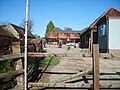 Chithurst Farm 4.jpg 2,560 × 1,920; 2.43 MB
-
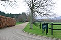 Drive to Bobbolds Farm - geograph.org.uk - 342651.jpg 640 × 428; 126 KB
-
 Footpath across field near Iping - geograph.org.uk - 1500359.jpg 640 × 360; 52 KB
-

-

-
 Gateway into Hammer Wood - geograph.org.uk - 1500337.jpg 640 × 360; 82 KB
-
 Hammer Lane near Chithurst - geograph.org.uk - 1500355.jpg 360 × 640; 86 KB
-
 Logpiles in Hammer Wood - geograph.org.uk - 1500340.jpg 640 × 360; 98 KB
-
 Monastery Garden - geograph.org.uk - 1187163.jpg 640 × 360; 86 KB
-
 Pond South-west of Woolhouse Farm - geograph.org.uk - 264130.jpg 640 × 480; 173 KB
-
 Post box in Chithurst - geograph.org.uk - 355246.jpg 640 × 480; 157 KB
-
 Pylon at SU84072365 - geograph.org.uk - 708972.jpg 640 × 480; 139 KB
-
 Pylons north of Chithurst - geograph.org.uk - 708977.jpg 640 × 480; 89 KB
-
 Pylons north of Chithurst - geograph.org.uk - 708982.jpg 480 × 640; 71 KB
-
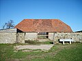
 Raised barn at Chithurst - geograph.org.uk - 1186886.jpg 640 × 360; 102 KB
-
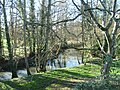
 River Rother at Chithurst - geograph.org.uk - 448948.jpg 640 × 480; 158 KB
-
 Robins Farm Cottage - geograph.org.uk - 351678.jpg 640 × 480; 90 KB
-

-
 Stream by St Mary's Churchyard, Chithurst - geograph.org.uk - 355226.jpg 640 × 480; 180 KB
-

-
 Woolhouse Farm - geograph.org.uk - 264117.jpg 640 × 480; 167 KB
-

-
 Byway junction on Sharver's Lane - geograph.org.uk - 1500297.jpg 640 × 360; 98 KB
-
 Faces to the Sun, Chithurst - geograph.org.uk - 355235.jpg 640 × 480; 181 KB
-
 Footpath at Tentworth - geograph.org.uk - 351682.jpg 640 × 480; 160 KB
-
 Footpath North of Woolhouse Farm - geograph.org.uk - 264111.jpg 640 × 480; 164 KB
-
 Gatehouse Lane - geograph.org.uk - 347911.jpg 428 × 640; 388 KB
-
 Graveyard near Robins - geograph.org.uk - 351674.jpg 640 × 480; 150 KB
-
 Green Lane in Holm Wood - geograph.org.uk - 709005.jpg 640 × 433; 143 KB
-
 Horses grazing near Iping - geograph.org.uk - 355176.jpg 640 × 480; 98 KB
-
 Monastic Woodland - geograph.org.uk - 343043.jpg 640 × 428; 164 KB
-
 Reservoir, from Brier Lane - geograph.org.uk - 708918.jpg 640 × 480; 103 KB
-
 Shed at Weston's Farm - geograph.org.uk - 342662.jpg 640 × 428; 82 KB
-

-
 View from bend in Brier Lane - geograph.org.uk - 708939.jpg 640 × 480; 145 KB
-
 Walnut Tree Farm - geograph.org.uk - 342667.jpg 640 × 428; 143 KB


