Category:Cherokee maps
Jump to navigation
Jump to search
Subcategories
This category has the following 2 subcategories, out of 2 total.
D
- Draught of the Cherokee Country (11 F)
Media in category "Cherokee maps"
The following 57 files are in this category, out of 57 total.
-
 0990R Eastern Cherokee Reservation Locator Map.svg 1,823 × 745; 3.35 MB
-

-
 Indians NW of South Carolina.jpg 1,770 × 1,217; 294 KB
-

-

-
-
 1815m4.jpg 1,689 × 1,442; 147 KB
-
 1817 Cherokee Reservation.jpg 1,200 × 675; 254 KB
-

-
 A map of the Tennassee state formerly part of North Carolina (3045318235).jpg 2,000 × 1,527; 2.5 MB
-
 Alabama tribal land map 1830.png 572 × 555; 78 KB
-

-

-

-
 Bulletin (1922) (20415182202).jpg 3,776 × 4,688; 3.77 MB
-
 Cessions Southeastern Tribes- Andrew Jackson.jpg 2,030 × 1,512; 1.91 MB
-
 Cherokee lang.png 497 × 310; 28 KB
-
 Cherokee Language Distribution.jpg 1,280 × 803; 285 KB
-
 Cherokee language map.png 640 × 396; 95 KB
-
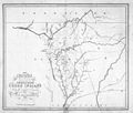
 Cherokee original claims.PNG 496 × 312; 27 KB
-
 Cherokee original claims1.PNG 496 × 312; 27 KB
-
 Cherokee Speaking Areas Within The USA.png 2,000 × 1,268; 9.69 MB
-
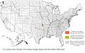
 Cherokee speaking US states.png 931 × 614; 85 KB
-
 Cherokee1822.jpg 512 × 432; 55 KB
-
 Cherokee1834.jpg 464 × 314; 58 KB
-
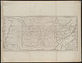
 Cherokeenation1830map.jpg 576 × 426; 74 KB
-
 CherokeeOTSA.PNG 266 × 139; 6 KB
-
 Chickamauga Towns.jpg 3,000 × 2,400; 1.46 MB
-
 Chickamauga Wars, theater of operations.jpg 3,000 × 2,400; 2.7 MB
-
 ChickasawWars.jpg 490 × 809; 155 KB
-
 Fort Armstrong and Strother.jpg 733 × 593; 71 KB
-
 Fort Okfuskee.jpg 1,395 × 707; 185 KB
-
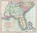
 Georgia, from the latest authorities. LOC 2010587363.jpg 4,536 × 5,105; 3.57 MB
-

-
 IndianTerritory.jpg 1,000 × 1,061; 233 KB
-
 Knoxville-region-1795-tn1.jpg 640 × 480; 80 KB
-

-
 Map of Cherokee Outlet.pdf 1,650 × 1,275; 310 KB
-
 Map of Qualla Boundary with subdivisions.jpg 1,106 × 876; 118 KB
-

-
 Map of the Qualla Indian Reserve Boundary NC.jpg 3,496 × 5,133; 2.48 MB
-
 Mappa a'n Hyns Dagrow.png 2,025 × 1,547; 3.19 MB
-
 Mialoquo-site-structures-tn1.jpg 419 × 250; 23 KB
-
 Mitchell-map-tellico-1755.jpg 433 × 318; 31 KB
-
 Mitchellmap-1755-telliquo.jpg 528 × 410; 75 KB
-
 Moseley map.jpg 500 × 296; 27 KB
-
 A new map of the Cherokee Nation (NYPL b20719744-5387010).jpg 7,597 × 5,863; 43.74 MB
-
 A new map of the Cherokee Nation (NYPL b20719744-5387010).tiff 10,328 × 7,760, 2 pages; 229.57 MB
-
 Oklahoma Tribal Statistical Area.svg 828 × 400; 1.49 MB
-
 Overhill-cherokee-little-tennessee.jpg 510 × 220; 41 KB
-
 Overhill-cherokee-map-full.jpg 525 × 319; 61 KB
-

-
 Rutherford trace map.jpg 450 × 377; 74 KB
-
 Trails of Tears de.png 2,025 × 1,547; 3.05 MB
-
 Trails of Tears en.png 2,025 × 1,547; 3.04 MB
-
 University of California publications in history (1911) (14750237496).jpg 2,940 × 2,336; 1,001 KB
-
 YamaseeWarMap01.png 1,008 × 697; 131 KB
.jpg)

_-_Geographicus_-_CarolinaGeorgia-bowen-1747.jpg)


.JPG)
.jpg)

_(19361536235).jpg)
_(19365563781).jpg)
_(19356574882).jpg)
_(20415182202).jpg)


.jpg)


_(14750237496).jpg)
