Category:Chatburn
Jump to navigation
Jump to search
English: Chatburn is a village located in the Ribble Valley, East Lancashire, England. It is situated in a hollow between two ridges north-east of Clitheroe, just off the A59 road. It lies near Pendle Hill, which is to the east of the village. The River Ribble flows to the west of the town. The town is approximately 400 feet above sea level. (→Chatburn)
Nederlands: Chatburn is een plaats en civil parish in het bestuurlijke gebied Ribble Valley, in het Engelse graafschap Lancashire. (→Chatburn)
Polski: Chatburn – wieś w Anglii, w hrabstwie Lancashire, w dystrykcie Ribble Valley. Leży 49 km na północ od miasta Manchester i 305 km na północny zachód od Londynu. (→Chatburn)

a village in Ribble Valley District, United Kingdom  | |||||
| Upload media | |||||
| Instance of | |||||
|---|---|---|---|---|---|
| Location | Ribble Valley, Lancashire, North West England, England | ||||
 | |||||
Subcategories
This category has the following 3 subcategories, out of 3 total.
A
- Arnot House, Lancashire (2 F)
C
- Chatburn railway station (2 F)
Media in category "Chatburn"
The following 159 files are in this category, out of 159 total.
-
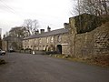
 "Hudson's" - geograph.org.uk - 465175.jpg 640 × 480; 102 KB
-
 'Manneken Pis' by Chatburn Brook - geograph.org.uk - 4210725.jpg 480 × 640; 144 KB
-
 6, Downham Road, Chatburn.jpg 4,000 × 3,000; 1.18 MB
-
 A Chatburn institution - geograph.org.uk - 4120315.jpg 2,798 × 1,993; 1.42 MB
-
 A garden centre on the corner of Worston Road - geograph.org.uk - 4015286.jpg 4,196 × 1,817; 4.22 MB
-
 A rail bridge over the A59 - geograph.org.uk - 3575280.jpg 4,333 × 2,884; 6.66 MB
-
 A59 eastbound near Arnot House - geograph.org.uk - 4246611.jpg 640 × 481; 69 KB
-
 A59 from Downham Road Bridge - geograph.org.uk - 3136776.jpg 640 × 480; 187 KB
-
 A59 from Downham Road Bridge - geograph.org.uk - 3136777.jpg 640 × 480; 166 KB
-
 A59 near The Royds - geograph.org.uk - 4246605.jpg 640 × 480; 60 KB
-
 A59 passes under Downham Road - geograph.org.uk - 4246608.jpg 640 × 480; 63 KB
-
 A59 passing under Downham Bridge - geograph.org.uk - 3346041.jpg 640 × 400; 45 KB
-
 A59 towards Skipton - geograph.org.uk - 5133027.jpg 640 × 480; 67 KB
-
 A59, Downham Road Bridge near Chatburn (geograph 4470210).jpg 640 × 481; 334 KB
-
 Beginning and end of a diversion - geograph.org.uk - 2462100.jpg 3,642 × 2,420; 1.3 MB
-
 Black Bull Inn, Chatburn - geograph.org.uk - 2326349.jpg 612 × 460; 125 KB
-
 Bold Venture Cottage - geograph.org.uk - 1141929.jpg 640 × 480; 68 KB
-
 Bold Venture Cottages - geograph.org.uk - 1141933.jpg 640 × 480; 70 KB
-
 Bold Venture Cottages, Chatburn - geograph.org.uk - 4480205.jpg 1,280 × 853; 469 KB
-
 Bold Venture Lime Works - geograph.org.uk - 4480206.jpg 1,280 × 825; 565 KB
-
 Bridge - geograph.org.uk - 451370.jpg 640 × 480; 131 KB
-
 Bridge Road, Chatburn - geograph.org.uk - 2326333.jpg 640 × 480; 103 KB
-
 Bridge Road, Chatburn - geograph.org.uk - 2326346.jpg 480 × 640; 62 KB
-
 Bridge Road, Chatburn - geograph.org.uk - 2326353.jpg 640 × 480; 116 KB
-
 Bridge Street, Chatburn - geograph.org.uk - 1583364.jpg 640 × 480; 74 KB
-
 Brown Cow, Chatburn - geograph.org.uk - 2326343.jpg 640 × 480; 109 KB
-
 Chatburn - geograph.org.uk - 38576.jpg 640 × 427; 104 KB
-
 Chatburn - geograph.org.uk - 4067963.jpg 3,644 × 2,355; 1.72 MB
-
 Chatburn - geograph.org.uk - 4068876.jpg 3,814 × 2,543; 1.58 MB
-
 Chatburn bridge over the A59 - geograph.org.uk - 4016057.jpg 4,592 × 2,891; 6.69 MB
-
 Chatburn Brook - geograph.org.uk - 2326332.jpg 480 × 640; 129 KB
-
 Chatburn Christ Church War Memorial - geograph.org.uk - 4470150.jpg 480 × 640; 405 KB
-
 Chatburn Methodist Church - geograph.org.uk - 2462198.jpg 3,872 × 2,592; 3.48 MB
-
 Chatburn Methodist Church - geograph.org.uk - 465155.jpg 640 × 480; 135 KB
-
 Chatburn Methodist Church, Lancs - geograph.org.uk - 5567617.jpg 2,592 × 1,944; 1.4 MB
-
 Chatburn Road, Greendale View - geograph.org.uk - 4468097.jpg 640 × 481; 386 KB
-
 Chatburn Road, North of Downham - geograph.org.uk - 4468078.jpg 640 × 480; 386 KB
-
 Chatburn Telephone Exchange, Lancs - geograph.org.uk - 5568155.jpg 2,592 × 1,944; 1.42 MB
-
 Chatburn, Bridge Road - geograph.org.uk - 4470204.jpg 640 × 481; 286 KB
-
 Chatburn, The Black Bull Inn - geograph.org.uk - 4470201.jpg 640 × 480; 310 KB
-
 Christ Church and churchyard, Chatburn - geograph.org.uk - 2462161.jpg 3,872 × 2,592; 3.37 MB
-
 Christ Church, Chatburn - geograph.org.uk - 3380903.jpg 3,072 × 2,304; 3.46 MB
-
 Christ Church, Chatburn - geograph.org.uk - 4015355.jpg 2,421 × 3,943; 7.06 MB
-
 Christ Church, Chatburn - geograph.org.uk - 4470173.jpg 640 × 480; 284 KB
-
 Christ Church, Chatburn - geograph.org.uk - 5767663.jpg 640 × 480; 72 KB
-
 Clitheroe Canoe Club - geograph.org.uk - 4016002.jpg 4,592 × 3,056; 7.73 MB
-
 Clitheroe Castle Museum editathon 035.jpg 5,184 × 3,456; 3.92 MB
-
 Clitheroe to Helifield Railway - geograph.org.uk - 1141927.jpg 640 × 480; 101 KB
-
 Clitheroe to Helifield Railway - geograph.org.uk - 1141937.jpg 640 × 480; 84 KB
-
 Clitheroe to Helifield Railway - geograph.org.uk - 1141939.jpg 640 × 480; 88 KB
-
 Cottage, Downham Road, Chatburn (geograph 1787543).jpg 1,632 × 1,224; 917 KB
-
 Countryside between Chatburn and Grindleton - geograph.org.uk - 1733795.jpg 2,816 × 2,112; 1.7 MB
-
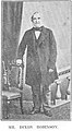 DixonRobinson.jpg 229 × 415; 33 KB
-
 Downham, Chatburn Road - geograph.org.uk - 4468109.jpg 640 × 481; 410 KB
-
 End of the road - geograph.org.uk - 1583346.jpg 640 × 443; 80 KB
-
 Entrance to Bankfield Quarry - geograph.org.uk - 406526.jpg 640 × 480; 236 KB
-
 Entrance to Ribblesdale Court - geograph.org.uk - 5133022.jpg 640 × 480; 110 KB
-
 Flooded Fields near Grindleton - geograph.org.uk - 2816535.jpg 640 × 480; 66 KB
-
 Footpath Between The Stacked Logs - geograph.org.uk - 3380834.jpg 3,032 × 2,250; 2.9 MB
-
 Footpath descending off Worsaw Hill - geograph.org.uk - 1743471.jpg 2,816 × 2,112; 2.48 MB
-

-
 Garden centre car park - geograph.org.uk - 5408209.jpg 4,032 × 3,024; 2.5 MB
-

-
 George VI postbox outside Post Office, Chatburn - geograph.org.uk - 5135036.jpg 1,935 × 2,848; 1.09 MB
-
 George VI postbox outside Post Office, Chatburn - geograph.org.uk - 5135037.jpg 2,820 × 1,993; 1.04 MB
-
 Graveyard and church, Chatburn - geograph.org.uk - 3446802.jpg 1,024 × 682; 406 KB
-
 Grazing off Sawley Road - geograph.org.uk - 5133017.jpg 640 × 480; 61 KB
-
 Grazing, Smithies Bridge - geograph.org.uk - 5133026.jpg 640 × 480; 97 KB
-
 Grindleton Bridge - geograph.org.uk - 1733799.jpg 2,816 × 2,112; 1.94 MB
-
 Grindleton Bridge - geograph.org.uk - 2816545.jpg 640 × 480; 88 KB
-
 Grindleton Bridge - geograph.org.uk - 4647201.jpg 5,184 × 2,637; 1.81 MB
-
 Heys Brook, Chatburn - geograph.org.uk - 2326352.jpg 480 × 640; 128 KB
-
 Houses on Clitheroe Road - geograph.org.uk - 5133001.jpg 640 × 436; 50 KB
-
 Hudson's, Chatburn - geograph.org.uk - 3446809.jpg 1,024 × 682; 539 KB
-
 Hudson's, Downham Road, Chatburn - geograph.org.uk - 2326341.jpg 630 × 472; 108 KB
-
 Kayley Lane, Chatburn - geograph.org.uk - 3184619.jpg 640 × 480; 179 KB
-
 Lanehead Quarry Biodiversity Corner - geograph.org.uk - 3309698.jpg 4,320 × 3,240; 4.16 MB
-
 Laneside (geograph 4573408).jpg 4,449 × 2,722; 7.85 MB
-
 Log piles by the A59, Chatburn Road - geograph.org.uk - 2546188.jpg 640 × 480; 131 KB
-
 Log-pile near Chatburn - geograph.org.uk - 3586654.jpg 3,264 × 2,448; 3.22 MB
-
 Main road, Chatburn - geograph.org.uk - 1583349.jpg 640 × 480; 89 KB
-
 Manor House Cottage and Manor House Barn, Chatburn 2.jpg 4,000 × 3,000; 4.93 MB
-
 Manor House Cottage and Manor House Barn, Chatburn.jpg 4,000 × 3,000; 1.19 MB
-
 New boundary stone at Smithies Bridge - geograph.org.uk - 857827.jpg 640 × 480; 118 KB
-
 Non-existent railway bridge - geograph.org.uk - 1583348.jpg 640 × 480; 85 KB
-
 Old road into Bold Venture Quarry - geograph.org.uk - 1141931.jpg 640 × 480; 106 KB
-
 Old Road, Chatburn - geograph.org.uk - 2326326.jpg 640 × 480; 124 KB
-
 Old Road, Chatburn - geograph.org.uk - 406588.jpg 640 × 480; 221 KB
-
 On the Ribble Way, SE of Fields House, Grindleton, Lancs - geograph.org.uk - 6010899.jpg 5,184 × 2,920; 5.61 MB
-
 Parish Church of Christ Church, Chatburn - geograph.org.uk - 3446796.jpg 1,024 × 682; 724 KB
-
 Pendle Hotel - geograph.org.uk - 1141940.jpg 640 × 480; 78 KB
-
 Pendle Hotel, Doorway - geograph.org.uk - 1141955.jpg 480 × 640; 93 KB
-
 Pendle Trading Estate, building - geograph.org.uk - 1141957.jpg 640 × 480; 73 KB
-
 Pendle Trading Estate, near Chatburn - geograph.org.uk - 1583336.jpg 640 × 480; 61 KB
-
 Piked Acre Wood - geograph.org.uk - 1743483.jpg 2,816 × 2,112; 2.02 MB
-

-
 Post Office and stores, Chatburn - geograph.org.uk - 5135040.jpg 2,848 × 1,836; 1.16 MB
-
 R Ribble by Ribble Lane, N of Chatburn - geograph.org.uk - 6010893.jpg 5,184 × 2,920; 6.54 MB
-
 Railway bridge over the A59 - geograph.org.uk - 4307660.jpg 1,500 × 999; 139 KB
-
 Ribble Lane, Chatburn - geograph.org.uk - 2326329.jpg 640 × 480; 117 KB
-
 Ribble Lane, Chatburn - geograph.org.uk - 3446812.jpg 1,024 × 680; 412 KB
-
 Ribble Way near Chatburn - geograph.org.uk - 1733793.jpg 2,816 × 2,112; 1.9 MB
-

-

-
 Road junction in Chatburn - geograph.org.uk - 2546178.jpg 640 × 480; 104 KB
-
 Road to Bold Venture Cottages - geograph.org.uk - 1141936.jpg 640 × 480; 87 KB
-
 Roadworks on Clitheroe Road - geograph.org.uk - 5133002.jpg 640 × 480; 72 KB
-
 Sawley Road - geograph.org.uk - 5133024.jpg 640 × 480; 64 KB
-
 Sawley Road leaving Chatburn - geograph.org.uk - 3308158.jpg 4,320 × 3,240; 3.99 MB
-
 Service station on Clitheroe Road - geograph.org.uk - 5133004.jpg 640 × 480; 56 KB
-
 Shackletons - geograph.org.uk - 1141960.jpg 640 × 480; 73 KB
-
 Shackletons - geograph.org.uk - 4067961.jpg 3,659 × 2,198; 1.57 MB
-
 Shackletons Garden Centre - geograph.org.uk - 2460894.jpg 3,872 × 2,592; 3.95 MB
-

-
 Sign for the Brown Cow, Chatburn - geograph.org.uk - 5133015.jpg 512 × 640; 57 KB
-
 Smithies Bridge - geograph.org.uk - 2100141.jpg 2,592 × 1,944; 1.6 MB
-
 Smithies Bridge, near Clitheroe - geograph.org.uk - 858792.jpg 640 × 480; 66 KB
-
 Smithies Brook - geograph.org.uk - 5133028.jpg 640 × 480; 134 KB
-
 Smithies Brook enters the Ribble - geograph.org.uk - 4210837.jpg 640 × 480; 74 KB
-
 Snow Covered Pasture by Sawley Road - geograph.org.uk - 3308154.jpg 4,320 × 3,240; 3.96 MB
-
 Stile on the Ribble Way - geograph.org.uk - 2462222.jpg 3,872 × 2,592; 6.61 MB
-

-
 Telephone Exchange, Chatburn - geograph.org.uk - 2460899.jpg 3,872 × 2,592; 4.99 MB
-
 Telephone exchange, Chatburn - geograph.org.uk - 5133006.jpg 640 × 480; 84 KB
-

-
 The A59 at Smithies Bridge - geograph.org.uk - 2732439.jpg 1,600 × 1,198; 320 KB
-
 The A59 runs under Downham Road - geograph.org.uk - 4307664.jpg 1,500 × 999; 146 KB
-
 The A59 to Clitheroe - geograph.org.uk - 4307656.jpg 1,500 × 999; 117 KB
-
 The A59 to Clitheroe - geograph.org.uk - 4307657.jpg 1,500 × 976; 129 KB
-
 The Black Bull Inn, Chatburn - geograph.org.uk - 2462121.jpg 3,872 × 2,592; 5.07 MB
-
 The Black Bull Inn, Chatburn - geograph.org.uk - 5133010.jpg 640 × 480; 84 KB
-
 The Brown Cow, Bridge Road, Chatburn - geograph.org.uk - 4470187.jpg 640 × 480; 290 KB
-
 The Brown Cow, Bridge Street, Chatburn - geograph.org.uk - 541626.jpg 640 × 480; 166 KB
-
 The Brown Cow, Chatburn - geograph.org.uk - 5133013.jpg 640 × 480; 50 KB
-
 The Clitheroe to Hellifield Railway - geograph.org.uk - 1583728.jpg 640 × 480; 61 KB
-
 The junction of Ribblesdale View with Downham Road, Chatburn - geograph.org.uk - 2462181.jpg 3,872 × 2,592; 5.37 MB
-
 The River Ribble - geograph.org.uk - 4566330.jpg 4,592 × 3,056; 7.75 MB
-
 The River Ribble - geograph.org.uk - 5139974.jpg 640 × 480; 62 KB
-
 The Village Hall, Chatburn (geograph 2462192).jpg 3,872 × 2,592; 3.8 MB
-
 Townson Bros, Pendle Trading Estate - geograph.org.uk - 1141956.jpg 640 × 480; 65 KB
-
 Tributary of River Ribble - geograph.org.uk - 1583355.jpg 640 × 480; 128 KB
-
 Two log piles - geograph.org.uk - 4573423.jpg 4,592 × 2,446; 7.62 MB
-
 Under the bridge over the A59 - geograph.org.uk - 4016095.jpg 4,376 × 2,913; 6.35 MB
-
 Venture House - geograph.org.uk - 1141934.jpg 640 × 480; 83 KB
-
 Venture House, Clock - geograph.org.uk - 1141935.jpg 640 × 480; 103 KB
-
 View towards Grindleton - geograph.org.uk - 1583723.jpg 640 × 480; 69 KB
-
 Village cricket at Chatburn - geograph.org.uk - 2462127.jpg 3,872 × 2,592; 3.92 MB
-
 Village Post Office and Store, Chatburn - geograph.org.uk - 4470192.jpg 640 × 484; 321 KB
-

-
 Winter on the River Ribble - geograph.org.uk - 3308513.jpg 4,320 × 3,240; 3.24 MB
-
 Clitheroe Canoe Club - geograph.org.uk - 412159.jpg 640 × 480; 210 KB
-
 Crow Hill, Worston - geograph.org.uk - 68650.jpg 640 × 480; 93 KB
-
 Entering Chatburn - geograph.org.uk - 101842.jpg 640 × 427; 126 KB
-
 Pendle Trading Estate - geograph.org.uk - 406538.jpg 640 × 480; 70 KB
-
 River Ribble south of Grindleton - geograph.org.uk - 451376.jpg 640 × 480; 148 KB
-
 Road junction - geograph.org.uk - 406580.jpg 640 × 480; 81 KB
-
 The Black Bull, Bridge Street, Chatburn - geograph.org.uk - 541623.jpg 640 × 480; 193 KB
-
 The Clitheroe to Hellifield Railway - geograph.org.uk - 465154.jpg 640 × 480; 98 KB
-
 The Pendle Hotel, Chatburn - geograph.org.uk - 38572.jpg 640 × 427; 138 KB


.jpg)


.jpg)


.jpg)


.jpg)


