Category:Charles Brooking's Map of Dublin (1728)
Jump to navigation
Jump to search
Media in category "Charles Brooking's Map of Dublin (1728)"
The following 17 files are in this category, out of 17 total.
-
 Corn Market House, Dublin 8.jpg 1,500 × 1,135; 1.63 MB
-
 Dr Steevens' Hospital (1728).jpg 1,500 × 1,096; 1.65 MB
-
 George I Essex Bridge.jpg 742 × 452; 272 KB
-
 Linen hall, Dublin.jpg 1,500 × 1,031; 1.62 MB
-
 Lord Mayors House, Dublin (1728).jpg 652 × 294; 166 KB
-
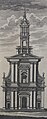 St. Ann's Church, Dawson Street (1728).jpg 592 × 1,500; 848 KB
-
 St. Werburgh's Church, Dublin (1728).jpg 594 × 1,500; 897 KB
-
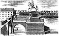
 Statue of George I on Essex Bridge, Dublin.jpg 1,448 × 882; 603 KB
-
 The city bason (city basin), Dublin.jpg 873 × 1,500; 1.19 MB
-
 The Custom house (1707).png 1,172 × 478; 1.5 MB
-
-
 The history and antiquities of the city of Dublin Fleuron T115001-2.png 2,009 × 861; 81 KB
-
 The history and antiquities of the city of Dublin Fleuron T115002-4.png 1,649 × 762; 82 KB
-
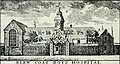
 The hospital in Steven's Street.jpg 1,081 × 1,500; 1.62 MB
-
 The Poor House, Dublin.png 579 × 319; 451 KB
-
 Tholsel image dublin.jpg 1,024 × 825; 329 KB
-
 Trinity College Dublin, West front (1728).png 1,082 × 700; 1.63 MB

.jpg)


.jpg)

,_Dublin.jpg)
.jpg)


.png)
.jpg)
.jpg)
.png)