Category:Chalgrave
Jump to navigation
Jump to search
village and civil parish in Bedfordshire, UK  | |||||
| Upload media | |||||
| Instance of | |||||
|---|---|---|---|---|---|
| Location | Central Bedfordshire, Bedfordshire, East of England, England | ||||
 | |||||
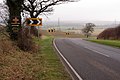
English: Chalgrave is a civil parish in the Central Bedfordshire district of Bedfordshire, England. The hamlets of Tebworth and Wingfield are in the west of the parish, with the church and manor in the east. Nearby places are Toddington (to the north), Chalton (to the east), Houghton Regis (to the south), and Hockliffe (to the west). Before 1929, the parish also included part of the village of Hockliffe.
Subcategories
This category has the following 4 subcategories, out of 4 total.
Media in category "Chalgrave"
The following 54 files are in this category, out of 54 total.
-
 "New Barn" near Chalgrave - geograph.org.uk - 204393.jpg 640 × 480; 89 KB
-
 A rest on the Icknield Way - geograph.org.uk - 3290421.jpg 1,600 × 1,067; 691 KB
-
 A5120 Bedford Road - geograph.org.uk - 234091.jpg 640 × 367; 57 KB
-
 A5120 goes down Lord's Hill to Houghton Regis - geograph.org.uk - 3292276.jpg 1,600 × 1,067; 433 KB
-
 All Saints Chalgrave - geograph.org.uk - 3800570.jpg 4,320 × 3,240; 5.75 MB
-
 All Saints, Chalgrave - Chancel - geograph.org.uk - 3263779.jpg 687 × 1,000; 210 KB
-
 All Saints, Chalgrave - East end - geograph.org.uk - 3263778.jpg 1,000 × 713; 238 KB
-
 All Saints, Chalgrave - geograph.org.uk - 3263775.jpg 1,000 × 713; 334 KB
-
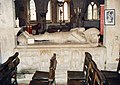 All Saints, Chalgrave - Tomb chest ^ effigy - geograph.org.uk - 3263780.jpg 1,024 × 727; 166 KB
-
 Arable land behind McDonald's - geograph.org.uk - 5818073.jpg 1,280 × 960; 315 KB
-
 Central Bedfordshire , Tebworth Road - geograph.org.uk - 5733070.jpg 5,673 × 3,781; 5.7 MB
-
 Central Bedfordshire , The A5 - geograph.org.uk - 5733075.jpg 6,000 × 4,000; 6.48 MB
-
 Chalgrave Parish Sign 326088 c8494e07-by-Rob-Farrow.jpg 331 × 332; 44 KB
-
 Chiltern Way marked as a byway toward Lodge - geograph.org.uk - 3292264.jpg 1,600 × 1,069; 555 KB
-
 Cottages off the Wingfield Road - geograph.org.uk - 3290420.jpg 1,600 × 1,068; 458 KB
-
 Cottages, Tebworth - geograph.org.uk - 4666872.jpg 640 × 480; 90 KB
-
 Direct Pallets, Hockliffe - geograph.org.uk - 6143479.jpg 1,920 × 1,280; 883 KB
-

-
 Electricity wires by the field edge - geograph.org.uk - 3290438.jpg 1,200 × 1,600; 274 KB
-
 Farmland below Wingfield - geograph.org.uk - 5360467.jpg 2,592 × 1,944; 1.3 MB
-
 Farmland south of Toddington - geograph.org.uk - 5360496.jpg 2,592 × 1,944; 1.07 MB
-
 Featherbed Lane down to "New Barn" - geograph.org.uk - 3292260.jpg 1,600 × 1,067; 364 KB
-
 Field entrance with some curious sheep - geograph.org.uk - 3290391.jpg 1,600 × 1,066; 537 KB
-
 Fields of rape below Wingfield - geograph.org.uk - 5360484.jpg 2,592 × 1,944; 1.49 MB
-
 Footpath crosses The Lane - geograph.org.uk - 3290395.jpg 1,600 × 1,067; 459 KB
-
 Footpath into Tebworth - geograph.org.uk - 3290407.jpg 1,600 × 1,070; 545 KB
-
 Footpath to Hockliffe - geograph.org.uk - 3290397.jpg 1,600 × 1,066; 697 KB
-
 Footpath toward Watergate Lodge - geograph.org.uk - 3290404.jpg 1,600 × 1,068; 513 KB
-
 Footpath towards Herne Grange and other destinations - geograph.org.uk - 3290434.jpg 1,600 × 1,077; 511 KB
-
 Former Methodist chapel, Tebworth - geograph.org.uk - 5360421.jpg 2,592 × 1,944; 1.55 MB
-

-
 Grave yard at All Saints' Chalgrave - geograph.org.uk - 3800572.jpg 4,320 × 3,240; 5.74 MB
-
 Hedgerow by New Barn Farm lane - geograph.org.uk - 3292273.jpg 1,600 × 1,066; 630 KB
-
 Houghton Regis - geograph.org.uk - 5463191.jpg 3,264 × 2,448; 3.24 MB
-
 Inn sign, The Plough Inn, Wingfield - geograph.org.uk - 4667247.jpg 428 × 640; 89 KB
-
 Inn sign, The Queens Head, Tebworth - geograph.org.uk - 4667214.jpg 480 × 640; 101 KB
-
 Instructive bench by the Large Pond - geograph.org.uk - 3290430.jpg 1,600 × 1,066; 765 KB
-
 Path toward Thorn Farm - geograph.org.uk - 3290415.jpg 1,200 × 1,600; 576 KB
-
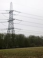 Pylon by Grove Spinney - geograph.org.uk - 3292267.jpg 1,200 × 1,600; 363 KB
-
 Pylons in the mist - geograph.org.uk - 3290386.jpg 1,600 × 1,067; 229 KB
-
 Roadworks for a link to the M1 from the west - geograph.org.uk - 4547167.jpg 3,264 × 2,448; 3.82 MB
-
 Sign outside Chalgrave Manor Golf Club - geograph.org.uk - 5053142.jpg 2,304 × 1,728; 817 KB
-
 Steps up to the public footpaths - geograph.org.uk - 3290417.jpg 1,200 × 1,600; 454 KB
-
 The entrance to Chalgrave Manor Golf Club - geograph.org.uk - 5053141.jpg 2,304 × 1,728; 847 KB
-
 The Plough Inn, Wingfield - geograph.org.uk - 4666912.jpg 640 × 428; 91 KB
-
 The Plough Inn, Wingfield - geograph.org.uk - 5360443.jpg 2,592 × 1,944; 1.27 MB
-
 The Queens Head, Tebworth - geograph.org.uk - 4666895.jpg 640 × 480; 103 KB
-
 The Toddington Road - geograph.org.uk - 5360512.jpg 2,592 × 1,944; 1.54 MB
-
 The view from Lords Hill, Chalgrave - geograph.org.uk - 5053143.jpg 2,304 × 1,728; 922 KB
-
 Toddington Road enters Tebworth - geograph.org.uk - 3290442.jpg 1,600 × 1,067; 451 KB
-
 Access to Chalgrave golf club - geograph.org.uk - 411290.jpg 640 × 480; 57 KB
-
 Arable field and golf course - geograph.org.uk - 411293.jpg 640 × 480; 60 KB
-
 Springtime in the rough - geograph.org.uk - 411283.jpg 640 × 480; 116 KB
-
 Track to Grove Farm, near Chalgrave - geograph.org.uk - 225638.jpg 640 × 480; 84 KB


