Category:Cavardirashütte
Jump to navigation
Jump to search
| Object location | | View all coordinates using: OpenStreetMap |
|---|
mountain hut  | |||||
| Upload media | |||||
| Instance of | |||||
|---|---|---|---|---|---|
| Location | Grisons, Switzerland | ||||
| Owned by |
| ||||
| Inception |
| ||||
| Mountain range | |||||
| Elevation above sea level |
| ||||
| official website | |||||
 | |||||
Media in category "Cavardirashütte"
The following 5 files are in this category, out of 5 total.
-
 Brunnifirn Cavardirashütte.jpg 2,816 × 2,112; 2.79 MB
-
 Cavardirashütte - Val Surrein.jpg 2,816 × 2,112; 2.92 MB
-
 Cavardirashütte von Westen.jpg 1,834 × 1,377; 282 KB
-
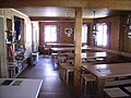 Cavardirashütte.jpg 2,816 × 2,112; 2.89 MB
-
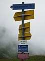 Wegweiser zum Brunnipass.jpg 2,112 × 2,816; 2.5 MB


