Category:Catrine
Jump to navigation
Jump to search
village in East Ayrshire, Scotland, UK  | |||||
| Upload media | |||||
| Instance of | |||||
|---|---|---|---|---|---|
| Location |
| ||||
| Population |
| ||||
 | |||||

Catrine is a village in East Ayrshire, Scotland which was formerly a centre of cotton manufacture.
Subcategories
This category has the following 6 subcategories, out of 6 total.
A
- Ballochmyle Estate (24 F)
B
- Burn o'Need (2 F)
C
- Catrine Parish Church (15 F)
- Catrine Village Hall (1 F)
H
- Howford Bridge, East Ayrshire (13 F)
Media in category "Catrine"
The following 48 files are in this category, out of 48 total.
-
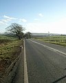 A76 towards Cumnock - geograph.org.uk - 330349.jpg 510 × 640; 81 KB
-
 A76 with winter trees - geograph.org.uk - 330354.jpg 480 × 640; 102 KB
-
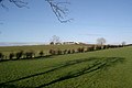 Across the fields to Little Heateth - geograph.org.uk - 330347.jpg 640 × 429; 57 KB
-
 Ash (Fraxinus excelsior) coppiced bowl.JPG 4,608 × 3,456; 3.64 MB
-
 Ballochmyle Woods at Catrine.JPG 3,814 × 2,829; 2.2 MB
-
 Bogend Farm - geograph.org.uk - 366287.jpg 640 × 449; 42 KB
-
 Bonded Warehouse - geograph.org.uk - 318499.jpg 640 × 426; 54 KB
-
 Braes of Ballochmyle, Mauchline.JPG 4,602 × 3,448; 8.49 MB
-
 Burr or Burls on Willow (Salix sps).JPG 2,735 × 3,892; 5.25 MB
-
 Catrine and Sorn from the air (geograph 5613185).jpg 500 × 640; 150 KB
-
 Catrine Estate suspension bridge abutment.JPG 3,618 × 2,996; 4.15 MB
-
 Catrine Estate's suspension bridge abutment.JPG 3,070 × 3,134; 4.18 MB
-
 Catrine House lodge, East Ayrshire.JPG 2,246 × 1,654; 1.85 MB
-
 CATRINE LIBRARY! (8510650452).jpg 2,134 × 2,848; 945 KB
-
 Catrine pedestrian bridge maker's plaque.JPG 3,379 × 2,807; 2.69 MB
-
 Catrine sewage works - geograph.org.uk - 734037.jpg 640 × 469; 108 KB
-
 Catrine station geograph-3299422-by-Ben-Brooksbank.jpg 2,433 × 1,447; 752 KB
-
 Catrine, River Ayr looking upstream.JPG 4,485 × 2,759; 6.05 MB
-
 Catrine, River Ayr, looking downstream.JPG 4,403 × 2,814; 5.52 MB
-
 Catrineshaw Farmhouse and buildings - geograph.org.uk - 372089.jpg 640 × 426; 77 KB
-
 Cattle - geograph.org.uk - 205181.jpg 640 × 480; 160 KB
-
 Council Renovation Area - geograph.org.uk - 318459.jpg 640 × 388; 22 KB
-
 Cows - geograph.org.uk - 205185.jpg 640 × 480; 153 KB
-
 Croftfoot Farm - geograph.org.uk - 576060.jpg 640 × 480; 51 KB
-
 Disused railway near Cumnock - geograph.org.uk - 330353.jpg 640 × 480; 59 KB
-
 Exit on to B713 to Auchinleck - geograph.org.uk - 318470.jpg 640 × 426; 71 KB
-
 Footbridge across R. Ayr - geograph.org.uk - 318577.jpg 640 × 426; 108 KB
-
 Gate, fence and hedge by the A76 - geograph.org.uk - 330350.jpg 640 × 480; 93 KB
-
 Kenstey Farm - geograph.org.uk - 373789.jpg 640 × 426; 76 KB
-
 Mauchline Road - geograph.org.uk - 205168.jpg 640 × 480; 138 KB
-
 Mill Square and Bridge Street - geograph.org.uk - 233807.jpg 640 × 480; 71 KB
-
 Mill workers' cottages, Bridge Street, Catrine.jpg 640 × 480; 64 KB
-
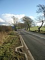
 Minor road to Sorn - geograph.org.uk - 366292.jpg 640 × 426; 87 KB
-
 New private housing - geograph.org.uk - 366298.jpg 640 × 426; 47 KB
-
 Old Catrine branchline, near Catrine House, East Ayrshire.jpg 4,179 × 2,546; 6.12 MB
-
 Old Catrine quoiting ground, near Catrine House, East Ayrshire, Scotland.jpg 4,582 × 2,850; 4.93 MB
-
 Path SCD33 near Catrine - geograph.org.uk - 350753.jpg 640 × 480; 202 KB
-
 Recreation Area - geograph.org.uk - 318485.jpg 640 × 426; 78 KB
-
 River Ayr - geograph.org.uk - 573935.jpg 450 × 600; 83 KB
-
 River Ayr Way at Catrine - geograph.org.uk - 350739.jpg 640 × 480; 152 KB
-
 River Ayr Way at Catrine - geograph.org.uk - 350742.jpg 640 × 480; 167 KB
-
 Riverside housing at Catrine - geograph.org.uk - 734062.jpg 640 × 480; 125 KB
-
 Road and railway near Catrine - geograph.org.uk - 350725.jpg 640 × 480; 151 KB
-
 Shawwood Council Estate - geograph.org.uk - 318241.jpg 640 × 426; 55 KB
-
 South Logan Farm - geograph.org.uk - 366294.jpg 640 × 426; 50 KB
-
 Sycamore with rotting branch.JPG 3,540 × 3,165; 4.58 MB
-
 The Burn o'Need at Catrine Braes Bridge.JPG 4,608 × 3,456; 3.52 MB
-
 Trees - geograph.org.uk - 205176.jpg 640 × 480; 157 KB


_coppiced_bowl.JPG)


.JPG)
.jpg)


.jpg)


