Category:Cathedral of the Dormition (Yaroslavl), pre-1937 building
Jump to navigation
Jump to search
| Object location | | View all coordinates using: OpenStreetMap |
|---|
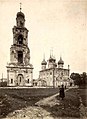
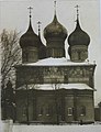
Русский: Успенский собор в Ярославле, разрушенный в 1937 г. (в 2010 г. на его месте был построен новый собор, сходный по форме, но бо́льших размеров)
Media in category "Cathedral of the Dormition (Yaroslavl), pre-1937 building"
The following 25 files are in this category, out of 25 total.
-
 Cathedral of the Assumption, Yaroslavl.jpg 900 × 570; 166 KB
-
 History of Volzhskaya embankment (Yaroslavl) 01.jpg 1,000 × 317; 52 KB
-
 History of Volzhskaya embankment (Yaroslavl) 02.jpg 1,000 × 507; 212 KB
-
 JOF015-Dormition-Cathedral-Yaroslavl.jpg 1,024 × 917; 643 KB
-
 JOF016-Dormition-Cathedral-Yaroslavl.jpg 1,024 × 917; 670 KB
-
 JOF017-Dormition-Cathedral-Yaroslavl.jpg 1,024 × 910; 640 KB
-
 JOF018-Dormition-Cathedral-Yaroslavl.jpg 1,024 × 921; 672 KB
-
 Old Assumption Cathedral in Yaroslavl 001.gif 540 × 334; 177 KB
-
 Old Assumption Cathedral in Yaroslavl 002.jpg 514 × 305; 39 KB
-
 Old Assumption Cathedral in Yaroslavl 003.jpg 1,000 × 619; 508 KB
-
 Photo of Yaroslavl of Yaroslavl Governorate 004.gif 524 × 299; 153 KB
-
 Rublengorod.jpg 605 × 266; 49 KB
-
 View of Yaroslavl in 1856.jpg 1,024 × 651; 126 KB
-
 Yar sobor icons.jpg 1,175 × 1,500; 484 KB
-
 Yar. strelka (Sabaneev).jpg 375 × 403; 49 KB
-
 Yar. strelka (Sabaneev, 1878).jpg 1,229 × 1,736; 510 KB
-
 Yaroslavl, 1731.jpg 1,391 × 851; 757 KB
-
 Yaroslavl-Uspenski sobor.jpg 450 × 330; 17 KB
-
 Yaroslavl-Uspensky sobor-1918.JPG 284 × 390; 19 KB
-
 Yarsobor square.jpg 635 × 342; 83 KB
-
 Yarsobor.jpg 279 × 365; 46 KB
-
 Старый Ярославль. Ильинская (Советская) площадь.jpg 1,000 × 611; 153 KB
-
 Старый Ярославль. Успенский собор и Демидовский лицей.jpg 1,280 × 815; 325 KB
-
 Успенский собор (Ярославль, 1881).jpg 800 × 555; 70 KB
-
 Ярославль. Успенский собор. Почтовая открытка.jpg 1,575 × 1,063; 559 KB

_02.jpg)


.jpg)
.jpg)


_%D0%BF%D0%BB%D0%BE%D1%89%D0%B0%D0%B4%D1%8C.jpg)

.jpg)

_01.jpg)