Category:Cartworth, West Yorkshire
Jump to navigation
Jump to search
village in West Yorkshire, England  | |||||
| Upload media | |||||
| Instance of | |||||
|---|---|---|---|---|---|
| Location | Holme Valley, Kirklees, West Yorkshire, Yorkshire and the Humber, England | ||||
 | |||||
Media in category "Cartworth, West Yorkshire"
The following 28 files are in this category, out of 28 total.
-
 Agnes and Herbert, Washpit Mills - geograph.org.uk - 1126197.jpg 640 × 417; 72 KB
-

-
 Choppards Mission Church, Wooldale - geograph.org.uk - 732769.jpg 640 × 480; 65 KB
-
 Disused well, Royd Lane, Cartworth - geograph.org.uk - 258611.jpg 640 × 480; 126 KB
-
 Green Lane Mill, Cartworth - geograph.org.uk - 1603604.jpg 640 × 480; 130 KB
-
 Hill House Road, Cartworth - geograph.org.uk - 932389.jpg 640 × 480; 75 KB
-

-
 Lane Bottom, Acre Lane, Cartworth - geograph.org.uk - 258651.jpg 640 × 480; 86 KB
-

-
 Millpond for Washpit Mills, Cartworth - geograph.org.uk - 1603663.jpg 640 × 480; 117 KB
-
 Millpond of Dover Mills, Cartworth - geograph.org.uk - 1603524.jpg 640 × 480; 168 KB
-
 Old Yew, Cartworth - geograph.org.uk - 932452.jpg 640 × 480; 77 KB
-
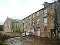 Part of Washpit Mills, Cartworth - geograph.org.uk - 1603659.jpg 640 × 480; 111 KB
-
 Ribble Bank House, Cartworth - geograph.org.uk - 1603489.jpg 640 × 472; 197 KB
-

-
 Sluice, Washpit Mills, Cartworth - geograph.org.uk - 1603670.jpg 640 × 470; 190 KB
-
 The infant River Ribble, Cartworth - geograph.org.uk - 1601225.jpg 640 × 480; 180 KB
-

-

-

-

-

-

-
 Toadstool - geograph.org.uk - 1569866.jpg 640 × 480; 166 KB
-
 Washpit Mills, Cartworth - geograph.org.uk - 1603619.jpg 489 × 640; 130 KB
-
 Washpit Mills, Cartworth - geograph.org.uk - 1603631.jpg 640 × 480; 110 KB
-
 Washpit Mills, Cartworth - geograph.org.uk - 1603649.jpg 640 × 416; 116 KB
-
 Old Yew Lane, off Royd Lane, Cartworth - geograph.org.uk - 258619.jpg 640 × 480; 122 KB


_-_geograph.org.uk_-_932226.jpg)


_-_geograph.org.uk_-_1603376.jpg)

_-_geograph.org.uk_-_1603359.jpg)


