Category:Carnethy Hill
Jump to navigation
Jump to search
second highest of the Pentland Hills, Scotland  | |||||
| Upload media | |||||
| Instance of | |||||
|---|---|---|---|---|---|
| Location | Midlothian, Scotland | ||||
| Mountain range | |||||
| Elevation above sea level |
| ||||
 | |||||
Media in category "Carnethy Hill"
The following 52 files are in this category, out of 52 total.
-
 A crisp winter day on Carnethy Hill - geograph.org.uk - 1238409.jpg 640 × 480; 96 KB
-

-
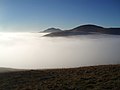 Breaking Through The Clouds - geograph.org.uk - 637952.jpg 640 × 480; 29 KB
-
 Bronze Age Structure on Carnethy Hill - geograph.org.uk - 41514.jpg 640 × 480; 53 KB
-
 Burn - wall crossing - geograph.org.uk - 477331.jpg 640 × 480; 109 KB
-
 Cairn on Hare Hill - geograph.org.uk - 330423.jpg 640 × 480; 136 KB
-
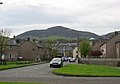 Carnethy Avenue, Penicuik. - geograph.org.uk - 7126.jpg 640 × 450; 58 KB
-
 Carnethy Hill - geograph.org.uk - 1195286.jpg 640 × 359; 45 KB
-
 Carnethy Hill - geograph.org.uk - 1401752.jpg 640 × 477; 86 KB
-
 Carnethy Hill - geograph.org.uk - 1428294.jpg 640 × 480; 104 KB
-
 Carnethy Hill - geograph.org.uk - 29509.jpg 640 × 480; 93 KB
-
 Carnethy Hill - geograph.org.uk - 30561.jpg 640 × 480; 62 KB
-
 Carnethy Hill - geograph.org.uk - 412604.jpg 640 × 480; 72 KB
-
 Carnethy Hill - geograph.org.uk - 943092.jpg 640 × 480; 84 KB
-
 Carnethy Hill from above the Logan Burn - geograph.org.uk - 790084.jpg 640 × 427; 217 KB
-
 Carnethy Hill from Turnhouse Hill - geograph.org.uk - 1638010.jpg 640 × 295; 32 KB
-
 Crooked Rig - geograph.org.uk - 477327.jpg 640 × 480; 103 KB
-
 East side of Hare Hill - geograph.org.uk - 330741.jpg 640 × 479; 140 KB
-
 Foothills of Carnethy Hill - geograph.org.uk - 10592.jpg 640 × 480; 60 KB
-
 Gate on Kirk Road - geograph.org.uk - 331619.jpg 640 × 479; 126 KB
-
 Glencorse Reservoir. - geograph.org.uk - 29504.jpg 640 × 480; 71 KB
-
 Harlaw Muir - geograph.org.uk - 750072.jpg 640 × 480; 83 KB
-

-

-
 Kirk Road - geograph.org.uk - 411779.jpg 640 × 480; 114 KB
-
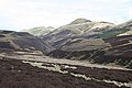
 Logan Burn. - geograph.org.uk - 53957.jpg 640 × 480; 98 KB
-

-
 Moorland, Carnethy Hill - geograph.org.uk - 411921.jpg 640 × 480; 95 KB
-
 Mosshouses Farm Steading - geograph.org.uk - 1159409.jpg 640 × 427; 122 KB
-
 Old field system - geograph.org.uk - 656151.jpg 640 × 480; 148 KB
-
 Path, Carnethy Hill - geograph.org.uk - 411932.jpg 640 × 480; 95 KB
-
 Runner, Carnethy Hill - geograph.org.uk - 411915.jpg 480 × 640; 79 KB
-
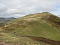
 Scald Law - geograph.org.uk - 411784.jpg 640 × 446; 72 KB
-
 Scald Law - geograph.org.uk - 41511.jpg 640 × 480; 86 KB
-
 Scald Law from Carnethy hill - geograph.org.uk - 29127.jpg 640 × 480; 176 KB
-
 Signpost on Kirk Road footpath - geograph.org.uk - 331670.jpg 640 × 479; 120 KB
-
 Snow covered fields, Silverburn - geograph.org.uk - 1195258.jpg 640 × 359; 82 KB
-
 South from Capelaw Hill - geograph.org.uk - 124651.jpg 640 × 480; 43 KB
-
 Stile beside Kirk Road - geograph.org.uk - 331595.jpg 640 × 480; 119 KB
-
 Survey stud, Carnethy Hill - geograph.org.uk - 411927.jpg 640 × 480; 135 KB
-
 The View from Kirk Road - geograph.org.uk - 331576.jpg 640 × 480; 113 KB
-

-
 Turnhouse Hill - geograph.org.uk - 1468826.jpg 640 × 360; 58 KB
-
 Turnhouse Hill - geograph.org.uk - 411941.jpg 640 × 480; 82 KB
-
 Turnhouse Hill - geograph.org.uk - 411952.jpg 640 × 480; 69 KB
-
 Turnhouse Hill - geograph.org.uk - 411959.jpg 640 × 480; 69 KB
-
 Turnhouse Hill from Carnethy Hill. - geograph.org.uk - 468433.jpg 640 × 433; 52 KB
-
 View from Carnethy Hill - geograph.org.uk - 468424.jpg 640 × 426; 58 KB
-

-
-

-
 Windpacked drift on Carnethy Hill - geograph.org.uk - 1157461.jpg 640 × 417; 43 KB


