Category:Carluke (civil parish)
Jump to navigation
Jump to search
Scottish parish in South Lanarkshire, Scotland, UK | |||||
| Upload media | |||||
| Instance of | |||||
|---|---|---|---|---|---|
| Part of |
| ||||
| Named after | |||||
| Location |
| ||||
| Population |
| ||||
| Area |
| ||||
 | |||||
Subcategories
This category has the following 7 subcategories, out of 7 total.
B
- Braidwood, South Lanarkshire (25 F)
C
K
- Kilncadzow (15 F)
L
- Law, South Lanarkshire (11 F)
M
- Mauldslie Woods (4 F)
Y
- Yieldshields (9 F)
Media in category "Carluke (civil parish)"
The following 200 files are in this category, out of 353 total.
(previous page) (next page)-
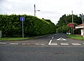
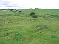
 "Spoil heap" - geograph.org.uk - 2222653.jpg 640 × 359; 62 KB
-

-
 46 Station Road, Law - geograph.org.uk - 4116281.jpg 640 × 480; 59 KB
-
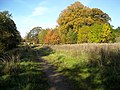
 A beech lined old track - geograph.org.uk - 2284237.jpg 640 × 480; 344 KB
-
 A Clydesdale woodland - geograph.org.uk - 2914995.jpg 640 × 480; 368 KB
-
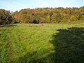
 A field, Oldhill - geograph.org.uk - 2690878.jpg 640 × 360; 198 KB
-
 A Giant Overhead - geograph.org.uk - 2085692.jpg 1,148 × 1,940; 1.33 MB
-
 A Strange Tree - geograph.org.uk - 2085714.jpg 1,715 × 1,139; 1.1 MB
-
 A721 heading to Kilncadzow - geograph.org.uk - 3764453.jpg 640 × 480; 68 KB
-
 A73 - geograph.org.uk - 2227409.jpg 640 × 359; 83 KB
-
 An abandoned driveway - geograph.org.uk - 2690848.jpg 640 × 360; 282 KB
-
 An old field boundary - geograph.org.uk - 2284005.jpg 640 × 480; 289 KB
-

-
 Approaching Carluke on Maudslie Road - geograph.org.uk - 5108156.jpg 640 × 481; 53 KB
-
 Approaching Carluke on Maudslie Road - geograph.org.uk - 5108162.jpg 640 × 447; 58 KB
-
 Around the Candymill Burn - geograph.org.uk - 5753371.jpg 1,024 × 576; 221 KB
-
 Auchenglen Road from Lanark Road - geograph.org.uk - 5108198.jpg 640 × 472; 60 KB
-
 Autumn colours near Poplarglen - geograph.org.uk - 4239613.jpg 4,608 × 3,456; 5.39 MB
-
 Autumn Colours on Clyde Walkway - geograph.org.uk - 1550736.jpg 640 × 480; 183 KB
-
 Autumnal Trees - geograph.org.uk - 1550777.jpg 640 × 480; 180 KB
-
 Avenue of trees on Yieldshields Road - geograph.org.uk - 3650751.jpg 640 × 480; 101 KB
-
 B7011 in Law - geograph.org.uk - 5108271.jpg 640 × 487; 54 KB
-
 Bank of Trees Beside Clyde Walkway - geograph.org.uk - 1550751.jpg 640 × 480; 171 KB
-
 Beech lined road - geograph.org.uk - 2220347.jpg 640 × 359; 100 KB
-
 Beech trees near Hyndburn - geograph.org.uk - 2283705.jpg 640 × 480; 280 KB
-
 Belstane Stables from the air - geograph.org.uk - 5718979.jpg 640 × 480; 111 KB
-
 Belstane Town Farm - geograph.org.uk - 3032997.jpg 640 × 480; 93 KB
-
 Birks Road - geograph.org.uk - 2221991.jpg 640 × 480; 112 KB
-
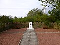
 Black Law Trig Point - geograph.org.uk - 3771378.jpg 640 × 480; 75 KB
-
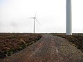
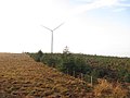
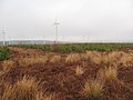
 Black Law wind farm from the air - geograph.org.uk - 5670033.jpg 640 × 480; 142 KB
-
 Black Law wind farm from the air - geograph.org.uk - 5681251.jpg 640 × 480; 147 KB
-
 Black Law wind farm from the air - geograph.org.uk - 5682173.jpg 640 × 480; 155 KB
-
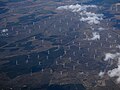 Black Law wind farm from the air - geograph.org.uk - 5718968.jpg 640 × 480; 126 KB
-
 Black Law Windfarm - geograph.org.uk - 5569775.jpg 3,264 × 2,448; 3.76 MB
-
 Blacklaw power station - geograph.org.uk - 2240593.jpg 640 × 480; 215 KB
-
 Blacklaw power station - geograph.org.uk - 2240599.jpg 640 × 480; 197 KB
-
 Blacklaw power station - geograph.org.uk - 2241151.jpg 640 × 480; 183 KB
-
 Boardwalk and steps on the Clyde Walkway - geograph.org.uk - 5906992.jpg 767 × 1,024; 324 KB
-
 Boardwalk on the Clyde Walkway - geograph.org.uk - 5907002.jpg 1,024 × 768; 355 KB
-
 Bogside Farm - geograph.org.uk - 3033000.jpg 640 × 480; 52 KB
-
 Brae above the Fiddler Burn - geograph.org.uk - 6020592.jpg 2,309 × 1,732; 1.1 MB
-
 Braidwood - geograph.org.uk - 2690852.jpg 640 × 360; 230 KB
-
 Braidwood - geograph.org.uk - 3758789.jpg 640 × 480; 75 KB
-
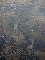
 Braidwood and Carluke from the air - geograph.org.uk - 2519653.jpg 480 × 640; 118 KB
-
 Braidwood and Carluke from the air - geograph.org.uk - 2519683.jpg 640 × 480; 124 KB
-
 Braidwood and Carluke from the air - geograph.org.uk - 5625991.jpg 640 × 480; 176 KB
-
 Braidwood from the air - geograph.org.uk - 5670025.jpg 480 × 640; 145 KB
-
 Braidwood Loch - geograph.org.uk - 1336131.jpg 640 × 480; 74 KB
-
 Braidwood Pond - geograph.org.uk - 1137041.jpg 461 × 640; 149 KB
-
 Braidwood Post Office - geograph.org.uk - 2690883.jpg 640 × 360; 194 KB
-
 Braidwood Road - geograph.org.uk - 5108252.jpg 640 × 484; 58 KB
-
 Bridge on the Clyde Walkway near Crossford - geograph.org.uk - 5907637.jpg 1,024 × 753; 303 KB
-
 Brownlee Road at Mauldslie Road Law - geograph.org.uk - 1964308.jpg 2,272 × 1,704; 874 KB
-
 Brownlee Road Law - geograph.org.uk - 1964299.jpg 2,272 × 1,704; 893 KB
-
 Brownlee Road, Law - geograph.org.uk - 2221997.jpg 640 × 480; 83 KB
-
 Brownlee Road, Law - geograph.org.uk - 2222014.jpg 640 × 480; 82 KB
-
 Building site, Roadmeetings - geograph.org.uk - 5753381.jpg 1,024 × 576; 286 KB
-
 Building site, Roadmeetings - geograph.org.uk - 5753383.jpg 1,024 × 576; 356 KB
-
 Burn Road Garage, Carluke - geograph.org.uk - 2529712.jpg 640 × 481; 72 KB
-
 Bushelhead Road from Lanark Road - geograph.org.uk - 5108175.jpg 640 × 461; 58 KB
-
 Caledonian Railway - West Coast Mainline - geograph.org.uk - 2222336.jpg 640 × 480; 124 KB
-
 Candy Mill - geograph.org.uk - 1734908.jpg 2,916 × 1,632; 886 KB
-
 Carluke - geograph.org.uk - 2227607.jpg 640 × 480; 83 KB
-
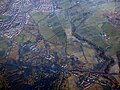
 Carluke from the air - geograph.org.uk - 5670032.jpg 640 × 480; 187 KB
-
 Carluke from the air - geograph.org.uk - 5670034.jpg 640 × 480; 196 KB
-
 Carluke from the air - geograph.org.uk - 5681358.jpg 640 × 480; 207 KB
-
 Carluke from the air - geograph.org.uk - 5718977.jpg 640 × 480; 197 KB
-
 Carluke High School - geograph.org.uk - 2670036.jpg 640 × 480; 52 KB
-
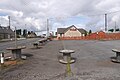
 Carluke Park ^ Ride - geograph.org.uk - 2610886.jpg 640 × 422; 81 KB
-
 Carluke railway station, Lanarkshire - geograph.org.uk - 3916686.jpg 1,024 × 768; 204 KB
-
 Carluke railway station, Lanarkshire - geograph.org.uk - 3916713.jpg 1,024 × 768; 179 KB
-
 Carluke Station - geograph.org.uk - 2256404.jpg 640 × 480; 79 KB
-
 Carluke Station - geograph.org.uk - 2610905.jpg 640 × 425; 106 KB
-
 Carluke Town Centre - geograph.org.uk - 4116297.jpg 640 × 480; 65 KB
-
-
 Carnwath Road, Kilncadzow - geograph.org.uk - 2689122.jpg 640 × 480; 300 KB
-
 Castlehill Industrial Estate - geograph.org.uk - 1220303.jpg 640 × 434; 73 KB
-
 Castlehill Ironworks - geograph.org.uk - 2227425.jpg 640 × 480; 99 KB
-
 Cattle grazing near Milton-Lockhart - geograph.org.uk - 4696149.jpg 4,608 × 3,456; 5.36 MB
-
 Cattle, Carluke - geograph.org.uk - 2227602.jpg 640 × 480; 101 KB
-
 Children's Play Park, Yieldshields - geograph.org.uk - 3650698.jpg 640 × 480; 90 KB
-
 Clothing recycling - geograph.org.uk - 2221977.jpg 640 × 480; 78 KB
-
 Clyde Walkway - geograph.org.uk - 1550782.jpg 640 × 480; 195 KB
-

-
 Clyde Walkway E of Crossford - View N - geograph.org.uk - 3749886.jpg 1,024 × 768; 250 KB
-
 Clyde Walkway in the Spring - geograph.org.uk - 1865517.jpg 640 × 481; 127 KB
-
 Clyde Walkway marker near Milton-Lockhart - geograph.org.uk - 4696139.jpg 4,608 × 3,456; 4.49 MB
-
 Clyde Walkway near Crossford - geograph.org.uk - 4239611.jpg 4,608 × 3,456; 5.45 MB
-
 Clyde Walkway north of Crossford - geograph.org.uk - 1865501.jpg 640 × 481; 104 KB
-
 Clyde's Mill Falls - geograph.org.uk - 3529106.jpg 4,608 × 3,456; 5.78 MB
-
 Colliery waste, Birks Road - geograph.org.uk - 2081576.jpg 480 × 640; 118 KB
-
 Colliery waste, north of Carluke - geograph.org.uk - 2529716.jpg 640 × 481; 43 KB
-
 Communications mast at Greenbank Farm - geograph.org.uk - 917039.jpg 622 × 640; 74 KB
-
 Dam and intake at Springfield Reservoir - geograph.org.uk - 6273550.jpg 5,152 × 3,864; 6.98 MB
-
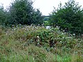
 Deciduous area, Thornmuir - geograph.org.uk - 2244116.jpg 480 × 640; 234 KB
-
 Ditch in a young plantation - geograph.org.uk - 2241155.jpg 640 × 480; 250 KB
-
 East Law - geograph.org.uk - 2081557.jpg 640 × 372; 81 KB
-
 East Law - geograph.org.uk - 2135371.jpg 640 × 480; 56 KB
-
 East Law - geograph.org.uk - 2264214.jpg 640 × 391; 31 KB
-
 East Law Farm - geograph.org.uk - 5108269.jpg 640 × 464; 41 KB
-
 Easter Monday 2013 - geograph.org.uk - 3390858.jpg 1,024 × 768; 94 KB
-
 Easter Monday 2013 - geograph.org.uk - 3395416.jpg 1,024 × 768; 102 KB
-
 Entering Braidwood from the South - geograph.org.uk - 1206235.jpg 640 × 480; 109 KB
-
 Entering Braidwood from the South - geograph.org.uk - 5108255.jpg 640 × 481; 100 KB
-
 Entrance to Bogside - geograph.org.uk - 3468525.jpg 640 × 479; 53 KB
-
 Entrance to Carluke Wilton Cemetery - geograph.org.uk - 2669991.jpg 640 × 480; 54 KB
-
 Entrance to Kilncadzow - geograph.org.uk - 3468124.jpg 640 × 480; 84 KB
-
 Entrance to Yieldshields - geograph.org.uk - 3468142.jpg 640 × 459; 60 KB
-
 Farm at Hole - geograph.org.uk - 843794.jpg 640 × 480; 47 KB
-
 Farmland east of Yieldshields - geograph.org.uk - 3650710.jpg 640 × 480; 80 KB
-
 Farmland, Bowridge - geograph.org.uk - 2283713.jpg 640 × 480; 231 KB
-
 Fiddler Burn - geograph.org.uk - 2689160.jpg 640 × 360; 229 KB
-
 Fiddler Burn - geograph.org.uk - 2709795.jpg 640 × 360; 253 KB
-
 Fiddler Burn - geograph.org.uk - 2918023.jpg 640 × 480; 274 KB
-
 Fields beside Milton Road - geograph.org.uk - 2345049.jpg 640 × 400; 85 KB
-
 Fog factory on a young plantation - geograph.org.uk - 2244170.jpg 640 × 480; 225 KB
-
 Footbridge over Jock's Burn - geograph.org.uk - 1659170.jpg 640 × 480; 109 KB
-
 Footbridges on the Clyde Walkway - geograph.org.uk - 1622766.jpg 480 × 640; 123 KB
-
 Footpath to Mauldsie Road - geograph.org.uk - 5172643.jpg 4,000 × 3,000; 4.95 MB
-
 Footpath to Mauldslie via Jock's Burn - geograph.org.uk - 2679529.jpg 4,000 × 3,000; 4.28 MB
-
 Forest edge, King's Law - geograph.org.uk - 2244129.jpg 640 × 480; 177 KB
-
 Former hedge, Thornmuir - geograph.org.uk - 2240533.jpg 640 × 480; 263 KB
-
 Fortified entrance - geograph.org.uk - 2689158.jpg 640 × 480; 241 KB
-
 Gallops, Beltane Place - geograph.org.uk - 2227597.jpg 640 × 480; 80 KB
-
 Garden Centre-Restaurant - geograph.org.uk - 1220305.jpg 640 × 320; 38 KB
-
 Garrion Burn - geograph.org.uk - 2222377.jpg 640 × 480; 124 KB
-
 Garrion Burn - geograph.org.uk - 3075586.jpg 480 × 640; 115 KB
-
 Garrion Gill - geograph.org.uk - 3128394.jpg 640 × 480; 71 KB
-
-
 Garrion Gill surge of water - geograph.org.uk - 3128395.jpg 640 × 480; 69 KB
-

-

-
 Gate on the Clyde Walkway - geograph.org.uk - 1211398.jpg 640 × 480; 132 KB
-
 Gatehouse and watchtowers, Milton-Lockhart - geograph.org.uk - 3529225.jpg 4,608 × 3,456; 5.12 MB
-
 General Roy Memorial, Miltonhead - geograph.org.uk - 2690865.jpg 640 × 360; 238 KB
-
 General Roy Monument - geograph.org.uk - 4696171.jpg 4,608 × 3,456; 4.66 MB
-
 Glimpse of the River Clyde - geograph.org.uk - 4696068.jpg 4,608 × 3,456; 4.53 MB
-
 Grassland by Butterhole - geograph.org.uk - 2914966.jpg 640 × 480; 234 KB
-
 Grassland off Birks Road - geograph.org.uk - 2222000.jpg 640 × 480; 89 KB
-
 Grassland off Maudslie Road - geograph.org.uk - 2081560.jpg 640 × 480; 94 KB
-
 Grassland on Law Hill - geograph.org.uk - 2081563.jpg 640 × 480; 92 KB
-
 Grassland, Birks - geograph.org.uk - 2222021.jpg 640 × 480; 95 KB
-
 Grassland, Hyndshaw - geograph.org.uk - 2215300.jpg 640 × 480; 114 KB
-
 Grassland, Middlehouse - geograph.org.uk - 2081279.jpg 640 × 359; 68 KB
-
 Grazing sheep, Gair - geograph.org.uk - 2227624.jpg 640 × 359; 80 KB
-
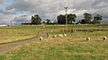 Grazing sheep, Gair - geograph.org.uk - 2228432.jpg 640 × 359; 75 KB
-
 Heading north on the old Roman Road - geograph.org.uk - 3928517.jpg 640 × 480; 55 KB
-
 Heading towards Overquarter Farm - geograph.org.uk - 3928525.jpg 640 × 480; 94 KB
-
 High Hedge on Yieldshields Road - geograph.org.uk - 3650757.jpg 640 × 480; 93 KB
-
 High Mill - Victoria Park - geograph.org.uk - 1220294.jpg 640 × 394; 66 KB
-
 Highmill Windmill - geograph.org.uk - 2677344.jpg 3,000 × 4,000; 4.25 MB
-
 Hill of Kilncadzow - geograph.org.uk - 2679552.jpg 640 × 480; 213 KB
-
 Hill of Westerhouse - geograph.org.uk - 2241136.jpg 640 × 480; 236 KB
-
 Hill of Westerhouse - geograph.org.uk - 2244160.jpg 640 × 480; 232 KB
-
 Hillside above St. Oswald's Chapel - geograph.org.uk - 6020586.jpg 2,309 × 1,732; 755 KB
-
 Himalayan balsam by the Clyde Walkway - geograph.org.uk - 5906959.jpg 1,024 × 768; 316 KB
-
 Himalayan balsam by the River Clyde - geograph.org.uk - 5906973.jpg 1,024 × 768; 351 KB
-
 Hyndburn Colliery - geograph.org.uk - 2215305.jpg 640 × 480; 98 KB
-
 Hyndshaw Colliery, near Carluke - geograph.org.uk - 945918.jpg 640 × 480; 85 KB
-

-
 Jacob's Ladder - geograph.org.uk - 3378753.jpg 640 × 360; 75 KB
-
 Jock's Burn - geograph.org.uk - 4696191.jpg 4,608 × 3,456; 5.05 MB
-
 Jock's Gill Wood - geograph.org.uk - 4696180.jpg 4,608 × 3,456; 5.49 MB
-

-
 Kilncadzow - geograph.org.uk - 5753359.jpg 1,024 × 683; 327 KB
-
 Kilncadzow Law - geograph.org.uk - 2709784.jpg 640 × 480; 241 KB
-
 Kilncadzow Law - geograph.org.uk - 4566333.jpg 2,560 × 1,920; 1.88 MB
-
 Kirkton Street, Carluke - geograph.org.uk - 2081545.jpg 640 × 480; 83 KB
-
 Law coal bing Looking towards Overtown - geograph.org.uk - 3075534.jpg 768 × 1,024; 120 KB
-
 Law Hill - geograph.org.uk - 2286440.jpg 500 × 375; 27 KB
-
 Law Hospital - geograph.org.uk - 1220320.jpg 640 × 438; 96 KB
-
 Law Hospital site from the air - geograph.org.uk - 5681372.jpg 640 × 480; 121 KB
-
 Law Junction - geograph.org.uk - 2222348.jpg 640 × 480; 135 KB
-
 Law Primary School - geograph.org.uk - 2135362.jpg 640 × 480; 58 KB
-
 Layby on minor road near Kilncadzow - geograph.org.uk - 2537283.jpg 640 × 480; 110 KB
-
 Lee Meadow - geograph.org.uk - 5723532.jpg 4,005 × 2,884; 2.02 MB
-
 Loch and quarry workings - geograph.org.uk - 2689163.jpg 640 × 360; 205 KB
-

-
 Lodge House at Mauldslie Bridge - geograph.org.uk - 5906955.jpg 1,024 × 768; 263 KB
-
 Lodge House near Mauldslie Mains - geograph.org.uk - 1210085.jpg 640 × 480; 110 KB
-
 Looking back on the Boghall Road - geograph.org.uk - 3928562.jpg 640 × 480; 57 KB
-
 Market Place Carluke - geograph.org.uk - 1220258.jpg 640 × 409; 74 KB
-
 Maudslie Road - geograph.org.uk - 2081549.jpg 640 × 480; 80 KB
-
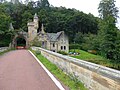
 Mauldslie Bridge - geograph.org.uk - 5313536.jpg 1,600 × 1,200; 591 KB
-
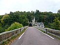 Mauldslie Bridge and Lodge - geograph.org.uk - 4696218.jpg 4,608 × 3,456; 4.82 MB
-
 Mauldslie Mains - Near Carluke - geograph.org.uk - 5108153.jpg 640 × 481; 50 KB
-
 Meadowhead Farm - geograph.org.uk - 5108266.jpg 640 × 454; 59 KB
-
 Milton Road - geograph.org.uk - 2345032.jpg 640 × 427; 77 KB
-
 Milton Road - geograph.org.uk - 2690858.jpg 640 × 360; 198 KB
-
 Milton-Lockhart entrance - geograph.org.uk - 3529492.jpg 1,024 × 768; 152 KB
-
 Minor road, Clydesdale - geograph.org.uk - 2918035.jpg 640 × 480; 341 KB
-
 More Devolution Madness , Gaelic Station Sign At Carluke - geograph.org.uk - 3384242.jpg 1,600 × 1,200; 224 KB
-
 Moss-side - geograph.org.uk - 3650681.jpg 640 × 480; 67 KB
-
 Netherton Burn - geograph.org.uk - 3650767.jpg 480 × 640; 127 KB
-

-
 Old beech wood - geograph.org.uk - 2241159.jpg 640 × 480; 224 KB
-
 Old Lanark Road - geograph.org.uk - 2689172.jpg 640 × 360; 276 KB
-
 Old Lanark Road - geograph.org.uk - 2689178.jpg 640 × 360; 220 KB
-
 Old Lanark Road - geograph.org.uk - 2690839.jpg 640 × 360; 234 KB
-
 Old Lanark Road near Crossgates - geograph.org.uk - 5723548.jpg 4,608 × 3,456; 5.06 MB

.jpg)


&filefrom=Old+Milestone+by+the+A73%2C+Lanark+Road%2C+Braidwood%2C+Carluke+parish+-+geograph.org.uk+-+6049266.jpg#mw-category-media)