Category:Caravans in the East Riding of Yorkshire
Jump to navigation
Jump to search
Subcategories
This category has the following 3 subcategories, out of 3 total.
Media in category "Caravans in the East Riding of Yorkshire"
The following 50 files are in this category, out of 50 total.
-
 A dwelling on Hooks Lane - geograph.org.uk - 887496.jpg 640 × 404; 217 KB
-
 Acey Farm, Preston - geograph.org.uk - 303482.jpg 640 × 480; 121 KB
-
 Allotment Gardens, Withernsea - geograph.org.uk - 215568.jpg 640 × 468; 172 KB
-

-
 Bail Wood - geograph.org.uk - 524100.jpg 640 × 468; 113 KB
-
 Breighton Airfield and Aeroplane Museum.jpg 640 × 480; 93 KB
-
 Car Park of The Northfield and Caravan Site (geograph 4951543).jpg 4,586 × 3,426; 4.63 MB
-
 Caravan farm at Wanlass (geograph 4448560).jpg 1,280 × 960; 1.14 MB
-
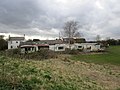
 Caravan graveyard - geograph.org.uk - 721898.jpg 640 × 480; 201 KB
-
 Caravan in a field (geograph 4223533).jpg 1,024 × 768; 316 KB
-
 Caravan park, Withernsea (geograph 1842464).jpg 503 × 640; 184 KB
-
 Caravan perched on the clifftop (geograph 7206969).jpg 5,026 × 3,522; 4.19 MB
-
 Caravan Sales Centre, Beeford - geograph.org.uk - 1281172.jpg 640 × 480; 64 KB
-
 Caravan sales Hutton Cranswick.jpg 640 × 427; 256 KB
-
 Caravan site at Flamborough, East Riding of Yorkshire, England.jpg 640 × 480; 84 KB
-
 Clifftop house - now washed away - geograph.org.uk - 1012439.jpg 640 × 384; 50 KB
-
 Entrance to Easingwold Farm (geograph 6148316).jpg 1,024 × 768; 168 KB
-

-
-
 Ferry Road, Hessle - geograph.org.uk - 318905.jpg 640 × 367; 100 KB
-
 Footpath to Thornwick Bay - geograph.org.uk - 965925.jpg 640 × 427; 147 KB
-
 Gardens at Patrington Haven Leisure Park 2009.jpg 3,456 × 2,304; 3.97 MB
-
 Green Lane - geograph.org.uk - 1240843.jpg 640 × 480; 57 KB
-
 Hollym - geograph.org.uk - 294451.jpg 640 × 401; 68 KB
-
 Hornhill Top Farm - geograph.org.uk - 1496426.jpg 640 × 480; 78 KB
-
 Houses on Baynard Avenue - geograph.org.uk - 749209.jpg 640 × 425; 66 KB
-
 Houses on Ferry Road, Wawne (geograph 4355254).jpg 640 × 480; 40 KB
-
 Kilnwick New Farm near Kilnwick (geograph 5950920).jpg 1,600 × 1,064; 681 KB
-
 Mobile homes behind Entick House (geograph 4403741).jpg 1,024 × 768; 182 KB
-
 Near the edge - geograph.org.uk - 1221089.jpg 640 × 427; 69 KB
-
 North east of Aike - geograph.org.uk - 1194155.jpg 640 × 426; 216 KB
-
 Old Caravan - geograph.org.uk - 383023.jpg 640 × 467; 116 KB
-
 Old Goole Mill.jpg 640 × 480; 204 KB
-
 Seaton Road, Northfield - geograph.org.uk - 518839.jpg 640 × 454; 82 KB
-
 Sewerby Mill, East Riding-geograph.org-2925782.jpg 640 × 480; 49 KB
-
 Sherwood Drive, Anlaby Common - geograph.org.uk - 563771.jpg 504 × 640; 151 KB
-
 Snuff Mill House, Cottingham - geograph.org.uk - 684948.jpg 495 × 640; 98 KB
-
 Southfield Lane, Skipsea - geograph.org.uk - 425668.jpg 640 × 433; 80 KB
-

-
 The Grange, Flamborough - geograph.org.uk - 1417097.jpg 640 × 480; 67 KB
-
 The Railway Cottages (geograph 2145883).jpg 800 × 600; 250 KB
-
 The Road to Withernsea (geograph 3042111).jpg 4,592 × 3,448; 4.05 MB
-
 Thornwick Bay Holiday Park - geograph.org.uk - 1226648.jpg 640 × 481; 85 KB
-
 Travellers Pause on A1079 - geograph.org.uk - 725862.jpg 1,737 × 1,308; 2.22 MB
-
 Upstream along the river Hull - geograph.org.uk - 1283755.jpg 429 × 640; 412 KB
-
 View from Thornwick Holiday Park - geograph.org.uk - 505635.jpg 640 × 480; 51 KB
-
 Willow Road, Burstwick - geograph.org.uk - 1107068.jpg 640 × 426; 178 KB
-
 Withernsea Sands Holiday Park (geograph 2097623).jpg 800 × 600; 222 KB
-
 Wolds Vintage Group Rally - geograph.org.uk - 211262.jpg 640 × 479; 51 KB
-
 Wolfreton Garth, Kirk Ella (geograph 5194876).jpg 1,600 × 1,065; 540 KB


.jpg)
.jpg)

.jpg)
.jpg)
.jpg)


.jpg)
,_Yorkshire,_2000_(geograph_3578169)_(cropped).jpg)
,_Yorkshire,_2000_(geograph_3578169).jpg)


.jpg)
.jpg)
.jpg)


.jpg)

.jpg)
.jpg)


.jpg)

.jpg)