Category:Capricorn Group, Queensland
Jump to navigation
Jump to search
| Object location | | View all coordinates using: OpenStreetMap |
|---|
southermost island groups of the Great Barrier Reef off the coast of Queensland, Australia | |||||
| Upload media | |||||
| Instance of |
| ||||
|---|---|---|---|---|---|
| Location | Queensland, AUS | ||||
 | |||||
Subcategories
This category has the following 2 subcategories, out of 2 total.
H
N
- North West Island (3 F)
Media in category "Capricorn Group, Queensland"
The following 23 files are in this category, out of 23 total.
-
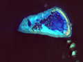
 Arrecife Capricornio.jpg 2,776 × 1,788; 3.03 MB
-
 Cayo coralino.jpg 4,288 × 2,848; 7.46 MB
-
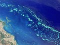 GreatBarrierReef-EO (cropped).JPG 540 × 405; 38 KB
-
 GreatBarrierReef-EO.JPG 540 × 540; 50 KB
-
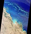 GreatBarrierReef-PIA03401.jpg 1,629 × 1,816; 404 KB
-
 Green Sea Turtle nesting at sunrise.jpg 6,000 × 4,000; 3.02 MB
-
-

-

-

-
-

-

-

-

-

-
-

-

-
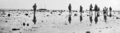
 Rockhampton (2009) 01.jpg 3,876 × 2,424; 7.38 MB
-
 Sentinel-2 image One Tree Reef and Island on 15th of March 2019.png 1,122 × 590; 188 KB
-
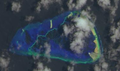 Sentinel-2 image One Tree Reef and Island on 21st of December 2019.png 1,071 × 630; 647 KB
-
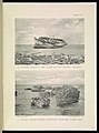 The Great Barrier Reef of Australia (PLATE XXX) (7044663997).jpg 1,369 × 1,843; 486 KB


.JPG)


_01.jpg)


_(7044663997).jpg)