Category:Cape Fiolent
Jump to navigation
Jump to search
| Object location | | View all coordinates using: OpenStreetMap |
|---|
| Parent categories were assigned using the {{Category Russia}} template. In general, new categories should not be added by hand. The tree of categories is maintained automatically, any human edits may be overridden by bot. |
| This is the category of the protected area of Russia number 9210006 | |
| This template and pages using it are maintained by the Russian WLE team. Please read the guidelines before making any changes that can affect the database! |
|
This is a category about a natural heritage site in Ukraine, id: 85-363-5003
|
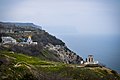
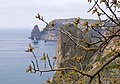
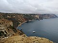
cape in Sevastopol, Crimea  | |||||
| Upload media | |||||
| Instance of | |||||
|---|---|---|---|---|---|
| Location | Balaklava Raion, Sevastopol, Ukraine | ||||
| Area |
| ||||
 | |||||
Subcategories
This category has the following 6 subcategories, out of 6 total.
Media in category "Cape Fiolent"
The following 200 files are in this category, out of 338 total.
(previous page) (next page)-
 07 FIOLENT 04.JPG 1,600 × 1,091; 1.14 MB
-
 11 ОЭ. в.ч. 10422. Мыс Фиолент.jpg 3,619 × 2,541; 2.5 MB
-
 15.Мис Фіолент (17).jpg 4,000 × 2,508; 1.38 MB
-
 15.Мис Фіолент (9).jpg 4,000 × 2,450; 1.26 MB
-
 500px photo (49160636).jpeg 1,356 × 2,048; 1.37 MB
-

-
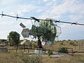 Abandoned Soviet military device (2005-09-128).jpg 1,280 × 960; 192 KB
-
 Beach of Cape Fiolent, Crimea.jpg 4,912 × 3,264; 8.45 MB
-
 Black sea water near Fiolent 2009 G1.jpg 3,456 × 2,592; 3.25 MB
-
 Black Sea, Fiolent, Crimea.jpg 4,912 × 3,264; 8.45 MB
-
 Camp site in Fiolent in 2021.jpg 3,547 × 2,368; 2.65 MB
-
 Cape Aya from Cape Fiolent, Crimea.jpg 4,912 × 3,264; 9.63 MB
-
 Cape Aya from Cape Fiolent, Rainbow, Crimea.jpg 4,912 × 3,264; 9.1 MB
-
 Cape Aya from Cape Fiolent, stormy weather, Crimea.jpg 4,912 × 3,264; 8.56 MB
-
 Cape Fiolent (211497425).jpeg 2,048 × 1,371; 773 KB
-
 Cape Fiolent - may 2014.jpg 3,264 × 2,176; 4.08 MB
-
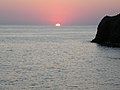
 Cape Fiolent at sunset, Crimea.jpg 4,912 × 3,264; 7.35 MB
-
 Cape Fiolent August 2021(1).jpg 4,127 × 2,756; 2.43 MB
-
 Cape Fiolent August 2021(2).jpg 4,223 × 2,821; 2.73 MB
-
 Cape Fiolent August 2021(3).jpg 4,035 × 2,696; 2.65 MB
-
 Cape Fiolent banner.jpg 3,500 × 500; 2.19 MB
-
 Cape Fiolent Crimea (211497419).jpeg 2,048 × 1,362; 863 KB
-
 Cape Fiolent in 2021.jpg 4,134 × 2,761; 2.98 MB
-
 Cape Fiolent Lighthouse.jpg 2,711 × 4,060; 2.3 MB
-
 Cape Fiolent, boat ride at sunset, Crimea.jpg 3,072 × 2,048; 3.33 MB
-
 Cape Fiolent, Crimea, Ukraine).jpg 1,600 × 1,063; 1.53 MB
-
 Cape Fiolent, Crimea.jpg 4,912 × 3,264; 10.39 MB
-
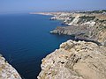
 Cape Fiolent, Jurassic Cliffs, Crimea.jpg 4,912 × 3,264; 10.56 MB
-
 Cape Fiolent, Jurassic Rocks, Crimea.jpg 4,912 × 3,264; 13.28 MB
-
 Cape Fiolent, Miocene-Jurassic Cliffs, Crimea.jpg 4,912 × 3,264; 10.88 MB
-
 Cape Fiolent, rocks at night, Crimea.jpg 3,072 × 2,048; 3.32 MB
-
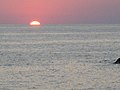
 Cape Fiolent, sunset, Crimea.jpg 3,072 × 2,048; 3.28 MB
-
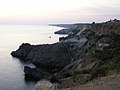
 Cape Fiolent, west side, Crimea.jpg 4,912 × 3,264; 11.57 MB
-
 Crimea 2Crimea DSC 0085-1.jpg 4,940 × 3,272; 2.39 MB
-
 Crimea 2Crimea DSC 0086-1.jpg 4,940 × 3,272; 2.42 MB
-
 Crimea 2Crimea DSC 0087-1.jpg 4,940 × 3,272; 3.62 MB
-
 Crimea 2Crimea DSC 0088-1.jpg 4,940 × 3,272; 2.62 MB
-
 Crimea 2Crimea DSC 0091-1.jpg 4,940 × 3,272; 2.35 MB
-
 Crimea 2Crimea DSC 0096-1.jpg 4,940 × 3,272; 3.03 MB
-
 Crimea 2Crimea DSC 0098-1.jpg 3,272 × 4,940; 2.27 MB
-
 Crimea 2Crimea DSC 0101-1.jpg 3,272 × 4,940; 2.58 MB
-
 Crimea 2Crimea DSC 0105-1.jpg 4,940 × 3,272; 2.43 MB
-
 Crimea 2Crimea DSC 0106-1.jpg 4,940 × 3,272; 4.46 MB
-
 Crimea 2Crimea DSC 0109-1.jpg 4,940 × 3,272; 3.92 MB
-
 Crimea 2Crimea DSC 0110-1.jpg 4,940 × 3,272; 3.31 MB
-
 Crimea 2Crimea DSC 0111-1.jpg 4,940 × 3,272; 4.11 MB
-
 Crimea 2Crimea DSC 0113-1.jpg 4,940 × 3,272; 4.26 MB
-
 Crimea 2Crimea DSC 0114-1.jpg 4,940 × 3,272; 4.16 MB
-
 Crimea 2Crimea DSC 0115-1.jpg 4,940 × 3,272; 3.88 MB
-
 Crimea 2Crimea DSC 0117.jpg 4,928 × 3,264; 2.31 MB
-
 Crimea 2Crimea DSC 0118-1.jpg 4,940 × 3,272; 2.97 MB
-
 Crimea 2Crimea DSC 0119-1.jpg 3,272 × 4,940; 3.65 MB
-
 Crimea 2Crimea DSC 0120-1.jpg 4,940 × 3,272; 3.32 MB
-
 Crimea 2Crimea DSC 0121-1.jpg 3,272 × 4,940; 3.4 MB
-
 Crimea 2Crimea DSC 0123.jpg 4,928 × 3,264; 3.47 MB
-
 Crimea 2Crimea DSC 0124-1.jpg 4,940 × 3,272; 3.5 MB
-
 Crimea 2Crimea DSC 0129-1.jpg 4,940 × 3,272; 2.63 MB
-
 Crimea 2Crimea DSC 0130-1.jpg 4,940 × 3,272; 3.16 MB
-
 Crimea near Cape Fiolent - panoramio - Wolodymyr Lavrynenko (26).jpg 2,048 × 1,536; 1.55 MB
-
 Crimean Peninsula (Unsplash).jpg 4,272 × 2,848; 3.41 MB
-
 Cкеля Богоявлення.JPG 2,048 × 1,536; 676 KB
-
 Feolent - panoramio - Павел Бондарчук.jpg 1,000 × 665; 145 KB
-
 Feral cat sitting on stairs in Crimea.jpg 2,815 × 4,215; 2.49 MB
-
 Fio.jpg 3,072 × 2,304; 1.62 MB
-
 Fiolent - panoramio.jpg 960 × 1,280; 487 KB
-
 Fiolent Kap.jpg 4,800 × 3,200; 8.26 MB
-
 Fiolent rope jumping.jpg 1,280 × 850; 336 KB
-
 Fiolent Sevastopol 2009 G1.jpg 2,950 × 2,215; 2.65 MB
-
 Fiolent Sevastopol 2009 G2.jpg 2,550 × 3,400; 3.26 MB
-
 Fiolent Sevastopol 2009 G3.jpg 3,360 × 2,520; 2.83 MB
-
 Fiolent Sevastopol 2009 G4.jpg 3,200 × 2,400; 3.64 MB
-
 Fiolent Sevastopol 2009 G5.jpg 3,000 × 2,250; 2.91 MB
-
 Fiolent Sevastopol 2009 G6.jpg 2,550 × 3,400; 4.01 MB
-
 Fiolent Sevastopol 2009 G7.jpg 3,400 × 2,550; 3.94 MB
-
 Fog - panoramio - Wolodymyr Lavrynenko.jpg 2,048 × 1,536; 990 KB
-
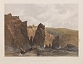
 HMS Spitfire at Cape Fiolent 1856.jpg 1,071 × 1,037; 72 KB
-
 Ilmol.jpg 2,592 × 1,944; 656 KB
-
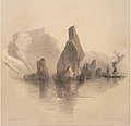
 Marine and Coast Sketches of the Black Sea, Sea of Azoff &c. (15342458157).jpg 673 × 1,000; 447 KB
-
 Monastery of St. George. (15349847648).jpg 1,000 × 777; 729 KB
-
 Mиc Фіолент.jpg 2,223 × 1,507; 2.14 MB
-
 Mис Фіолент.JPG 1,536 × 2,048; 594 KB
-
 Orestes and Pylades Cliffs by Cape Fiolent, Crimea.jpg 4,912 × 3,264; 13.38 MB
-
 Orestes and Pylades Cliffs, Cape Fiolent, Crimea.jpg 4,912 × 3,264; 13.3 MB
-
 Quiet Fiolent, Crimea 0858.jpg 2,048 × 1,536; 567 KB
-
 Quiet Fiolent, Crimea 0859.jpg 2,048 × 1,536; 588 KB
-
 Quiet Fiolent, Crimea 0860.jpg 2,048 × 1,536; 661 KB
-
 Quiet Fiolent, Crimea 0866.jpg 2,048 × 1,536; 500 KB
-
 Quiet Fiolent, Crimea 0877.jpg 1,536 × 2,048; 611 KB
-
 Quiet Fiolent, Crimea 0879.jpg 2,048 × 1,536; 708 KB
-
 Quiet Fiolent, Crimea 0886.jpg 2,048 × 1,536; 698 KB
-
 Quiet Fiolent, Crimea 0900.jpg 2,048 × 1,536; 676 KB
-
 Quiet Fiolent, Crimea 0904.jpg 2,048 × 1,536; 654 KB
-
 Quiet Fiolent, Crimea 0906.jpg 1,536 × 2,048; 523 KB
-
 Quiet Fiolent, Crimea 0907.jpg 2,048 × 1,536; 542 KB
-
 Quiet Fiolent, Crimea 0908.jpg 2,048 × 1,536; 509 KB
-
 Quiet Fiolent, Crimea 0909.jpg 2,048 × 1,536; 502 KB
-
 Quiet Fiolent, Crimea 0910.jpg 2,048 × 1,536; 486 KB
-
 Quiet Fiolent, Crimea 0911.jpg 2,048 × 1,536; 502 KB
-
 Quiet Fiolent, Crimea 0912.jpg 2,048 × 1,536; 556 KB
-
 Quiet Fiolent, Crimea 0913.jpg 2,048 × 1,536; 432 KB
-
 Quiet Fiolent, Crimea 0914.jpg 2,048 × 1,536; 406 KB
-
 Quiet Fiolent, Crimea 0921.jpg 2,048 × 1,536; 555 KB
-
 Quiet Fiolent, Crimea 1162.jpg 2,048 × 1,536; 678 KB
-
 Quiet Fiolent, Crimea 1192.jpg 1,536 × 2,048; 654 KB
-
 Quiet Fiolent, Crimea 1196.jpg 2,048 × 1,536; 691 KB
-
 Quiet Fiolent, Crimea 1197.jpg 2,048 × 1,536; 651 KB
-
 Sevastopol 04-14 img39 Cape Fiolent.jpg 4,991 × 3,327; 5.44 MB
-
 Sevastopol 04-14 img45 Cape Fiolent.jpg 3,302 × 4,402; 5.97 MB
-
 Sevastopol, Feolent - panoramio.jpg 3,072 × 2,048; 2.52 MB
-
 Sevastopol, Feolent cape. - panoramio.jpg 2,000 × 3,008; 771 KB
-
 Sewastopol, cape Feolent - panoramio.jpg 3,072 × 2,048; 2.13 MB
-
 Somehere.jpg 1,944 × 2,592; 1.17 MB
-
 Storm in Black Sea, Cliffs, Fiolent, Crimea.jpg 4,912 × 3,264; 8.92 MB
-
 Storm in Black Sea, Fiolent, Crimea.jpg 4,912 × 3,264; 8.93 MB
-
 To the east from Fiolent.jpg 3,072 × 2,304; 1.56 MB
-
 Untitled - panoramio - Wolodymyr Lavrynenko (10).jpg 1,536 × 2,048; 1.85 MB
-
 Untitled - panoramio - Wolodymyr Lavrynenko (11).jpg 2,048 × 1,536; 1.63 MB
-
 Аквальний комплекс біля мису Фіолент.jpg 3,072 × 2,304; 1.71 MB
-
 Берег Мис Фиолент.jpg 4,323 × 2,882; 5.98 MB
-
 Беркут. Фото 2.jpg 2,986 × 1,990; 3.4 MB
-
 Беркут. Фото 3.jpg 3,169 × 2,112; 3.88 MB
-
 Беседка в честь Александра Пушкина.jpg 4,608 × 3,072; 6.8 MB
-
 Брили на березі біля Фіоленту.jpg 2,315 × 1,727; 3.55 MB
-
 В Севастополі.JPG 2,592 × 1,944; 1.12 MB
-
 Великі скелі.JPG 2,048 × 1,532; 809 KB
-
 Весна на мысе Фиолент.jpg 2,000 × 1,400; 993 KB
-
 Вечір на м.Фіолент.jpg 3,456 × 2,304; 3.39 MB
-
 Вид вниз с мыса Фиолент.jpg 3,968 × 2,976; 5.49 MB
-
 Вид з мису Фіолет.jpg 2,142 × 1,607; 2.57 MB
-
 Вид з Фіоленту на захід.JPG 3,696 × 2,448; 2.42 MB
-
 Вид на восток со скал мыса Фиолент, Крым, Crimea.jpg 4,912 × 3,264; 9 MB
-
 Вид на м. Фіолент від монастиря.jpg 2,048 × 1,536; 1.39 MB
-
 Вид на море и горы, мыс Фиолент.jpg 3,968 × 2,976; 4.11 MB
-
 Вид на море, мыс Фиолент.jpg 3,968 × 2,976; 3.51 MB
-
 Вид на мыс Айя со скал мыса Фиолент, Крым, Crimea.jpg 4,912 × 3,264; 9 MB
-
 Вид с мыса Фиолент.jpg 3,968 × 2,976; 3.06 MB
-
 Вид с мыса Фиолента.jpg 1,920 × 1,427; 709 KB
-
 Високий берег.JPG 2,048 × 1,532; 611 KB
-
 Всем известные ступеньки.jpg 4,608 × 3,072; 12.36 MB
-
 Георгиевская скала.jpg 4,608 × 3,072; 8.68 MB
-
 Голубь мира. Море. Пляж.jpg 960 × 1,280; 445 KB
-
 Гора возле Фиолента.JPG 3,072 × 2,304; 2.36 MB
-
 Долина мису.JPG 2,048 × 1,536; 611 KB
-
 Живописный спуск на пляж.jpg 4,272 × 2,848; 4.2 MB
-
 Живописный спуск на пляж2.jpg 4,272 × 2,848; 4.3 MB
-
 Живописный спуск на пляж3.jpg 3,889 × 2,593; 3.7 MB
-
 Живописный спуск на пляж4.jpg 4,272 × 2,848; 4.5 MB
-
 З води мис.JPG 4,272 × 2,848; 3.68 MB
-
 Заказник "Мис Фіолент". Скеля Богоявлення.JPG 2,048 × 1,536; 721 KB
-
 Заказник "Мис Фіолент".jpg 3,072 × 2,304; 1.39 MB
-
 Кримський заказник "Мис Фіолент".jpg 3,072 × 2,304; 1.69 MB
-
 Кримський мис Фіолент.jpg 3,072 × 2,304; 1.69 MB
-
 Круті береги на фіоленті.jpg 3,456 × 2,304; 6.23 MB
-
 Крым. м.Фиолент.jpg 3,968 × 2,976; 4.63 MB
-
 Крым. Мыс Фиолент.jpg 3,968 × 2,976; 5.26 MB
-
 Легкий бриз.jpg 4,288 × 2,848; 7.97 MB
-
 Лестница на острове Святого Явления.JPG 3,872 × 2,592; 3.12 MB
-
 Лукоморье.JPG 4,000 × 3,000; 2.46 MB
-
 Межі заказника «Мис Фіолент».Мис Фіолент.jpg 3,622 × 2,494; 1.05 MB
-
 Миc Фіолент.JPG 2,034 × 1,509; 1.77 MB
-
 Мис вид з пляжу.JPG 3,383 × 5,079; 6.69 MB
-
 Мис з пляжу 2.JPG 4,272 × 2,848; 7.41 MB
-
 Мис з пляжу.JPG 2,848 × 4,272; 4.73 MB
-
 Мис проти сонця.JPG 4,272 × 2,848; 5.72 MB
-
 Мис та тінь.JPG 4,272 × 2,848; 3.89 MB
-
 Мис Фіолент ( арка в скелі ) - panoramio.jpg 3,072 × 2,304; 2.06 MB
-
 Мис Фіолент - panoramio (1).jpg 2,048 × 1,536; 1.2 MB
-
 Мис Фіолент - panoramio (2).jpg 2,048 × 1,536; 1.2 MB
-
 Мис Фіолент - panoramio (3).jpg 2,048 × 1,536; 1.21 MB
-
 Мис Фіолент - panoramio - Oleksandr Kaktus (1).jpg 3,072 × 2,304; 1.45 MB
-
 Мис Фіолент - panoramio - Oleksandr Kaktus (2).jpg 3,072 × 2,304; 861 KB
-
 Мис Фіолент - panoramio - Oleksandr Kaktus (3).jpg 3,072 × 2,304; 1.48 MB
-
 Мис Фіолент - panoramio - Oleksandr Kaktus (4).jpg 3,072 × 2,304; 1.5 MB
-
 Мис Фіолент - panoramio - Oleksandr Kaktus (5).jpg 3,072 × 2,304; 741 KB
-
 Мис Фіолент - panoramio - Oleksandr Kaktus.jpg 3,072 × 2,304; 1,020 KB
-
 Мис Фіолент - panoramio.jpg 3,072 × 2,304; 1.25 MB
-
 Мис Фіолент 001.jpg 11,632 × 4,611; 13.84 MB
-
 Мис Фіолент 002.jpg 7,531 × 3,516; 7.29 MB
-
 Мис Фіолент 003.jpg 8,365 × 4,447; 8.83 MB
-
 Мис Фіолент 01.JPG 2,416 × 4,288; 4.14 MB
-
 Мис Фіолент 02.JPG 4,288 × 2,416; 4.07 MB
-
 Мис Фіолент 03.JPG 4,288 × 2,416; 4.49 MB
-
 Мис Фіолент 04.JPG 4,288 × 2,416; 4.09 MB
-
 Мис Фіолент 05.JPG 2,416 × 4,288; 4.23 MB
-
 Мис Фіолент 06.JPG 4,288 × 2,416; 3.89 MB
-
 Мис Фіолент 07.JPG 2,416 × 4,288; 4.43 MB
-
 Мис Фіолент 08.JPG 4,288 × 2,416; 4.13 MB
-
 Мис Фіолент 09.JPG 4,288 × 2,416; 4.67 MB
-
 Мис Фіолент 1, фотосерія.jpg 2,846 × 4,286; 2.94 MB
-
 Мис Фіолент 1.jpg 685 × 1,024; 198 KB
-
 Мис Фіолент 10.JPG 4,288 × 2,416; 4.41 MB
-
 Мис Фіолент 11.JPG 4,288 × 2,416; 4.2 MB
-
 Мис Фіолент 2, фотосерія.jpg 4,286 × 2,846; 9.8 MB
-
 Мис Фіолент 2.jpg 1,024 × 685; 234 KB
-
 Мис Фіолент 3, фотосерія.jpg 2,846 × 4,286; 3.46 MB
-
 Мис Фіолент 3.jpg 1,024 × 686; 103 KB
-
 Мис Фіолент 4, фотосерія.jpg 4,286 × 2,846; 9.93 MB
-
 Мис Фіолент 4.jpg 1,024 × 685; 143 KB
-
 Мис Фіолент 5, фотосерія.jpg 4,286 × 2,846; 10.36 MB
-
 Мис Фіолент в Криму.jpg 3,072 × 2,304; 1.69 MB


.jpg)
.jpg)
.jpeg)
.jpg)
.jpg)


.jpeg)


.jpg)
.jpg)
.jpg)
.jpeg)


.jpg)


.jpg)
.jpg)


.jpg)
.jpg)


.jpg)
.jpg)


_-_panoramio.jpg)
.jpg)
.jpg)
.jpg)
.jpg)
.jpg)
.jpg)
.jpg)
.jpg)


