Category:Cantick Head Lighthouse
Jump to navigation
Jump to search
| Object location | | View all coordinates using: OpenStreetMap |
|---|
English: Cantick Head Lighthouse
lighthouse in Orkney Islands, Scotland, UK   | |||||
| Upload media | |||||
| Instance of | |||||
|---|---|---|---|---|---|
| Made from material | |||||
| Location |
| ||||
| Main building contractor | |||||
| Operator | |||||
| Heritage designation |
| ||||
| Inception |
| ||||
| Date of official opening |
| ||||
| Significant event |
| ||||
| Source of energy | |||||
| Height |
| ||||
 | |||||
Media in category "Cantick Head Lighthouse"
The following 26 files are in this category, out of 26 total.
-

-
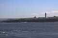
 Cantick Head from the ferry - geograph.org.uk - 1128387.jpg 640 × 480; 28 KB
-
 Cantick Head lighthouse - geograph.org.uk - 2523996.jpg 1,600 × 1,200; 227 KB
-
 Cantick Head Lighthouse - geograph.org.uk - 3262200.jpg 2,578 × 1,541; 1.73 MB
-
 Cantick Head Lighthouse - geograph.org.uk - 4465136.jpg 640 × 480; 401 KB
-
 Cantick Head Lighthouse - geograph.org.uk - 881192.jpg 457 × 640; 44 KB
-
 Cantick Head Lighthouse 02.jpg 640 × 360; 29 KB
-
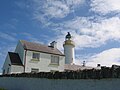
 Cantick Head Lighthouse and cottages - geograph.org.uk - 1532174.jpg 640 × 427; 52 KB
-
 Cantick Head Lighthouse by night - geograph.org.uk - 1531195.jpg 640 × 445; 31 KB
-
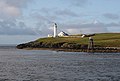
 Cantick Head Lighthouse from the Orkney Ferry - geograph.org.uk - 5317332.jpg 2,000 × 1,333; 611 KB
-
 Cantick Head lighthouse South Walls (4863568989).jpg 3,000 × 4,000; 4.4 MB
-

-
 Cantick head lighthouse.jpg 1,200 × 800; 241 KB
-
 Cantick Head, South Walls - geograph.org.uk - 1128224.jpg 640 × 360; 28 KB
-
 Cantick Head, South Walls - geograph.org.uk - 1128235.jpg 640 × 360; 42 KB
-
 Cantick Head, South Walls - geograph.org.uk - 954392.jpg 640 × 431; 66 KB
-
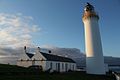
 CantickHeadLH.JPG 2,272 × 1,704; 1.36 MB
-

-
 Lighthouse on Orkney (4014902776).jpg 3,888 × 2,592; 6.81 MB
-
 Road alongside Kirk Hope - geograph.org.uk - 1128411.jpg 640 × 360; 58 KB
-
 Rough grazing at Cantick Head - geograph.org.uk - 1547740.jpg 640 × 427; 67 KB
-
 Ruff of Cantick - geograph.org.uk - 1532508.jpg 640 × 410; 34 KB
-
 Ruff of Cantick Navigation Light - geograph.org.uk - 1534322.jpg 640 × 427; 84 KB
-
 South Walls, Cantick Head lighthouse - geograph.org.uk - 2609546.jpg 480 × 640; 44 KB
-

-


.jpg)


.jpg)


