Category:Canning Highway
Jump to navigation
Jump to search
highway in Perth, Western Australia  | |||||
| Upload media | |||||
| Instance of | |||||
|---|---|---|---|---|---|
| Location | Western Australia, AUS | ||||
| Inception |
| ||||
| Length |
| ||||
| Partially coincident with |
| ||||
 | |||||
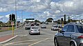
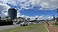
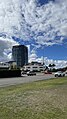
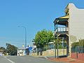
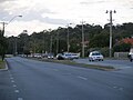
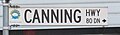
English: Canning Highway is a major road in the southern suburbs of Perth, which connects Victoria Park, Applecross and Fremantle.
Subcategories
This category has the following 7 subcategories, out of 7 total.
C
- Canning Bridge bus interchange (13 F)
- Canning Bridge IGA (3 F)
- Cirque On Kishorn (5 F)
S
- Sabina, Applecross (7 F)
T
- The Precinct, Mount Pleasant (3 F)
Media in category "Canning Highway"
The following 57 files are in this category, out of 57 total.
-
 2023-04-17-Canning-Bridge-1.jpg 4,032 × 2,268; 2.7 MB
-
 2023-04-17-Canning-Bridge-6.jpg 4,032 × 2,268; 2.43 MB
-
 2023-04-17-Canning-Highway-1.jpg 4,032 × 2,268; 2.32 MB
-
 2023-04-17-Canning-Highway-2.jpg 2,268 × 4,032; 2.53 MB
-
 2023-04-17-Canning-Highway-4.jpg 2,268 × 4,032; 2.76 MB
-
 2023-04-17-Mount-Pleasant-2.jpg 2,268 × 4,032; 2.05 MB
-
 2023-04-17-Mount-Pleasant-3.jpg 4,032 × 2,268; 1.82 MB
-
 2023-04-17-Mount-Pleasant-4.jpg 4,032 × 2,268; 2.26 MB
-
 2023-04-17-Mount-Pleasant-5.jpg 2,268 × 4,032; 2.28 MB
-
 Canning Highway near Glyde Street.jpg 2,488 × 990; 482 KB
-
 Canning Highway near Hubble Street.jpg 1,645 × 1,236; 364 KB
-
 Canning Hwy 000 E Victoria Park bridge over Causeway.jpg 1,600 × 1,200; 607 KB
-
 Canning Hwy 004 E Victoria Park Washington.jpg 1,600 × 1,200; 549 KB
-
 Canning Hwy 005 W Victoria Park near Gloucester.jpg 4,624 × 3,468; 6.29 MB
-
 Canning Hwy 010 E Kensington near Berwick (2012).jpg 1,600 × 1,200; 561 KB
-
 Canning Hwy 010 E Kensington near Berwick.jpg 4,146 × 2,190; 2.31 MB
-
 Canning Hwy 010 W Kensington near Berwick.jpg 1,600 × 1,200; 666 KB
-
 Canning Hwy 011 W Kensington towards Metro Hotel.jpg 2,848 × 2,136; 1.28 MB
-
 Canning Hwy 057 E Canning Bridge left lanes.jpg 2,560 × 1,440; 1.52 MB
-
 Canning Hwy 057 E Canning Bridge looking NE.jpg 1,600 × 1,200; 449 KB
-
 Canning Hwy 057 W Canning Bridge from end stn.jpg 2,880 × 2,160; 1.93 MB
-
 Canning Hwy 058 W Como Canning Bridge.jpg 4,624 × 3,468; 5.17 MB
-
 Canning Hwy 059 W Applecross Canning Bridge.jpg 4,624 × 3,468; 4.87 MB
-
 Canning Hwy 062 E Applecross Esplanade 2023-04-17.jpg 4,032 × 2,268; 2.86 MB
-
 Canning Hwy 062 W Applecross Esplanade.jpg 1,600 × 1,200; 629 KB
-
 Canning Hwy 064 E Applecross Kishorn from footbridge 2.jpg 1,600 × 1,200; 660 KB
-
 Canning Hwy 064 E Applecross Kishorn from footbridge.jpg 2,048 × 1,536; 1.4 MB
-
 Canning Hwy 064 W Applecross Kishorn.jpg 2,048 × 1,536; 1.63 MB
-
 Canning Hwy 066 E Applecross Sleat, April 2006.jpg 1,024 × 768; 152 KB
-
 Canning Hwy 069 E Applecross Ullapool.jpg 4,624 × 3,468; 4.89 MB
-
 Canning Hwy 078 W Ardross Kearns.jpg 4,624 × 3,468; 4.91 MB
-
 Canning Hwy 079 W Ardross near Riseley.jpg 4,624 × 3,468; 5.24 MB
-
 Canning Hwy 099 E Alfred Cove Clydesdale - April 2006.jpg 1,024 × 768; 97 KB
-
 Canning Hwy 138 E Bicton Westbury.jpg 1,600 × 1,200; 528 KB
-
 Canning Hwy 160 W EF before Stirling Hwy intersection.jpg 1,280 × 567; 228 KB
-
 Causeway exit to Canning Hwy.jpg 4,624 × 3,468; 7.05 MB
-
Causeway sth gnangarra.ogv 1 min 55 s, 960 × 540; 37.53 MB
-
 East Street intersection with Canning Highway.jpg 1,280 × 657; 318 KB
-
 Fremantle welcome - Fremantle Canning Hwy.jpg 1,600 × 1,200; 538 KB
-
 Intersection Canning Highway.jpg 1,280 × 577; 284 KB
-
 Melville welcome - Applecross Canning Hwy.jpg 1,600 × 1,200; 704 KB
-
 Melville welcome Bicton Canning at Westbury 1.jpg 1,600 × 1,200; 705 KB
-
 Morton Bay Fig planted by C.Y. O'Connor (1).jpg 4,160 × 3,120; 7.15 MB
-
 Morton Bay Fig planted by C.Y. O'Connor (2).jpg 4,160 × 3,120; 6.08 MB
-
 Morton Bay Fig planted by C.Y. O'Connor (3).jpg 4,160 × 3,120; 5.19 MB
-
 OIC canning hwy rt 1 and 6.jpg 1,600 × 1,200; 287 KB
-
 OIC e fremantle canning 29.jpg 1,600 × 1,200; 516 KB
-
 OIC palmyra telephone exchange.jpg 1,600 × 1,200; 475 KB
-
 OIC street sign melville 1980s canning.jpg 1,600 × 1,200; 351 KB
-
 OIC street signs vic park new canning.jpg 1,599 × 470; 188 KB
-
 Rainbow Sea Container on Canning Highway, Fremantle, December 2021 01.jpg 3,264 × 2,448; 2.39 MB
-
 Rainbow Sea Container on Canning Highway, Fremantle, December 2021 02.jpg 3,264 × 2,448; 2.54 MB
-
 South Perth welcome - Como Canning 2.jpg 2,560 × 1,440; 1.33 MB
-
 Vic Park transfer stn gardens.jpg 4,624 × 3,468; 8.33 MB
-
 Vic Park transfer stn Stand F.jpg 4,624 × 3,468; 5.96 MB
-
 Victoria Park welcome Canning at Berwick.jpg 1,600 × 1,200; 604 KB
-
 Victoria Quay gnangarra-10.jpg 4,928 × 3,264; 9.11 MB


.jpg)


.jpg)
.jpg)
.jpg)


