Category:Canary Islands in the 17th century
Jump to navigation
Jump to search
Autonomous communities of Spain: Andalusia · Aragon · Asturias · Balearic Islands · Basque Autonomous Community · Canary Islands · Cantabria · Castile and León · Castile-La Mancha · Catalonia · Extremadura · Galicia · Community of Madrid · Region of Murcia · Navarre · La Rioja · Valencian Community · Autonomous cities: Ceuta · Melilla
Countries of Africa: Algeria · Angola · Benin · Cape Verde · Democratic Republic of the Congo · Republic of the Congo · Djibouti · Egypt‡ · Equatorial Guinea · Ethiopia · The Gambia · Ghana · Guinea · Ivory Coast · Kenya · Libya · Madagascar · Mali · Mauritania · Morocco · Mozambique · Namibia · São Tomé and Príncipe · Senegal · Somalia · South Africa · Sudan · Tanzania · Tunisia
Other areas: Canary Islands · Ceuta · Madeira · Melilla
‡: partly located in Africa
Other areas: Canary Islands · Ceuta · Madeira · Melilla
‡: partly located in Africa
Subcategories
This category has the following 3 subcategories, out of 3 total.
*
T
- Tenerife in the 17th century (2 F)
Media in category "Canary Islands in the 17th century"
The following 12 files are in this category, out of 12 total.
-
-

-
 Description de l'univers (1683) (14597622169).jpg 1,726 × 2,826; 858 KB
-
 Description de l'univers (1683) (14597637758).jpg 2,132 × 3,158; 1.59 MB
-
 Description de l'univers (1683) (14783934852).jpg 2,082 × 3,088; 1.47 MB
-
 Description de l'univers (1683) (14804139823).jpg 1,974 × 2,888; 1.35 MB
-
 Insulae Canariae olim Fortunatae dictae - CBT 6620206.jpg 6,003 × 4,738; 6.96 MB
-
 Map of the Canary and Cape Verde Islands, 1683.jpg 725 × 1,077; 164 KB
-
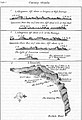
 Map of the Canary Islands, 1683.jpg 725 × 1,078; 175 KB
-
 Tree on the Island of Fer (Hierro), 1683.jpg 725 × 1,078; 186 KB
-
 Tree on the Island of Fer (Hierro), 1685.jpg 647 × 900; 440 KB
-
 View of the Canary Islands, 1683.jpg 725 × 1,078; 167 KB


_(14597622169).jpg)
_(14597637758).jpg)
_(14783934852).jpg)
_(14804139823).jpg)


,_1683.jpg)
,_1685.jpg)
