Category:Campton and Chicksands
Jump to navigation
Jump to search
civil parish in Central Bedfordshire, England  | |||||
| Upload media | |||||
| Instance of | |||||
|---|---|---|---|---|---|
| Named after | |||||
| Location | Central Bedfordshire, Bedfordshire, East of England, England | ||||
| official website | |||||
 | |||||
Subcategories
This category has the following 3 subcategories, out of 3 total.
C
- Chicksands (18 F)
- Chicksands Priory (3 F)
Media in category "Campton and Chicksands"
The following 143 files are in this category, out of 143 total.
-
 A wet day in Chicksands Wood - geograph.org.uk - 3374105.jpg 3,648 × 2,736; 2.57 MB
-
 A507 south of Shefford - geograph.org.uk - 2522765.jpg 640 × 480; 48 KB
-
 All Saints Campton - geograph.org.uk - 3485940.jpg 1,600 × 1,068; 382 KB
-
 All Saints' church, Campton - geograph.org.uk - 4619164.jpg 4,320 × 3,240; 4.54 MB
-
 All Saints' Church, Campton - geograph.org.uk - 4626503.jpg 640 × 480; 79 KB
-
 All Saints' Church, Campton - geograph.org.uk - 4631894.jpg 640 × 480; 91 KB
-
 Ampthill Road (A507) - geograph.org.uk - 4629153.jpg 640 × 480; 81 KB
-

-
 Ampthill Road looking west - geograph.org.uk - 2522802.jpg 640 × 480; 55 KB
-
 Arable land next to Rowney Warren Woods - geograph.org.uk - 2581465.jpg 2,896 × 1,944; 1.33 MB
-
 Beadlow Manor Hotel Golf Club - geograph.org.uk - 4629151.jpg 640 × 451; 59 KB
-
 Boundary of Military compound - geograph.org.uk - 4706969.jpg 480 × 640; 125 KB
-
-
 Bridleway by the stream - geograph.org.uk - 4158443.jpg 1,600 × 1,067; 760 KB
-
 Campton church - geograph.org.uk - 4862888.jpg 640 × 480; 127 KB
-
 Campton Farmland - geograph.org.uk - 1209298.jpg 640 × 492; 111 KB
-
 Campton Road - geograph.org.uk - 4626519.jpg 640 × 480; 77 KB
-
 Campton Road - geograph.org.uk - 4631913.jpg 640 × 480; 64 KB
-
 Campton Village Hall - geograph.org.uk - 3485949.jpg 1,600 × 1,069; 372 KB
-
 Chicksands Wood - geograph.org.uk - 4706798.jpg 640 × 480; 99 KB
-
 Chicksands Wood - geograph.org.uk - 4706799.jpg 480 × 640; 109 KB
-
 Church in Campton - geograph.org.uk - 3064320.jpg 2,560 × 1,920; 1.06 MB
-
 Close Up of Concrete Structure - geograph.org.uk - 2161190.jpg 3,872 × 2,592; 4.44 MB
-
 Corrugated Iron Structure on top of WWII Railway Workings - geograph.org.uk - 2161211.jpg 3,872 × 2,592; 5.18 MB
-
 Cottages, Gravenhurst Road, Campton - geograph.org.uk - 4862885.jpg 640 × 428; 139 KB
-
 Disused Farm structure - geograph.org.uk - 4706843.jpg 480 × 640; 82 KB
-
 Don't even think about it^ - geograph.org.uk - 4706828.jpg 640 × 480; 93 KB
-

-
 Entrance to Chicksands MOD base - geograph.org.uk - 3800783.jpg 4,198 × 2,974; 5.44 MB
-
 Entrance to Chicksands Wood - geograph.org.uk - 4706796.jpg 480 × 640; 109 KB
-
 Farm Equipment - geograph.org.uk - 4706989.jpg 480 × 640; 66 KB
-
 Farm Road - geograph.org.uk - 1554610.jpg 640 × 480; 51 KB
-
 Field by Hitchin Road, Shefford - geograph.org.uk - 5570303.jpg 2,048 × 1,536; 1.51 MB
-

-
 Footpath and cycle way into Shefford - geograph.org.uk - 3485925.jpg 1,600 × 1,068; 474 KB
-
 Footpath by the barbed wire fence - geograph.org.uk - 4158407.jpg 1,600 × 1,068; 688 KB
-
 Footpath near the firing range - geograph.org.uk - 4158383.jpg 1,200 × 1,600; 566 KB
-
 Footpath through Chicksands Firing Range - geograph.org.uk - 4706826.jpg 480 × 640; 131 KB
-
 Footpath through Chicksands Firing Range - geograph.org.uk - 4706831.jpg 480 × 640; 103 KB
-
 Footpath through Chicksands Firing Range - geograph.org.uk - 4706833.jpg 480 × 640; 107 KB
-
 Footpath to Appley Corner - geograph.org.uk - 4158373.jpg 1,600 × 1,067; 646 KB
-
 Footpath to Top Farm - geograph.org.uk - 1554614.jpg 640 × 480; 61 KB
-
 Footpath to Wood Farm - geograph.org.uk - 4158400.jpg 1,600 × 1,066; 616 KB
-
 Gateway to Campton Manor - geograph.org.uk - 4631898.jpg 640 × 480; 115 KB
-
 Giant hose reels Rowney Warren Farm - geograph.org.uk - 2581480.jpg 2,896 × 1,944; 1.33 MB
-
 Gravenhurst Road - geograph.org.uk - 4626514.jpg 640 × 480; 107 KB
-
 Gravenhurst Road entering Campton - geograph.org.uk - 3132767.jpg 640 × 425; 71 KB
-
 Greensand Ridge Walk - geograph.org.uk - 4162640.jpg 1,200 × 1,600; 878 KB
-
 Greensand Ridge Walk - geograph.org.uk - 4162713.jpg 1,600 × 1,067; 696 KB
-
 Greensand Ridge Walk by Chicksands Woods - geograph.org.uk - 4162641.jpg 1,600 × 1,066; 531 KB
-
 Heading north east from Shefford - geograph.org.uk - 4631887.jpg 640 × 480; 94 KB
-
 Houses on Gravenhurst Road, Campton - geograph.org.uk - 4631906.jpg 640 × 480; 61 KB
-
 Houses on Mill Lane, Campton - geograph.org.uk - 4626506.jpg 640 × 480; 75 KB
-
 Irrigation on Farmland Rowney Warren Woods - geograph.org.uk - 2581474.jpg 2,896 × 1,944; 1.37 MB
-
 John Bunyan Trail - geograph.org.uk - 4706986.jpg 480 × 640; 84 KB
-
 John Bunyan Trail by Second Lodge Farm - geograph.org.uk - 4158437.jpg 1,600 × 1,067; 688 KB
-

-
 Layby on Hitchin Road, Shefford - geograph.org.uk - 5570302.jpg 2,048 × 1,536; 1.43 MB
-
 Little Island at Chicksand Barracks - geograph.org.uk - 382498.jpg 640 × 427; 144 KB
-
 Lodge house, Chicksands - geograph.org.uk - 3800778.jpg 3,931 × 2,785; 4.27 MB
-
 Lodgeway Tractors, Chicksands - geograph.org.uk - 3374088.jpg 3,648 × 2,736; 2.73 MB
-
 Memorial to Henry John Robert Osborn - geograph.org.uk - 2148804.jpg 2,048 × 1,536; 677 KB
-
 Memorial to Henry John Robert Osborn - geograph.org.uk - 2148810.jpg 1,344 × 1,792; 621 KB
-
 Mill Lane Campton by the White Hart - geograph.org.uk - 3485936.jpg 1,600 × 1,074; 412 KB
-

-
 Mill Lane, Campton - geograph.org.uk - 4626508.jpg 640 × 480; 73 KB
-
 MOD waypoint No. 9 - geograph.org.uk - 4706835.jpg 480 × 640; 94 KB
-
 Mysterious Concrete Structure - geograph.org.uk - 2161181.jpg 3,872 × 2,592; 4.77 MB
-
 Nature Reserve - geograph.org.uk - 4706852.jpg 640 × 480; 55 KB
-
 Nature Reserve sign - geograph.org.uk - 4706838.jpg 640 × 480; 90 KB
-
 Not that way then^ - geograph.org.uk - 4706855.jpg 640 × 480; 81 KB
-
 Oak tree by the John Bunyan Trail - geograph.org.uk - 3064398.jpg 2,560 × 1,920; 1.02 MB
-
 Obelisk for George Montagu-Dunk Chicksands Woods - geograph.org.uk - 2161148.jpg 2,376 × 3,600; 3.35 MB
-
 Obelisk for George Montagu-Dunk Chicksands Woods - geograph.org.uk - 2161151.jpg 2,385 × 2,697; 1.67 MB
-
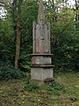 Obelisk in Chicksands Wood - geograph.org.uk - 4706803.jpg 480 × 640; 91 KB
-
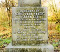 Osborn Memorial - geograph.org.uk - 2161273.jpg 2,522 × 2,189; 2.34 MB
-

-
 Path from Chicksands - geograph.org.uk - 4706836.jpg 480 × 640; 75 KB
-
 Path into Chicksands Firing Range - geograph.org.uk - 4706824.jpg 480 × 640; 56 KB
-
 Path through Chicksands Firing Range - geograph.org.uk - 4706816.jpg 640 × 480; 51 KB
-
 Path through Chicksands Firing Range - geograph.org.uk - 4706820.jpg 640 × 480; 118 KB
-
 Path through Chicksands Wood - geograph.org.uk - 4162725.jpg 1,600 × 1,067; 579 KB
-
 Path towards Temple Grove - geograph.org.uk - 4706847.jpg 640 × 480; 64 KB
-
 Path towards Temple Grove - geograph.org.uk - 4706848.jpg 480 × 640; 76 KB
-
 Path towards Temple Grove - geograph.org.uk - 4706850.jpg 640 × 480; 71 KB
-
 Path towards Temple Grove - geograph.org.uk - 4706853.jpg 480 × 640; 71 KB
-
 Paths under the A507 - geograph.org.uk - 3485926.jpg 1,600 × 1,068; 495 KB
-
 Post Box - geograph.org.uk - 2141805.jpg 1,024 × 768; 206 KB
-
 Priory Road approaching Ampthill Road - geograph.org.uk - 6221941.jpg 1,024 × 683; 209 KB
-
 Private track to Second Lodge Farm - geograph.org.uk - 4158392.jpg 1,600 × 1,068; 463 KB
-
 Pump House Rowney Warren Woods - geograph.org.uk - 2581477.jpg 2,896 × 1,944; 1.37 MB
-
 Pumping Station - geograph.org.uk - 4706982.jpg 640 × 480; 85 KB
-
 RAF Chicksand barracks - geograph.org.uk - 382505.jpg 640 × 427; 117 KB
-
 RAF Chicksands Barracks - geograph.org.uk - 382488.jpg 640 × 427; 94 KB
-
 Rectory Road, Campton - geograph.org.uk - 4631895.jpg 640 × 480; 88 KB
-
 Remains of WWII Railway Workings - geograph.org.uk - 2161201.jpg 3,872 × 2,592; 4.26 MB
-
 Reservoir by Penseroso Grove - geograph.org.uk - 4158418.jpg 1,600 × 1,068; 446 KB
-
 Rowney Warren Wood - geograph.org.uk - 4162749.jpg 1,600 × 1,067; 530 KB
-
 Second Lodge Farm - geograph.org.uk - 3064413.jpg 2,560 × 1,920; 996 KB
-
 Sign for the White Hart Campton - geograph.org.uk - 4631902.jpg 493 × 640; 58 KB
-
 Snapped tree in Druids Grove - geograph.org.uk - 4158422.jpg 1,600 × 1,066; 593 KB
-
 Solar energy field - geograph.org.uk - 3374097.jpg 3,648 × 2,736; 2.78 MB
-
 South Lodge at Chicksands - geograph.org.uk - 3485945.jpg 1,200 × 1,600; 480 KB
-
 Southern Edge of Rowney Warren - geograph.org.uk - 6002126.jpg 1,303 × 977; 490 KB
-
 Steam on the A600 - geograph.org.uk - 4158476.jpg 1,600 × 1,066; 366 KB
-
 Stream by Second Lodge Farm - geograph.org.uk - 4158433.jpg 1,600 × 1,067; 476 KB
-
 Stream by the bridleway to Chicksands - geograph.org.uk - 4158448.jpg 1,600 × 1,066; 713 KB
-
 Stubble field near Campton - geograph.org.uk - 4626512.jpg 640 × 480; 87 KB
-
 Stubble field of Campton Road - geograph.org.uk - 4626516.jpg 640 × 480; 69 KB
-
 Stubble field off Campton Road - geograph.org.uk - 4626517.jpg 640 × 480; 80 KB
-
 The entrance to Monkey Puzzle Nursery, Shefford - geograph.org.uk - 6271132.jpg 1,860 × 1,182; 1.61 MB
-
 The Old Rectory - geograph.org.uk - 3485941.jpg 1,600 × 1,068; 394 KB
-
 The Old Rectory, Campton - geograph.org.uk - 4619248.jpg 4,320 × 3,240; 3.7 MB
-
 The White Hart - geograph.org.uk - 2141792.jpg 1,024 × 768; 185 KB
-
 The White Hart Campton - geograph.org.uk - 4631901.jpg 640 × 480; 60 KB
-
 Towards Appley Corner - geograph.org.uk - 4707000.jpg 640 × 480; 63 KB
-
 Towards Rowney Warren Wood - geograph.org.uk - 4706973.jpg 640 × 480; 60 KB
-
 Towards Rowney Warren Wood - geograph.org.uk - 4706974.jpg 640 × 480; 55 KB
-
 Towards Second Lodge Farm - geograph.org.uk - 4706971.jpg 640 × 480; 68 KB
-
 Towards the Old Dairy - geograph.org.uk - 4706845.jpg 640 × 480; 62 KB
-
 Track block - geograph.org.uk - 3374080.jpg 640 × 480; 79 KB
-
 Tree Of Life (64646031).jpeg 567 × 797; 212 KB
-
 Underpass beneath the A507 - geograph.org.uk - 4631893.jpg 640 × 480; 87 KB
-
 Updated Henry Osborn Memorial - geograph.org.uk - 2161218.jpg 2,393 × 3,613; 4.66 MB
-
 Vegetable processing plant. Chicksands - geograph.org.uk - 3374085.jpg 3,648 × 2,736; 2.65 MB
-
 View back down the path away from Monument - geograph.org.uk - 2161295.jpg 3,872 × 2,592; 3.6 MB
-
 View from Chicksands Wood - geograph.org.uk - 4706807.jpg 640 × 480; 63 KB
-
 View from Nature Reserve sign - geograph.org.uk - 4706840.jpg 640 × 480; 63 KB
-
 View from the John Bunyan Trail - geograph.org.uk - 4706991.jpg 640 × 480; 54 KB
-
 View from the John Bunyan Trail - geograph.org.uk - 4706994.jpg 640 × 480; 58 KB
-
 View of Chicksands Wood - geograph.org.uk - 4706809.jpg 640 × 480; 52 KB
-
 View towards Chicksands - geograph.org.uk - 4706979.jpg 640 × 480; 54 KB
-
 Warren Court at 09.38 - geograph.org.uk - 3374092.jpg 3,648 × 2,736; 2.73 MB
-
 Welcome^ - geograph.org.uk - 4706813.jpg 640 × 480; 109 KB
-
 Across The John Bunyan Trail - geograph.org.uk - 400451.jpg 640 × 480; 258 KB
-
 Courtyard Entrance Next To Chicksands - geograph.org.uk - 400482.jpg 640 × 480; 149 KB
-
 Crossroads at Rowney Warren - geograph.org.uk - 685605.jpg 640 × 480; 105 KB
-
 Logging Operation 1 - geograph.org.uk - 685615.jpg 640 × 480; 143 KB
-
 Logging Operation 2 - geograph.org.uk - 685620.jpg 640 × 480; 135 KB
-
 Mid Beds District Council Offices - geograph.org.uk - 382472.jpg 640 × 427; 67 KB
-
 RAF Chicksands - geograph.org.uk - 382483.jpg 640 × 427; 88 KB
-
 Track Looking SSE in Rowney Warren Wood - geograph.org.uk - 400447.jpg 640 × 480; 223 KB
-
 Tracks Crossing in Rowney Warren Wood - geograph.org.uk - 400445.jpg 640 × 480; 205 KB


_-_geograph.org.uk_-_4629153.jpg)


_-_geograph.org.uk_-_4729283.jpg)


.jpeg)


