Category:California montane chaparral and woodlands
Jump to navigation
Jump to search
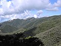
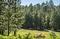
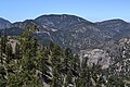
English: This is a collection of photos that best represent the California montane chaparral and woodlands of Central and Southern California.
Español: Esta es una colección de fotos que mejor representan los montano chaparrales y bosques de California del centro y sur de California.
Mediterranean forests, woodlands, and scrub ecoregion in California   | |||||
| Upload media | |||||
| Instance of | |||||
|---|---|---|---|---|---|
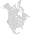
| Location | California, Pacific States Region | ||||
 | |||||
Subcategories
This category has only the following subcategory.
V
- Vasquez Rocks Natural Area Park (250 F)
Media in category "California montane chaparral and woodlands"
The following 62 files are in this category, out of 62 total.
-
 California Montane Chaparral and Woodlands map.svg 1,712 × 1,992; 339 KB
-
 A good place to get lost (5082186123).jpg 1,200 × 803; 1.12 MB
-
 A Sunrise on Vasquez Canyon Road.jpg 7,541 × 4,242; 10.16 MB
-
 Angeles National Forest (15480542552).jpg 1,280 × 960; 250 KB
-
 Angeles National Forest.jpg 1,536 × 2,048; 601 KB
-
 Angelesnationalforest.jpg 1,632 × 1,224; 523 KB
-
 Arrastre Canyon-LA County (18474899973).png 938 × 570; 1.36 MB
-
 Baldwin Lake prescribed fire project (32192781238).jpg 2,048 × 1,365; 3.22 MB
-
 Big Bear Lake (7891777826) (2).jpg 4,750 × 3,166; 8.04 MB
-
 Big Sur (10376511155).jpg 2,048 × 1,536; 795 KB
-
 Bottchers Gap view south.jpg 1,000 × 751; 163 KB
-
 Central Californian Coastline, Big Sur - May 2013.jpg 8,000 × 5,210; 13.57 MB
-
 Central Coast @ Lucia - panoramio (3).jpg 4,272 × 2,848; 2.35 MB
-
 Chaparral1.jpg 1,600 × 1,200; 298 KB
-
 Coast horned lizard (Phrynosoma coronatum), Tehachapi Mountains.jpg 1,280 × 960; 172 KB
-
 Dry Canyon Reservoir 2013.JPG 3,648 × 2,736; 4.21 MB
-
 Elizabeth Lake - panoramio.jpg 4,288 × 2,848; 2.47 MB
-
 Forest and meadow atop Mount Pinos.jpg 1,500 × 1,000; 728 KB
-
 Garland Ranch Regional Park - Carmel Valley, CA - DSC06854.JPG 4,320 × 3,240; 4.18 MB
-
 Geocaching at Vasquez Rocks (2398110682).jpg 3,456 × 2,592; 4.6 MB
-
 Going Down Tehachapi Loop.jpg 5,276 × 2,960; 4.24 MB
-
 Jeffrey Pine forest atop Mt Pinos - 19891524319.jpg 4,899 × 3,245; 15.26 MB
-
 Jeffrey Pine forest atop Mt Pinos - 20078294095.jpg 4,881 × 3,233; 14.3 MB
-
 Jeffrey Pine forest atop Mt Pinos - 20083659651.jpg 4,722 × 3,128; 13.2 MB
-
 Jeffrey Pine forest atop Mt Pinos.jpg 4,836 × 3,203; 12.56 MB
-
 Josephine Peak & Strawberry Peak.jpg 5,184 × 3,888; 18.33 MB
-
 Liebre Mountains 001.jpg 1,280 × 960; 201 KB
-
 Lockwood Valley from Mount Pinos highway overlook.jpg 7,733 × 4,488; 27.16 MB
-
 Lonely Tree (25118079873).jpg 6,517 × 3,617; 25.36 MB
-
 Looking Up (36546138).jpeg 2,048 × 1,365; 1.76 MB
-
 Montane chaparral grassland in Santa Clarita Valley.jpg 3,175 × 2,381; 5.46 MB
-
 Mount San Jacinto State Park 2.jpg 4,000 × 3,000; 4.94 MB
-
 Mount Wilson Road.jpg 3,387 × 2,340; 2.22 MB
-
 Mount Wilson Trail (4794325051).jpg 1,635 × 611; 362 KB
-
 Mount-Islip.jpg 1,400 × 1,050; 590 KB
-
 Mount-waterman.jpg 4,608 × 3,072; 5.65 MB
-

-
 Near Pyramid Reservoir, CA, View S, Stream Course, 2011 - panoramio.jpg 4,000 × 3,000; 4.54 MB
-
 North Slope Santa Ynez Mtns.jpg 1,600 × 900; 144 KB
-
Pack of coyotes howling.ogg 44 s; 927 KB
-
 Parque nacional Constitución de 1857.jpg 1,200 × 797; 336 KB
-
 Pinus flexilis forest Mount Baden-Powell.jpg 3,264 × 2,448; 5.08 MB
-
 Pinus jeffreyi MtPinos1.jpg 3,264 × 2,448; 6.5 MB
-
 Pinus lambertiana forest Cucamonga Wilderness.jpg 2,566 × 2,006; 3.83 MB
-
 Purisma Hills.jpg 2,048 × 1,536; 1.85 MB
-
 Saint Francis Dam Site 2012.jpg 3,648 × 2,736; 2.49 MB
-
 San Francisquito Canyon2015.jpg 3,264 × 2,448; 2.49 MB
-
 Side of the road (5043317778).jpg 1,200 × 803; 1.15 MB
-
 Sierra Pelona montane chaparral.jpg 5,911 × 2,786; 12.94 MB
-
 Slide, Barton Flats 4-5-14 (13739055504).jpg 1,870 × 1,118; 1.13 MB
-
 Summer Clouds (4800793522).jpg 1,200 × 803; 1.09 MB
-
 Summit of Mount Pinos.jpg 1,500 × 1,000; 675 KB
-
 Tahquitz Peak (31865855108).jpg 2,048 × 1,463; 4.52 MB
-
 TejonWest.jpg 2,694 × 2,016; 808 KB
-
 Transverse Ranges from Mount Pinos.jpg 4,893 × 3,241; 15.15 MB
-
 Vasquez Rocks (15878641765).jpg 5,996 × 3,371; 5.23 MB
-
 Vasquez Rocks - 48016767691.jpg 3,000 × 2,247; 5.58 MB
-
 Vasquez Rocks - 48016774676.jpg 3,000 × 2,247; 5.68 MB
-
 Vasquez Rocks chaparral.jpg 3,000 × 2,247; 5.58 MB
-
 Winter ANF HWY 2 in San Gabriel Mountains (33896578744).jpg 875 × 656; 139 KB
-
 Yucca in Bloom at Big Tujunga Canyon in Sunland.JPG 3,000 × 4,000; 4.26 MB
-
 Cupressussargentii.jpg 800 × 531; 186 KB
.jpg)

.jpg)


.png)
.jpg)
_(2).jpg)
.jpg)


.jpg)

,_Tehachapi_Mountains.jpg)


.jpg)


.jpg)
.jpeg)


.jpg)

.jpg)
.jpg)

.jpg)

.jpg)


.jpg)


.jpg)