Category:Cadastral maps of the Kingdom of Galicia (Central Europe)
Jump to navigation
Jump to search
Subcategories
This category has only the following subcategory.
S
Media in category "Cadastral maps of the Kingdom of Galicia (Central Europe)"
The following 6 files are in this category, out of 6 total.
-
 AGAD Mapa Galicji – Projekt sejmowych okręgów wyborczych – Kurya wiejska.png 2,592 × 1,944; 7.5 MB
-
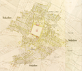 Mapa-katastralna-Sokolowa Malopolskiego 1853.png 1,431 × 1,240; 3.52 MB
-
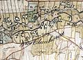
 Nowoatniec - mapa katastralna (1852).jpg 1,001 × 573; 200 KB
-
 Odrzechowa 1817.jpg 709 × 516; 362 KB
-
 Pielnia - mapa (1852).jpg 3,072 × 2,304; 7.13 MB
-
 Wzdow mapa 1798.jpg 4,272 × 2,848; 1.75 MB


.jpg)

.jpg)
