Category:CIA World Factbook maps of Saint Kitts and Nevis
Jump to navigation
Jump to search
Media in category "CIA World Factbook maps of Saint Kitts and Nevis"
The following 10 files are in this category, out of 10 total.
-
 Basseterre Map 1.png 325 × 349; 7 KB
-
 Saint Kitts and Nevis carte.gif 330 × 355; 21 KB
-
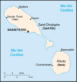
 Saint Kitts and Nevis-CIA WFB Map (de).png 330 × 355; 5 KB
-
 Saint Kitts and Nevis-CIA WFB Map Japanese.png 330 × 355; 9 KB
-
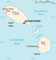 Saint Kitts and Nevis-CIA WFB Map.png 326 × 350; 6 KB
-
 Saint Kitts ja Nevis.png 327 × 352; 19 KB
-
 Sc-map.gif 330 × 355; 7 KB
-
 St kitts rel96.jpg 978 × 1,222; 186 KB
-
 World Factbook (1982) St. Christopher-Nevis.jpg 587 × 584; 85 KB
-
 World Factbook (1990) St. Kitts and Nevis.jpg 541 × 559; 82 KB


.png)


_St._Christopher-Nevis.jpg)
_St._Kitts_and_Nevis.jpg)