Category:Buttermere, Wiltshire
Jump to navigation
Jump to search
village and civil parish in Wiltshire, UK  | |||||
| Upload media | |||||
| Instance of | |||||
|---|---|---|---|---|---|
| Location | Wiltshire, South West England, England | ||||
 | |||||
Subcategories
This category has only the following subcategory.
S
Media in category "Buttermere, Wiltshire"
The following 70 files are in this category, out of 70 total.
-
 Arable land and Horse pasture east of Hungerford Road - geograph.org.uk - 3360843.jpg 3,648 × 2,736; 2.63 MB
-
 Beside Combe Wood - geograph.org.uk - 243772.jpg 480 × 640; 134 KB
-
 Bridleway on Sheepless Hill - geograph.org.uk - 1014664.jpg 640 × 480; 125 KB
-
 Bugle (Ajuga reptans), Buttermere - geograph.org.uk - 1921107.jpg 480 × 640; 227 KB
-
 Buttermere Bottom - geograph.org.uk - 1014666.jpg 640 × 480; 148 KB
-
 Buttermere Bottom - geograph.org.uk - 1014667.jpg 640 × 480; 112 KB
-
 Buttermere Bottom - geograph.org.uk - 1014670.jpg 640 × 480; 116 KB
-
 Buttermere Bottom - geograph.org.uk - 1014674.jpg 640 × 480; 132 KB
-
 Buttermere Bottom - geograph.org.uk - 1014676.jpg 640 × 480; 116 KB
-
 Buttermere Bottom - geograph.org.uk - 1014679.jpg 640 × 480; 142 KB
-
 Buttermere Bottom - geograph.org.uk - 1016120.jpg 640 × 480; 105 KB
-
 Buttermere Bottom - geograph.org.uk - 2393270.jpg 2,560 × 1,920; 2.35 MB
-
 Buttermere Bottom - geograph.org.uk - 243779.jpg 640 × 480; 103 KB
-
 Buttermere Bottom - geograph.org.uk - 243782.jpg 640 × 480; 109 KB
-
 Buttermere Bottom Bluebells - geograph.org.uk - 2393221.jpg 2,560 × 1,920; 2.26 MB
-
 Buttermere to Vernham Dean road - geograph.org.uk - 769276.jpg 640 × 480; 129 KB
-
 Buttermere, Wiltshire - geograph.org.uk - 2393121.jpg 2,560 × 1,920; 2.35 MB
-
 Byway near Buttermere - geograph.org.uk - 1345824.jpg 640 × 480; 108 KB
-
 Byway on Ham Hill - geograph.org.uk - 2393090.jpg 2,560 × 1,920; 2.43 MB
-
 Byway, Buttermere - geograph.org.uk - 5641537.jpg 640 × 480; 105 KB
-
 Byway, Buttermere - geograph.org.uk - 5641543.jpg 640 × 480; 83 KB
-
 Copse on Ham Hill, Wiltshire - geograph.org.uk - 4190075.jpg 4,608 × 3,456; 6.97 MB
-
 Dead Caterpillar - geograph.org.uk - 2393186.jpg 2,560 × 1,920; 2.37 MB
-
 Descending the Test Way - geograph.org.uk - 3208441.jpg 2,048 × 1,536; 706 KB
-
 Downland at Buttermere - geograph.org.uk - 2393200.jpg 2,560 × 1,920; 2.37 MB
-
 Downland, Buttermere - geograph.org.uk - 5641527.jpg 640 × 480; 83 KB
-
 Downland, Buttermere - geograph.org.uk - 5641529.jpg 640 × 480; 96 KB
-
 Entrance to Manor Farm on White Farm Lane - geograph.org.uk - 4046186.jpg 3,288 × 2,477; 1.54 MB
-
 Farmland near Buttermere - geograph.org.uk - 3035115.jpg 2,592 × 1,944; 1.71 MB
-
 Farmland, Buttermere - geograph.org.uk - 1014688.jpg 640 × 480; 110 KB
-
 Farmland, Buttermere - geograph.org.uk - 6087641.jpg 1,024 × 768; 274 KB
-
 Farmland, Buttermere - geograph.org.uk - 769240.jpg 640 × 480; 110 KB
-
 Farmland, Buttermere - geograph.org.uk - 769250.jpg 640 × 480; 121 KB
-
 Farmland, Buttermere - geograph.org.uk - 769253.jpg 640 × 480; 109 KB
-
 Farmland, Buttermere - geograph.org.uk - 769280.jpg 640 × 480; 141 KB
-
 Farmland, Vernham Dean - geograph.org.uk - 769268.jpg 640 × 480; 121 KB
-
 Flowers on Sheepless Hill - geograph.org.uk - 3208440.jpg 2,048 × 1,536; 985 KB
-
 Footpath through wheat, Henley - geograph.org.uk - 769232.jpg 640 × 480; 98 KB
-
 Footpath to Ballyack House - geograph.org.uk - 99744.jpg 640 × 481; 81 KB
-
 Gorse-lined Byway - geograph.org.uk - 2391943.jpg 2,560 × 1,920; 2.3 MB
-
 Ham Hill Byway - geograph.org.uk - 2393103.jpg 2,560 × 1,920; 2.42 MB
-
 Heath Plantation Crossroads - geograph.org.uk - 99749.jpg 640 × 481; 80 KB
-
 Horse pasture west of White Farm Lane - geograph.org.uk - 3360936.jpg 3,648 × 2,736; 3.14 MB
-
 Inside Buttermere Church - geograph.org.uk - 2393149.jpg 1,920 × 2,560; 2.05 MB
-
 Lane in Buttermere - geograph.org.uk - 2393112.jpg 2,560 × 1,920; 2.28 MB
-
 Maize below Ham Hill - geograph.org.uk - 1014721.jpg 640 × 480; 169 KB
-
 Meadow, Buttermere - geograph.org.uk - 243802.jpg 640 × 480; 115 KB
-
 Medieval finger-ring (FindID 962606).jpg 1,985 × 1,769; 711 KB
-
 On the downs at Buttermere - geograph.org.uk - 243617.jpg 640 × 480; 118 KB
-
 On the Test Way near Buttermere - geograph.org.uk - 243744.jpg 640 × 480; 139 KB
-
 Pasture, Buttermere - geograph.org.uk - 6087637.jpg 1,024 × 768; 208 KB
-
 Pastures, Buttermere - geograph.org.uk - 1014683.jpg 640 × 480; 146 KB
-
 Pastures, Buttermere - geograph.org.uk - 1014685.jpg 640 × 480; 163 KB
-
 Path crossroads on the Test Way - geograph.org.uk - 3208444.jpg 2,048 × 1,536; 445 KB
-
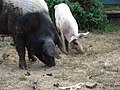 Pigs in Buttermere - geograph.org.uk - 243797.jpg 640 × 480; 160 KB
-
 Ramsons (Allium ursinum ) - geograph.org.uk - 1921082.jpg 480 × 640; 214 KB
-
 Red Boxes, Buttermere - geograph.org.uk - 2393129.jpg 2,560 × 1,920; 2.29 MB
-
 Reservoir in Buttermere Bottom - geograph.org.uk - 2393256.jpg 2,560 × 1,920; 2.47 MB
-
 Roe buck near Buttermere - geograph.org.uk - 1921257.jpg 640 × 471; 138 KB
-
 Roe deer near Buttermere - geograph.org.uk - 1921247.jpg 640 × 481; 135 KB
-
 Shalbourne Soaring Society - southern end of field - geograph.org.uk - 3360659.jpg 3,648 × 2,736; 2.89 MB
-
 Sheepless Hill - geograph.org.uk - 1014665.jpg 640 × 480; 130 KB
-
 Sheepless Sheepless Hill - geograph.org.uk - 2393238.jpg 2,560 × 1,920; 2.41 MB
-
 Telephone box at Grange Farm - geograph.org.uk - 3360916.jpg 3,648 × 2,736; 2.52 MB
-
 Timber from Buttermere Wood - geograph.org.uk - 3035123.jpg 2,592 × 1,944; 1.45 MB
-
 Un-named lane junction with Ashley Drove - geograph.org.uk - 3359458.jpg 3,555 × 2,645; 2.55 MB
-
 Un-named lane southwest of Moordown Farm - geograph.org.uk - 3359447.jpg 3,648 × 2,588; 1.92 MB
-
 Westwards from Inkpen Hill - geograph.org.uk - 2391931.jpg 2,560 × 1,920; 2.32 MB
-
 White Farm Lane south of Grange Farm - geograph.org.uk - 3360895.jpg 3,150 × 2,379; 1.73 MB
-
 Woodcote Road approaches Grange Farm - geograph.org.uk - 3360879.jpg 3,648 × 2,736; 2.21 MB


,_Buttermere_-_geograph.org.uk_-_1921107.jpg)


.jpg)


_-_geograph.org.uk_-_1921082.jpg)


