Category:Bungalows in the City of Bradford
Jump to navigation
Jump to search
Media in category "Bungalows in the City of Bradford"
The following 15 files are in this category, out of 15 total.
-
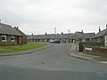
 Armidale Way - Ashbourne Way - geograph.org.uk - 2420595.jpg 640 × 480; 51 KB
-
 Ashbourne Crescent - New Park Road - geograph.org.uk - 1497442.jpg 640 × 480; 213 KB
-
 Ashbourne Crescent - New Park Road - geograph.org.uk - 1497447.jpg 640 × 480; 207 KB
-
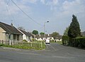
 Bradford Road, Clayton - geograph.org.uk - 392648.jpg 640 × 480; 99 KB
-
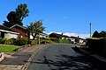
 Browcliffe - Breakmoor Avenue - geograph.org.uk - 1514043.jpg 640 × 480; 71 KB
-
 Caythorpe Walk - Park Road - geograph.org.uk - 2373250.jpg 640 × 462; 53 KB
-

-
 Highgate Close - Lingfield Terrace - geograph.org.uk - 2955810.jpg 640 × 480; 56 KB
-
 Jacmil - Tong Lane - geograph.org.uk - 2323865.jpg 640 × 486; 114 KB
-
 Middlebrook Crescent, Bradford - geograph.org.uk - 5092284.jpg 1,600 × 1,067; 574 KB
-
 Middlebrook Drive - geograph.org.uk - 5092264.jpg 1,600 × 1,067; 469 KB
-
 New Bungalow, Knowle Farm - geograph.org.uk - 3009846.jpg 640 × 450; 53 KB
-
 Sayle Avenue - Hambledon Avenue - geograph.org.uk - 1460317.jpg 640 × 480; 191 KB
-
 Snape Drive - Great Horton Road - geograph.org.uk - 1083685.jpg 640 × 446; 179 KB
-
 Southfield Lane, Bradford - geograph.org.uk - 5183248.jpg 1,600 × 1,065; 662 KB


