Category:Buitenplaats Marlot (The Hague)
Jump to navigation
Jump to search
| Object location | | View all coordinates using: OpenStreetMap |
|---|
.jpg) | |||||
| Upload media | |||||
| Instance of | |||||
|---|---|---|---|---|---|
| Part of | |||||
| Location | The Hague, South Holland, Netherlands | ||||
| Street address |
| ||||
| Located on street | |||||
| Owned by | |||||
| Heritage designation |
| ||||
 | |||||
|
This is a category about rijksmonumentcomplex number 510691
|
Hoofdgebouw
|
This is a category about rijksmonument number 510692
|
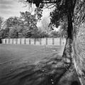
Parkaanleg
|
This is a category about rijksmonument number 510693
|
Fruitmuur (retranchementenmuur)
|
This is a category about rijksmonument number 510694
|
Fruitmuur
|
This is a category about rijksmonument number 510695
|
Twee tuinmuren met entree
|
This is a category about rijksmonument number 510696
|
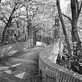
Brug met toegangshek
|
This is a category about rijksmonument number 510697
|
Brug ten oosten van het huis Marlot gelegen
|
This is a category about rijksmonument number 510698
|
Tennishal
|
This is a category about rijksmonument number 510699
|
| Address |
|
Subcategories
This category has only the following subcategory.
Media in category "Buitenplaats Marlot (The Hague)"
The following 43 files are in this category, out of 43 total.
-
 -hal - 's-Gravenhage - 20407754 - RCE.jpg 1,200 × 1,200; 511 KB
-
 Brug en hek, op westzijde landgoed - 's-Gravenhage - 20407741 - RCE.jpg 1,200 × 1,200; 492 KB
-
 Deel van achterzijde fruitmuur (retranchementmuur) - 's-Gravenhage - 20407737 - RCE.jpg 1,200 × 1,200; 555 KB
-

-
 Detail achterzijde fruitmuur (retranchementmuur) - 's-Gravenhage - 20407731 - RCE.jpg 1,200 × 1,200; 523 KB
-
 Detail achterzijde fruitmuur (retranchementmuur) - 's-Gravenhage - 20407746 - RCE.jpg 1,198 × 1,200; 537 KB
-
 Detail fruitmuur, links achter (retranchementmuur) - 's-Gravenhage - 20407748 - RCE.jpg 1,200 × 1,200; 480 KB
-
 Detail voorzijde fruitmuur (retranchementmuur) - 's-Gravenhage - 20407730 - RCE.jpg 1,200 × 1,200; 527 KB
-

-
 Landgoed Marlot - Den Haag.JPG 2,048 × 1,536; 1.42 MB
-
 Leidsestraatweg 77 - 's-Gravenhage - 20087846 - RCE.jpg 1,200 × 802; 253 KB
-
 Leidsestraatweg 77 - 's-Gravenhage - 20087847 - RCE.jpg 1,200 × 809; 208 KB
-
 Marlot, vanaf de Bezuidenhoutseweg.jpg 964 × 692; 549 KB
-
 Marlot, vanaf de Leidsestraatweg.jpg 942 × 677; 564 KB
-
 Muurankers in de gevel van het huis - 's-Gravenhage - 20407729 - RCE.jpg 1,200 × 1,200; 299 KB
-
 Overzicht fruitmuur bij sporthal - 's-Gravenhage - 20407732 - RCE.jpg 1,200 × 1,200; 553 KB
-
 Overzicht fruitmuur bij sporthal - 's-Gravenhage - 20407735 - RCE.jpg 1,200 × 1,200; 488 KB
-

-

-

-
-
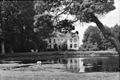
 Overzicht met park en vijver - 's-Gravenhage - 20087848 - RCE.jpg 1,200 × 894; 301 KB
-

-
 Overzicht tuinmuur bij sporthal - 's-Gravenhage - 20407758 - RCE.jpg 1,200 × 1,200; 481 KB
-
 Park Marlot, 2011, img. 001.jpg 6,144 × 4,088; 7.81 MB
-
 Park Marlot, 2011, img. 002.jpg 6,144 × 4,088; 5.25 MB
-
 Psathyrella (Franjehoed) in Park Marlot, The Hague 01.jpg 4,032 × 3,024; 3.35 MB
-
 Psathyrella (Franjehoed) in Park Marlot, The Hague 02.jpg 4,032 × 3,024; 2.92 MB
-
 Psathyrella (Franjehoed) in Park Marlot, The Hague 03.jpg 4,032 × 3,024; 2.72 MB
-
 Rechte waterpartij achter het huis - 's-Gravenhage - 20407749 - RCE.jpg 1,200 × 1,198; 536 KB
-
 RM510692 Den Haag - Marlot (hoofdgebouw landhuis).jpg 3,264 × 2,448; 2.38 MB
-
 RM510693 Den Haag - Marlot parkaanleg.jpg 3,264 × 2,448; 2.63 MB
-
 RM510694 Den Haag - Marlot - Fruitmuur noordwestzijde.jpg 3,264 × 2,448; 2.71 MB
-
 RM510696 Den Haag - Marlot - Fruitmuur met tandlijst (foto 2).jpg 3,264 × 2,448; 3.47 MB
-
 RM510696 Den Haag - Marlot - Fruitmuur westzijde.jpg 3,264 × 2,448; 3.14 MB
-
 RM510697 Den Haag - Marlot (brug met toegangshek).jpg 3,264 × 2,448; 3.33 MB
-
 RM510698 Den Haag - Marlot (brug).jpg 3,264 × 2,448; 3.69 MB
-
 RM510699 Den Haag - Marlot - tennishal voorzijde.jpg 2,448 × 3,264; 1.97 MB
-
 RM510699 Den Haag - Marlot - tennishal zijgevel.jpg 3,124 × 2,408; 2.07 MB
-
 Sporthal op de plaats van de moestuinen - 's-Gravenhage - 20407747 - RCE.jpg 1,200 × 1,200; 538 KB
-

-

-


_-_%27s-Gravenhage_-_20407737_-_RCE.jpg)

_-_%27s-Gravenhage_-_20407731_-_RCE.jpg)
_-_%27s-Gravenhage_-_20407746_-_RCE.jpg)
_-_%27s-Gravenhage_-_20407748_-_RCE.jpg)
_-_%27s-Gravenhage_-_20407730_-_RCE.jpg)


_in_Park_Marlot,_The_Hague_01.jpg)
_in_Park_Marlot,_The_Hague_02.jpg)
_in_Park_Marlot,_The_Hague_03.jpg)


.jpg)

.jpg)
.jpg)


_Oude_buitenplaatsen_rondom_%27s-Gravenhage_(originele_serietitel),_RP-P-1931-1549.jpg)
,_links_van_het_huis_-_%27s-Gravenhage_-_20407752_-_RCE.jpg)