Category:Buildings in the London Borough of Croydon
Jump to navigation
Jump to search
Boroughs of London: City of London · City of Westminster · Barking and Dagenham · Barnet · Bexley · Brent · Bromley · Camden · Croydon · Ealing · Enfield · Greenwich · Hackney · Hammersmith and Fulham · Haringey · Harrow · Havering · Hillingdon · Hounslow · Islington · Kensington and Chelsea · Kingston · Lambeth · Lewisham · Merton · Newham · Redbridge · Richmond · Southwark · Sutton · Tower Hamlets · Waltham Forest · Wandsworth
Wikimedia category | |||||
| Upload media | |||||
| Instance of | |||||
|---|---|---|---|---|---|
| Category combines topics | |||||
| London | |||||
capital and largest city of England and the United Kingdom     .svg)   | |||||
| Pronunciation audio | |||||
| Instance of |
| ||||
| Location |
| ||||
| Located in or next to body of water | |||||
| Official language | |||||
| Head of government |
| ||||
| Inception |
| ||||
| Significant event |
| ||||
| Highest point |
| ||||
| Population |
| ||||
| Area |
| ||||
| Elevation above sea level |
| ||||
| Replaces | |||||
| IATA airport code |
| ||||
| Different from | |||||
| official website | |||||
 | |||||
Subcategories
This category has the following 37 subcategories, out of 37 total.
Media in category "Buildings in the London Borough of Croydon"
The following 54 files are in this category, out of 54 total.
-

-
 101 George Street and College Road Tower, Croydon, 21 Dec 2022.jpg 960 × 1,280; 301 KB
-
 101 George Street Croydon, 21 Dec 2022 (cropped).jpg 378 × 587; 63 KB
-
 After the Storm (geograph 3826193).jpg 6,000 × 4,000; 3.86 MB
-
 Albury Nursing Home - geograph.org.uk - 1270056.jpg 640 × 427; 61 KB
-
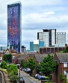
 Altitude 25, Croydon, 15 Oct 2021.jpg 3,024 × 4,032; 1.52 MB
-
 Ashleigh Addiscombe Road.JPG 2,768 × 1,992; 1.39 MB
-
 Community Centre in Westow Street - geograph.org.uk - 1118144.jpg 640 × 480; 114 KB
-
 Coulsdon, Methodist Sunday school, Windermere Road - geograph.org.uk - 1731145.jpg 2,632 × 1,724; 4.65 MB
-
 Coulsdon, Surrey Garage - geograph.org.uk - 1778868.jpg 3,456 × 2,304; 3.42 MB
-
 Courts, Barclay Road (1) (geograph 6091345).jpg 640 × 499; 134 KB
-
 Cricket Pavilion, Trinity School - geograph.org.uk - 2449683.jpg 640 × 430; 56 KB
-
 Croydon and District Masonic Hall - geograph.org.uk - 1223238.jpg 640 × 480; 59 KB
-

-
 Croydon skyline 15.02.2022 (11).jpg 3,456 × 2,592; 1.95 MB
-
 Croydon Tower Block - geograph.org.uk - 825221.jpg 640 × 480; 64 KB
-
 Croydon Visitor Centre - geograph.org.uk - 1628886.jpg 640 × 480; 70 KB
-
 Croydon, Commercial House - geograph.org.uk - 1775818.jpg 3,264 × 2,448; 4.22 MB
-
 Croydon, Corner of Wellesley Road and George Street - geograph.org.uk - 1777290.jpg 3,264 × 2,448; 4.07 MB
-

-
 Davis House, Robert Street (geograph 2632202).jpg 392 × 640; 157 KB
-
 Day Aggregates recycling plant, Purley - geograph.org.uk - 1723262.jpg 640 × 480; 114 KB
-
 Gate lodge, Whitgift School - geograph.org.uk - 2153107.jpg 640 × 430; 121 KB
-
 Gate Lodge, Whitgift School - geograph.org.uk - 2164887.jpg 640 × 430; 156 KB
-
 Gate Lodge, Whitgift School - geograph.org.uk - 2706150.jpg 640 × 430; 94 KB
-
 Geoffrey Harris House, Croydon - geograph.org.uk - 38303.jpg 640 × 430; 76 KB
-
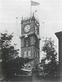 Gillett & Johnston tower.jpg 418 × 555; 103 KB
-
 HM Land Registry - Trafalgar House.jpg 768 × 1,024; 235 KB
-
 Lodge To Combe House Q26351523.jpg 1,822 × 2,429; 3 MB
-
 Lord Roberts.jpg 3,024 × 4,032; 4.59 MB
-
 Monks Orchard Lodge.jpeg 640 × 468; 193 KB
-
 NHS Croydon GP-led Health Centre.jpg 2,520 × 3,776; 3.23 MB
-
 Norbury Function Rooms - geograph.org.uk - 1640109.jpg 640 × 480; 78 KB
-
 Norfolk House, Croydon - geograph.org.uk - 1629685.jpg 640 × 480; 91 KB
-
 Offices, High Street - geograph.org.uk - 1775462.jpg 640 × 477; 123 KB
-
 Park Hill 13.02.2022 (3).jpg 3,456 × 2,592; 1.96 MB
-
 Purley grid substation - geograph.org.uk - 1314695.jpg 640 × 480; 132 KB
-
 Purley View Nursing Home - geograph.org.uk - 932392.jpg 640 × 427; 64 KB
-
 Resources Centre - geograph.org.uk - 1215643.jpg 640 × 480; 90 KB
-

-
 Saffron Square Tower, Croydon, London (cropped).jpg 213 × 362; 129 KB
-
 Saffron Square Tower, Croydon, London.jpg 452 × 554; 437 KB
-
 Samuel Coleridge Taylor youth centre - geograph.org.uk - 970325.jpg 640 × 480; 118 KB
-
-
 St Paul's Hall, Norfolk Road - geograph.org.uk - 1450634.jpg 640 × 480; 124 KB
-
 The Forge, Addington Village Road, CR0 - geograph.org.uk - 59708.jpg 640 × 597; 77 KB
-
 The Forum,Forestdale.jpg 2,016 × 1,512; 1.16 MB
-
 Valley Leisure Park.JPG 768 × 1,024; 130 KB
-
 View on Landsdowne road - panoramio.jpg 2,448 × 3,264; 3.54 MB
-
 Waddon Pumping Station - geograph.org.uk - 452319.jpg 640 × 400; 56 KB
-
 Westow Street Community Centre, SE19 - geograph.org.uk - 50986.jpg 640 × 573; 132 KB
-
 Whitgift School; view from main entrance April 2020.jpg 2,554 × 1,913; 1.63 MB
-

-
 Zodiac Court, London Road, Croydon - geograph.org.uk - 939551.jpg 640 × 480; 58 KB
.jpg)

.jpg)
.jpg)


_(geograph_6091345).jpg)


.jpg)


.jpg)


.jpg)


.jpg)


_-_geograph.org.uk_-_1112681.jpg)


