Category:Buildings in Hertfordshire photographed in 2009
Jump to navigation
Jump to search
Ceremonial counties of England: Bedfordshire · Berkshire · Buckinghamshire · Cambridgeshire · Cheshire · Cornwall · Cumbria · Derbyshire · Devon · Dorset · East Sussex · Essex · Greater London · Greater Manchester · Hampshire · Hertfordshire · Isle of Wight · Kent · Lincolnshire · Norfolk · North Yorkshire · Northamptonshire · Oxfordshire · Shropshire · Somerset · South Yorkshire · Suffolk · Surrey · Warwickshire · West Midlands · West Sussex · West Yorkshire · Wiltshire · Worcestershire
City-counties:
Former historic counties:
Other former counties:
City-counties:
Former historic counties:
Other former counties:
Subcategories
This category has only the following subcategory.
Media in category "Buildings in Hertfordshire photographed in 2009"
The following 200 files are in this category, out of 208 total.
(previous page) (next page)-

-

-

-
 'The White Horse' inn - geograph.org.uk - 1214476.jpg 640 × 480; 64 KB
-
 'The Old Bell' inn on Bell Street - geograph.org.uk - 1347633.jpg 640 × 480; 74 KB
-
 StAlbansRailStation-PS01.JPG 3,264 × 2,448; 2.18 MB
-
 Watford Junction Station geograph-4057487-by-Ben-Brooksbank.jpg 2,168 × 1,494; 3.73 MB
-

-
 Akeman Street, Tring - geograph.org.uk - 1603977.jpg 640 × 509; 87 KB
-
 Apsley End - St Mary's.jpg 3,213 × 4,283; 8.41 MB
-
 Ashwell Museum on Swan Street - geograph.org.uk - 1246806.jpg 640 × 480; 59 KB
-

-
-

-

-
 Aylesbury Arm, Lock No 7 - geograph.org.uk - 1443001.jpg 640 × 480; 59 KB
-

-
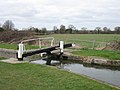
 Aylesbury Arm, Wilstone Lock (No 8) - geograph.org.uk - 1442999.jpg 640 × 480; 77 KB
-

-
 Banyers Hotel - geograph.org.uk - 1480890.jpg 640 × 455; 187 KB
-
 Berkhamsted High Street - geograph.org.uk - 1310961.jpg 640 × 480; 82 KB
-
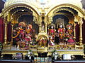
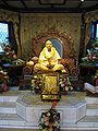
 Bhaktivedanta Manor - 01.JPG 2,304 × 1,728; 1.01 MB
-
 Bhaktivedanta Manor - 02.JPG 2,304 × 1,728; 1.05 MB
-
 Bhaktivedanta Manor - 03.JPG 2,304 × 1,728; 1.05 MB
-
 Bhaktivedanta Manor - 04.JPG 1,728 × 2,304; 791 KB
-
 Bhaktivedanta Manor - 05.JPG 2,304 × 1,728; 1.03 MB
-
 Bhaktivedanta Manor - 12.JPG 2,304 × 1,728; 1.02 MB
-
 Bhaktivedanta Manor - 18.JPG 2,304 × 1,728; 1.02 MB
-
 Bhaktivedanta Manor - 19.JPG 2,304 × 1,728; 1 MB
-
 Bhaktivedanta Manor - 20.JPG 2,304 × 1,728; 1.01 MB
-
 Bhaktivedanta Manor - 21.JPG 2,304 × 1,728; 1.01 MB
-
 Bhaktivedanta Manor - 22.JPG 2,304 × 1,728; 1.03 MB
-
 Bhaktivedanta Manor - 26.JPG 2,304 × 1,728; 1.04 MB
-
 Bhaktivedanta Manor - 27.JPG 2,304 × 1,728; 1.02 MB
-
 Bhaktivedanta Manor - 28.JPG 2,304 × 1,728; 1.03 MB
-
 Bhaktivedanta Manor - 30.JPG 1,253 × 934; 462 KB
-
 Bhaktivedanta Manor - 31.JPG 2,304 × 1,728; 1.02 MB
-
 Bhaktivedanta Manor - 32.JPG 2,304 × 1,728; 1.02 MB
-
 Bhaktivedanta Manor - 33.JPG 1,728 × 2,304; 926 KB
-
 Bricket Wood stn building.JPG 1,600 × 1,200; 559 KB
-
 Bricket Wood stn entrance.JPG 1,600 × 1,200; 561 KB
-
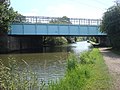 Bridge 170A, Grand Union Canal - geograph.org.uk - 1397461.jpg 640 × 480; 96 KB
-
 Bridge 170A, Grand Union Canal - geograph.org.uk - 1397469.jpg 640 × 480; 89 KB
-

-
 The 'Bridge House' - geograph.org.uk - 1547262.jpg 640 × 480; 75 KB
-
 Bridge Motors - geograph.org.uk - 1392968.jpg 640 × 480; 84 KB
-
 Bridge Motors - geograph.org.uk - 1395198.jpg 640 × 480; 78 KB
-

-

-
 Butty and bridge 170B - geograph.org.uk - 1392963.jpg 640 × 480; 97 KB
-
 Car wash on Berkhamsted High Street - geograph.org.uk - 1450311.jpg 640 × 484; 125 KB
-
 Co-operative Store, Silk Mill, Tring - geograph.org.uk - 1602804.jpg 640 × 480; 126 KB
-
 Coffee Stand and Cab Office at Tring Station, Aldbury - geograph.org.uk - 1318032.jpg 2,100 × 1,575; 615 KB
-
 Common Moor Lock - geograph.org.uk - 1397350.jpg 640 × 480; 90 KB
-

-
-

-
 Costa Coffee, Tring High Street - geograph.org.uk - 1603935.jpg 640 × 476; 130 KB
-
 Cottage - geograph.org.uk - 1262552.jpg 640 × 359; 70 KB
-
 Cottages on Beanfield Road - geograph.org.uk - 1212830.jpg 640 × 442; 64 KB
-
 Croxley Green Post Office - geograph.org.uk - 1397254.jpg 640 × 480; 100 KB
-
 Croxley tube station 011.jpg 2,736 × 3,648; 4.19 MB
-
 The 'Dolphin', Hertford - geograph.org.uk - 1547235.jpg 640 × 480; 71 KB
-

-
 Empty bedroom (4103505582).jpg 3,472 × 2,604; 1.29 MB
-
 Entrance to Tring Memorial Park - geograph.org.uk - 1514803.jpg 640 × 480; 123 KB
-
 Entrance to Tring Recycling Centre - geograph.org.uk - 1403089.jpg 640 × 467; 103 KB
-
 Exit from Tring Recycling Centre - geograph.org.uk - 1405735.jpg 640 × 480; 54 KB
-
 Frogmore, St Albans AL2, UK - panoramio - Jason Puddephatt.jpg 640 × 424; 150 KB
-

-
 StMaryMagdalenechurch.JPG 5,834 × 3,219; 2.36 MB
-
 Green Dragon pub - geograph.org.uk - 1166306.jpg 640 × 480; 98 KB
-
 Grove Bridge - panoramio.jpg 3,447 × 2,058; 1.27 MB
-
 St John's Church - geograph.org.uk - 1457914.jpg 640 × 480; 88 KB
-
 Hatfield House - geograph.org.uk - 1423574.jpg 640 × 480; 89 KB
-
 Hertford East station concourse geograph-3672436-by-Ben-Brooksbank.jpg 2,390 × 1,323; 3.31 MB
-
 Hertford East station, 2009 geograph-3672426-by-Ben-Brooksbank.jpg 2,315 × 1,436; 3.28 MB
-
 High Street, Tring - geograph.org.uk - 1484358.jpg 640 × 470; 63 KB
-

-
 House at Tring - geograph.org.uk - 1482203.jpg 640 × 532; 118 KB
-
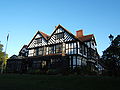
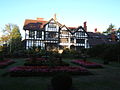
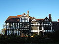
 Hunsdon House - geograph 1445429.jpg 640 × 480; 144 KB
-
 Keepers Cottage, Near Hastoe, Tring - geograph.org.uk - 1201366.jpg 640 × 480; 99 KB
-
 Kings Langley railway station (geograph 3379450).jpg 1,024 × 724; 225 KB
-
 Kings Langley, The Rose and Crown - geograph.org.uk - 1336474.jpg 640 × 480; 104 KB
-
 Lych Gate and Yew Tunnel, Wilstone Cemetery - geograph.org.uk - 1217365.jpg 2,448 × 3,264; 4.02 MB
-
 Moor Park Station - geograph.org.uk - 1592078.jpg 640 × 480; 81 KB
-
 Mutton Lane Cemetery - geograph.org.uk - 1263850.jpg 426 × 640; 214 KB
-
 Nash Mill Church of England Primary School original building.jpg 2,592 × 1,944; 672 KB
-
 New Age shop and Healing centre, St Albans, Hertfordshire.jpg 1,600 × 1,200; 364 KB
-
 Norcott Court - geograph.org.uk - 1762260.jpg 604 × 404; 83 KB
-

-
 Old Cottages, Ayot St Lawrence - geograph.org.uk - 1257233.jpg 640 × 480; 97 KB
-
 'The Orange Tree' public house - geograph.org.uk - 1282248.jpg 640 × 439; 62 KB
-

-
 Pelham Substation - geograph.org.uk - 1413789.jpg 640 × 428; 99 KB
-
 Rickmansworth station 137.jpg 3,648 × 2,736; 3.39 MB
-
 Rickmansworth Tesco - geograph.org.uk - 1392973.jpg 640 × 480; 76 KB
-
 Rotating Writing House, Shaw's Corner - geograph.org.uk - 1257237.jpg 640 × 480; 120 KB
-
 Royal Hotel, Tring Station - geograph.org.uk - 1581961.jpg 640 × 480; 108 KB
-
 Royal Hotel, Tring Station - geograph.org.uk - 1581964.jpg 494 × 640; 63 KB
-
 Royal Hotel, Tring Station - geograph.org.uk - 1581965.jpg 480 × 640; 91 KB
-
 Royal Hotel, Tring Station - geograph.org.uk - 1581966.jpg 640 × 486; 79 KB
-
 Royal Hotel, Tring Station - geograph.org.uk - 1581967.jpg 640 × 480; 90 KB
-
 Royal Hotel, Tring Station - geograph.org.uk - 1581968.jpg 482 × 640; 95 KB
-
 Royal Hotel, Tring Station - geograph.org.uk - 1581969.jpg 640 × 523; 142 KB
-
 Royal Hotel, Tring Station - geograph.org.uk - 1581970.jpg 480 × 640; 78 KB
-
 Royal Hotel, Tring Station - geograph.org.uk - 1581971.jpg 480 × 640; 90 KB
-

-
 Sopwell Nunnery Ruins - geograph.org.uk - 1479898.jpg 640 × 480; 78 KB
-
 St Albans Abbey Station - geograph.org.uk - 1552231.jpg 640 × 428; 83 KB
-
 St Albans Clock Tower.jpg 1,900 × 3,349; 4.18 MB
-
 St Albans signal box.jpg 1,944 × 1,296; 998 KB
-
 St Albans, St Michael's Street - geograph.org.uk - 1347118.jpg 640 × 480; 75 KB
-
 St Albans, The Black Lion Inn - geograph.org.uk - 1347037.jpg 640 × 480; 83 KB
-
 St Albans, The Verulam Arms - geograph.org.uk - 1330238.jpg 640 × 480; 71 KB
-

-
 St Cross, Wilstone - The West End - geograph.org.uk - 1235869.jpg 480 × 640; 225 KB
-
 St Cross, Wilstone, from the East - geograph.org.uk - 1235872.jpg 480 × 640; 210 KB
-
 St James, Stanstead Abbotts - north side - geograph.org.uk - 1447154.jpg 640 × 480; 148 KB
-
 St Mary's Parish Church, Standon - geograph.org.uk - 1485432.jpg 480 × 640; 76 KB
-
 St Thomas, Northaw - lych gate - geograph.org.uk - 1330854.jpg 640 × 480; 130 KB
-
 St. Mary, the parish church of Meesden - geograph.org.uk - 1300456.jpg 640 × 480; 122 KB
-
 StAlbansClockTower-PS01.JPG 2,448 × 3,264; 2.13 MB
-
 StAlbansPub-PS01.JPG 3,264 × 2,448; 2.43 MB
-
 Stream - The Waffle House, Kingsbury Watermill.jpg 4,288 × 2,848; 6.95 MB
-
 Terraced Cottages, Aldbury - geograph.org.uk - 1578652.jpg 640 × 480; 136 KB
-
 Terraced Cottages, Aldbury - geograph.org.uk - 1578656.jpg 640 × 480; 112 KB
-
 Terraced Houses, Aldbury - geograph.org.uk - 1577997.jpg 640 × 480; 125 KB
-
 Terraced Houses, Aldbury - geograph.org.uk - 1578615.jpg 640 × 474; 70 KB
-
 The 'Lord Haig', Hertford - geograph.org.uk - 1547241.jpg 640 × 480; 68 KB
-
 The Almshouses, Hitchin - geograph.org.uk - 1356499.jpg 640 × 427; 321 KB
-
 The Feathers - geograph.org.uk - 1395131.jpg 640 × 480; 50 KB
-

-

-
-
 The Holiday Inn, Borehamwood - geograph.org.uk - 1520677.jpg 640 × 480; 63 KB
-
 The Natural History Museum at Tring - geograph.org.uk - 1483625.jpg 640 × 480; 72 KB
-

-
 The Old Forge, Wilstone - geograph.org.uk - 1228236.jpg 640 × 480; 74 KB
-
 The Pennsylvanian - geograph.org.uk - 1395620.jpg 480 × 640; 78 KB
-

-

-
 The Red House - geograph.org.uk - 1392950.jpg 640 × 480; 82 KB
-

-

-
 Ticket Office at Tring Station, Aldbury - geograph.org.uk - 1318021.jpg 2,592 × 1,944; 2.04 MB
-
 Tring Fire Station - geograph.org.uk - 1601043.jpg 640 × 480; 97 KB
-
 Tring Fire Station - geograph.org.uk - 1601059.jpg 640 × 491; 93 KB
-
 Tring School - geograph.org.uk - 1576856.jpg 640 × 486; 125 KB
-
 Tring School - geograph.org.uk - 1576857.jpg 640 × 480; 186 KB
-
 Typical 1930s suburban houses - geograph.org.uk - 1174258.jpg 640 × 480; 72 KB
-

-
 Vestry Hall, Church Yard, Tring - geograph.org.uk - 1596900.jpg 480 × 640; 107 KB
-
 Victorian Brickwork, Station Road, Tring - geograph.org.uk - 1554788.jpg 640 × 480; 183 KB
-
 Victorian Villa, Station Road, Tring - geograph.org.uk - 1554810.jpg 640 × 470; 160 KB
-
 Victorian Villas, Station Road, Tring - geograph.org.uk - 1554790.jpg 480 × 640; 203 KB
-
 Victorian Villas, Station Road, Tring - geograph.org.uk - 1554805.jpg 640 × 480; 156 KB
-
 View towards St Albans Cathedral - geograph.org.uk - 1318302.jpg 640 × 480; 85 KB
-
 Walter Rothschild Museum, Park Street - geograph.org.uk - 1210592.jpg 640 × 480; 176 KB
-

-
-
 Plaque on Eleanor Cross, Waltham Cross - geograph.org.uk - 1202072.jpg 640 × 492; 124 KB
-
 War Memorial - geograph.org.uk - 1566790.jpg 640 × 480; 84 KB
-
 Ware Station geograph-4053091-by-Ben-Brooksbank.jpg 2,237 × 1,420; 2.36 MB
-
 Watford High Street station geograph-4057474-by-Ben-Brooksbank.jpg 2,392 × 1,460; 3.68 MB
-
 Watford High Street stn signage.JPG 1,600 × 1,200; 637 KB
-
 Watford Junction stn bay platform 10 look north.JPG 1,600 × 1,200; 631 KB
-
 Watford Junction stn bay platform 10 look south.JPG 1,569 × 1,162; 668 KB
-
 Watford Junction stn entrance.JPG 1,600 × 1,200; 498 KB
-
 Watford Junction stn entrance2.JPG 1,600 × 1,200; 499 KB
-
 Watford Junction stn fast mainline platforms look north.JPG 1,600 × 1,200; 456 KB
-
 Watford Junction stn fast mainline platforms look north2.JPG 1,600 × 1,200; 420 KB
-
 Watford Junction stn fast mainline platforms look south.JPG 1,600 × 1,200; 632 KB
-
 Watford Junction stn fast mainline platforms look south2.JPG 1,600 × 1,200; 636 KB
-
 Watford Junction stn mainline signage.JPG 1,600 × 1,200; 204 KB
-
 Watford Junction stn Overground platform 1 look south.JPG 1,600 × 1,200; 410 KB
-
 Watford Junction stn Overground platform 2 look north.JPG 1,600 × 1,200; 484 KB
-
 Watford Junction stn Overground platform 2 look south.JPG 1,600 × 1,200; 637 KB
-
 Watford Junction stn Overground platform 2 look south2.JPG 1,600 × 1,200; 634 KB
-
 Watford Junction stn Overground platform 3 look north.JPG 1,600 × 1,200; 629 KB
-
 Watford Junction stn Overground platform 3 look north2.JPG 1,600 × 1,200; 438 KB
-
 Watford Junction stn Overground platform 3 look south.JPG 1,600 × 1,200; 396 KB
-
 Watford Junction stn Overground platform 4 look north with unit 508302.JPG 1,600 × 1,200; 608 KB
-
 Watford Junction stn Overground platform 4 look south.JPG 1,600 × 1,200; 628 KB
-
 Watford Junction stn Overground platform 4 look south2.JPG 1,600 × 1,200; 618 KB
-
 Watford Junction stn Overground signage.JPG 1,600 × 1,200; 610 KB
-
 Watford Junction stn platform 11 look north.JPG 1,600 × 1,200; 627 KB
-
 Watford Junction stn platform 11 look north2.JPG 1,600 × 1,200; 607 KB
-
 Watford Junction stn platform 11 look south.JPG 1,600 × 1,200; 433 KB
-
 Watford Junction stn platform 11 look south2.JPG 1,600 × 1,200; 396 KB
-
 Watford Junction stn slow mainline platforms look north.JPG 1,600 × 1,200; 467 KB
-
 Watford Junction stn slow mainline platforms look north2.JPG 1,600 × 1,200; 626 KB
-
 Watford Junction stn slow mainline platforms look north3.JPG 1,600 × 1,200; 623 KB
-
 Watford Junction stn slow mainline platforms look south.JPG 1,600 × 1,200; 480 KB
-
 Watford Junction stn slow mainline platforms look south2.JPG 1,600 × 1,200; 462 KB
-
 Watford Junction stn slow mainline platforms look south3.JPG 1,600 × 1,200; 619 KB
-
 Watford North stn entrance.JPG 1,600 × 1,200; 537 KB
-
 Watford North stn entrance2.JPG 1,600 × 1,200; 495 KB
-
 Watford North stn level crossing look northwest closed.JPG 1,600 × 1,200; 607 KB
-
 Watford North stn level crossing look northwest.JPG 1,600 × 1,200; 631 KB


_-_geograph.org.uk_-_1228951.jpg)
_-_geograph.org.uk_-_1235879.jpg)
_-_geograph.org.uk_-_1442993.jpg)
_-_geograph.org.uk_-_1442994.jpg)

_-_geograph.org.uk_-_1442998.jpg)
_-_geograph.org.uk_-_1442999.jpg)
_-_geograph.org.uk_-_1442995.jpg)


.jpg)


.jpg)


.jpg)