Category:Buildings in County Kilkenny
Jump to navigation
Jump to search
Subcategories
This category has the following 25 subcategories, out of 25 total.
B
C
- Conahy Parochial House (2 F)
- Cottages in County Kilkenny (4 F)
F
G
H
- Hebron House (4 F)
K
N
- New Building (Kilkenny) (5 F)
P
R
S
- Shee's Almshouse (empty)
T
- The Auld House, Killamery (3 F)
W
Media in category "Buildings in County Kilkenny"
The following 44 files are in this category, out of 44 total.
-
 1parked bike (8129566244) (2).jpg 1,962 × 3,163; 9.15 MB
-
 1staircase (8129563470) (2).jpg 2,112 × 3,168; 11.68 MB
-
 3empower (8129557844).jpg 1,857 × 1,346; 4.01 MB
-
 Abandoned house Kells.jpg 4,032 × 2,016; 2.99 MB
-
 Art alley (8180268362).jpg 1,935 × 2,752; 5.74 MB
-
 Bank limited (8180264934).jpg 2,112 × 3,168; 5.18 MB
-
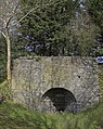
 Buildings and Bend - geograph.org.uk - 1324222.jpg 600 × 450; 314 KB
-

-
 Cave Bar - geograph.org.uk - 897838.jpg 640 × 426; 75 KB
-
 Dining rooms (8180252014).jpg 3,063 × 1,866; 5.62 MB
-
 Filling station near Newrath - geograph.org.uk - 1478706.jpg 640 × 480; 62 KB
-
 GardaStnBennetsbridge059-1.jpg 3,888 × 2,592; 1.79 MB
-
 Gate (8129496171).jpg 2,112 × 3,168; 8.37 MB
-
 Glassed in (8129518538).jpg 2,112 × 3,168; 8.09 MB
-
 Grain Store - geograph.org.uk - 558304.jpg 640 × 427; 64 KB
-
 Grass (8125284409) (2).jpg 2,100 × 2,702; 6.61 MB
-
 Green Scenery at Rathlogan - panoramio.jpg 4,320 × 3,240; 2.66 MB
-
 Hay shed - geograph.org.uk - 669503.jpg 640 × 427; 95 KB
-
 Hay shed - geograph.org.uk - 735751.jpg 640 × 426; 51 KB
-
 Hebron House door.png 1,600 × 3,200; 7.91 MB
-
 Hebron House from Nortwest.png 3,000 × 1,500; 5.26 MB
-
 Hebron House Western approach.png 3,000 × 1,500; 8.98 MB
-
 Ladbrokes (8133794819).jpg 1,743 × 1,543; 3.35 MB
-
 Limekiln - geograph.org.uk - 513044.jpg 393 × 494; 154 KB
-
 Mill on the King's River, Kells - geograph.org.uk - 1391838.jpg 640 × 430; 352 KB
-
 New Building.png 3,000 × 3,000; 10.78 MB
-
 Old chimney stack - geograph.org.uk - 940161.jpg 640 × 480; 31 KB
-
 Old Toll House, Fiddown (geograph 5651984).jpg 640 × 480; 71 KB
-
 Outbuildings at Shankill Castle.png 1,280 × 959; 2.24 MB
-
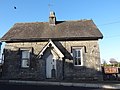
 Police station - geograph.org.uk - 544827.jpg 640 × 480; 57 KB
-
 Red windows (8180211606).jpg 1,938 × 2,939; 5.11 MB
-
 Renovated Mill - geograph.org.uk - 1762744.jpg 600 × 419; 108 KB
-
 Sign at Step House.jpg 4,032 × 2,016; 3.42 MB
-
 Slated cottage Ballygorey.png 3,000 × 1,500; 5.69 MB
-
 Soirts bar (8133788631).jpg 2,112 × 2,395; 6.21 MB
-
 Step House, Ballyragget.jpg 4,032 × 2,016; 2.44 MB
-
 Stone and bikes (8125264795) (2).jpg 3,168 × 2,112; 8.12 MB
-
 The Grove Dungarvan.png 4,032 × 2,016; 9.13 MB
-
 The Grove house Dungarvan.png 1,592 × 3,001; 6.67 MB
-
 Ullard House.png 3,000 × 1,657; 7.61 MB
-
 Uncle sams Irish fast food (8125255555) (2).jpg 3,126 × 1,804; 5.13 MB
-
 White strucco (8133813504).jpg 2,112 × 1,408; 4.24 MB
-
 Gate and Lodge - geograph.org.uk - 1426531.jpg 640 × 360; 81 KB
-
 Ruined cottage - geograph.org.uk - 490743.jpg 600 × 399; 205 KB
_(2).jpg)
_(2).jpg)
.jpg)

.jpg)
.jpg)


.jpg)


.jpg)
.jpg)

_(2).jpg)


.jpg)


.jpg)


.jpg)


.jpg)

_(2).jpg)


_(2).jpg)
.jpg)

