Category:Bude–Stratton
Jump to navigation
Jump to search
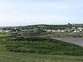
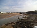
English: Bude-Stratton is a coastal civil parish with a town council in Cornwall, England, United Kingdom. According to the 2001 census it had a population of 9,242.
civil parish in Cornwall, England, UK | |||||
| Upload media | |||||
| Instance of | |||||
|---|---|---|---|---|---|
| Location | Cornwall, South West England, England | ||||
| Area |
| ||||
 | |||||
Subcategories
This category has the following 13 subcategories, out of 13 total.
B
- Bude Light 2000 (5 F)
C
- Crooklets Beach, Bude (17 F)
F
L
- Lower Longbeak, Cornwall (11 F)
- Lynstone (1 F)
N
- River Neet (15 F)
- Northcott, Cornwall (1 F)
P
S
- Summerleaze Beach, Bude (45 F)
Media in category "Bude–Stratton"
The following 200 files are in this category, out of 559 total.
(previous page) (next page)-
 'Tommy's Pit' - geograph.org.uk - 3668371.jpg 640 × 480; 80 KB
-
 10-12 Lansdown Road - geograph.org.uk - 5611454.jpg 1,000 × 662; 566 KB
-
 14-18 Lansdown Road - geograph.org.uk - 5611455.jpg 1,000 × 662; 513 KB
-
 4-5 The Strand - geograph.org.uk - 5611356.jpg 1,000 × 662; 579 KB
-
 4-8 Lansdown Road - geograph.org.uk - 5611456.jpg 1,000 × 662; 585 KB
-
 6 Granville Terrace - geograph.org.uk - 5610491.jpg 1,000 × 745; 794 KB
-
 A better view at high tide - geograph.org.uk - 1979550.jpg 640 × 422; 82 KB
-
 A photo-shoot on the rocks at Bude Haven's breakwater - geograph.org.uk - 4720812.jpg 3,980 × 2,974; 4.42 MB
-
 A plethora of poles - geograph.org.uk - 4141113.jpg 1,024 × 712; 151 KB
-
 A prime location - geograph.org.uk - 4276577.jpg 1,600 × 1,063; 372 KB
-
 A seat by the path and road at Upton - geograph.org.uk - 4917274.jpg 1,600 × 1,200; 316 KB
-
 A view into Lower Pound Lock - geograph.org.uk - 5577731.jpg 1,714 × 2,285; 1.28 MB
-
 A view of Bude from Wroes restaurant - geograph.org.uk - 5694338.jpg 3,455 × 1,962; 4.39 MB
-
 A3072 approaching Stratton - geograph.org.uk - 2889797.jpg 2,256 × 1,496; 892 KB
-
 A3072 at Brooks Garden Centre - geograph.org.uk - 5390069.jpg 2,751 × 1,827; 946 KB
-
 A3072 at Stratton View Business Park - geograph.org.uk - 5390080.jpg 3,057 × 1,456; 763 KB
-
 A3073 heading into Bude - geograph.org.uk - 3303070.jpg 640 × 480; 71 KB
-
 A39 Stratton Road - geograph.org.uk - 5390766.jpg 2,992 × 1,635; 1.14 MB
-
 A39, Stratton - geograph.org.uk - 5390598.jpg 3,052 × 1,859; 1.11 MB
-
 A39, Stratton - geograph.org.uk - 5390617.jpg 3,072 × 1,827; 1,012 KB
-
 Above Higher Northcott - geograph.org.uk - 3304700.jpg 640 × 480; 86 KB
-
 Access to Crooklets Beach - geograph.org.uk - 4276572.jpg 1,600 × 1,063; 379 KB
-
 Across Crooklets beach to Wrangle Point - geograph.org.uk - 2472714.jpg 640 × 563; 102 KB
-

-
 Age Concern charity shop, 25 Queen St, Bude - geograph.org.uk - 4185270.jpg 2,904 × 2,178; 3.01 MB
-

-
 At least it's not a tractor - geograph.org.uk - 4119871.jpg 1,600 × 1,044; 314 KB
-
 At the top of Stone Hill - geograph.org.uk - 5642781.jpg 1,306 × 979; 697 KB
-
 Back Lane in Flexbury - geograph.org.uk - 5607864.jpg 640 × 427; 192 KB
-
 Barclays Bank - geograph.org.uk - 5611347.jpg 1,000 × 662; 654 KB
-
 Barn conversions at Crockwood Farm - geograph.org.uk - 5631275.jpg 1,142 × 857; 464 KB
-
 Barn on the road from Poughill to Northcott Mouth - geograph.org.uk - 4918735.jpg 1,600 × 1,067; 183 KB
-
 Barns at Higher Northcott - geograph.org.uk - 5633002.jpg 1,306 × 979; 417 KB
-
 Beach at Northcott Mouth.jpg 4,176 × 2,848; 5.77 MB
-
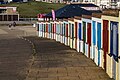
 Beach huts - Crooklets Beach - geograph.org.uk - 4276573.jpg 1,600 × 1,063; 344 KB
-
 Beach Huts at Crooklets Beach - geograph.org.uk - 4870189.jpg 1,024 × 683; 255 KB
-
 Beach huts behind Crooklets Beach - geograph.org.uk - 3137914.jpg 480 × 640; 68 KB
-
 Beach huts on Crooklets beach - geograph.org.uk - 5512983.jpg 480 × 640; 64 KB
-

-
 Bee on thistle, Upton Park - geograph.org.uk - 6190512.jpg 1,073 × 1,153; 133 KB
-
 Bench with a view, near Upton - geograph.org.uk - 5323085.jpg 3,642 × 2,731; 3.25 MB
-
 Benchend in St Olaf's church, Poughill - geograph.org.uk - 4920869.jpg 1,200 × 1,600; 376 KB
-
 Bencoolen Road - geograph.org.uk - 5601561.jpg 1,000 × 662; 589 KB
-
 Between the Maer Cliff beaches - geograph.org.uk - 5631862.jpg 1,795 × 1,346; 401 KB
-
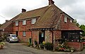 Beulah B and B, near Poughill - geograph.org.uk - 5075209.jpg 1,024 × 661; 171 KB
-
 Bird hide and pathside sculpture, Bude Canal - geograph.org.uk - 4918473.jpg 1,600 × 1,200; 621 KB
-
 Boats at Bude Haven at low tide - geograph.org.uk - 3668380.jpg 640 × 480; 70 KB
-
 Boats on the Beach, Bude Haven - geograph.org.uk - 4043327.jpg 1,024 × 698; 140 KB
-
 Boats ^ the mouth of the R Neet, Bude - geograph.org.uk - 3760681.jpg 1,024 × 768; 148 KB
-
 Breaking waves at Compass Point - geograph.org.uk - 2756569.jpg 1,024 × 676; 159 KB
-
 Breakwater at Bude Haven - geograph.org.uk - 5323071.jpg 4,000 × 3,000; 2.9 MB
-
 Breakwater at Bude Haven - geograph.org.uk - 5323073.jpg 4,000 × 3,000; 3.09 MB
-
 Bridge over Bude Canal near Rodd's Bridge - geograph.org.uk - 4918497.jpg 1,600 × 1,200; 523 KB
-
 Bridge over the River Neet - geograph.org.uk - 5642789.jpg 1,469 × 1,102; 934 KB
-
 Bridleway by the A3072 - geograph.org.uk - 5390045.jpg 3,072 × 2,048; 1.4 MB
-
 Bridleway gate near Higher Northcott - geograph.org.uk - 5632994.jpg 979 × 1,306; 535 KB
-
 Bridleway heading to A39 - geograph.org.uk - 3303057.jpg 640 × 480; 88 KB
-
 Bridleway near Higher Northcott - geograph.org.uk - 5632996.jpg 979 × 1,306; 510 KB
-
 Bridleway south of Crockwood - geograph.org.uk - 5631270.jpg 1,142 × 857; 621 KB
-
 Bridleway to Mayfield - geograph.org.uk - 3304734.jpg 640 × 480; 103 KB
-
 Bridleway to Tiscott - geograph.org.uk - 5633000.jpg 1,306 × 979; 599 KB
-
 British Red Cross charity shop, 14 Queen Street, Bude - geograph.org.uk - 4185259.jpg 3,224 × 2,418; 3.38 MB
-
 Broadclose Park - geograph.org.uk - 3304815.jpg 640 × 480; 64 KB
-
 Bude , Animals in Need - geograph.org.uk - 2512424.jpg 2,848 × 4,288; 5.47 MB
-
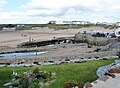
 Bude , Bude Beach - geograph.org.uk - 2512376.jpg 4,244 × 2,780; 4.54 MB
-
 Bude , Bude Canal - geograph.org.uk - 2512359.jpg 4,288 × 2,848; 5.02 MB
-
 Bude , Bude Canal - geograph.org.uk - 2512430.jpg 4,288 × 2,848; 5.46 MB
-
 Bude , Bude Canal Lock - geograph.org.uk - 2512377.jpg 2,820 × 4,270; 4.78 MB
-
 Bude , Bude Canal Paddleboat - geograph.org.uk - 2512432.jpg 4,282 × 2,840; 4.47 MB
-
 Bude , Bude Canal ^ Buildings - geograph.org.uk - 2512380.jpg 4,282 × 2,840; 4.04 MB
-
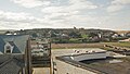
 Bude , Coastal Town - geograph.org.uk - 2512340.jpg 4,198 × 2,704; 4.17 MB
-
 Bude , Ergue-Gaberic Way - geograph.org.uk - 2512350.jpg 4,286 × 2,846; 4.98 MB
-
 Bude , Esso Petrol Station - geograph.org.uk - 2512434.jpg 4,260 × 2,804; 4.73 MB
-
 Bude , Fishing on Bude Canal - geograph.org.uk - 2512365.jpg 4,262 × 2,810; 5.85 MB
-
 Bude , Morrisons ^ Car - geograph.org.uk - 2512435.jpg 4,150 × 2,624; 3.26 MB
-
 Bude , Park ^ Bandstand - geograph.org.uk - 2512404.jpg 4,276 × 2,830; 6.74 MB
-
 Bude , River Neet ^ Bridge - geograph.org.uk - 2512425.jpg 4,286 × 2,844; 4.49 MB
-
 Bude , Sandy Beach - geograph.org.uk - 2512388.jpg 4,270 × 2,820; 4.02 MB
-
 Bude , Sandy Beach ^ Dunes - geograph.org.uk - 2512392.jpg 4,242 × 2,776; 4.36 MB
-
 Bude , The River Neet - geograph.org.uk - 2512372.jpg 4,282 × 2,840; 5.32 MB
-
 Bude , The River Neet - geograph.org.uk - 2512391.jpg 4,288 × 2,848; 5.14 MB
-
 Bude , The River Neet - geograph.org.uk - 2512420.jpg 4,282 × 2,838; 4.88 MB
-
 Bude , The River Neet - geograph.org.uk - 2512421.jpg 4,288 × 2,848; 5.3 MB
-
 Bude , The River Neet - geograph.org.uk - 2512423.jpg 4,240 × 2,774; 4.53 MB
-
 Bude , The River Neet - geograph.org.uk - 2512428.jpg 4,288 × 2,848; 4.93 MB
-
 Bude - Calm Day - geograph.org.uk - 2816407.jpg 640 × 419; 76 KB
-
 Bude - geograph.org.uk - 4151475.jpg 2,048 × 1,330; 1.54 MB
-
 Bude and its southern beach - geograph.org.uk - 4918190.jpg 1,600 × 1,200; 313 KB
-
 Bude and North Cornwall Golf Club - geograph.org.uk - 5647434.jpg 640 × 427; 202 KB
-
 Bude and Strattan Cornwall England.jpg 1,080 × 850; 185 KB
-
 Bude Beach - geograph.org.uk - 4956172.jpg 3,888 × 2,592; 4.4 MB
-
 Bude beach and coastline to the north - geograph.org.uk - 6260968.jpg 1,600 × 1,200; 570 KB
-
 Bude beach, retaining wall of pool and cliffs - geograph.org.uk - 6260964.jpg 1,600 × 1,200; 706 KB
-
 Bude Bench - geograph.org.uk - 4193394.jpg 800 × 600; 89 KB
-
 Bude Boats - geograph.org.uk - 4760042.jpg 800 × 600; 93 KB
-
 Bude Breakwater - geograph.org.uk - 3668359.jpg 480 × 640; 86 KB
-
 Bude Breakwater - geograph.org.uk - 4760030.jpg 800 × 600; 92 KB
-
 Bude breakwater - geograph.org.uk - 4918194.jpg 1,600 × 1,200; 370 KB
-
 Bude bridge replacement scheme - geograph.org.uk - 3396919.jpg 1,023 × 755; 135 KB
-

-
 Bude Canal - geograph.org.uk - 2675663.jpg 640 × 480; 146 KB
-
 Bude Canal - geograph.org.uk - 2963396.jpg 640 × 480; 64 KB
-
 Bude Canal - geograph.org.uk - 2963398.jpg 640 × 480; 54 KB
-
 Bude Canal - geograph.org.uk - 3302124.jpg 640 × 480; 75 KB
-
 Bude Canal - geograph.org.uk - 3395500.jpg 1,089 × 775; 125 KB
-
 Bude Canal - geograph.org.uk - 5609465.jpg 1,000 × 662; 632 KB
-
 Bude canal and castle - geograph.org.uk - 4918218.jpg 1,600 × 1,200; 284 KB
-
 Bude canal and one of the chain sculptures - geograph.org.uk - 4918227.jpg 1,600 × 1,200; 395 KB
-
 Bude Canal and sea lock - geograph.org.uk - 5680329.jpg 1,600 × 1,055; 442 KB
-
 Bude canal basin - geograph.org.uk - 4918220.jpg 1,600 × 1,200; 244 KB
-
 Bude Canal, Bude Cornwall - geograph.org.uk - 4719560.jpg 4,000 × 3,000; 4.29 MB
-
 Bude Castle - geograph.org.uk - 1829302.jpg 640 × 480; 94 KB
-
 Bude Castle - geograph.org.uk - 5610325.jpg 1,000 × 662; 604 KB
-
 Bude Cricket Club - geograph.org.uk - 3201935.jpg 1,600 × 1,200; 249 KB
-
 Bude Cricket Club - Pavilion - geograph.org.uk - 3201930.jpg 1,600 × 1,200; 196 KB
-
 Bude Harbour - geograph.org.uk - 2424810.jpg 640 × 480; 59 KB
-
 Bude Harbour - geograph.org.uk - 2963391.jpg 640 × 480; 68 KB
-
 Bude Haven - geograph.org.uk - 5609487.jpg 1,000 × 662; 645 KB
-
 Bude Haven - geograph.org.uk - 5610234.jpg 1,000 × 662; 654 KB
-
 Bude Haven - geograph.org.uk - 5610292.jpg 1,000 × 662; 524 KB
-
 Bude Haven - geograph.org.uk - 6236385.jpg 5,472 × 3,648; 3.4 MB
-
 Bude Haven - geograph.org.uk - 6260961.jpg 1,600 × 1,200; 749 KB
-
 Bude Haven and bay - geograph.org.uk - 1979464.jpg 640 × 423; 60 KB
-
 Bude Haven and Efford Cottage, Bude, Cornwall - geograph.org.uk - 4720868.jpg 3,960 × 2,946; 4.17 MB
-
 Bude Haven and surrounding area viewed from Wroes restaurant - geograph.org.uk - 5694349.jpg 4,000 × 3,000; 5.29 MB
-

-
 Bude Haven from Chapel Rock - geograph.org.uk - 3111870.jpg 800 × 533; 341 KB
-
 Bude Haven, Bude, Cornwall - geograph.org.uk - 4719583.jpg 4,000 × 3,000; 4.67 MB
-
 Bude looking south - geograph.org.uk - 2424830.jpg 640 × 480; 68 KB
-
 Bude Methodist Church (geograph 7117503).jpg 1,024 × 683; 666 KB
-
 Bude pool, seen from the coast path - geograph.org.uk - 5547033.jpg 640 × 480; 141 KB
-
 Bude Post Office - geograph.org.uk - 5611462.jpg 1,000 × 662; 475 KB
-
 Bude Post Office - geograph.org.uk - 5632939.jpg 1,591 × 2,122; 839 KB
-
 Bude Scene - geograph.org.uk - 4760028.jpg 800 × 600; 78 KB
-
 Bude Sea Pool - geograph.org.uk - 2756550.jpg 3,815 × 2,509; 2.28 MB
-
 Bude Sea Pool - geograph.org.uk - 5610269.jpg 1,000 × 662; 615 KB
-
 Bude sea pool and beach at low tide - geograph.org.uk - 5547028.jpg 1,600 × 571; 104 KB
-
 Bude seawater swimming pool - geograph.org.uk - 6261034.jpg 1,600 × 1,200; 956 KB
-
 Bude seawater swimming pool and associated cabins - geograph.org.uk - 6261039.jpg 1,600 × 1,200; 755 KB
-
 Bude Station site - geograph.org.uk - 1961560.jpg 640 × 425; 65 KB
-
 Bude station site plaque - geograph.org.uk - 1961549.jpg 447 × 640; 27 KB
-
 Bude swimming pool - geograph.org.uk - 5631262.jpg 1,469 × 1,102; 521 KB
-
 Bude View - geograph.org.uk - 4760036.jpg 800 × 600; 83 KB
-
 Budehaven Community School - geograph.org.uk - 5390742.jpg 3,068 × 1,571; 873 KB
-
 Budeiful Brides - geograph.org.uk - 5610512.jpg 662 × 1,000; 529 KB
-
 Built for the view - geograph.org.uk - 4276583.jpg 1,600 × 1,063; 410 KB
-
 Bus shelter inbound to Bude along Stratton Road - geograph.org.uk - 6260943.jpg 1,600 × 1,198; 550 KB
-
 Bus shelter, Poughill - geograph.org.uk - 4918729.jpg 1,600 × 1,201; 392 KB
-
 Business site by A39 north of Stratton - geograph.org.uk - 4917097.jpg 1,600 × 1,200; 333 KB
-
 Canada goose nesting, Bude Canal nature reserve - geograph.org.uk - 4918252.jpg 1,600 × 1,200; 726 KB
-
 Canal towpath near to Lynstone - geograph.org.uk - 5578588.jpg 1,306 × 979; 441 KB
-
 Canal towpath northeast of Lynstone - geograph.org.uk - 5578589.jpg 1,306 × 979; 615 KB
-

-
 Car Park at Bude - geograph.org.uk - 5582285.jpg 640 × 427; 157 KB
-
 Car park for swimming pool, Bude - geograph.org.uk - 4918693.jpg 1,600 × 802; 155 KB
-
 Carpark at the Morrison's supermarket in Stratton - geograph.org.uk - 5631261.jpg 1,469 × 1,102; 350 KB
-
 Cemetery, Bude - geograph.org.uk - 1328354.jpg 640 × 483; 153 KB
-
 Channel marker at Bude Haven - geograph.org.uk - 3668384.jpg 480 × 640; 67 KB
-
 Cheaper parking this side - geograph.org.uk - 4276575.jpg 1,600 × 1,063; 377 KB
-
 Church House, Poughill - geograph.org.uk - 5633019.jpg 2,448 × 1,836; 1.67 MB
-
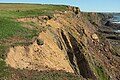 Cliff erosion, Efford Down - geograph.org.uk - 6190809.jpg 4,288 × 2,848; 2.8 MB
-
 Cliff scenery on Efford Beacon - geograph.org.uk - 5578843.jpg 1,102 × 1,469; 678 KB
-
 Cliff, Upton - geograph.org.uk - 6190830.jpg 1,813 × 2,659; 760 KB
-
 Cliffs - geograph.org.uk - 253177.jpg 640 × 426; 47 KB
-
 Cliffs and rocks at Upton, south of Bude - geograph.org.uk - 4917258.jpg 1,600 × 1,200; 284 KB
-
 Cliffs at Maer Down - geograph.org.uk - 4920834.jpg 1,600 × 1,200; 266 KB
-
 Cliffs at Maer Down - geograph.org.uk - 5579703.jpg 1,795 × 1,346; 757 KB
-
 Cliffs, Efford Down - geograph.org.uk - 6190705.jpg 1,832 × 3,051; 1.01 MB
-
 Cliffs, Efford Down - geograph.org.uk - 6190709.jpg 3,264 × 1,832; 1.37 MB
-
 Cliffs, Upton - geograph.org.uk - 6190907.jpg 3,264 × 1,832; 1.44 MB
-
 Cliffs, Upton - geograph.org.uk - 6190966.jpg 4,288 × 2,848; 1.56 MB
-
 Close-up of the trig beacon details - geograph.org.uk - 5547043.jpg 640 × 480; 232 KB
-
 Coach Rock - geograph.org.uk - 3668378.jpg 640 × 480; 70 KB
-
 Coast path at Upton, looking south - geograph.org.uk - 5547052.jpg 640 × 480; 148 KB
-

-
 Coast path, with Upton in the distance - geograph.org.uk - 5547055.jpg 640 × 480; 188 KB
-
 Coastal Path behind houses in Upton - geograph.org.uk - 5579669.jpg 1,142 × 857; 336 KB
-

-
 Coastline at Efford Down - geograph.org.uk - 5323082.jpg 3,387 × 2,540; 2.49 MB
-
 Coastline at Efford Down - geograph.org.uk - 5323083.jpg 4,000 × 3,000; 3.84 MB
-
 Compass Beacon - geograph.org.uk - 3111926.jpg 533 × 800; 280 KB
-
 Compass Point - geograph.org.uk - 3302159.jpg 640 × 480; 86 KB
-
-
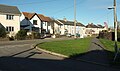
 Construction of new housing estate, Bude - geograph.org.uk - 4918701.jpg 1,600 × 1,200; 191 KB
-
 Cormorant below Efford Cliffs - geograph.org.uk - 6190721.jpg 951 × 678; 144 KB
-

-
 Cornish coast between Bude and Widemouth Bay - geograph.org.uk - 5323086.jpg 4,000 × 3,000; 4.79 MB
-
 Cornwall Hospice Care charity shop, 33 Queen Street, Bude - geograph.org.uk - 4185279.jpg 3,648 × 2,736; 4.28 MB
-
 Cornwall ^ Devon Air Ambulance - geograph.org.uk - 2401369.jpg 2,048 × 1,536; 1.21 MB
-
 Cornwall ^ Devon Air Ambulance - geograph.org.uk - 2401398.jpg 2,048 × 1,536; 2 MB
-
 Cot Hill in Stratton - geograph.org.uk - 5547012.jpg 640 × 480; 160 KB
-
 Cottages at Helebridge - geograph.org.uk - 2963416.jpg 640 × 480; 115 KB
-
 Cottages in Poughill - geograph.org.uk - 5641616.jpg 2,448 × 1,836; 1.07 MB
-
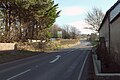
 Country lane near Stratton - geograph.org.uk - 2889706.jpg 2,256 × 1,496; 810 KB
-
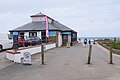
 Crooklets Beach - geograph.org.uk - 3304485.jpg 640 × 480; 85 KB
-
 Crooklets Beach - geograph.org.uk - 3395475.jpg 992 × 724; 141 KB
-
 Crooklets Beach - geograph.org.uk - 4439943.jpg 640 × 430; 91 KB
-
 Crooklets Beach - geograph.org.uk - 4920769.jpg 1,600 × 1,200; 236 KB
-
 Crooklets Beach - geograph.org.uk - 6236400.jpg 5,472 × 3,648; 3.46 MB
-
 Crooklets Beach - north of Bude - geograph.org.uk - 4119823.jpg 4,912 × 3,264; 5.63 MB


.jpg)


