Category:Buckland Common
Jump to navigation
Jump to search
hamlet in Buckinghamshire, England, UK  | |||||
| Upload media | |||||
| Instance of | |||||
|---|---|---|---|---|---|
| Location | Cholesbury-cum-St Leonards, Buckinghamshire, South East England, England | ||||
| official website | |||||
 | |||||
Buckland Common is a in Buckinghamshire, England. It is located in the , 4 miles (6.4 km) east of and the same distance south of Tring in Hertfordshire with which it shares a boundary. The northern end of the settlement is delineated by a short section of Grim's Ditch.
Media in category "Buckland Common"
The following 17 files are in this category, out of 17 total.
-

-
 Autumn in Widow Croft (geograph 2699250).jpg 2,202 × 1,440; 1.43 MB
-
 Barn with old signs, Buckland Common - geograph.org.uk - 90207.jpg 640 × 480; 81 KB
-
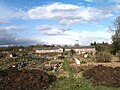 Buckland Common Allottments 2009.jpg 800 × 600; 94 KB
-
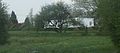 Buckland Common Buckinghamshire.jpg 330 × 146; 31 KB
-
 Buckland Wood by Leyland's Farm - geograph.org.uk - 89825.jpg 640 × 480; 166 KB
-
 Chiltern Way - geograph.org.uk - 1566000.jpg 640 × 480; 116 KB
-
 Chiltern Way - geograph.org.uk - 1566034.jpg 640 × 480; 141 KB
-
 Entrance to Dundridge Manor (North Gate) - geograph.org.uk - 1185782.jpg 480 × 640; 193 KB
-
 Entrance to Dundridge Manor (West Gate) - geograph.org.uk - 1185786.jpg 640 × 465; 194 KB
-
 GOC Cholesbury to Chartridge 036 White Lion pub, Buckland Common (30831355408).jpg 3,651 × 2,736; 3.04 MB
-

-
 Oak Lane past Widow Croft - geograph.org.uk - 1185768.jpg 640 × 502; 176 KB
-

-

-
 Widow Croft, Oak Lane, near Brazier's End - geograph.org.uk - 106785.jpg 471 × 640; 160 KB
-
 Curved Wall, Longcroft - geograph.org.uk - 464245.jpg 480 × 640; 224 KB

.jpg)


_-_geograph.org.uk_-_1185782.jpg)
_-_geograph.org.uk_-_1185786.jpg)
.jpg)


