Category:Bruff
Jump to navigation
Jump to search
English: Bruff (Brú na nDeise in Irish) is a town in east County Limerick, in the midwest of Ireland, located on the old Limerick–Cork road (R512). The town lies on the Morning Star river, with two bridges in the town itself. The area around Bruff is quite scenic, and the horse-shoe lake of Lough Gur is nearby.
Gaeilge: Paróiste agus baile is ea an Brú. Is mó a thugann Gaeilgeoirí na háite Brú na nDéise mar ainm orthu araon. Bruff atá ag lucht an Bhéarla ar an áit.
Svenska: Bruff ( iriska: An Brú) är ett litet samhälle i den östra delen av grevskapet Limerick i den västcentrala delen av Irland, belägen på den gamla vägen mellan Limerick och Cork (R512).
town in Munster, Ireland  | |||||
| Upload media | |||||
| Instance of | |||||
|---|---|---|---|---|---|
| Location | County Limerick, Munster, Ireland | ||||
| official website | |||||
 | |||||
Media in category "Bruff"
The following 12 files are in this category, out of 12 total.
-
 Baggotstown House, Bruff.jpg 3,960 × 2,177; 3.42 MB
-

-
 Bruff RFC Crest.png 500 × 555; 207 KB
-
-
 Geroid Island, Lough Gur - geograph.org.uk - 464879.jpg 640 × 334; 47 KB
-
 Memorial, Bruff, Co. Limerick - geograph.org.uk - 1386757.jpg 465 × 640; 80 KB
-
 New housing, Bruff, Co. Limerick - geograph.org.uk - 1386749.jpg 640 × 466; 94 KB
-
 Old Limekiln - geograph.org.uk - 441785.jpg 480 × 640; 417 KB
-
 The Morningstar - geograph.org.uk - 3685935.jpg 1,024 × 768; 275 KB
-
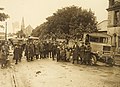
 Troop roll call in Limerick during Irish Civil War (5976742263).jpg 2,000 × 1,364; 890 KB
-
 Wall art, Bruff, Co. Limerick - geograph.org.uk - 1386755.jpg 640 × 481; 93 KB
-
 Late Bronze Age Enclosure, Knockadoon - geograph.org.uk - 463069.jpg 640 × 386; 110 KB


.jpg)


.jpg)

