Category:Brotherton
Jump to navigation
Jump to search
village and civil parish in the Selby district of North Yorkshire, England  | |||||
| Upload media | |||||
| Instance of | |||||
|---|---|---|---|---|---|
| Location | Selby, North Yorkshire, Yorkshire and the Humber, England | ||||
 | |||||
English: Brotherton is a village and civil parish in the Selby district of North Yorkshire, England. According to the 2001 census it had a population of 672. The village is on the border with the City of Wakefield and West Yorkshire (here formed by the River Aire). Brotherton was on the A1 road two miles north of Knottingley, before the road was relocated. It is now on the A162, north of Ferrybridge, south of Fairburn. Brotherton is often mistaken as being located in West Yorkshire; it is a North Yorkshire village.
Subcategories
This category has the following 6 subcategories, out of 6 total.
A
- A162 bridge, Ferrybridge (25 F)
B
- Brotherton railway bridge (14 F)
- Brotherton War Memorial (1 F)
J
- John Carr's bridge, Ferrybridge (32 F)
S
Media in category "Brotherton"
The following 200 files are in this category, out of 209 total.
(previous page) (next page)-

-
 A footpath goes over the A1 at Botherton - geograph.org.uk - 2550823.jpg 800 × 600; 263 KB
-
 A snowy A1 Motorway at Fairburn - geograph.org.uk - 3305881.jpg 3,338 × 2,281; 1.87 MB
-
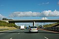 A1(M) - A1246 bridge - geograph.org.uk - 2646524.jpg 640 × 428; 67 KB
-
 A1(M) near Fairburn - geograph.org.uk - 4382502.jpg 640 × 428; 73 KB
-
 A1(M) northbound - geograph.org.uk - 4827816.jpg 640 × 428; 85 KB
-
 A1(M) river bridge - geograph.org.uk - 5652127.jpg 4,608 × 3,456; 3.85 MB
-
 A1(M), Brotherton Ings - geograph.org.uk - 4806183.jpg 640 × 426; 27 KB
-
 A1(M), northbound - geograph.org.uk - 4793127.jpg 640 × 426; 30 KB
-
 A1246 - geograph.org.uk - 271388.jpg 640 × 480; 74 KB
-
 A1246 bridge over the A1(M) - geograph.org.uk - 2515418.jpg 640 × 430; 36 KB
-
 A1246 Bridge, A1(M) - geograph.org.uk - 4806182.jpg 640 × 339; 22 KB
-
 A1M Motorway at Fairburn. - geograph.org.uk - 2799419.jpg 3,184 × 2,187; 1.16 MB
-
 Aire View - Low Street - geograph.org.uk - 3629632.jpg 640 × 480; 111 KB
-
 All's quiet on the power front - geograph.org.uk - 5652087.jpg 4,608 × 3,456; 2.4 MB
-
 Arch detail - geograph.org.uk - 1106959.jpg 480 × 640; 113 KB
-
 Barge lifter - geograph.org.uk - 5652107.jpg 4,608 × 3,456; 3.6 MB
-
 Barge lifter - geograph.org.uk - 5656871.jpg 4,608 × 3,456; 3.63 MB
-
 Belmont - Old Great North Road - geograph.org.uk - 3629570.jpg 640 × 480; 85 KB
-
 Beware of overhead power lines - geograph.org.uk - 6017586.jpg 3,468 × 2,147; 1.36 MB
-
 Bridge and Church, Brotherton - geograph.org.uk - 5271917.jpg 640 × 480; 79 KB
-

-

-

-
 Bridge SMJ 2-8 - Low Street - geograph.org.uk - 3629488.jpg 640 × 447; 63 KB
-
 Brotherton Bound - geograph.org.uk - 5656902.jpg 4,608 × 3,456; 3.55 MB
-
 Brotherton Cemetery - off Church Street - geograph.org.uk - 3629470.jpg 640 × 480; 106 KB
-
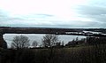
 Brotherton from the bank of the River Aire - geograph.org.uk - 3617505.jpg 1,024 × 768; 202 KB
-

-
 Brotherton graveyard - geograph.org.uk - 3357104.jpg 640 × 427; 141 KB
-
 Brotherton graveyard - geograph.org.uk - 3357108.jpg 640 × 427; 140 KB
-
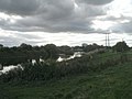
 Brotherton Ings - geograph.org.uk - 271384.jpg 640 × 480; 73 KB
-
 Brotherton Ings - geograph.org.uk - 284643.jpg 640 × 480; 91 KB
-
 Brotherton pylon - geograph.org.uk - 1090004.jpg 640 × 461; 45 KB
-
 Brotherton Quarries - geograph.org.uk - 1106867.jpg 480 × 640; 70 KB
-
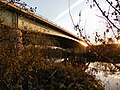
 Brotherton Railway Bridge - geograph.org.uk - 2694925.jpg 1,600 × 1,045; 233 KB
-
 Brotherton Railway Bridge - geograph.org.uk - 2795002.jpg 4,068 × 2,908; 1.69 MB
-
 Brotherton railway bridge - geograph.org.uk - 5652090.jpg 4,187 × 2,737; 2.56 MB
-
 Brotherton Railway Line. - geograph.org.uk - 2767944.jpg 1,864 × 2,323; 852 KB
-
 Brotherton Tunnel - geograph.org.uk - 3357115.jpg 640 × 427; 121 KB
-

-
 Brotherton War memorial - geograph.org.uk - 5652102.jpg 4,608 × 3,456; 4.18 MB
-
 Bus stop on the A162 near Brotherton - geograph.org.uk - 956923.jpg 640 × 372; 55 KB
-
 Caution Work in Progress - geograph.org.uk - 2783490.jpg 1,760 × 1,168; 368 KB
-
 Cemetery footbridge - geograph.org.uk - 3357111.jpg 640 × 427; 148 KB
-
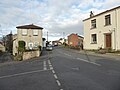 Church Street, Brotherton - geograph.org.uk - 5220869.jpg 640 × 480; 56 KB
-
 Construction of new A1246 road bridge at Fairburn - geograph.org.uk - 2783504.jpg 1,168 × 1,760; 459 KB
-
 Dale Stone Place - High Street - geograph.org.uk - 3629552.jpg 640 × 480; 68 KB
-
 Derelict building, Brotherton - geograph.org.uk - 5220856.jpg 480 × 640; 150 KB
-
 Digging up the A1 at Fairburn - geograph.org.uk - 764957.jpg 640 × 425; 69 KB
-

-

-
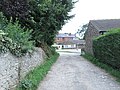
 Entrance to Public Footpath - geograph.org.uk - 895398.jpg 640 × 480; 141 KB
-
 Fairburn and Railway - geograph.org.uk - 1524859.jpg 480 × 640; 84 KB
-
 Fairburn Ings RSPB nature reserve - geograph.org.uk - 2402905.jpg 1,600 × 949; 335 KB
-
 Fairburn Ings RSPB nature reserve - geograph.org.uk - 5664769.jpg 4,608 × 3,456; 4.45 MB
-
 Fairburn Railway Line and Ings - geograph.org.uk - 2799413.jpg 2,979 × 3,459; 2.18 MB
-
 Fairybridge (sic) Alley from the North - geograph.org.uk - 58781.jpg 640 × 480; 117 KB
-
 Fenced Public Footpath - geograph.org.uk - 895405.jpg 640 × 480; 121 KB
-
 Ferry Bridge - geograph.org.uk - 3354876.jpg 640 × 427; 94 KB
-
 Ferrybridge "A" generating hall - geograph.org.uk - 6017582.jpg 4,608 × 3,072; 3.73 MB
-
 Ferrybridge A station turbine house - geograph.org.uk - 5664744.jpg 4,608 × 3,456; 3.65 MB
-
 Ferrybridge and power station - geograph.org.uk - 5220874.jpg 640 × 480; 79 KB
-
 Ferrybridge at sunset - geograph.org.uk - 5652095.jpg 4,608 × 3,456; 1.53 MB
-
 Ferrybridge Lock - geograph.org.uk - 303130.jpg 640 × 480; 75 KB
-
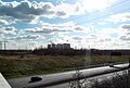
 Ferrybridge Power Station - geograph.org.uk - 3405426.jpg 3,628 × 2,721; 2.54 MB
-
 Ferrybridge Power Station Train - geograph.org.uk - 2794983.jpg 4,288 × 3,216; 2.28 MB
-
 Ferrybridge turbine hall - geograph.org.uk - 5652078.jpg 4,608 × 3,456; 3.13 MB
-
 Ferrybridge"C" power station (disused) and the river Aire - geograph.org.uk - 6057156.jpg 3,324 × 2,216; 1.42 MB
-
 Fly-ash lagoon discharge - geograph.org.uk - 3405446.jpg 4,288 × 3,216; 3.86 MB
-
 Fly-ash removal - geograph.org.uk - 2767955.jpg 3,425 × 2,479; 1.44 MB
-
 Fly-ash removal at Ferrybridge power station - geograph.org.uk - 3405466.jpg 3,164 × 2,373; 1.49 MB
-
 Footbridge over the A1246 at Brotherton - geograph.org.uk - 3306604.jpg 4,288 × 3,216; 2.59 MB
-
 Footpath - Church Street to School Croft - geograph.org.uk - 3629401.jpg 480 × 640; 104 KB
-
 Footpath - Hall Court - geograph.org.uk - 3629533.jpg 480 × 640; 82 KB
-
 Footpath - High Street - geograph.org.uk - 3629560.jpg 640 × 480; 87 KB
-
 Footpath - Low Street - geograph.org.uk - 3629491.jpg 480 × 640; 133 KB
-
 Footpath - near Footbridge - geograph.org.uk - 3629461.jpg 640 × 480; 120 KB
-
 Footpath - near Footbridge - geograph.org.uk - 3629466.jpg 640 × 480; 150 KB
-
 Footpath - Old Great North Road - geograph.org.uk - 3629590.jpg 480 × 640; 118 KB
-
 Former School - School Croft - geograph.org.uk - 3629397.jpg 640 × 480; 77 KB
-
 Foxcliff - geograph.org.uk - 2397151.jpg 1,600 × 1,200; 254 KB
-
 Gated entrance to Brotherton Quarry - geograph.org.uk - 2022306.jpg 640 × 480; 77 KB
-
 Gauk Street - Church Street - geograph.org.uk - 3629538.jpg 640 × 480; 54 KB
-
 Gauk Street - Old Great North Road - geograph.org.uk - 3629363.jpg 640 × 480; 65 KB
-
 Great North Road Bridge, A1(M) - geograph.org.uk - 3035187.jpg 640 × 360; 34 KB
-
 Greystones Lodge - Church Street - geograph.org.uk - 3629508.jpg 640 × 480; 76 KB
-
 Hall Court - Church Street - geograph.org.uk - 3629510.jpg 640 × 480; 75 KB
-
 Hanover Place - High Street - geograph.org.uk - 3629550.jpg 640 × 480; 77 KB
-

-

-
 High Street, Brotherton - geograph.org.uk - 5220840.jpg 640 × 480; 69 KB
-
 Houses in Hall Court, Brotherton - geograph.org.uk - 4557812.jpg 1,024 × 768; 131 KB
-
 Hydro electric plant - geograph.org.uk - 5653129.jpg 4,608 × 3,456; 4.06 MB
-

-
 Kings Mills from downstream of the weir - geograph.org.uk - 2767895.jpg 2,492 × 3,129; 1.31 MB
-
 Knottingley weir Fishing pond - geograph.org.uk - 2767860.jpg 3,443 × 2,860; 1.5 MB
-
 Lining up for a fish supper - geograph.org.uk - 5647261.jpg 4,278 × 2,570; 2.37 MB
-
 Lone Tree - geograph.org.uk - 395171.jpg 640 × 480; 100 KB
-
 Looking directly into the sun - geograph.org.uk - 6017611.jpg 4,608 × 3,072; 5.54 MB
-
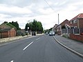
 Looking south along the A162 - geograph.org.uk - 2555647.jpg 800 × 600; 185 KB
-
 Looking upstream to Brotherton railway bridge - geograph.org.uk - 3640378.jpg 4,288 × 3,216; 2.87 MB
-

-

-

-
 Making ripples - geograph.org.uk - 2694966.jpg 1,600 × 1,049; 244 KB
-
 Marsh Croft - Low Street - geograph.org.uk - 3629635.jpg 640 × 480; 87 KB
-
 Marsh Drain - geograph.org.uk - 553499.jpg 640 × 480; 124 KB
-
 Moto cross track, Jawbone Quarry - geograph.org.uk - 2397147.jpg 1,600 × 1,200; 574 KB
-
 Motorway road Building at Fairburn - geograph.org.uk - 2783470.jpg 1,760 × 1,168; 587 KB
-
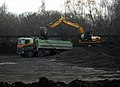
 Moving the Muck. Construction of the new Motorway - geograph.org.uk - 2783506.jpg 1,760 × 1,168; 206 KB
-
 Narrow boat at Ferrybridge - geograph.org.uk - 5650344.jpg 3,891 × 2,745; 3.21 MB
-
 Narrow boat leaving Brotherton - geograph.org.uk - 5650342.jpg 3,398 × 2,475; 1.52 MB
-
 Narrowboat "Milly Molly Mandy" - geograph.org.uk - 2694943.jpg 1,600 × 1,047; 399 KB
-
 Near Burton Salmon - geograph.org.uk - 2917948.jpg 640 × 354; 20 KB
-
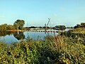
 New Motorway Bridge 2005 - geograph.org.uk - 2783482.jpg 1,760 × 1,168; 300 KB
-
 New Motorway Bridge over River Aire at Fairburn - geograph.org.uk - 2785858.jpg 1,760 × 1,168; 366 KB
-
 Newly erected communications mast - geograph.org.uk - 2694952.jpg 1,176 × 1,600; 266 KB
-
 Norfolk Close - High Street - geograph.org.uk - 3629547.jpg 640 × 480; 60 KB
-
 Old and new at Ferrybridge - geograph.org.uk - 579148.jpg 640 × 403; 100 KB
-
 Old and new at Ferrybridge - geograph.org.uk - 579159.jpg 630 × 416; 74 KB
-
 Old and new at Ferrybridge - geograph.org.uk - 579162.jpg 636 × 418; 109 KB
-

-

-
 Old Milestone by Church Street, Brotherton Parish (geograph 6045173).jpg 480 × 640; 348 KB
-

-
 Old Quarry - geograph.org.uk - 1106981.jpg 640 × 480; 115 KB
-
 Once the A1 now a quiet road - geograph.org.uk - 2005325.jpg 640 × 427; 69 KB
-
 Outfall, River Aire, Brotherton Ings - geograph.org.uk - 4580268.jpg 1,024 × 768; 167 KB
-
 Past Reflections - geograph.org.uk - 6017600.jpg 4,608 × 3,072; 4.04 MB
-
 Peugeot repair centre - geograph.org.uk - 5220052.jpg 640 × 480; 81 KB
-
 Playing Fields - School Croft - geograph.org.uk - 3629390.jpg 640 × 480; 86 KB
-
 Power Lines over the fields - geograph.org.uk - 553523.jpg 640 × 480; 73 KB
-
 Power poles and Pylons - geograph.org.uk - 6017593.jpg 2,674 × 3,910; 2.17 MB
-
 Power silhouette - geograph.org.uk - 6017613.jpg 4,608 × 3,072; 2.56 MB
-
 Power station stockpile part 2 - geograph.org.uk - 2794991.jpg 2,435 × 2,803; 1,015 KB
-

-

-
 Pump station on stilts - geograph.org.uk - 686478.jpg 640 × 427; 64 KB
-

-

-
 Quarry Arch - geograph.org.uk - 1147350.jpg 480 × 640; 151 KB
-
 Quarry face - geograph.org.uk - 1106879.jpg 640 × 480; 99 KB
-
 Quarry Walls - geograph.org.uk - 1147358.jpg 480 × 640; 69 KB
-
 Rail bridge at Brotherton - geograph.org.uk - 5220049.jpg 640 × 480; 77 KB
-
 Ramsden Close - Church Street - geograph.org.uk - 3629536.jpg 640 × 480; 83 KB
-
 Redundant Power Station - geograph.org.uk - 5647114.jpg 4,121 × 2,584; 2.56 MB
-
 Removing the old A1 road at Fairburn - geograph.org.uk - 2783441.jpg 1,760 × 1,168; 530 KB
-
 River Aire - geograph.org.uk - 3357074.jpg 640 × 427; 63 KB
-
-
 River Aire downstream at Brotherton - geograph.org.uk - 775701.jpg 640 × 480; 52 KB
-
 River Aire near Brotherton Marsh - geograph.org.uk - 3173616.jpg 2,048 × 1,536; 525 KB
-
 Riverside view towards Brotherton - geograph.org.uk - 4667695.jpg 640 × 427; 82 KB
-
 RSPB Nature Reserve Fairburn Ings - geograph.org.uk - 2780635.jpg 3,543 × 2,105; 1.04 MB
-
 School Croft - Old Great North Road - geograph.org.uk - 3629387.jpg 640 × 480; 78 KB
-
 Temporary Motorway at Fairburn 2005 - geograph.org.uk - 2783417.jpg 1,760 × 1,168; 323 KB
-
 Thaal Indian Restaurant - geograph.org.uk - 5336587.jpg 800 × 600; 112 KB
-
 The A1 at Fairburn - geograph.org.uk - 2550815.jpg 800 × 600; 223 KB
-
 The A1 at the Brotherton turn off - geograph.org.uk - 2550819.jpg 800 × 624; 229 KB
-
 The A1's at Fairburn - geograph.org.uk - 5655587.jpg 2,968 × 2,012; 1.13 MB
-
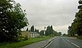
 The A1, north of Brotherton - geograph.org.uk - 2550817.jpg 800 × 600; 187 KB
-
 The Aire and Calder Navigation Canal at Ferrybridge - geograph.org.uk - 3739006.jpg 3,648 × 2,736; 3.73 MB
-

-
 The boom for Knottingley weir. - geograph.org.uk - 579176.jpg 626 × 408; 71 KB
-
 The boundary between West and North Yorkshire - geograph.org.uk - 4580258.jpg 1,024 × 768; 147 KB
-
 The bridge over the old A1 trunkroad - geograph.org.uk - 553602.jpg 640 × 480; 67 KB
-
 The dinner queue - geograph.org.uk - 5653141.jpg 2,708 × 1,858; 1.59 MB
-

-
 The Great North Road at Brotherton. - geograph.org.uk - 579158.jpg 640 × 427; 91 KB
-
 The Great North Road bridge at Ferrybridge - geograph.org.uk - 5656865.jpg 4,608 × 3,456; 3.68 MB
-
 The New A1 Bridge over the River Aire - geograph.org.uk - 895417.jpg 640 × 480; 52 KB
-
 The New A1 Crossing the River Aire - geograph.org.uk - 895420.jpg 640 × 480; 47 KB
-
 The Old A1 near Ferrybridge - geograph.org.uk - 956841.jpg 640 × 243; 28 KB
-
 The Old A1, Ferrybridge Bypass - geograph.org.uk - 2555635.jpg 800 × 600; 195 KB
-
 The old Brotherton School - geograph.org.uk - 553612.jpg 640 × 480; 84 KB
-
 The Old Generating Hall - geograph.org.uk - 2694933.jpg 1,600 × 1,108; 275 KB
-

-
 The old road bridge at Ferrybridge - geograph.org.uk - 1286111.jpg 640 × 427; 82 KB
-
 The railway bridge at Brotherton - geograph.org.uk - 3617502.jpg 1,024 × 768; 182 KB
-
 The Rise - Low Street - geograph.org.uk - 3629486.jpg 640 × 480; 108 KB
-
 The River Aire - geograph.org.uk - 1286124.jpg 640 × 427; 62 KB
-
 The River Aire and Ferrybridge Power Station - geograph.org.uk - 3640371.jpg 4,288 × 3,216; 1.9 MB
-
 The river Aire at Fairburn - geograph.org.uk - 5652132.jpg 4,608 × 3,456; 3.69 MB
-
 The river Aire at Ferrybridge - geograph.org.uk - 5652080.jpg 3,906 × 2,689; 1.8 MB
-
 The River Aire towards Ferrybridge - geograph.org.uk - 4120398.jpg 1,600 × 1,064; 551 KB
-
 The River Aire upstream (north) of Ferry Bridge - geograph.org.uk - 4557762.jpg 1,024 × 768; 119 KB
-

-
 The Thaal Indian Restaurant - geograph.org.uk - 553592.jpg 640 × 480; 95 KB
-
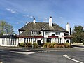
 The Three Horse Shoes public house Brotherton - geograph.org.uk - 3305888.jpg 3,569 × 2,647; 2.08 MB
-
 The Three Horse Shoes, Brotherton - geograph.org.uk - 895427.jpg 640 × 480; 55 KB
-
 The three towers and Ferrybridge flood lock - geograph.org.uk - 6304146.jpg 4,288 × 3,216; 1.7 MB
-

-
 This way to the soup kitchen^ - geograph.org.uk - 3738999.jpg 3,648 × 2,736; 3.5 MB
-
 Topping up the Stockpile - geograph.org.uk - 2794970.jpg 2,600 × 1,733; 625 KB
-
 Transport, old and the new - geograph.org.uk - 764920.jpg 640 × 384; 75 KB
-
 Tree planting on the new Motorway at Fairburn - geograph.org.uk - 2783464.jpg 1,760 × 1,168; 451 KB
-
 Two Clubhouses - geograph.org.uk - 553579.jpg 640 × 480; 100 KB
-
 Vehicle storage compound - geograph.org.uk - 956917.jpg 640 × 343; 53 KB
-
 Vicars Croft - Old Great North Road - geograph.org.uk - 3629371.jpg 640 × 480; 66 KB
-
 Vicars Mews - Old Great North Road - geograph.org.uk - 3629370.jpg 640 × 480; 81 KB


_-_A1246_bridge_-_geograph.org.uk_-_2646524.jpg)
_near_Fairburn_-_geograph.org.uk_-_4382502.jpg)
_northbound_-_geograph.org.uk_-_4827816.jpg)
_river_bridge_-_geograph.org.uk_-_5652127.jpg)
,_Brotherton_Ings_-_geograph.org.uk_-_4806183.jpg)
,_northbound_-_geograph.org.uk_-_4793127.jpg)

_-_geograph.org.uk_-_2515418.jpg)
_-_geograph.org.uk_-_4806182.jpg)


_-_geograph.org.uk_-_2040758.jpg)


_Alley_from_the_North_-_geograph.org.uk_-_58781.jpg)


_and_the_river_Aire_-_geograph.org.uk_-_6057156.jpg)


_-_geograph.org.uk_-_3035187.jpg)


_-_geograph.org.uk_-_4557743.jpg)


_-_geograph.org.uk_-_2515450.jpg)


.jpg)
.jpg)


_of_Ferry_Bridge_-_geograph.org.uk_-_4557762.jpg)


