Category:Bronx River Parkway
Jump to navigation
Jump to search
highway in New York  | |||||
| Upload media | |||||
| Instance of | |||||
|---|---|---|---|---|---|
| Location | New York | ||||
| Transport network |
| ||||
| Owned by | |||||
| Maintained by | |||||
| Inception |
| ||||
| Length |
| ||||
| |||||
Subcategories
This category has the following 3 subcategories, out of 3 total.
H
- Bronx River Parkway (HAER images) (163 F)
R
Media in category "Bronx River Parkway"
The following 43 files are in this category, out of 43 total.
-
 America's Highways 1776–1976 - page 161.jpg 2,182 × 1,635; 2 MB
-
 Bike Sunday in front of Westchester County Center jeh.jpg 2,996 × 2,698; 1.78 MB
-
 Bromley Bronx Plate 43 publ. 1938.jpg 8,862 × 6,117; 14.86 MB
-
 Bronx Banner.jpg 2,844 × 406; 189 KB
-
 Bronx River Forest in Norwood Bronx IMG 2756 HLG.jpg 4,032 × 3,024; 5.66 MB
-
 Bronx River Forest sign IMG 2758 HLG.jpg 3,024 × 4,032; 3.75 MB
-
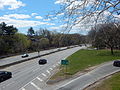
 Bronx River Parkway at the Cross Bronx Expressway.jpg 640 × 480; 70 KB
-
 Bronx River Parkway exit 10C.jpg 4,608 × 3,456; 6.43 MB
-
 Bronx River Parkway from Gun Hill Road.jpg 3,344 × 4,647; 13.08 MB
-
 Bronx River Parkway Last Exit Southbound.jpg 640 × 480; 73 KB
-
 Bronx River Parkway Map.svg 1,027 × 609; 1.51 MB
-
 Bronx River Parkway Near the Northern Terminus.jpg 640 × 480; 73 KB
-
 Bronx River Parkway Northbound at the Sprain Brook Parkway.jpg 640 × 480; 34 KB
-
 Bronx River Parkway Westchester mile marker 10.JPG 2,816 × 2,112; 3.68 MB
-
 Bronx River Parkway.jpg 3,264 × 2,448; 1.74 MB
-
 Bronx River Pkwy Shield free.svg 601 × 601; 19 KB
-
 Bronx River Pkwy Shield.svg 1,350 × 1,080; 10 KB
-
 Bronx River1.JPG 2,848 × 2,136; 1.47 MB
-
 Bronx, V. 18, Plate No. 15 (Map bounded by Bronx Blvd., E. 229th St., Carpenter Ave., E. 222nd St.) NYPL2001616.tiff 6,728 × 8,978, 2 pages; 172.88 MB
-
 Bronx, V. 18, Plate No. 22 (Map bounded by E. 241st St., Bronx Blvd., Oakley Ave.) NYPL2001623.tiff 6,680 × 8,914, 2 pages; 170.42 MB
-
 Bronx, V. 18, Plate No. 26 (Map bounded by Bronx River Rd., Baldwin St., Bronx St.) NYPL2001627.tiff 6,680 × 8,914, 2 pages; 170.42 MB
-
 Bronx, V. 18, Plate No. 3 (Map bounded by Bronx Blvd., Gun Hill Rd., White Plains Rd., Magenta St.) NYPL2001604.tiff 6,732 × 8,983, 2 pages; 173.08 MB
-
 Bronx, V. 18, Plate No. 4 (Map bounded by Bronx Blvd., E. 213th St., White Plains Rd., Gun Hill Rd.) NYPL2001605.tiff 6,667 × 8,897, 2 pages; 169.77 MB
-
 Bronx, V. 18, Plate No. 8 (Map bounded by Bronx Blvd., E. 222nd St., Bronx Blvd.) NYPL2001609.tiff 6,667 × 8,897, 2 pages; 169.77 MB
-
 BronxRiverPkwyNorthSignRoad (40478905281).jpg 2,400 × 1,600; 2.16 MB
-
 BronxRoverPkwyCurves-NearExit27 (26607971748).jpg 2,400 × 1,600; 1.77 MB
-
 Damaged Girder (53062594172).jpg 3,024 × 4,032; 1.61 MB
-
 Gun Hill Road @ NB Bronx River Pkwy On-Ramp.jpg 3,648 × 2,736; 2.05 MB
-
 Gun Hill Road @ SB Bronx River Pkwy On-Ramp.jpg 3,648 × 2,736; 1.98 MB
-
 I895bronxriver.JPG 2,576 × 1,932; 838 KB
-
 IRT Pelham Line over Bronx River Pkwy.jpg 5,152 × 3,864; 8.11 MB
-
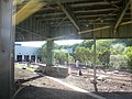 IRT Whp shop under BRP jeh.jpg 3,264 × 2,448; 1,004 KB
-
 MN Harlem Line over SB Bronx River Pkwy on-ramp; Woodlawn.jpg 5,152 × 3,864; 7.45 MB
-
 Morrison Avenue - 6 Train Leaves.jpg 5,152 × 3,864; 7.41 MB
-
 Morrison–Sound View Avenues (IRT Pelham Line) by David Shankbone.jpg 3,264 × 2,448; 3.43 MB
-
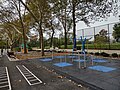 Noble Playground Bx 2023 jeh.jpg 4,000 × 3,000; 5.99 MB
-
 Parks and parkways in the Borough of the Bronx, New York City (1914) (14585419257).jpg 2,256 × 2,994; 1.17 MB
-
 Westchester County Center.png 498 × 413; 465 KB
-
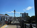
 Woodlawn Junction jeh.jpg 2,406 × 1,204; 551 KB
-
 Woodlawn Metro-North Station between Bronx River Parkway Ramps.jpg 5,152 × 3,864; 4.19 MB
-
 Woodlawn Metro-North Station from Bronx River Pkwy Off-Ramp.JPG 5,152 × 3,864; 4.19 MB
-
 Woodlawn MNR Station and SB Bronx River Pkwy Ramps from Webster Ave.JPG 5,152 × 3,864; 4.21 MB
-
 Woodlwan Metro-North Station; Parking Lot Entrance.JPG 5,152 × 3,864; 4.26 MB


.jpg)
.jpg)
.jpg)


_by_David_Shankbone.jpg)

_(14585419257).jpg)


