Category:Bronbeek
Jump to navigation
Jump to search
| Object location | | View all coordinates using: OpenStreetMap |
|---|
royal palace in Arnhem, The Nederland  | |||||
| Upload media | |||||
| Instance of | |||||
|---|---|---|---|---|---|
| Part of |
| ||||
| Location | Arnhem, Gelderland, Netherlands | ||||
| Street address |
| ||||
| Located on street | |||||
| Headquarters location | |||||
| Has part(s) | |||||
| Inception |
| ||||
| official website | |||||
 | |||||
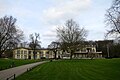
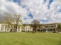
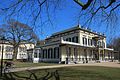
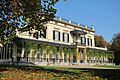
English: Bronbeek is a former Royal palace in Arnhem, the Netherlands. It is now a museum and a home for elderly soldiers
Nederlands: Bronbeek is een voormalig landgoed in Arnhem, Nederland
|
This is a category about rijksmonument number 46518
|
| Address |
|
Subcategories
This category has the following 5 subcategories, out of 5 total.
Media in category "Bronbeek"
The following 153 files are in this category, out of 153 total.
-
 2013-04-17 — Bronbeek.jpg 2,048 × 1,364; 3.01 MB
-
 20180220-kroonbronbeek.jpg 1,215 × 810; 160 KB
-
 A dove house in the garden of miliaire home Bronbeek Arnhem - panoramio.jpg 3,648 × 2,432; 3.08 MB
-

-
 Achtergevel commandantswoning - Arnhem - 20025051 - RCE.jpg 1,200 × 1,197; 325 KB
-
 Adjudant-onderofficier b.d. Cornelis Willem Ottevanger.jpg 1,250 × 833; 716 KB
-
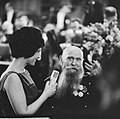
 Aktie Open het Dorp , Mies Bouwman met oudgediende, Bestanddeelnr 914-5532.jpg 2,611 × 2,633; 1.09 MB
-
 Aktie Open het Dorp, Mies Bouwman met Syt van Rooy, 93 jaar, Bestanddeelnr 914-5511.jpg 3,688 × 2,422; 1.81 MB
-
 An unexpected meeting with an owl in the Bronbeek Park - panoramio.jpg 1,824 × 1,368; 764 KB
-
 Arnhem-velperweg-grenspaal-bronbeek.JPG 1,200 × 1,600; 359 KB
-
 Autumn reflections at Bronbeek Militairy Museum Arnhem - panoramio.jpg 2,432 × 3,648; 2.05 MB
-
 Begrafenis van der Heijden.jpg 3,096 × 2,259; 2.1 MB
-
 Bewoners aan de maaltijd in tehuis Bronbeek voor oud-KNIL-militairen (2948429269).jpg 3,307 × 2,293; 2.02 MB
-

-
-

-

-

-

-
 Bewoners tehuis Bronbeek voor oud-KNIL-militairen (2948429287).jpg 219 × 445; 22 KB
-
-

-
 Bronbeek - panoramio (1).jpg 2,052 × 3,648; 3.67 MB
-
 Bronbeek - panoramio (2).jpg 3,648 × 2,052; 3.55 MB
-
 Bronbeek - panoramio (3).jpg 3,648 × 2,052; 3.67 MB
-
 Bronbeek - panoramio (7).jpg 2,052 × 3,648; 1.04 MB
-
 Bronbeek - panoramio.jpg 3,648 × 2,052; 3.63 MB
-
 Bronbeek Arnhem 1.JPG 6,016 × 4,000; 13.59 MB
-
 Bronbeek Arnhem 2.jpg 1,024 × 768; 302 KB
-
 Bronbeek Arnhem 3.jpg 1,024 × 768; 356 KB
-
 Bronbeek Arnhem 7.JPG 6,016 × 4,000; 13.35 MB
-
 Bronbeek Arnhem in 1865.jpg 5,724 × 3,543; 5.64 MB
-
BRONBEEK BESTAAT 75 JAAR-PGM4011507.webm 1 min 50 s, 720 × 576; 14.55 MB
-

-
-
 Bronbeek in Arnhem Bewoners genieten van het zonnetje, Bestanddeelnr 908-3947.jpg 4,200 × 3,304; 2.21 MB
-
 Bronbeek in Arnhem Bewoners genieten van het zonnetje, Bestanddeelnr 908-3948.jpg 3,450 × 2,724; 1.59 MB
-
 Bronbeek in Arnhem Bewoners genieten van het zonnetje, Bestanddeelnr 908-3949.jpg 3,444 × 2,748; 1.76 MB
-

-
 Bronbeek, gevel - Arnhem - 20025602 - RCE.jpg 1,200 × 1,187; 410 KB
-
 Bronbeek, gevel - Arnhem - 20025603 - RCE.jpg 1,199 × 1,200; 434 KB
-

-

-

-

-
 Bronbeek, tehuis voor 143 oud-KNIL-miliairen te Arnhem exterieur, Bestanddeelnr 930-0738.jpg 3,688 × 2,433; 1.41 MB
-

-

-
 Bronbeek.JPG 640 × 480; 112 KB
-
 Commandantswoning, interieur - Arnhem - 20025053 - RCE.jpg 1,197 × 1,200; 304 KB
-
 Commandantswoning, interieur - Arnhem - 20025054 - RCE.jpg 1,195 × 1,200; 296 KB
-
 Commandantswoning, interieur - Arnhem - 20025055 - RCE.jpg 1,200 × 1,197; 303 KB
-
 Commandantswoning, interieur plafond - Arnhem - 20025056 - RCE.jpg 1,200 × 1,192; 351 KB
-
 Commandantswoning, interieur plafond - Arnhem - 20025057 - RCE.jpg 1,198 × 1,200; 309 KB
-
 Commemoration of Abolition of Royal Netherlands East Indies Army, KNIL. Bronbeek Arnhem.jpg 6,016 × 4,000; 4.98 MB
-
 De commandant en de officieren van Bronbeek.jpg 5,998 × 4,045; 10.22 MB
-

-

-

-

-

-

-
-
 Een militaire fanfare bij het Koninklijk tehuis voor KNIL,K, SFA022800570.jpg 3,540 × 2,496; 1.23 MB
-

-

-
 Flickr - Erfgoed in Beeld - Arnhem, KNIL Monument.jpg 1,000 × 724; 223 KB
-

-
-
 Groepje-veteranen-te-Bronbe.jpg 1,923 × 2,520; 589 KB
-

-
 Huize Insulinde, Hees, Nijmegen 1938 Tehuis voor oud-Indische militairen.jpg 1,839 × 1,283; 823 KB
-
 Indonesische Betjak.jpg 2,551 × 1,931; 1.21 MB
-
 Invalidenhuis Bronbeek, achtergevel - Arnhem - 20025038 - RCE.jpg 1,188 × 1,200; 434 KB
-
 Invalidenhuis Bronbeek, achtergevel - Arnhem - 20025039 - RCE.jpg 1,195 × 1,200; 372 KB
-
 Invalidenhuis Bronbeek, achtergevel - Arnhem - 20025040 - RCE.jpg 1,185 × 1,200; 407 KB
-
 Invalidenhuis Bronbeek, interieur begane grond - Arnhem - 20025041 - RCE.jpg 1,193 × 1,200; 242 KB
-
 Invalidenhuis Bronbeek, voorgevel met ingang - Arnhem - 20025036 - RCE.jpg 1,200 × 1,200; 345 KB
-
 Invalidenhuis Bronbeek, voorgevel met ingang - Arnhem - 20025037 - RCE.jpg 1,177 × 1,200; 324 KB
-
 Invalidenhuis, Bronbeek gedeelte voorgevel - Arnhem - 20025035 - RCE.jpg 1,188 × 1,200; 341 KB
-
 Invalidenhuis, overzicht voorgevel - Arnhem - 20025034 - RCE.jpg 1,190 × 1,200; 333 KB
-
 Inwendige, commandantswoning - Arnhem - 20025052 - RCE.jpg 1,195 × 1,200; 295 KB
-
 Inwoners van het Koninklijk tehuis voor KNIL,K, SFA022800578.jpg 3,545 × 2,492; 1.01 MB
-
 Inwoners van het Koninklijk tehuis voor KNIL,K, SFA022800579.jpg 3,545 × 2,492; 955 KB
-
 Koloniaal Militair Invalidenhuis en Museum Bronbeek te Arnhem, KITLV 119485.tiff 2,664 × 1,809; 13.8 MB
-
 Koloniale Reserve op bezoek bij Bronbeek in Arnhem.jpg 1,586 × 1,007; 551 KB
-

-

-

-

-
 NC van Heurn (Bronbeek), SFA022800563.jpg 2,418 × 3,544; 1.15 MB
-
 Nederlandse leger, KNIL,K, SFA022800565.jpg 3,542 × 2,211; 957 KB
-
 Nicolaas Cornelis van Heurn (1853-1918).jpg 5,221 × 6,631; 3 MB
-
 NIMH - 2011 - 0722 - Aerial photograph of Arnhem, The Netherlands - 1920 - 1940.jpg 3,500 × 2,591; 2.4 MB
-
 NIMH - 2011 - 0723 - Aerial photograph of Arnhem, The Netherlands - 1920 - 1940.jpg 3,500 × 2,562; 2.17 MB
-
 Op Bronbeek.jpg 531 × 400; 73 KB
-
 Op-Bronbeek.jpg 4,037 × 2,870; 1.96 MB
-
Opheffing van het KNIL-centrum Weeknummer 51-11 - Open Beelden - 25589.ogv 1 min 32 s, 320 × 240; 6.61 MB
-
Opheffing van het KNIL-centrum.ogv 1 min 32 s, 352 × 288; 15.11 MB
-
 Oud-militairen van het KNIL in Bronbeek (2949282436).jpg 443 × 299; 35 KB
-

-
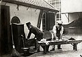
 Ovens en bakker.jpg 565 × 400; 115 KB
-
 Overview of militairy home Bronbeek with surrounding Park - panoramio.jpg 3,648 × 2,432; 2.98 MB
-
 Overzicht invalidenhuis, Bronbeek en commandantswoning - Arnhem - 20025033 - RCE.jpg 1,192 × 1,200; 270 KB
-
 Overzicht middenstuk en linkerzijde voorgevel - Arnhem - 20359779 - RCE.jpg 1,200 × 956; 259 KB
-
-
 Overzicht voorgevel met anker op de voorgrond - Arnhem - 20359701 - RCE.jpg 1,200 × 962; 263 KB
-
 Paasberg, 6824 Arnhem, Netherlands - panoramio (1).jpg 2,048 × 1,148; 656 KB
-
 Paasberg, 6824 Arnhem, Netherlands - panoramio (10).jpg 2,048 × 1,148; 871 KB
-
 Paasberg, 6824 Arnhem, Netherlands - panoramio (11).jpg 2,048 × 1,148; 628 KB
-
 Paasberg, 6824 Arnhem, Netherlands - panoramio (12).jpg 1,148 × 2,048; 538 KB
-
 Paasberg, 6824 Arnhem, Netherlands - panoramio (14).jpg 2,048 × 1,148; 701 KB
-
 Paasberg, 6824 Arnhem, Netherlands - panoramio (15).jpg 2,048 × 1,148; 527 KB
-
 Paasberg, 6824 Arnhem, Netherlands - panoramio (16).jpg 2,048 × 1,148; 527 KB
-
 Paasberg, 6824 Arnhem, Netherlands - panoramio (17).jpg 2,048 × 1,148; 504 KB
-
 Paasberg, 6824 Arnhem, Netherlands - panoramio (18).jpg 2,048 × 1,148; 658 KB
-
 Paasberg, 6824 Arnhem, Netherlands - panoramio (19).jpg 1,148 × 2,048; 787 KB
-
 Paasberg, 6824 Arnhem, Netherlands - panoramio (20).jpg 2,048 × 1,148; 718 KB
-
 Paasberg, 6824 Arnhem, Netherlands - panoramio (22).jpg 2,048 × 1,148; 795 KB
-
 Paasberg, 6824 Arnhem, Netherlands - panoramio (27).jpg 2,048 × 1,148; 798 KB
-
 Paasberg, 6824 Arnhem, Netherlands - panoramio (4).jpg 2,048 × 1,148; 633 KB
-
 Paasberg, 6824 Arnhem, Netherlands - panoramio (5).jpg 2,048 × 1,148; 679 KB
-
 Paasberg, 6824 Arnhem, Netherlands - panoramio (6).jpg 2,048 × 1,148; 923 KB
-
 Paasberg, 6824 Arnhem, Netherlands - panoramio (9).jpg 2,048 × 1,148; 621 KB
-
 Paasberg, 6824 Arnhem, Netherlands - panoramio.jpg 2,048 × 1,150; 547 KB
-
 Plaquette Beatrix Bronbeek.jpg 3,724 × 2,483; 1.39 MB
-
 Portierswoning - Arnhem - 20025031 - RCE.jpg 1,188 × 1,200; 396 KB
-
 Portierswoning - Arnhem - 20025032 - RCE.jpg 1,183 × 1,200; 425 KB
-
 Portierswoning Bronbeek, Arnhem.jpg 2,448 × 3,264; 3.39 MB
-

-

-
-
 Sonsbeek park.jpg 2,142 × 1,482; 847 KB
-
 Spaarnestad Photo-SFA022800582 (2949282778).jpg 316 × 444; 27 KB
-

-
 The Bronbeek governors building with Christmas lights - panoramio.jpg 3,648 × 2,432; 2.16 MB
-
-
-

-
 Toegangshek - Arnhem - 20025030 - RCE.jpg 1,200 × 1,200; 471 KB
-

-

-

-

-

-
 Verzorgingstehuis KNIL-veteranen Bronbeek in Arnhem.jpg 1,000 × 710; 128 KB
-
 Veteranen op Bronbeek.jpg 531 × 400; 71 KB
-

-
 Voorgevel commandantswoning - Arnhem - 20025048 - RCE.jpg 1,197 × 1,200; 312 KB
-
 Voorgevel commandantswoning - Arnhem - 20025049 - RCE.jpg 1,195 × 1,200; 334 KB
-
 Voorgevel commandantswoning - Arnhem - 20025050 - RCE.jpg 1,192 × 1,200; 319 KB
-
-
 Werner-en-Graaf-van-Luckner.jpg 6,016 × 4,749; 6.41 MB


.jpg)


.jpg)
.jpg)
.jpg)
.jpg)
.jpg)
.jpg)
.jpg)


_kolonel_Van_Santen_(r),_Bestanddeelnr_907-3029.jpg)
_kolonel_Van_Santen_(r),_Bestanddeelnr_907-3030.jpg)


_MET_HET_ACHTERLIGGENDE_TEHUIS_-_Arnhem_-_20339627_-_RCE.jpg)
,_OVERZICHT_VOORGEVEL_-_Arnhem_-_20339626_-_RCE.jpg)


.jpg)


,_SFA022800563.jpg)

.jpg)


.jpg)
.jpg)


.jpg)
.jpg)
.jpg)
.jpg)
.jpg)
.jpg)
.jpg)
.jpg)
.jpg)
.jpg)
.jpg)
.jpg)
.jpg)
.jpg)
.jpg)
.jpg)
.jpg)


,_Bestanddeelnr_914-7621.jpg)

.jpg)


