Category:Bromley maps of Manhattan published in 1930
Jump to navigation
Jump to search
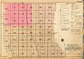
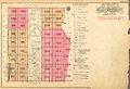
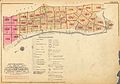
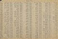
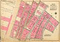
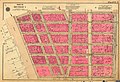
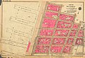
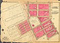
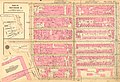
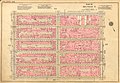
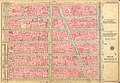
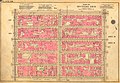
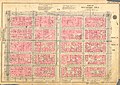
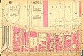
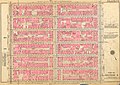
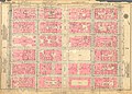
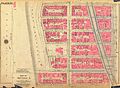
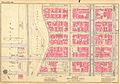
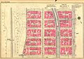
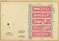
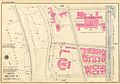
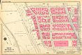
Maps from: Land Book of the Borough of Manhattan City of New York. Desk and Library Edition. (New York: G. W. Bromley & Co., 1930) comprising title page, five section indexes, four street index pages, and 191 plates (maps).
Online at The New York Public Library Digital Collections website, Land Book of the Borough of Manhattan…
This work is in the public domain because it was published in the United States between 1929 and 1963, and although there may or may not have been a copyright notice, the copyright was not renewed. For further explanation, see Commons:Hirtle chart and the copyright renewal logs. Note that it may still be copyrighted in jurisdictions that do not apply the rule of the shorter term for US works (depending on the date of the author's death), such as Canada (70 years p.m.a.), Mainland China (50 years p.m.a., not Hong Kong or Macao), Germany (70 years p.m.a.), Mexico (100 years p.m.a.), Switzerland (70 years p.m.a.), and other countries with individual treaties.
|
 |
Media in category "Bromley maps of Manhattan published in 1930"
The following 200 files are in this category, out of 201 total.
(previous page) (next page)-
 Bromley Manhattan title page publ. 1930.jpg 6,813 × 4,995; 7.05 MB
-
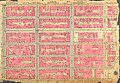
 Bromley Manhattan section index Battery to 14th St. publ. 1930.jpg 8,455 × 5,967; 12.18 MB
-
 Bromley Manhattan section index 14th–59th St. publ. 1930.jpg 8,416 × 5,975; 11.92 MB
-
 Bromley Manhattan section index 59th–110th St. publ. 1930.jpg 8,415 × 5,776; 10.86 MB
-
 Bromley Manhattan section index 110th–145th St. publ. 1930.jpg 8,454 × 5,846; 10.55 MB
-
 Bromley Manhattan section index 145th St. to Spuyten Duyvil publ. 1930.jpg 8,421 × 5,886; 10.2 MB
-
 Bromley Manhattan street index Abington Sq. to Hester St. publ. 1930.jpg 8,095 × 5,349; 16.02 MB
-
 Bromley Manhattan street index Hillside Ave. to Waverly Place publ. 1930.jpg 8,206 × 5,620; 16.06 MB
-
 Bromley Manhattan street index Weehawken St. to York Ave. and 1st to 79th St. publ. 1930.jpg 8,180 × 5,545; 16.24 MB
-
 Bromley Manhattan street index 80th–228th St. publ. 1930.jpg 8,184 × 5,610; 15.58 MB
-
 Bromley Manhattan Plate 001 publ. 1930.jpg 8,517 × 5,902; 13.49 MB
-
 Bromley Manhattan Plate 002 publ. 1930.jpg 8,413 × 5,846; 12.01 MB
-
 Bromley Manhattan Plate 003 publ. 1930.jpg 8,754 × 5,862; 13.58 MB
-
 Bromley Manhattan Plate 004 publ. 1930.jpg 8,532 × 5,991; 13.83 MB
-
 Bromley Manhattan Plate 005 publ. 1930.jpg 8,519 × 5,849; 15.61 MB
-
 Bromley Manhattan Plate 006 publ. 1930.jpg 8,555 × 5,853; 12.09 MB
-
 Bromley Manhattan Plate 007 publ. 1930.jpg 8,636 × 6,037; 13.94 MB
-
 Bromley Manhattan Plate 008 publ. 1930.jpg 8,413 × 5,893; 12.91 MB
-
 Bromley Manhattan Plate 009 publ. 1930.jpg 8,767 × 5,895; 13.16 MB
-
 Bromley Manhattan Plate 010 publ. 1930.jpg 8,493 × 5,860; 12.65 MB
-
 Bromley Manhattan Plate 011 publ. 1930.jpg 8,563 × 5,867; 14.33 MB
-
 Bromley Manhattan Plate 012 publ. 1930.jpg 8,492 × 5,984; 14.15 MB
-
 Bromley Manhattan Plate 013 publ. 1930.jpg 8,666 × 5,933; 15.02 MB
-
 Bromley Manhattan Plate 014 publ. 1930.jpg 8,545 × 6,062; 12.73 MB
-
 Bromley Manhattan Plate 015 publ. 1930.jpg 8,620 × 6,058; 14.79 MB
-
 Bromley Manhattan Plate 016 publ. 1930.jpg 8,631 × 5,995; 12.91 MB
-
 Bromley Manhattan Plate 017 publ. 1930.jpg 8,392 × 5,866; 12.57 MB
-
 Bromley Manhattan Plate 018 publ. 1930.jpg 8,421 × 5,769; 14.35 MB
-
 Bromley Manhattan Plate 019 publ. 1930.jpg 8,618 × 5,781; 13.08 MB
-
 Bromley Manhattan Plate 020 publ. 1930.jpg 8,377 × 5,921; 13.24 MB
-
 Bromley Manhattan Plate 021 publ. 1930.jpg 8,775 × 6,034; 13.39 MB
-
 Bromley Manhattan Plate 022 publ. 1930.jpg 8,414 × 5,774; 12.32 MB
-
 Bromley Manhattan Plate 023 publ. 1930.jpg 8,521 × 5,993; 13.93 MB
-
 Bromley Manhattan Plate 024 publ. 1930.jpg 8,451 × 5,772; 12.29 MB
-
 Bromley Manhattan Plate 025 publ. 1930.jpg 8,504 × 5,890; 13.48 MB
-
 Bromley Manhattan Plate 026 publ. 1930.jpg 8,402 × 5,947; 11.88 MB
-
 Bromley Manhattan Plate 027 publ. 1930.jpg 8,628 × 5,933; 14.77 MB
-
 Bromley Manhattan Plate 028 publ. 1930.jpg 8,438 × 5,822; 12.39 MB
-
 Bromley Manhattan Plate 029 publ. 1930.jpg 8,392 × 5,800; 12.25 MB
-
 Bromley Manhattan Plate 030 publ. 1930.jpg 8,413 × 5,938; 13.47 MB
-
 Bromley Manhattan Plate 031 publ. 1930.jpg 8,454 × 5,824; 13.16 MB
-
 Bromley Manhattan Plate 032 publ. 1930.jpg 8,671 × 5,951; 15.91 MB
-
 Bromley Manhattan Plate 033 publ. 1930.jpg 8,408 × 5,896; 12.1 MB
-
 Bromley Manhattan Plate 034 publ. 1930.jpg 8,436 × 5,980; 14.89 MB
-
 Bromley Manhattan Plate 035 publ. 1930.jpg 8,416 × 5,931; 15.7 MB
-
 Bromley Manhattan Plate 036 publ. 1930.jpg 8,582 × 5,885; 13.75 MB
-
 Bromley Manhattan Plate 037 publ. 1930.jpg 8,497 × 5,855; 13.46 MB
-
 Bromley Manhattan Plate 038 publ. 1930.jpg 8,438 × 5,953; 12.95 MB
-
 Bromley Manhattan Plate 039 publ. 1930.jpg 8,645 × 5,889; 12.32 MB
-
 Bromley Manhattan Plate 040 publ. 1930.jpg 8,415 × 5,682; 9.63 MB
-
 Bromley Manhattan Plate 041 publ. 1930.jpg 8,453 × 5,936; 11.04 MB
-
 Bromley Manhattan Plate 042 publ. 1930.jpg 8,243 × 5,888; 14.94 MB
-
 Bromley Manhattan Plate 043 publ. 1930.jpg 8,669 × 6,025; 13.86 MB
-
 Bromley Manhattan Plate 044 publ. 1930.jpg 8,437 × 5,936; 13.02 MB
-
 Bromley Manhattan Plate 045 publ. 1930.jpg 8,369 × 5,939; 15.05 MB
-
 Bromley Manhattan Plate 046 publ. 1930.jpg 8,339 × 5,807; 9.86 MB
-
 Bromley Manhattan Plate 047 publ. 1930.jpg 8,669 × 5,895; 12.29 MB
-
 Bromley Manhattan Plate 048 publ. 1930.jpg 8,360 × 5,798; 12.35 MB
-
 Bromley Manhattan Plate 049 publ. 1930.jpg 8,761 × 5,944; 13.29 MB
-
 Bromley Manhattan Plate 050 publ. 1930.jpg 8,571 × 5,914; 15.82 MB
-
 Bromley Manhattan Plate 051 publ. 1930.jpg 8,666 × 5,836; 13.12 MB
-
 Bromley Manhattan Plate 052 publ. 1930.jpg 8,596 × 5,969; 11.99 MB
-
 Bromley Manhattan Plate 053 publ. 1930.jpg 8,414 × 5,904; 11.95 MB
-
 Bromley Manhattan Plate 054 publ. 1930.jpg 8,342 × 5,746; 13.46 MB
-
 Bromley Manhattan Plate 055 publ. 1930.jpg 8,319 × 5,783; 13.96 MB
-
 Bromley Manhattan Plate 056 publ. 1930.jpg 8,355 × 5,865; 13.91 MB
-
 Bromley Manhattan Plate 057 publ. 1930.jpg 8,483 × 5,833; 13.61 MB
-
 Bromley Manhattan Plate 058 publ. 1930.jpg 8,288 × 5,812; 11.09 MB
-
 Bromley Manhattan Plate 059 publ. 1930.jpg 8,320 × 5,851; 11.48 MB
-
 Bromley Manhattan Plate 060 publ. 1930.jpg 8,289 × 5,773; 11.96 MB
-
 Bromley Manhattan Plate 061 publ. 1930.jpg 8,333 × 5,874; 12.72 MB
-
 Bromley Manhattan Plate 062 publ. 1930.jpg 8,268 × 5,738; 11.17 MB
-
 Bromley Manhattan Plate 063 publ. 1930.jpg 8,526 × 5,941; 11.26 MB
-
 Bromley Manhattan Plate 064 publ. 1930.jpg 8,270 × 5,727; 14.15 MB
-
 Bromley Manhattan Plate 065 publ. 1930.jpg 8,214 × 5,731; 14.02 MB
-
 Bromley Manhattan Plate 066 publ. 1930.jpg 8,243 × 5,717; 11.55 MB
-
 Bromley Manhattan Plate 067 publ. 1930.jpg 8,276 × 5,867; 12.55 MB
-
 Bromley Manhattan Plate 068 publ. 1930.jpg 8,216 × 5,711; 13.52 MB
-
 Bromley Manhattan Plate 069 publ. 1930.jpg 8,687 × 5,847; 13.02 MB
-
 Bromley Manhattan Plate 070 publ. 1930.jpg 8,268 × 5,747; 11.43 MB
-
 Bromley Manhattan Plate 071 publ. 1930.jpg 8,266 × 5,701; 11.51 MB
-
 Bromley Manhattan Plate 072 publ. 1930.jpg 8,210 × 5,715; 12.46 MB
-
 Bromley Manhattan Plate 073 publ. 1930.jpg 8,300 × 5,716; 11.85 MB
-
 Bromley Manhattan Plate 074 publ. 1930.jpg 8,326 × 5,758; 11.64 MB
-
 Bromley Manhattan Plate 075 publ. 1930.jpg 8,328 × 5,870; 12.07 MB
-
 Bromley Manhattan Plate 076 publ. 1930.jpg 8,240 × 5,843; 12.6 MB
-
 Bromley Manhattan Plate 077 publ. 1930.jpg 8,325 × 5,938; 13.7 MB
-
 Bromley Manhattan Plate 078 publ. 1930.jpg 8,301 × 5,969; 12.69 MB
-
 Bromley Manhattan Plate 079 publ. 1930.jpg 8,495 × 5,966; 13.46 MB
-
 Bromley Manhattan Plate 080 publ. 1930.jpg 8,583 × 5,977; 11.03 MB
-
 Bromley Manhattan Plate 081 publ. 1930.jpg 8,312 × 5,951; 11.35 MB
-
 Bromley Manhattan Plate 082 publ. 1930.jpg 8,279 × 5,921; 14.14 MB
-
 Bromley Manhattan Plate 083 publ. 1930.jpg 8,400 × 6,044; 13.26 MB
-
 Bromley Manhattan Plate 084 publ. 1930.jpg 8,428 × 5,970; 15.58 MB
-
 Bromley Manhattan Plate 085 publ. 1930.jpg 8,653 × 5,997; 15.58 MB
-
 Bromley Manhattan Plate 086 publ. 1930.jpg 8,412 × 5,838; 14.54 MB
-
 Bromley Manhattan Plate 087 publ. 1930.jpg 8,334 × 5,841; 14.4 MB
-
 Bromley Manhattan Plate 088 publ. 1930.jpg 8,583 × 5,999; 12.73 MB
-
 Bromley Manhattan Plate 089 publ. 1930.jpg 8,440 × 5,892; 14.35 MB
-
 Bromley Manhattan Plate 090 publ. 1930.jpg 8,267 × 6,050; 14.42 MB
-
 Bromley Manhattan Plate 091 publ. 1930.jpg 8,354 × 5,956; 15.56 MB
-
 Bromley Manhattan Plate 092 publ. 1930.jpg 8,469 × 5,957; 11.57 MB
-
 Bromley Manhattan Plate 093 publ. 1930.jpg 8,445 × 5,982; 11.5 MB
-
 Bromley Manhattan Plate 094 publ. 1930.jpg 8,330 × 5,976; 12.63 MB
-
 Bromley Manhattan Plate 095 publ. 1930.jpg 8,346 × 6,010; 13.24 MB
-
 Bromley Manhattan Plate 096 publ. 1930.jpg 8,314 × 5,954; 11.72 MB
-
 Bromley Manhattan Plate 097 publ. 1930.jpg 8,322 × 5,874; 12.16 MB
-
 Bromley Manhattan Plate 098 publ. 1930.jpg 8,239 × 5,753; 11.24 MB
-
 Bromley Manhattan Plate 099 publ. 1930.jpg 8,288 × 5,736; 11.91 MB
-
 Bromley Manhattan Plate 100 publ. 1930.jpg 8,228 × 5,738; 12.96 MB
-
 Bromley Manhattan Plate 101 publ. 1930.jpg 8,223 × 5,678; 11.16 MB
-
 Bromley Manhattan Plate 102 publ. 1930.jpg 8,203 × 5,654; 10.98 MB
-
 Bromley Manhattan Plate 103 publ. 1930.jpg 8,280 × 5,667; 13.35 MB
-
 Bromley Manhattan Plate 104 publ. 1930.jpg 8,403 × 5,919; 13.27 MB
-
 Bromley Manhattan Plate 105 publ. 1930.jpg 8,573 × 5,870; 14.81 MB
-
 Bromley Manhattan Plate 106 publ. 1930.jpg 8,270 × 5,871; 14.84 MB
-
 Bromley Manhattan Plate 107 publ. 1930.jpg 8,491 × 5,846; 14.88 MB
-
 Bromley Manhattan Plate 108 publ. 1930.jpg 8,300 × 5,676; 8.47 MB
-
 Bromley Manhattan Plate 109 publ. 1930.jpg 8,522 × 5,680; 9.55 MB
-
 Bromley Manhattan Plate 110 publ. 1930.jpg 8,290 × 5,942; 13.3 MB
-
 Bromley Manhattan Plate 111 publ. 1930.jpg 8,310 × 5,991; 14.89 MB
-
 Bromley Manhattan Plate 112 publ. 1930.jpg 8,278 × 5,970; 12.96 MB
-
 Bromley Manhattan Plate 113 publ. 1930.jpg 8,461 × 6,042; 13.74 MB
-
 Bromley Manhattan Plate 114 publ. 1930.jpg 8,355 × 6,041; 14.48 MB
-
 Bromley Manhattan Plate 115 publ. 1930.jpg 8,496 × 5,929; 13.25 MB
-
 Bromley Manhattan Plate 116 publ. 1930.jpg 8,625 × 5,822; 10.79 MB
-
 Bromley Manhattan Plate 117 publ. 1930.jpg 8,426 × 5,808; 11.72 MB
-
 Bromley Manhattan Plate 118 publ. 1930.jpg 8,403 × 5,972; 14.99 MB
-
 Bromley Manhattan Plate 119 publ. 1930.jpg 8,638 × 5,983; 12.49 MB
-
 Bromley Manhattan Plate 120 publ. 1930.jpg 8,392 × 5,774; 13.94 MB
-
 Bromley Manhattan Plate 121 publ. 1930.jpg 8,446 × 5,771; 12.85 MB
-
 Bromley Manhattan Plate 122 publ. 1930.jpg 8,287 × 5,756; 12.11 MB
-
 Bromley Manhattan Plate 123 publ. 1930.jpg 8,721 × 5,776; 12.53 MB
-
 Bromley Manhattan Plate 124 publ. 1930.jpg 8,304 × 5,674; 12.15 MB
-
 Bromley Manhattan Plate 125 publ. 1930.jpg 8,711 × 5,795; 12.55 MB
-
 Bromley Manhattan Plate 126 publ. 1930.jpg 8,316 × 5,988; 11.62 MB
-
 Bromley Manhattan Plate 127 publ. 1930.jpg 8,420 × 5,979; 11.15 MB
-
 Bromley Manhattan Plate 128 publ. 1930.jpg 8,428 × 6,030; 12.42 MB
-
 Bromley Manhattan Plate 129 publ. 1930.jpg 8,332 × 5,975; 15.24 MB
-
 Bromley Manhattan Plate 130 publ. 1930.jpg 8,328 × 5,883; 12.77 MB
-
 Bromley Manhattan Plate 131 publ. 1930.jpg 8,500 × 5,995; 13.9 MB
-
 Bromley Manhattan Plate 132 publ. 1930.jpg 8,250 × 5,803; 10.53 MB
-
 Bromley Manhattan Plate 133 publ. 1930.jpg 8,359 × 5,927; 11.78 MB
-
 Bromley Manhattan Plate 134 publ. 1930.jpg 8,243 × 5,887; 14.79 MB
-
 Bromley Manhattan Plate 135 publ. 1930.jpg 8,338 × 5,902; 14.87 MB
-
 Bromley Manhattan Plate 136 publ. 1930.jpg 8,188 × 5,859; 12.15 MB
-
 Bromley Manhattan Plate 137 publ. 1930.jpg 8,610 × 5,939; 15.65 MB
-
 Bromley Manhattan Plate 138 publ. 1930.jpg 8,417 × 5,700; 12.68 MB
-
 Bromley Manhattan Plate 139 publ. 1930.jpg 8,258 × 5,658; 10.72 MB
-
 Bromley Manhattan Plate 140 publ. 1930.jpg 8,250 × 5,676; 11.54 MB
-
 Bromley Manhattan Plate 141 publ. 1930.jpg 8,268 × 5,750; 11.84 MB
-
 Bromley Manhattan Plate 142 publ. 1930.jpg 8,301 × 5,757; 11.49 MB
-
 Bromley Manhattan Plate 143 publ. 1930.jpg 8,344 × 5,803; 9.92 MB
-
 Bromley Manhattan Plate 144 publ. 1930.jpg 8,645 × 6,036; 14.67 MB
-
 Bromley Manhattan Plate 145 publ. 1930.jpg 8,385 × 5,923; 13.19 MB
-
 Bromley Manhattan Plate 146 publ. 1930.jpg 8,362 × 5,929; 14.44 MB
-
 Bromley Manhattan Plate 147 publ. 1930.jpg 8,425 × 5,882; 15.13 MB
-
 Bromley Manhattan Plate 148 publ. 1930.jpg 8,654 × 5,978; 13.61 MB
-
 Bromley Manhattan Plate 149 publ. 1930.jpg 8,629 × 6,018; 14.5 MB
-
 Bromley Manhattan Plate 150 publ. 1930.jpg 8,519 × 5,941; 12.57 MB
-
 Bromley Manhattan Plate 151 publ. 1930.jpg 8,437 × 5,933; 14.21 MB
-
 Bromley Manhattan Plate 152 publ. 1930.jpg 8,360 × 5,933; 12.11 MB
-
 Bromley Manhattan Plate 153 publ. 1930.jpg 8,346 × 5,907; 14.38 MB
-
 Bromley Manhattan Plate 154 publ. 1930.jpg 8,389 × 5,951; 15.17 MB
-
 Bromley Manhattan Plate 155 publ. 1930.jpg 8,384 × 5,923; 14.5 MB
-
 Bromley Manhattan Plate 156 publ. 1930.jpg 8,341 × 5,915; 9.95 MB
-
 Bromley Manhattan Plate 157 publ. 1930.jpg 8,347 × 5,923; 13.95 MB
-
 Bromley Manhattan Plate 158 publ. 1930.jpg 8,380 × 6,012; 12.57 MB
-
 Bromley Manhattan Plate 159 publ. 1930.jpg 8,686 × 5,970; 11.96 MB
-
 Bromley Manhattan Plate 160 publ. 1930.jpg 8,580 × 5,979; 11.78 MB
-
 Bromley Manhattan Plate 161 publ. 1930.jpg 8,380 × 5,982; 13.52 MB
-
 Bromley Manhattan Plate 162 publ. 1930.jpg 8,359 × 5,906; 11.38 MB
-
 Bromley Manhattan Plate 163 publ. 1930.jpg 8,287 × 5,986; 12.61 MB
-
 Bromley Manhattan Plate 164 publ. 1930.jpg 8,386 × 5,877; 11.5 MB
-
 Bromley Manhattan Plate 165 publ. 1930.jpg 8,475 × 5,836; 10.44 MB
-
 Bromley Manhattan Plate 166 publ. 1930.jpg 8,362 × 5,833; 9.68 MB
-
 Bromley Manhattan Plate 167 publ. 1930.jpg 8,359 × 5,849; 12.82 MB
-
 Bromley Manhattan Plate 168 publ. 1930.jpg 8,569 × 5,776; 10.5 MB
-
 Bromley Manhattan Plate 169 publ. 1930.jpg 8,604 × 5,996; 12.97 MB
-
 Bromley Manhattan Plate 170 publ. 1930.jpg 8,522 × 5,798; 9.7 MB
-
 Bromley Manhattan Plate 171 publ. 1930.jpg 8,770 × 5,809; 10.76 MB
-
 Bromley Manhattan Plate 172 publ. 1930.jpg 8,597 × 6,049; 12.97 MB
-
 Bromley Manhattan Plate 173 publ. 1930.jpg 8,685 × 5,866; 14.42 MB
-
 Bromley Manhattan Plate 174 publ. 1930.jpg 8,396 × 6,044; 12.72 MB
-
 Bromley Manhattan Plate 175 publ. 1930.jpg 8,772 × 5,859; 13.55 MB
-
 Bromley Manhattan Plate 176 publ. 1930.jpg 8,593 × 5,779; 10.45 MB
-
 Bromley Manhattan Plate 177 publ. 1930.jpg 8,422 × 5,865; 10.39 MB
-
 Bromley Manhattan Plate 178 publ. 1930.jpg 8,458 × 5,978; 9.52 MB
-
 Bromley Manhattan Plate 179 publ. 1930.jpg 8,362 × 5,758; 12.19 MB
-
 Bromley Manhattan Plate 180 publ. 1930.jpg 8,447 × 5,985; 11.43 MB
-
 Bromley Manhattan Plate 181 publ. 1930.jpg 8,728 × 5,786; 12.06 MB
-
 Bromley Manhattan Plate 182 publ. 1930.jpg 8,407 × 5,951; 10.92 MB
-
 Bromley Manhattan Plate 183 publ. 1930.jpg 8,360 × 5,810; 10.37 MB
-
 Bromley Manhattan Plate 184 publ. 1930.jpg 8,381 × 6,051; 12.15 MB
-
 Bromley Manhattan Plate 185 publ. 1930.jpg 8,400 × 5,875; 11.64 MB
-
 Bromley Manhattan Plate 186 publ. 1930.jpg 8,380 × 5,937; 8.95 MB
-
 Bromley Manhattan Plate 187 publ. 1930.jpg 8,461 × 5,914; 9.38 MB
-
 Bromley Manhattan Plate 188 publ. 1930.jpg 8,365 × 5,911; 10.7 MB
-
 Bromley Manhattan Plate 189 publ. 1930.jpg 8,376 × 5,840; 10.73 MB
-
 Bromley Manhattan Plate 190 publ. 1930.jpg 8,401 × 5,855; 11.55 MB


