Category:Bromley maps of Manhattan published 1920–21
Jump to navigation
Jump to search
Maps from:
- Bromley, George W. and Bromley, Walter S. Atlas of the City of New York Borough of Manhattan. Volume Two. 14th Street to 59th Street. (Philadelphia: George W. Bromley and Co., 1920), comprising 45 section maps (double-page plates) plus title page, street index, double-page volume index, and list of correction dates.
- Bromley, George W. and Bromley, Walter S. Atlas of the City of New York Borough of Manhattan. Volume Three. 59th Street to 110th Street. (Philadelphia: George W. Bromley and Co., 1921), comprising 40 section maps (double-page plates) plus title page, double-page volume index with street index, and Manhattan volume outline.
The source, The New York Public Library Digital Collections website, has two scan sets of Volume Two (only the first has the list of correction dates):
- (ID numbers 1524602–1524608, 1524666, and 1524609–1524649) Volume Two
- (ID numbers 1526299–1526346) Volume Two
- Volume Three: 59th Street to 110th Street.
This category includes selected TIF versions in addition to the JPGs.
Media in category "Bromley maps of Manhattan published 1920–21"
The following 103 files are in this category, out of 103 total.
-

-
 Bromley Manhattan V. 2 title page publ. 1920.jpg 3,977 × 5,299; 3.97 MB
-

-
 Bromley Manhattan V. 2 title page publ. 1920 smaller version.jpg 3,007 × 3,987; 2.18 MB
-

-
 Bromley Manhattan V. 3 title page publ. 1921.jpg 2,987 × 3,992; 2.22 MB
-

-

-

-
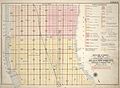 Bromley Manhattan V. 2 outline and volume index publ. 1920.jpg 6,289 × 4,588; 7.37 MB
-

-
 Bromley Manhattan V. 2 list of correction dates of the Atlas publ. 1920.jpg 6,937 × 4,816; 4 MB
-

-
 Bromley Manhattan V. 3 volume index with street index publ. 1921.jpg 6,545 × 4,565; 7.1 MB
-
 Street Index (Vol. 2)- Astor Court - 59th Street W. NYPL1524603.tiff 5,428 × 7,230; 112.31 MB
-
 Bromley Manhattan V. 2 street index publ. 1920.jpg 4,122 × 5,767; 6.13 MB
-
 Bromley Manhattan V. 2 Plate 01 publ. 1920.jpg 6,462 × 4,464; 6.02 MB
-
 Bromley Manhattan V. 2 Plate 01 published 1920.jpg 6,532 × 4,510; 6.67 MB
-
 Bromley Manhattan V. 2 Plate 02 publ. 1920.jpg 6,551 × 4,692; 10.13 MB
-
 Bromley Manhattan V. 2 Plate 03 publ. 1920.jpg 6,625 × 4,635; 10.19 MB
-
 Bromley Manhattan V. 2 Plate 04 publ. 1920.jpg 6,831 × 4,700; 10.54 MB
-
 Bromley Manhattan V. 2 Plate 05 publ. 1920.jpg 6,420 × 4,574; 8.87 MB
-
 Bromley Manhattan V. 2 Plate 06 publ. 1920.jpg 6,584 × 4,629; 7.83 MB
-
 Bromley Manhattan V. 2 Plate 07 publ. 1920.jpg 6,664 × 4,625; 8.21 MB
-
 Bromley Manhattan V. 2 Plate 08 publ. 1920.jpg 6,465 × 4,521; 8.61 MB
-
 Bromley Manhattan V. 2 Plate 09 publ. 1920.jpg 6,732 × 4,564; 10.06 MB
-
 Bromley Manhattan V. 2 Plate 10 publ. 1920.jpg 6,763 × 4,577; 9.05 MB
-
 Bromley Manhattan V. 2 Plate 11 publ. 1920.jpg 6,654 × 4,541; 7.23 MB
-
 Bromley Manhattan V. 2 Plate 12 publ. 1920.jpg 6,537 × 4,545; 8.25 MB
-
 Bromley Manhattan V. 2 Plate 13 publ. 1920.jpg 6,467 × 4,542; 9.64 MB
-
 Bromley Manhattan V. 2 Plate 14 publ. 1920.jpg 6,429 × 4,540; 8.78 MB
-
 Bromley Manhattan V. 2 Plate 15 publ. 1920.jpg 6,479 × 4,482; 8.47 MB
-
 Bromley Manhattan V. 2 Plate 16 publ. 1920.jpg 6,430 × 4,525; 8.23 MB
-
 Bromley Manhattan V. 2 Plate 17 publ. 1920.jpg 6,670 × 4,595; 6.77 MB
-
 Bromley Manhattan V. 2 Plate 18 publ. 1920.jpg 6,602 × 4,621; 7.26 MB
-
 Bromley Manhattan V. 2 Plate 19 publ. 1920.jpg 6,445 × 4,466; 7.21 MB
-
 Bromley Manhattan V. 2 Plate 20 publ. 1920.jpg 6,490 × 4,583; 8.36 MB
-
 Bromley Manhattan V. 2 Plate 21 publ. 1920.jpg 6,438 × 4,443; 8.18 MB
-
 Bromley Manhattan V. 2 Plate 22 publ. 1920.jpg 6,447 × 4,519; 8.48 MB
-
 Bromley Manhattan V. 2 Plate 23 publ. 1920.jpg 6,468 × 4,471; 7.6 MB
-
 Bromley Manhattan V. 2 Plate 24 publ. 1920.jpg 6,458 × 4,446; 7.68 MB
-
 Bromley Manhattan V. 2 Plate 25 publ. 1920.jpg 6,468 × 4,544; 8.97 MB
-
 Bromley Manhattan V. 2 Plate 26 publ. 1920.jpg 6,453 × 4,472; 7.64 MB
-
 Bromley Manhattan V. 2 Plate 27 publ. 1920.jpg 6,433 × 4,457; 8.02 MB
-
 Bromley Manhattan V. 2 Plate 28 publ. 1920.jpg 6,472 × 4,467; 7.97 MB
-
 Bromley Manhattan V. 2 Plate 29 publ. 1920.jpg 6,432 × 4,485; 7.65 MB
-
 Bromley Manhattan V. 2 Plate 30 publ. 1920.jpg 6,481 × 4,509; 8.06 MB
-
 Bromley Manhattan V. 2 Plate 31 publ. 1920 smaller scale NYPL1524635.jpg 2,292 × 1,589; 1.72 MB
-
 Bromley Manhattan V. 2 Plate 31 publ. 1920.jpg 6,458 × 4,473; 8.64 MB
-
 Bromley Manhattan V. 2 Plate 32 publ. 1920.jpg 6,446 × 4,472; 7.74 MB
-
 Bromley Manhattan V. 2 Plate 33 publ. 1920.jpg 6,480 × 4,505; 7.57 MB
-
 Bromley Manhattan V. 2 Plate 34 publ. 1920.jpg 6,593 × 4,622; 8.99 MB
-
 Bromley Manhattan V. 2 Plate 35 publ. 1920.jpg 6,414 × 4,616; 8.53 MB
-
 Bromley Manhattan V. 2 Plate 36 publ. 1920.jpg 6,474 × 4,633; 9.39 MB
-
 Bromley Manhattan V. 2 Plate 37 publ. 1920.jpg 6,427 × 4,530; 7.6 MB
-
 Bromley Manhattan V. 2 Plate 38 publ. 1920.jpg 6,497 × 4,558; 8.67 MB
-
 Bromley Manhattan V. 2 Plate 39 publ. 1920.jpg 6,645 × 4,643; 6.68 MB
-
 Bromley Manhattan V. 2 Plate 40 publ. 1920.jpg 6,634 × 4,600; 6.39 MB
-
 Bromley Manhattan V. 2 Plate 41 publ. 1920.jpg 6,453 × 4,613; 7.47 MB
-
 Bromley Manhattan V. 2 Plate 42 publ. 1920.jpg 6,442 × 4,629; 8.35 MB
-
 Bromley Manhattan V. 2 Plate 43 publ. 1920.jpg 6,459 × 4,662; 8.96 MB
-
 Bromley Manhattan V. 2 Plate 44 publ. 1920.jpg 6,573 × 4,627; 9.61 MB
-
 Bromley Manhattan V. 2 Plate 45 publ. 1920.jpg 6,720 × 4,605; 9.53 MB
-
 Bromley Manhattan V. 3 Plate 01 publ. 1921.jpg 6,500 × 4,595; 6.17 MB
-
 Bromley Manhattan V. 3 Plate 02 publ. 1921.jpg 6,756 × 4,622; 6.4 MB
-
 Bromley Manhattan V. 3 Plate 03 publ. 1921.jpg 6,688 × 4,683; 6.67 MB
-
 Bromley Manhattan V. 3 Plate 04 publ. 1921.jpg 6,554 × 4,567; 6.39 MB
-
 Bromley Manhattan V. 3 Plate 05 publ. 1921.jpg 6,515 × 4,659; 6.84 MB
-
 Bromley Manhattan V. 3 Plate 06 publ. 1921.jpg 6,457 × 4,686; 6.06 MB
-
 Bromley Manhattan V. 3 Plate 07 publ. 1921.jpg 6,103 × 4,844; 5.76 MB
-
 Bromley Manhattan V. 3 Plate 08 publ. 1921.jpg 6,529 × 4,676; 5.84 MB
-
 Bromley Manhattan V. 3 Plate 09 publ. 1921.jpg 6,528 × 4,617; 6.63 MB
-
 Bromley Manhattan V. 3 Plate 10 publ. 1921.jpg 6,468 × 4,642; 6.38 MB
-
 Bromley Manhattan V. 3 Plate 11 publ. 1921.jpg 6,456 × 4,613; 6.03 MB
-
 Bromley Manhattan V. 3 Plate 12 publ. 1921.jpg 6,515 × 4,626; 6.73 MB
-
 Bromley Manhattan V. 3 Plate 13 publ. 1921.jpg 6,501 × 4,496; 6.25 MB
-
 Bromley Manhattan V. 3 Plate 14 publ. 1921.jpg 6,473 × 4,458; 5.74 MB
-
 Bromley Manhattan V. 3 Plate 15 publ. 1921.jpg 6,479 × 4,485; 5.7 MB
-
 Bromley Manhattan V. 3 Plate 16 publ. 1921.jpg 6,488 × 4,480; 6.02 MB
-
 Bromley Manhattan V. 3 Plate 17 publ. 1921.jpg 6,498 × 4,494; 5.83 MB
-
 Bromley Manhattan V. 3 Plate 18 publ. 1921.jpg 6,492 × 4,495; 5.67 MB
-
 Bromley Manhattan V. 3 Plate 19 publ. 1921.jpg 6,446 × 4,600; 7.16 MB
-
 Bromley Manhattan V. 3 Plate 20 publ. 1921.jpg 6,737 × 4,628; 6.6 MB
-
 Bromley Manhattan V. 3 Plate 21 publ. 1921.jpg 6,547 × 4,480; 3.65 MB
-
 Bromley Manhattan V. 3 Plate 22 publ. 1921.jpg 6,656 × 4,604; 6.68 MB
-
 Bromley Manhattan V. 3 Plate 23 publ. 1921.jpg 6,506 × 4,634; 6.66 MB
-
 Bromley Manhattan V. 3 Plate 24 publ. 1921.jpg 6,569 × 4,690; 7.16 MB
-
 Bromley Manhattan V. 3 Plate 25 publ. 1921.jpg 6,537 × 4,713; 7.29 MB
-
 Bromley Manhattan V. 3 Plate 26 publ. 1921.jpg 6,697 × 4,504; 4.61 MB
-
 Bromley Manhattan V. 3 Plate 27 publ. 1921.jpg 6,745 × 4,496; 5.31 MB
-
 Bromley Manhattan V. 3 Plate 28 publ. 1921.jpg 6,580 × 4,689; 7.61 MB
-
 Bromley Manhattan V. 3 Plate 29 publ. 1921.jpg 6,495 × 4,727; 7.75 MB
-
 Bromley Manhattan V. 3 Plate 30 publ. 1921.jpg 6,477 × 4,645; 6.87 MB
-
 Bromley Manhattan V. 3 Plate 31 publ. 1921.jpg 6,554 × 4,686; 7.6 MB
-
 Bromley Manhattan V. 3 Plate 32 publ. 1921.jpg 6,502 × 4,529; 4.67 MB
-
 Bromley Manhattan V. 3 Plate 33 publ. 1921.jpg 6,706 × 4,658; 6.82 MB
-
 Bromley Manhattan V. 3 Plate 34 publ. 1921.jpg 6,481 × 4,651; 6.99 MB
-
 Bromley Manhattan V. 3 Plate 35 publ. 1921.jpg 6,490 × 4,492; 6.68 MB
-
 Bromley Manhattan V. 3 Plate 36 publ. 1921.jpg 6,551 × 4,488; 6.17 MB
-
 Bromley Manhattan V. 3 Plate 37 publ. 1921.jpg 6,780 × 4,509; 6.69 MB
-
 Bromley Manhattan V. 3 Plate 38 publ. 1921.jpg 6,462 × 4,527; 6.46 MB
-
 Bromley Manhattan V. 3 Plate 39 publ. 1921.jpg 6,476 × 4,508; 6.59 MB
-
 Bromley Manhattan V. 3 Plate 40 publ. 1921.jpg 6,789 × 4,509; 6.67 MB


