Category:Broederenkerk, Zutphen
Jump to navigation
Jump to search
| Object location | | View all coordinates using: OpenStreetMap |
|---|
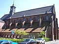
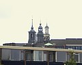
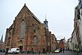
church building in Zutphen, Netherlands  | |||||
| Upload media | |||||
| Instance of | |||||
|---|---|---|---|---|---|
| Location | Zutphen, Gelderland, Netherlands | ||||
| Street address |
| ||||
| Located on street |
| ||||
| Heritage designation |
| ||||
| Significant event |
| ||||
| Religion or worldview | |||||
 | |||||
Nederlands: Broederenkerk - anno 14e eeuw - buiten gebruik 1972 - thans bibliotheek
|
This is a category about rijksmonument number 41172
|
| Address |
|
Subcategories
This category has only the following subcategory.
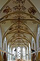
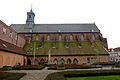
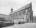
Media in category "Broederenkerk, Zutphen"
The following 89 files are in this category, out of 89 total.
-
 20160917 Broederenkerk met kunstwerk Lydia Schouten Zutphen.jpg 3,456 × 5,184; 2.48 MB
-
 20160917 Broederenkerk1 Zutphen.jpg 3,456 × 5,184; 2.82 MB
-
 20160917 Broederenkerk2 Zutphen.jpg 3,456 × 5,184; 2.71 MB
-
 Achtergevel van de Broederenkerk te Zutphen - Zutphen - 20226846 - RCE.jpg 905 × 1,200; 248 KB
-
 Bibliotheek - Zutphen -december 2012- (8369190595).jpg 2,448 × 3,264; 3.34 MB
-
 Bibliotheek - Zutphen -december 2012- (8369191555).jpg 3,264 × 2,448; 3.26 MB
-
 Bibliotheek - Zutphen -december 2012- (8369193303).jpg 3,264 × 2,448; 2.99 MB
-
 Bibliotheek - Zutphen -december 2012- (8369194989).jpg 2,448 × 3,264; 3.08 MB
-
 Bibliotheek - Zutphen -december 2012- (8370259748).jpg 2,448 × 3,264; 3.07 MB
-
 Bibliotheek - Zutphen -december 2012- (8370261168).jpg 2,448 × 3,264; 2.66 MB
-
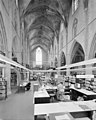
 Bibliotheek Broederenkerk Zutphen.jpg 1,048 × 1,576; 1.63 MB
-
 Bibliotheek Zutphen in Broederenkerk.JPG 5,184 × 3,456; 6.88 MB
-
 Broederenkerk Zutphen.jpg 1,577 × 1,050; 1.54 MB
-
-
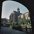
 De Broederenkerk te Zutphen naar het zuid-oosten - Zutphen - 20226850 - RCE.jpg 1,200 × 936; 234 KB
-

-

-

-
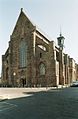
 De voorgevel van de Broederenkerk te Zutphen - Zutphen - 20226845 - RCE.jpg 905 × 1,200; 302 KB
-
 De zuid-westgevel van de Broederenkerk te Zutphen - Zutphen - 20226892 - RCE.jpg 960 × 1,200; 270 KB
-

-
 Exterieur BROEDERENKLOOSTER, DORMITORIUMVLEUGEL - Zutphen - 20277114 - RCE.jpg 1,200 × 946; 366 KB
-
 Exterieur NOORDGEVEL - Zutphen - 20277110 - RCE.jpg 1,200 × 953; 270 KB
-
 Exterieur NOORDGEVEL, DWARSPAND - Zutphen - 20277113 - RCE.jpg 1,200 × 953; 300 KB
-
 Exterieur NOORDOOST GEVEL - Zutphen - 20277111 - RCE.jpg 1,200 × 954; 317 KB
-
 Exterieur timpaan (SLECHTE TOESTAND) - Zutphen - 20277100 - RCE.jpg 1,199 × 1,200; 383 KB
-
 Exterieur WESTGEVEL, ZUIDGEVEL - Zutphen - 20277112 - RCE.jpg 960 × 1,200; 272 KB
-
 Exterieur ZUIDGEVEL - Zutphen - 20277109 - RCE.jpg 1,200 × 946; 335 KB
-
 Exterieur ZUIDGEVEL, FRONTON BOVEN INGANG - Zutphen - 20277101 - RCE.jpg 1,200 × 1,197; 463 KB
-
 Exterieur ZUIDGEVEL, timpaan - Zutphen - 20277102 - RCE.jpg 1,195 × 1,200; 411 KB
-
 Het Grote Zutboek in de Broederenkerk te Zutphen.jpg 4,000 × 6,000; 10.78 MB
-

-
-

-

-

-

-

-
 Interieur preekstoel - Zutphen - 20327383 - RCE.jpg 939 × 1,200; 79 KB
-

-
 INTERIEUR, MIDDENSCHIP NAAR HET OOSTEN - Zutphen - 20277106 - RCE.jpg 1,200 × 946; 264 KB
-
 INTERIEUR, MIDDENSCHIP NAAR NOORDER ZIJBEUK - Zutphen - 20277108 - RCE.jpg 950 × 1,200; 286 KB
-
 INTERIEUR, NOORDER ZIJBEUK NAAR HET ZUIDOOSTEN - Zutphen - 20277107 - RCE.jpg 1,200 × 960; 246 KB
-
 INTERIEUR, OVERZICHT MIDDENSCHIP NAAR HET WESTEN - Zutphen - 20277105 - RCE.jpg 958 × 1,200; 243 KB
-
 INTERIEUR, OVERZICHT NAAR HET OOSTEN - Zutphen - 20277104 - RCE.jpg 1,200 × 950; 254 KB
-
 Interieur, overzicht richting het oosten - Zutphen - 20373697 - RCE.jpg 1,200 × 1,186; 235 KB
-
 Interieur, overzicht richting het westen - Zutphen - 20373699 - RCE.jpg 1,200 × 1,195; 267 KB
-
 Interieur, overzicht richting koor - Deventer - 20055022 - RCE.jpg 894 × 1,200; 225 KB
-

-
 Interieur, overzicht van de passage - Zutphen - 20420126 - RCE.jpg 781 × 1,200; 230 KB
-

-

-

-

-
 Opslag grafzerken - Zutphen - 20226899 - RCE.jpg 1,179 × 1,200; 362 KB
-
 Opslag grafzerken - Zutphen - 20226900 - RCE.jpg 1,184 × 1,200; 346 KB
-
 Opslag grafzerken - Zutphen - 20226901 - RCE.jpg 1,188 × 1,200; 334 KB
-
 Opslag grafzerken - Zutphen - 20226902 - RCE.jpg 1,186 × 1,200; 348 KB
-
 Overzicht noordelijke zijbeuk, richting het oosten - Zutphen - 20373701 - RCE.jpg 1,186 × 1,200; 241 KB
-
 Overzicht noordgevel met dwarspand - Zutphen - 20366576 - RCE.jpg 1,010 × 1,200; 247 KB
-
 Overzicht noordwestgevel met zicht op de dakruiter - Zutphen - 20373693 - RCE.jpg 1,198 × 1,200; 279 KB
-
 Overzicht van de voorgevel vanaf het plein - Zutphen - 20420125 - RCE.jpg 786 × 1,200; 214 KB
-
 Overzicht van de zijgevel - Zutphen - 20420128 - RCE.jpg 1,200 × 785; 282 KB
-
 Overzicht westgevel - Zutphen - 20373695 - RCE.jpg 1,200 × 1,200; 271 KB
-
 Overzicht westgevel met zicht op de dakruiter - Zutphen - 20373692 - RCE.jpg 1,193 × 1,200; 232 KB
-
 Overzicht westgevel met zicht op de dakruiter - Zutphen - 20373694 - RCE.jpg 1,200 × 1,198; 317 KB
-

-
 Refectorium, west gedeelte van de noordgevel - Zutphen - 20227075 - RCE.jpg 861 × 1,200; 318 KB
-
 Reliëf "Verrijzenis van Christus" - Zutphen - 20226877 - RCE.jpg 955 × 1,200; 307 KB
-
 Reliëfsteen van het Gilde der Heilige Gekroonden - Zutphen - 20226876 - RCE.jpg 1,200 × 923; 375 KB
-

-

-
 Venster koorsluiting - Zutphen - 20226874 - RCE.jpg 924 × 1,200; 354 KB
-

-
-
 Zicht vanuit het noordoosten - Zutphen - 20327382 - RCE.jpg 1,200 × 954; 151 KB
-
 Zijgevel van de Broederenkerk te Zutphen - Zutphen - 20226847 - RCE.jpg 915 × 1,200; 262 KB
-

-
 Zuidwestgevel van de Broederenkerk te Zutphen - Zutphen - 20226888 - RCE.jpg 894 × 1,200; 219 KB
-
 Zutphen Broederenkerk.jpg 2,592 × 1,936; 1.81 MB
-
 Zutphen Bruderkirche.jpg 2,580 × 1,932; 1.01 MB
-
 Zutphen, 3 torens.jpg 1,625 × 1,283; 292 KB
-
 Zutphen, Netherlands - panoramio (108).jpg 1,155 × 2,048; 575 KB
-
 Zutphen, Netherlands - panoramio (14).jpg 2,048 × 1,375; 457 KB
-
 Zutphen, Netherlands - panoramio (17).jpg 2,048 × 1,375; 368 KB
-
 Zutphen, Netherlands - panoramio (19).jpg 2,048 × 1,375; 477 KB
-
 Zutphen, Netherlands - panoramio (28).jpg 2,048 × 1,375; 460 KB
-
 Zutphen, Netherlands - panoramio (34).jpg 2,048 × 1,375; 352 KB
-
 Zutphen, toren van de Broederenkerk RM41172 IMG 5619 2018-07-15 09.47.jpg 2,879 × 4,594; 7.99 MB


.jpg)
.jpg)
.jpg)
.jpg)
.jpg)
.jpg)


_-_Zutphen_-_20277100_-_RCE.jpg)


._-_Zutphen_-_20226890_-_RCE.jpg)


_van_het_voormalig_Broederenklooster_-_Zutphen_-_20373696_-_RCE.jpg)


.jpg)
.jpg)
.jpg)
.jpg)
.jpg)
.jpg)
